At 171 Pine Street was the William Brooks house. This became the YMCA.
Author: admin
Beech Street
Elm Street


Holyoke Industrial Edition map from 1876
Holyoke Industrial Edition map from 1876

20 is the Skinner
21 is HWP
22 Warner File
23 Chapman

1 is Albion
2 Crocker
3 Valley
4 Hadley
5 Gas Works
6 and 7 are Parsons
8 is Hadley Falls Paper Co near gatehouse
9 is Whiting Paper 1 and 13 is Whiting 2
10 and 11 are Hampden Mills 1 and 2
12 Lyman Mills
14 Prentiss
15 Willard’s Planing Mill (at end of John Street)
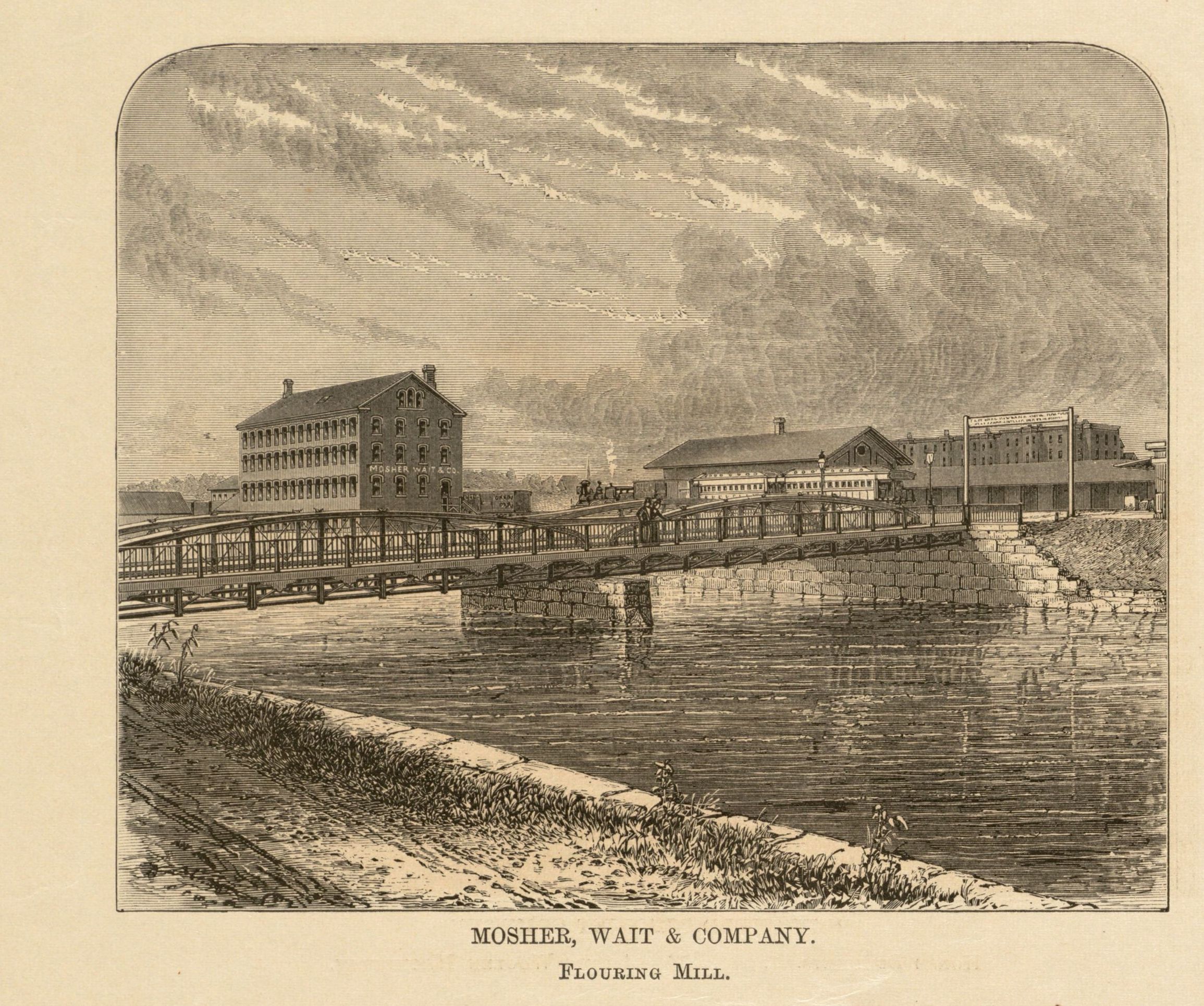
16 Mosher, Wait and Co Flouring Mill (near Holyoke and Westfield Depot)
17 Massasoit
18 Beebe and Holbrook
19 pulp mill between Beebe and Massasoit
Montague

CANALS and MILLS
Montague Navigational Canal – see Navigational Canals of the Connecticut River
Turners Falls Dam number 1 and 2
Montague Paper Company Bridge over Turners Falls Power Canal
Keith Paper Mill and its Workers Housing
CHURCHES
Our Lady of Czestochowa Church
German Methodist Episcopal Church
Saint Mary’s Roman Catholic Church
German Lutheran Church
English Methodist Church – Fifth Street 1880
Montague Congregational Church
CEMETERIES – LINK
OTHER
Peskeomskut Park
Palmer

Palmer has four villages – Thorndike, Bondsville, Three Rivers, and Depot Village. It was settled in 1727 and was a town in 1775.
Palmer History – EXTERNAL LINK
Canals
Power Canals of the Chicopee River
Wright Wire Mill District
Parks and Schools
Chase Memorial Park
Cemeteries – LINK
Churches
Saint Bartholomew’s Church 1 State St. in the Bondsville village of Palmer
Saint Mary’s Church
Saint Thomas the Apostle Parish
Saint Paul’s Unitarian Universalist Church
Catholic Churches of Palmer – External LINK
Wilbraham
CANALS
Power Canals of the Chicopee River
CHURCHES
St. Cecilia Parish 1951 – 42 Main St – Rectory: 7 Maple St – www.saintceciliawilbraham.org
Grace Union Church – 8 Chapel Street – Grace Union Church Parsonage – 24 Maple
Wilbraham Methodist Episcopal Church – Glendale Methodist Episcopal Society Church – 940 Glendale Rd 1868
SCHOOLS
Memorial School and Auditorium
Minnechaug Regional High School
CEMETERIES
Woodland Dell Cemetery – on 17V Woodland Dell Street near Main (behind the library) – 1851 first burial is Louisa Wright and officially opens in 1858
Glendale Cemetery – 376V Glendale Road near Monson Road – 1787 – war memorial just outside the grounds and a bell – this is a former Baptist cemetery – Caleb Stebbins is the first burial
OTHER
Academy Historic District – Wilbraham – Monson Academy Alumni Memorial Chapel (Wilbraham Methodist Church) – 404 Main Street from 1867
Crane Park – Wilbraham Civil War Memorial – 1894 – 322 Main Street
Wilbraham Old Meetinghouse and Hearse House – Wilbraham Old Methodist Meeting House (Wilbraham Historical Commission Museum) 1793 – 450 Main Street – Wilbraham Hearse House – Adams Cemetery Hearse House
Loren Phelps Farm
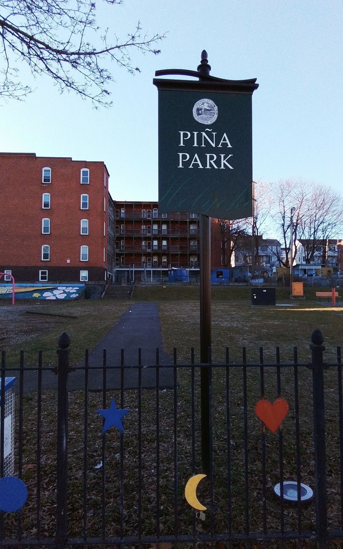
Pina Park
Pina Park


Mosher, Wait, and Co.
Mosher, Wait, and Co.
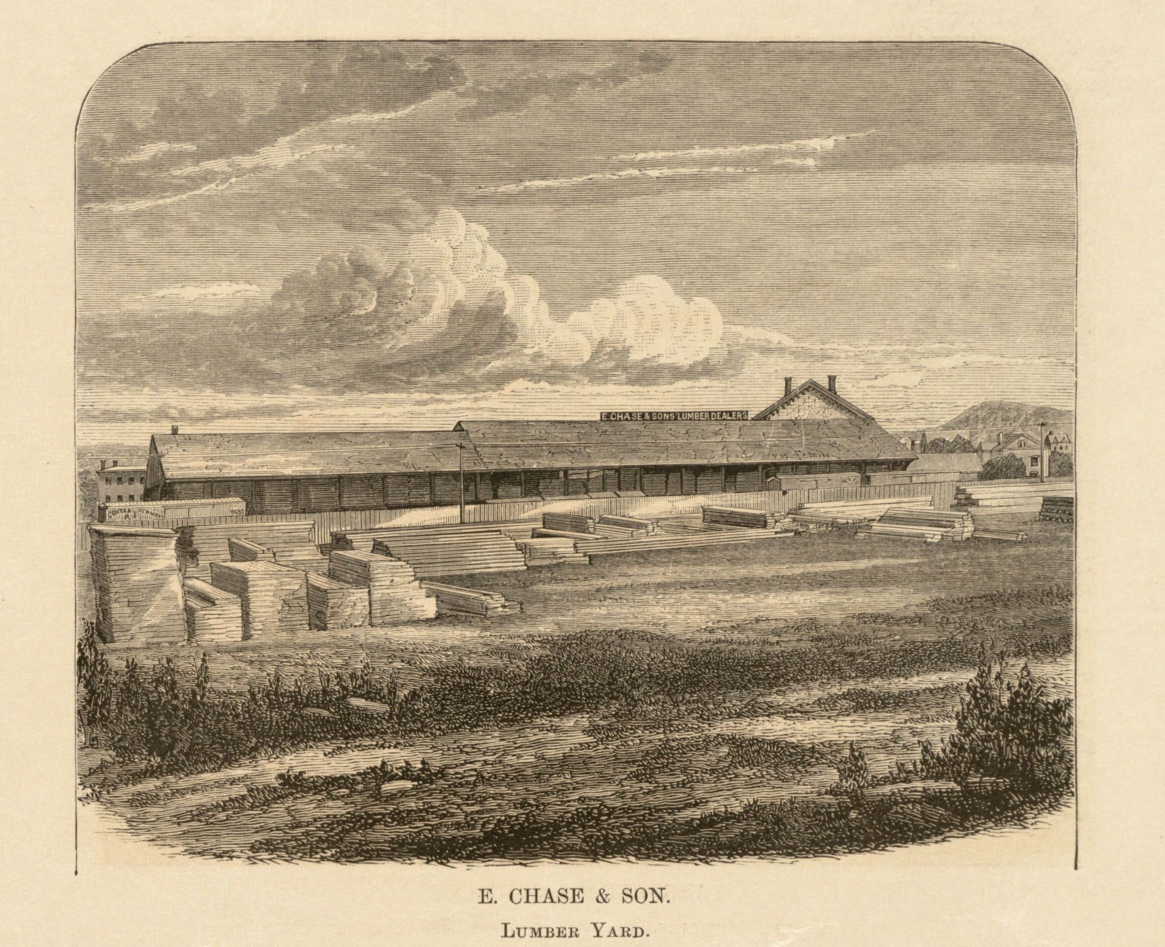
Chase Lumber Yard
Chase Lumber Yard