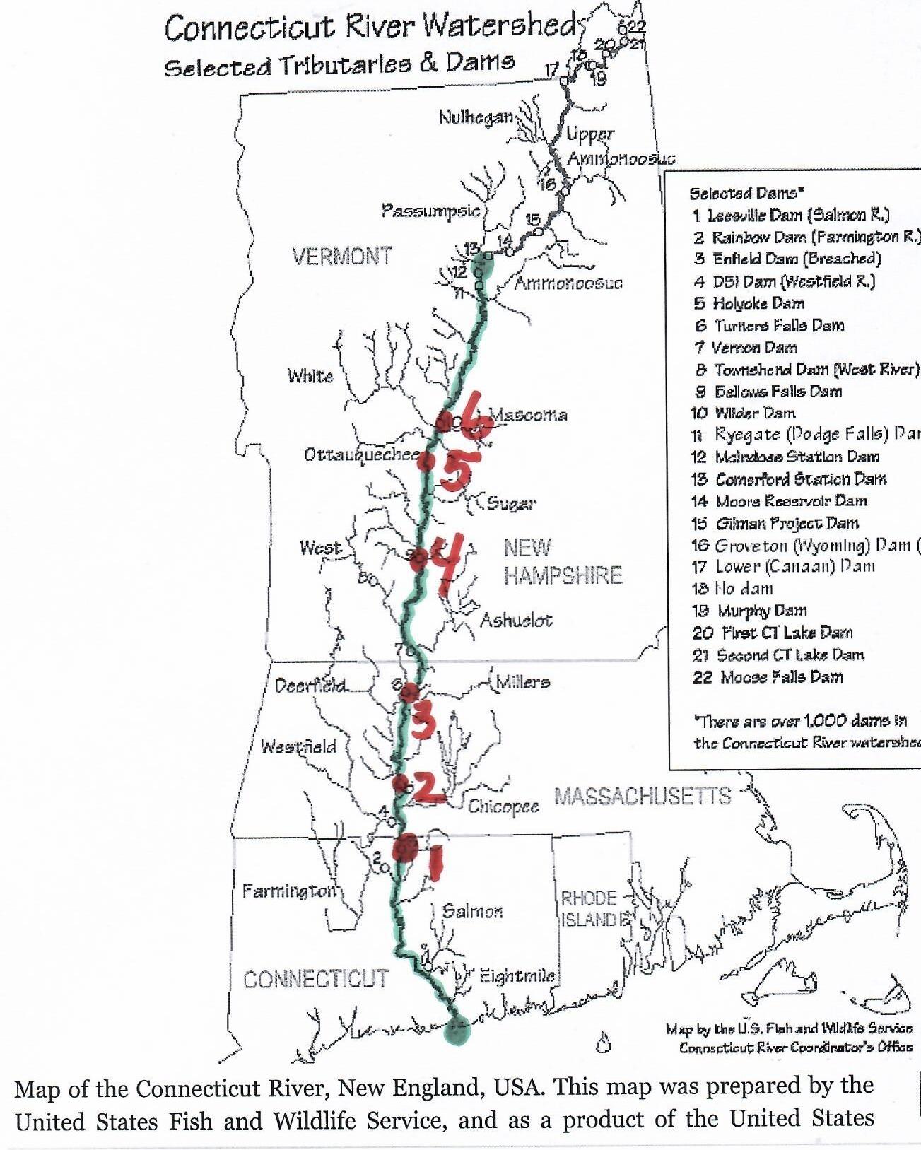
The navigational canals of the Connecticut River were made to allow transport of goods from Long Island Sound to upper Vermont without portage. At the end of the canal days, one could go from Old Saybrook Connecticut to the Wells River in Vermont 280 miles upstream. This was a difference in elevation of 500 feet.
| canal | LINK | location | starts | ends | length | falls (feet) | locks | |
| 1 | Enfield Falls Canal | LINK | Windsor Locks Connecticut | 1829 | 1970s | 5.25 miles | 30 | 4 |
| 2 | South Hadley Falls Canal | LINK | South Hadley Massachusetts | 1794 | 1862 | 2.5 miles | 58 | 10 |
| 3 | Turners Falls Canal | LINK | Montague Massachusetts | 1798 | 1856 | 3 miles | 55 | 10 |
| 4 | Bellows Falls Canal | LINK | Rockingham Vermont | 1802 | 1858 | 0.5 miles | 52 | 9 |
| 5 | Sumner Falls Canal | LINK | between North Hartland and Hartland Vermont | 1803 to 1806 | 1856 | feet | 12 | 2 |
| 6 | Olcott Falls Canal | LINK | Wilder Vermont and New Hampshire | 1810 | feet | 40 | 5 |
Farmington Canal – external VIDEO