Easthampton was divided into two by Native American groups – Nashawannuck and Pascommuck. These were geographical names given by the Nonotuck tribe of the area. They built a fort along Fort Road in 1664.
Immaculate Conception Church Campus (Easthampton) is found on Adams Street. The first church was a wooden church that was erected in 1868 at the same site as the present church. A new church was completed in 1883 but it burned before it could be used. In 1884 this present church was made (dedicated August 15 1884). This church is in the neo-Gothic style.
The Immaculate Conception Church was a mission church of the Northampton church since 1868 under P V Moyce (pastor in Northampton).
The first pastor was Jeremiah J Twomey. FINDAGRAVE – his original burial location was alongside the Immaculate Conception Church but when it was built into a larger masonry church, the burial had to be moved.
Third pastor was Richard Walshe FINDAGRAVE – The cemetery was established in about 1884 on Everett Street by Walshe. He was the pastor from 1878 to 1914 – 36 years.
At 21 Adams Street is the convent for the nuns. It was a home at first (1870s build) but Immaculate Conception purchased it. They owned it from 1915 to the late 1980s. The order of nuns that worked in the school here was the Sisters of Saint Joseph.
At 33 Adams Street is the rectory of the priests. It was built at some point in the late 1800s.
The parish is now called Our Lady of the Valley since it is a joining of many churches in town. This happened in 2010 with the joining of Notre Dame du Bon Conseil (Pleasant Street) and Sacred Heart of Jesus (Franklin Street) with the Immaculate Conception Church.
stop 1 – Immaculate Conception Rectory
stop 2 – Immaculate Conception Church
stop 3 – Immaculate Conception Convent
The convent is from 1875 but for most of its existence it was the convent for the Catholic school across the street.
stop 4 – Immaculate Conception School
The Immaculate Conception School was started in 1909.
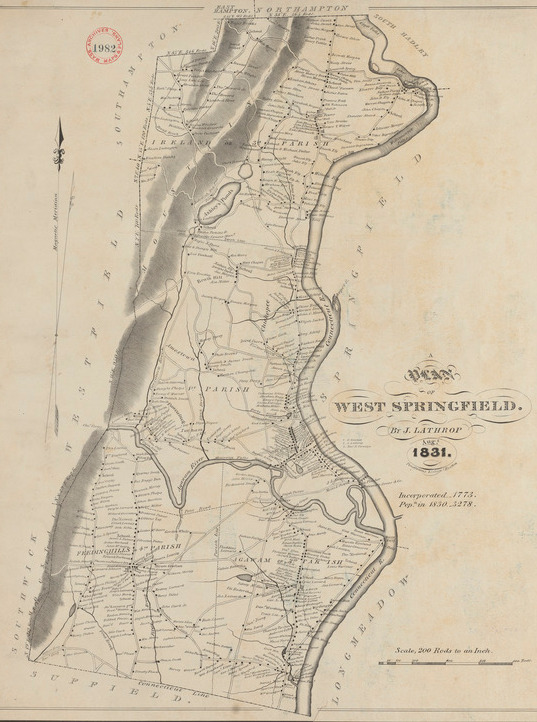
West Springfield is a canal community like many of the communities in Hampden County. The canal was completed in 1839 and was named the Agawam Canal. The community became a town in 1774. This location was settled in 1655. Agawam would separate in 1855 and Holyoke in 1850.
The Saint Thomas the Apostle Church Campus in West Springfield was founded in 1869. It is located on Pine Street. The parish of Saint Thomas the Apostle started as a mission church of the Holy Name Church of Chicopee. The Holy Name Parish was the first Catholic parish in Western Massachusetts.
The old church was destroyed in 1905. The present was built in 1906 at 63 Pine Street. It is clearly in the neo-Gothic style. The first pastor of the church from its inception in 1877 was William Phelan. Another former pastor is James Tyrrell. FINDAGRAVE – pastor from Dec 7 1905 to Oct 22 1925. A list of pastors can be found at the external LINK.
The Saint Thomas the Apostle Rectory is at 47 Pine Street.
The Saint Thomas the Apostle Rectory Carriage House is nearby.
The Saint Thomas the Apostle School is at 75 Pine Street. It is from about 1961.
The Saint Thomas the Apostle Hall is at 87 Pine Street and is from about 1962. This is the former convent for the nuns that taught at the school. The first convent was from 1931.
The Saint Thomas the Apostle Cemetery is from about 1870 also. It is located nearby at Kings Highway.
Congregation Kodimoh Cemetery – Beth El Chapel is from 1927.
Rohan Park is in the location of the former Kirtland School. This school was at first called the New Oakdale School. It was opened in January of 1909. Sure it was built in 1908 but in 1916 it already received an addition to its back. (the school was at 298 Sargeant Street)
The park is defined by parallel streets – Sargeant and West Franklin Streets and then Chapman and Saint Jerome Avenues. It closed in 1991 and was razed in 1997.
The school is named after Edwin Kirtland a former superintendent of the Holyoke school system. The school was an elementary school and a neighborhood school. PHOTO – Kirtland died in 1910 and the school soon after was changed into his name.
The park is named after Robert Rohan Sr who was a state representative for Holyoke for 18 years. (1975 to 1993) FINDAGRAVE
Robert Rohan’s father was Patrick Rohan who was a driver for the fire chief of Holyoke.
The John Stacy Apartments are from 1910 and are at 320-322 Sargeant Street. These were built as the Oakdale neighborhood developed into a trolley neighborhood. In 1892 the Holyoke Streetcar trolley line went up Sargeant Street. See Line G at this LINK.
In 1914 the apartment complex at 321 Sargeant Street across the street from the Stacey were built. The trolley allowed mill workers to move out of the downtown area.
Down Pinehurst Road is the house of James Newton. This Colonial Revival house was built in 1909 on the massive homestead that Newton had in the Oakdale area. Newton lived at 159 Chestnut Street for many years and then in 1909 moved to the Pinehurst. Read about his original HOME. Then read about the many addresses of this Pinehurst mansion HERE. Lastly, read about his MILL. He would have this beautiful mansion built at 21 and 25 Pinehurst Road.
The house has an address of 25 and the carriage house has an address of 21 but both point to Northampton Street since there was once a private driveway from the west. Thus the front of the house is now in the backyard.
Across the street in 1911 the James Bertram Newton house was built at 6 Pinehurst Road. This house had many addresses through the years including a Franklin Street address. James Bertram Newton was the son of James Hale Newton and would live in this second Newton house on Pinehurst Street. FINDAGRAVE
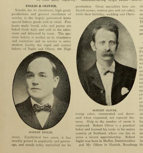
At 243-245 Sargeant Street is the Skinner Workers House. William Skinner had his manager living in this house. The house is from 1892. Around 1917 Robert Inglis a baker had changed this into a bakery. The bakery was at 408 High Street in 1916 but moved here. This was the home for Robert Inglis (245 Sargeant). The bakery was Inglis and Oliver.
Native American Burial Grounds in Chicopee Massachusetts
There are hints of a native burial at Walnut Island in the Chicopee River that was found about 1910. Also a burial along Chicopee Street that was found in the 1800s.
The South Amherst Cemetery is between South East Street and Middle Street in Amherst. The land was purchased in 1818. External LINK to its history page. In 1846 trees were added.
Sweet Alice Pond Loop Trail – MAP – on Bay Road near the Kestrel Center – 1 mile trail is with purple blazes – another loop leads to the Trolley Trail
Puffer’s Pond – MAP – 171 State Street – attached to the Mill River Conservation Area, the Lower Mill River Conservation Area, and the Upper Mill River Conservation Area
Amethyst Brook – MAP – Amethyst Brook Conservation Area and the Whitney Conservation Area – Thayer Street and Pelham Road
Wentworth Farm – MAP – 135 Stanley Street – Wentworth Farm Conservation Area
Mount Pollux – MAP – off of 1413 South East Street – Mount Pollux Conservation Area
Lawrence Swamp – MAP – 101 Station Road – near the Hop Brook and the Baby Carriage Brook
Eastman Brook Conservation Area – MAP – 280 Leverett Road
Granby was formed June 11 1768 from the eastern portion of South Hadley. Granby had been settled in 1727. The West Street Cemetery in Granby was founded while this land was still part of South Hadley. It is a churchyard cemetery since it is very close to the former Meeting House (or Congregational Church) that was on West Street. The old part of this cemetery is on land donated by James Smith on July 10 1769.
Benjamin Franklin Potter and Lydia Day Potter were moved from a churchyard cemetery in Enfield Massachusetts in the 1930s to this Granby cemetery due to the Quabbin Reservoir construction. Also two of her children were moved. FINDAGRAVE
There are two reburials from the Old South Hadley Cemetery when it was moved from 1903. These are confirmed.
Samuel Dickinson husband of Esther White Dickinson – FINDAGRAVE – stone is there


