
Essex Street Historic District
Author: admin
Ingleside School
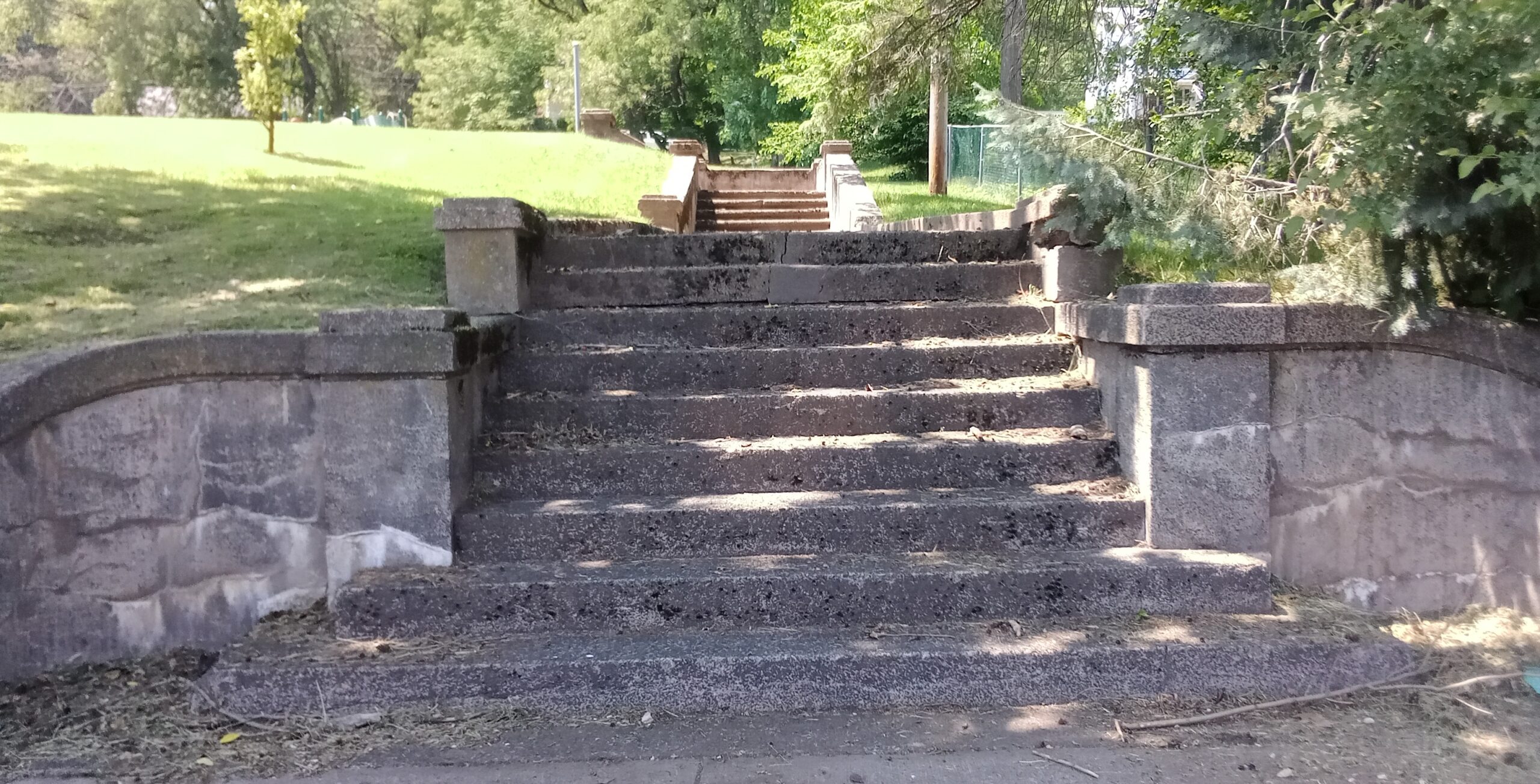
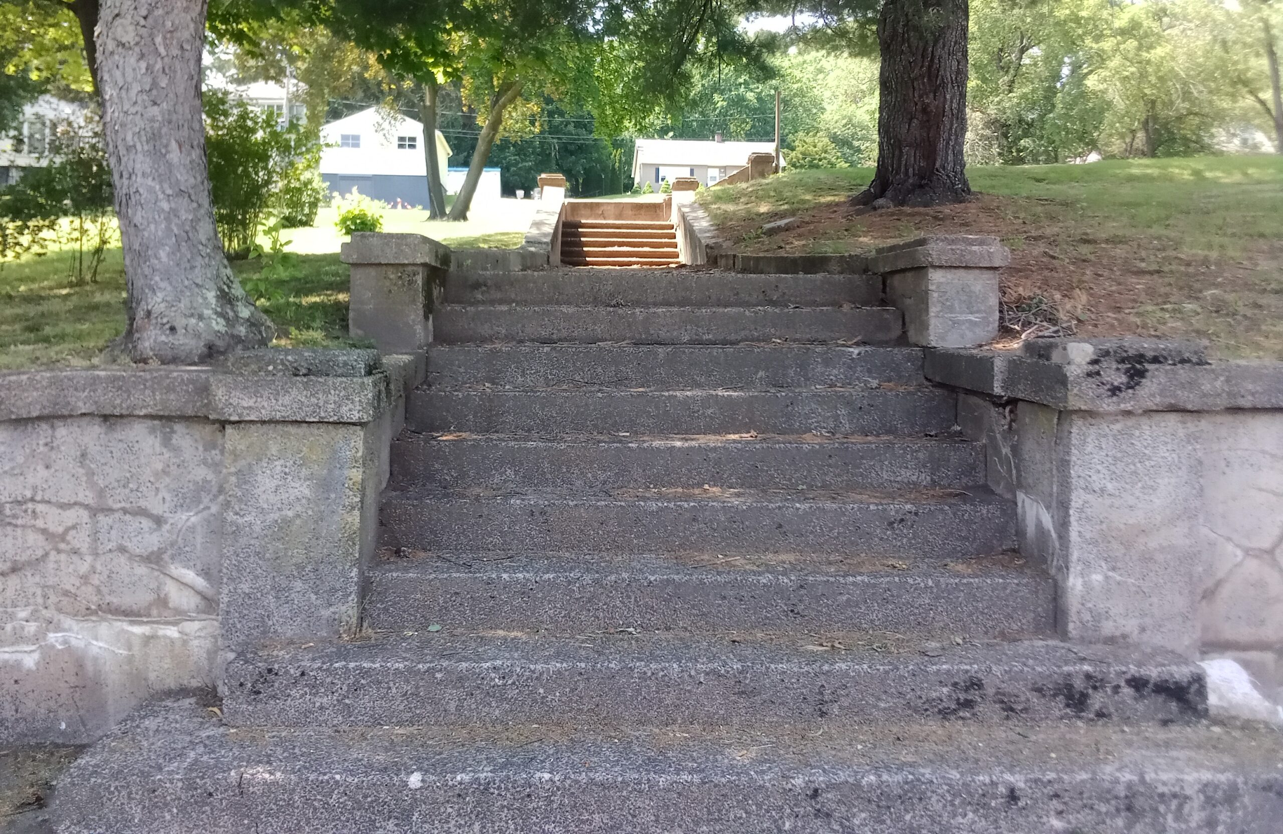
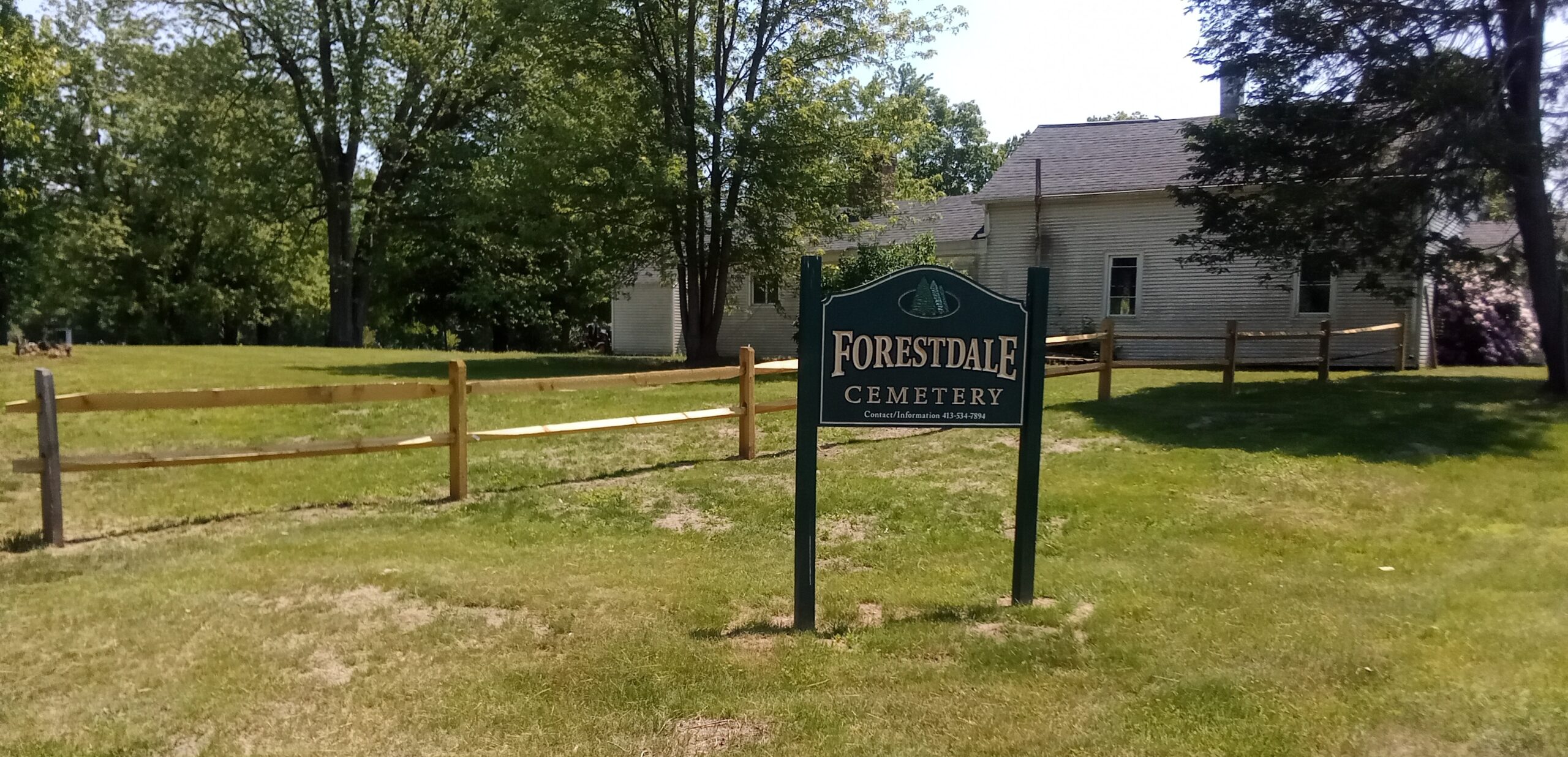
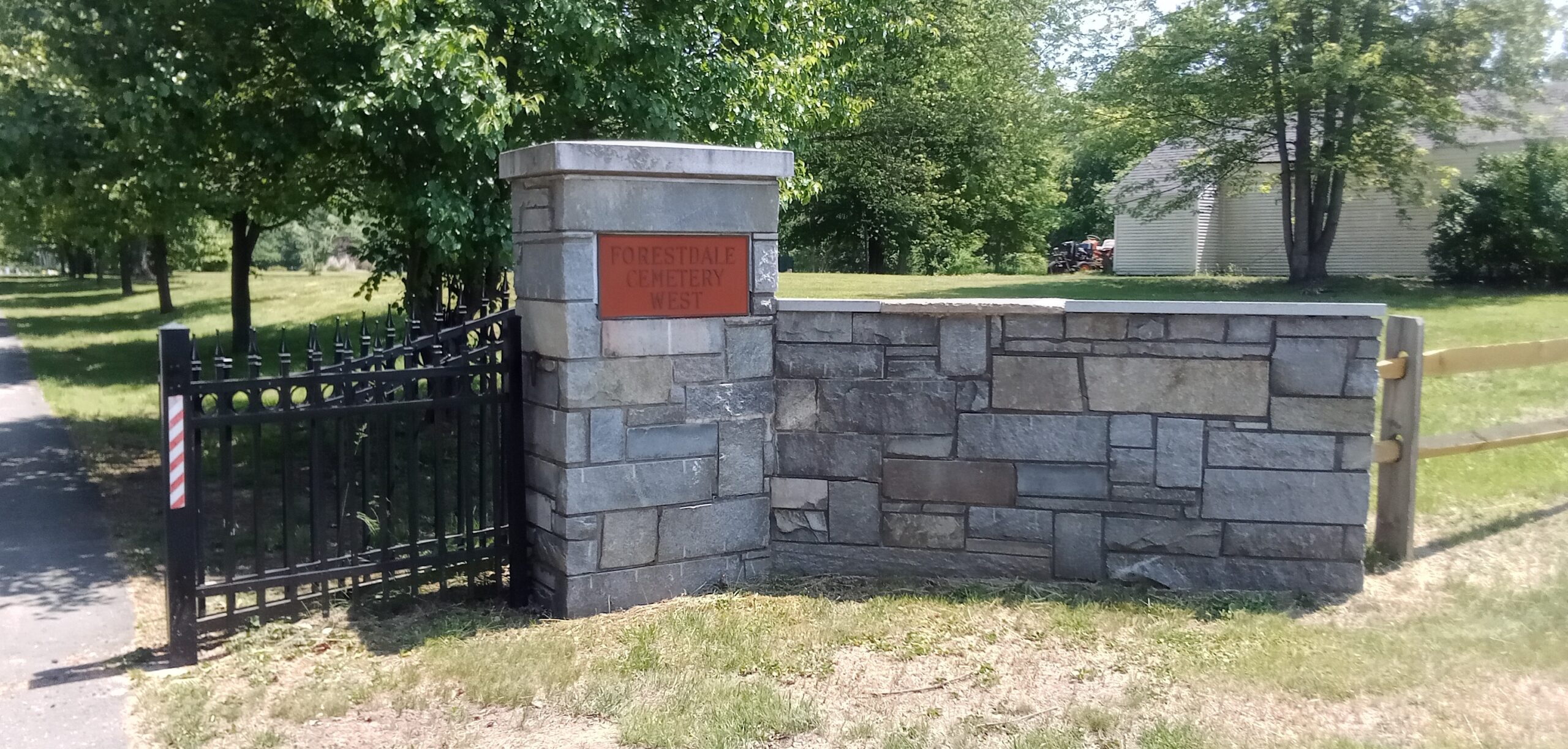
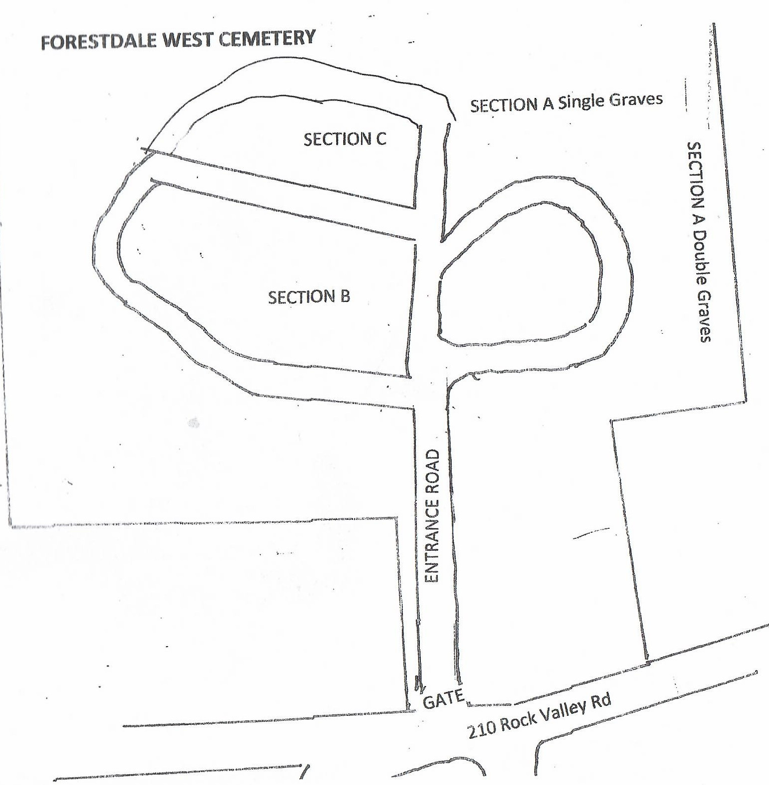
Forestdale West Cemetery tour
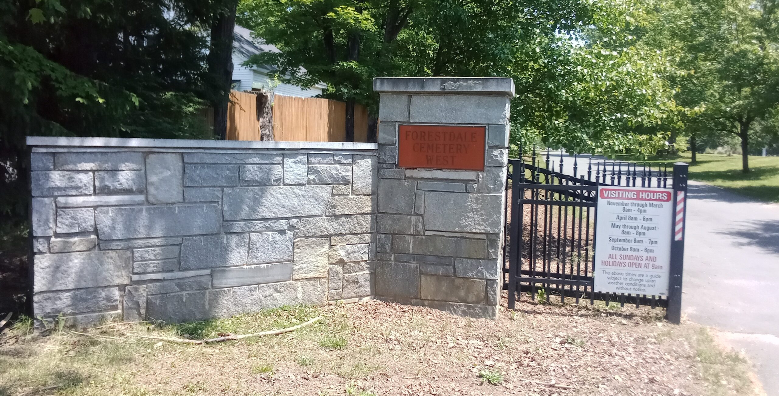
Forestdale West Cemetery tour – gates
Baby Boy Hatch
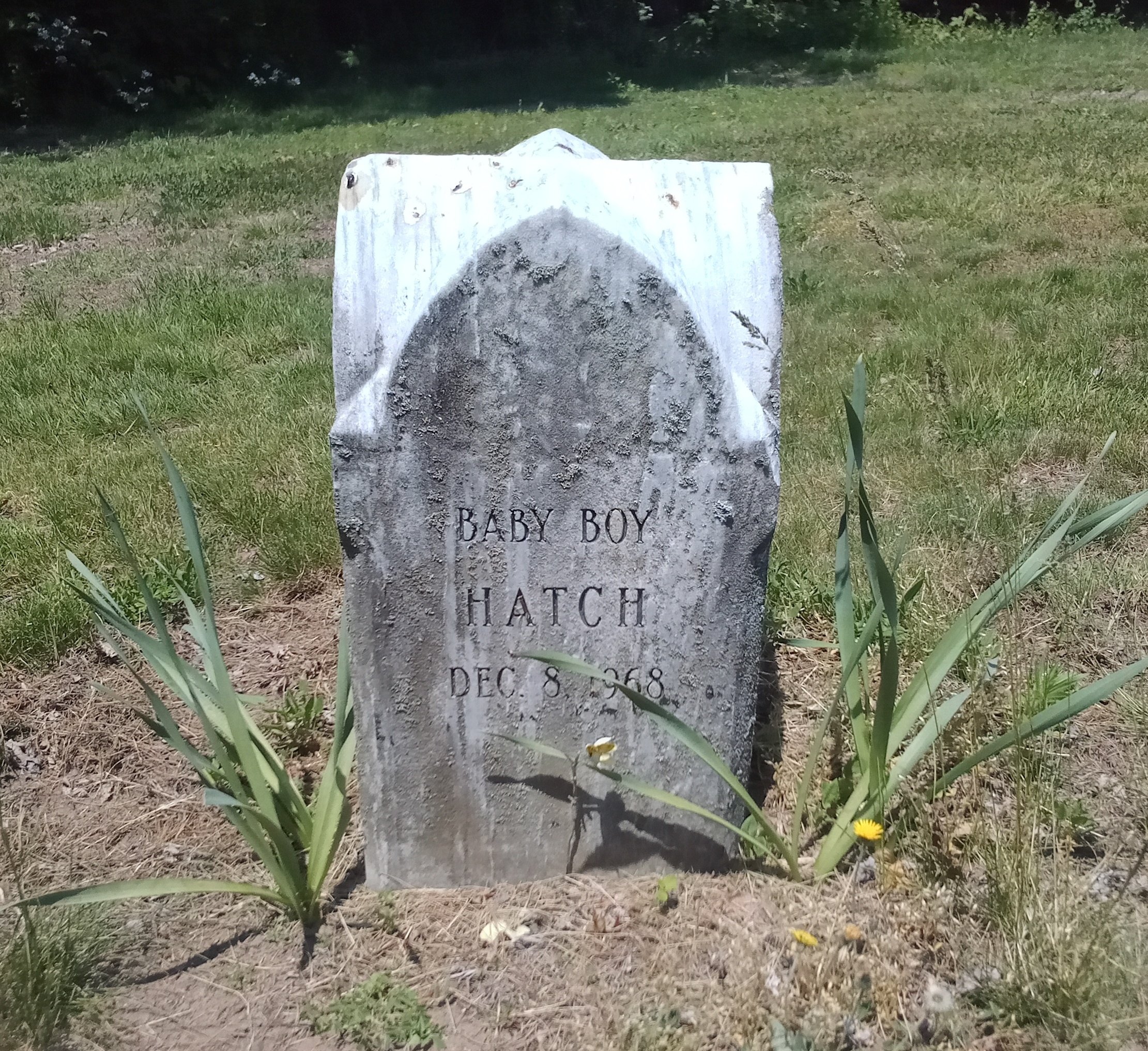
This is the first burial in Forestdale West Cemetery of Holyoke. This happened 4 decades before any other burials because the administrator of the cemetery was hoping to have a new cemetery here but continue burials in Forestdale Cemetery. In order to not pay taxes on the land, you need to have at least one burial.
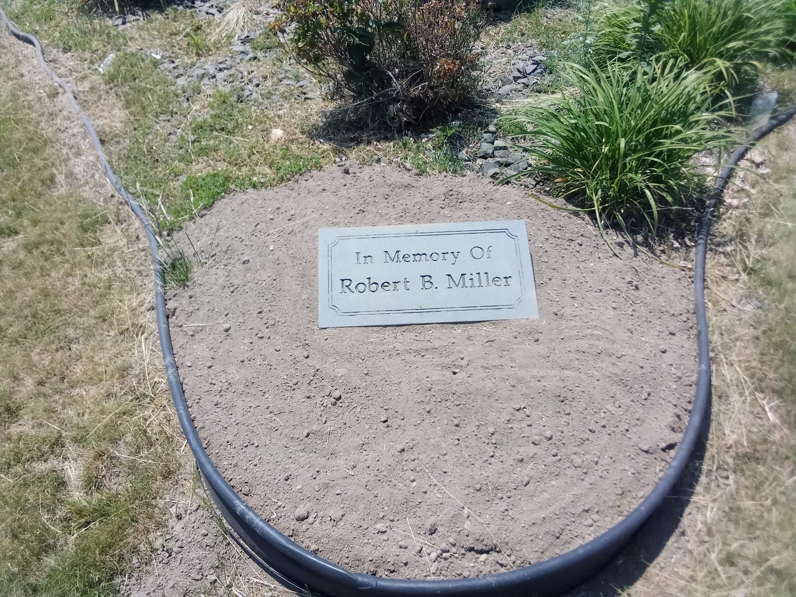
Robert Miller Memorial
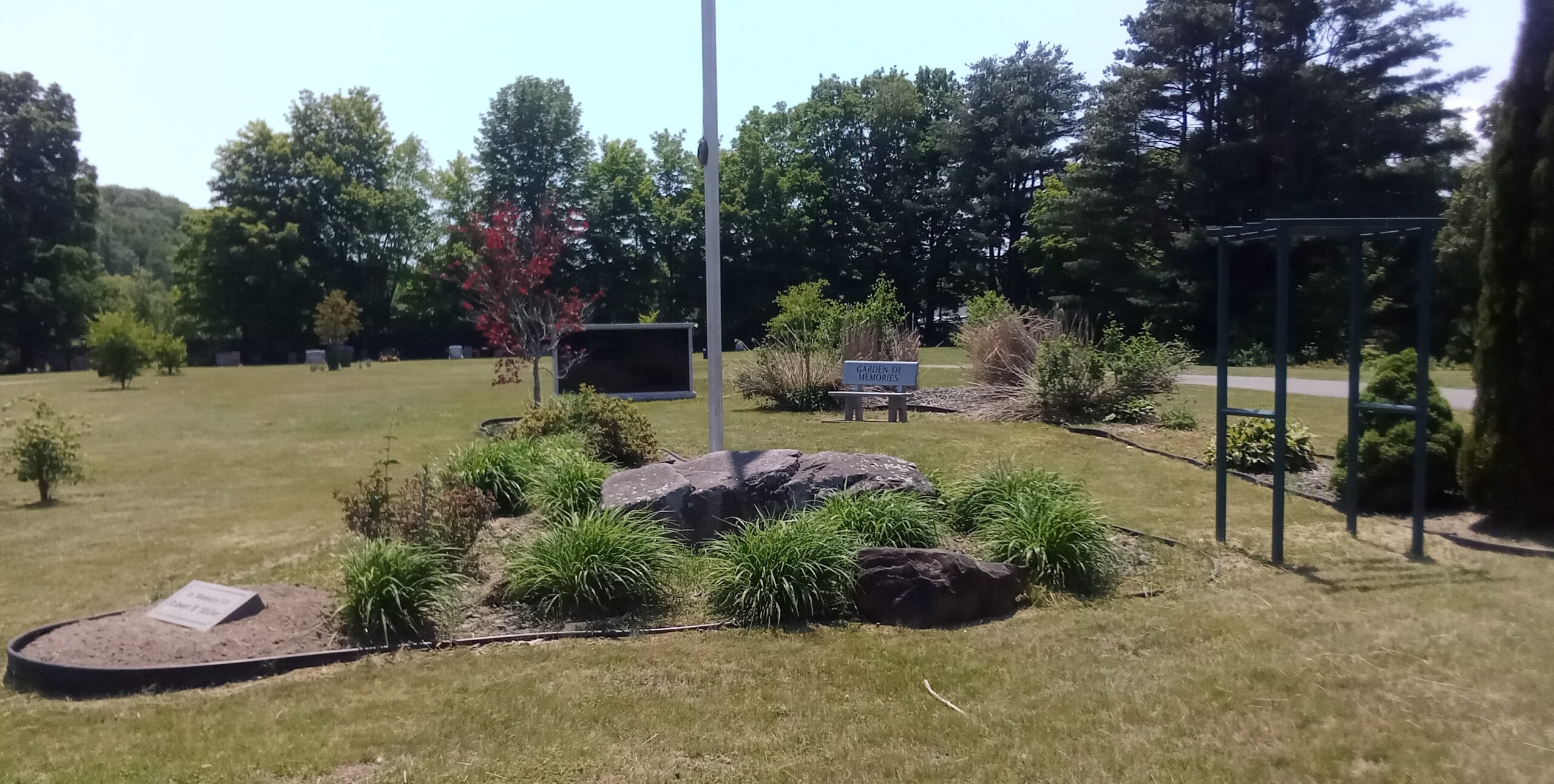
Robert Miller is buried in Forestdale Cemetery but he has a memorial area in the Forestdale West Cemetery. FINDAGRAVE
Spatial Arrangement of the Cemetery
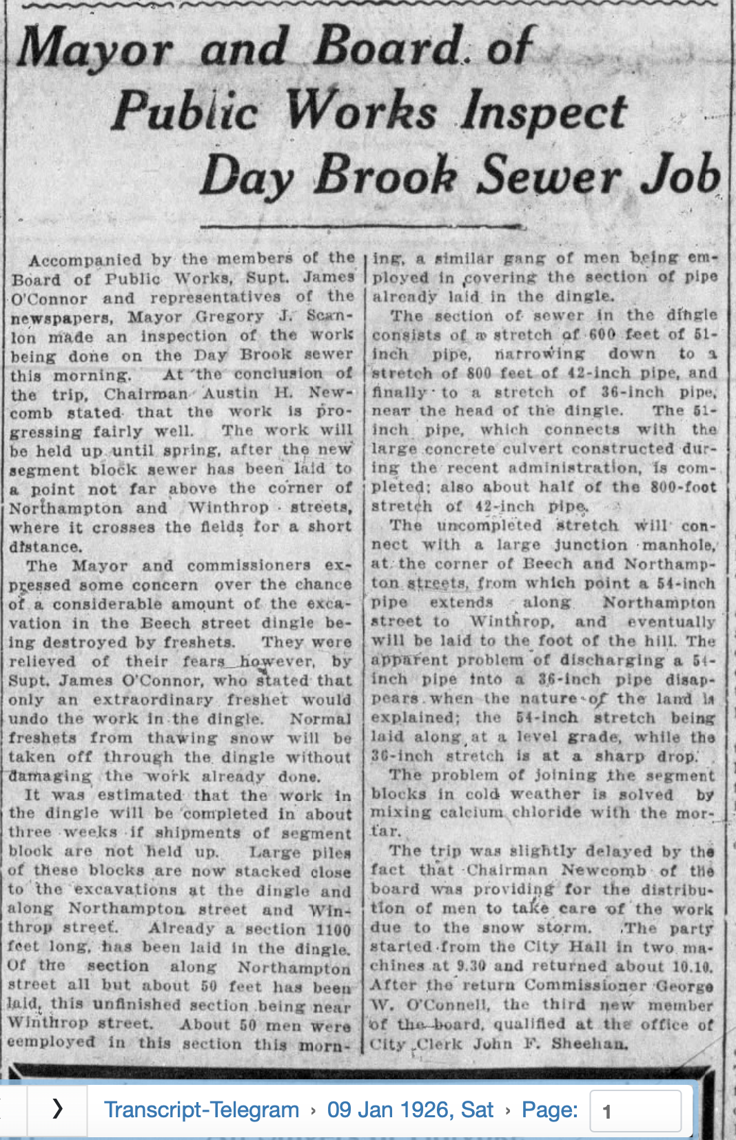
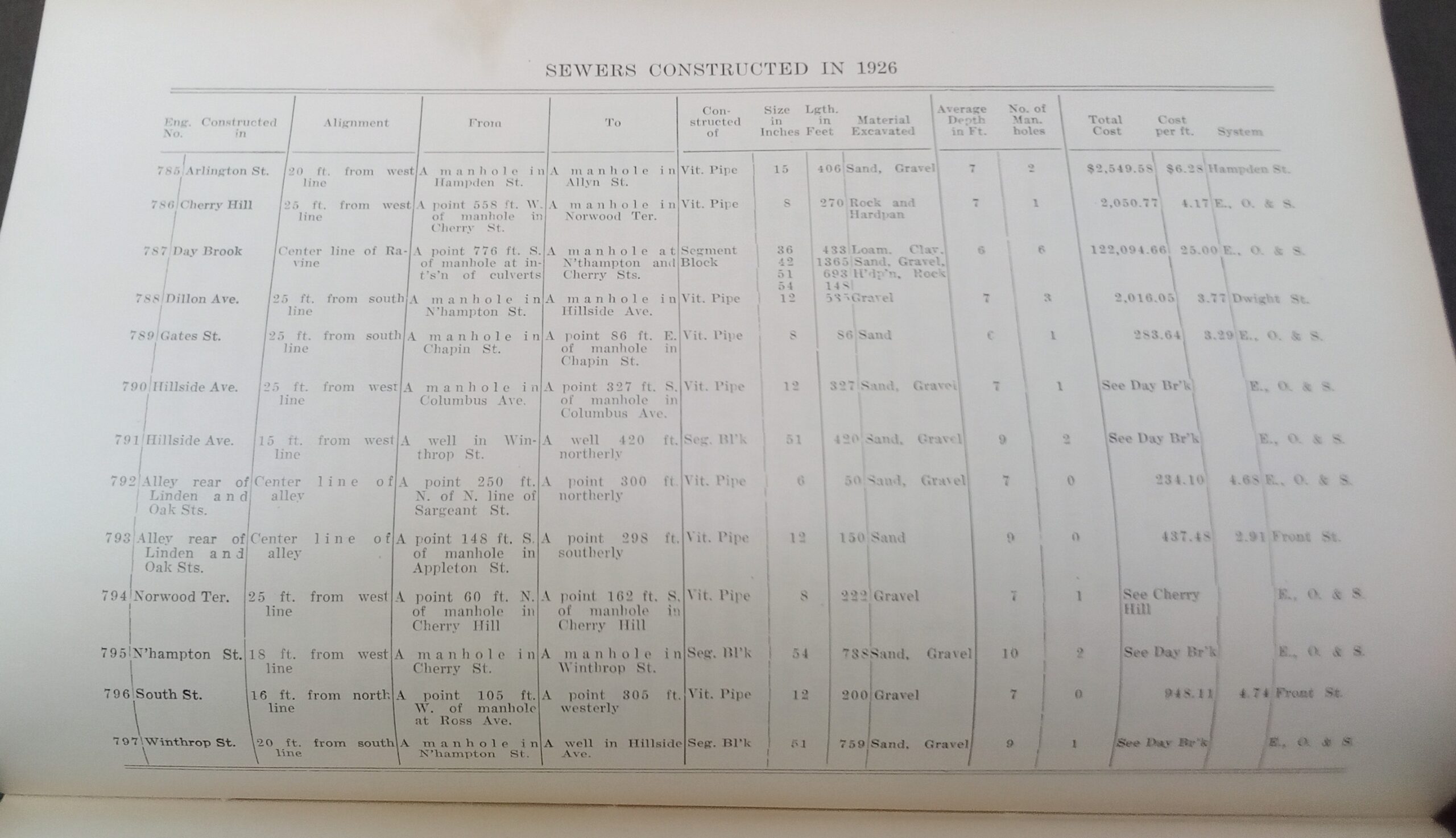
Day Brook data
Day Brook data
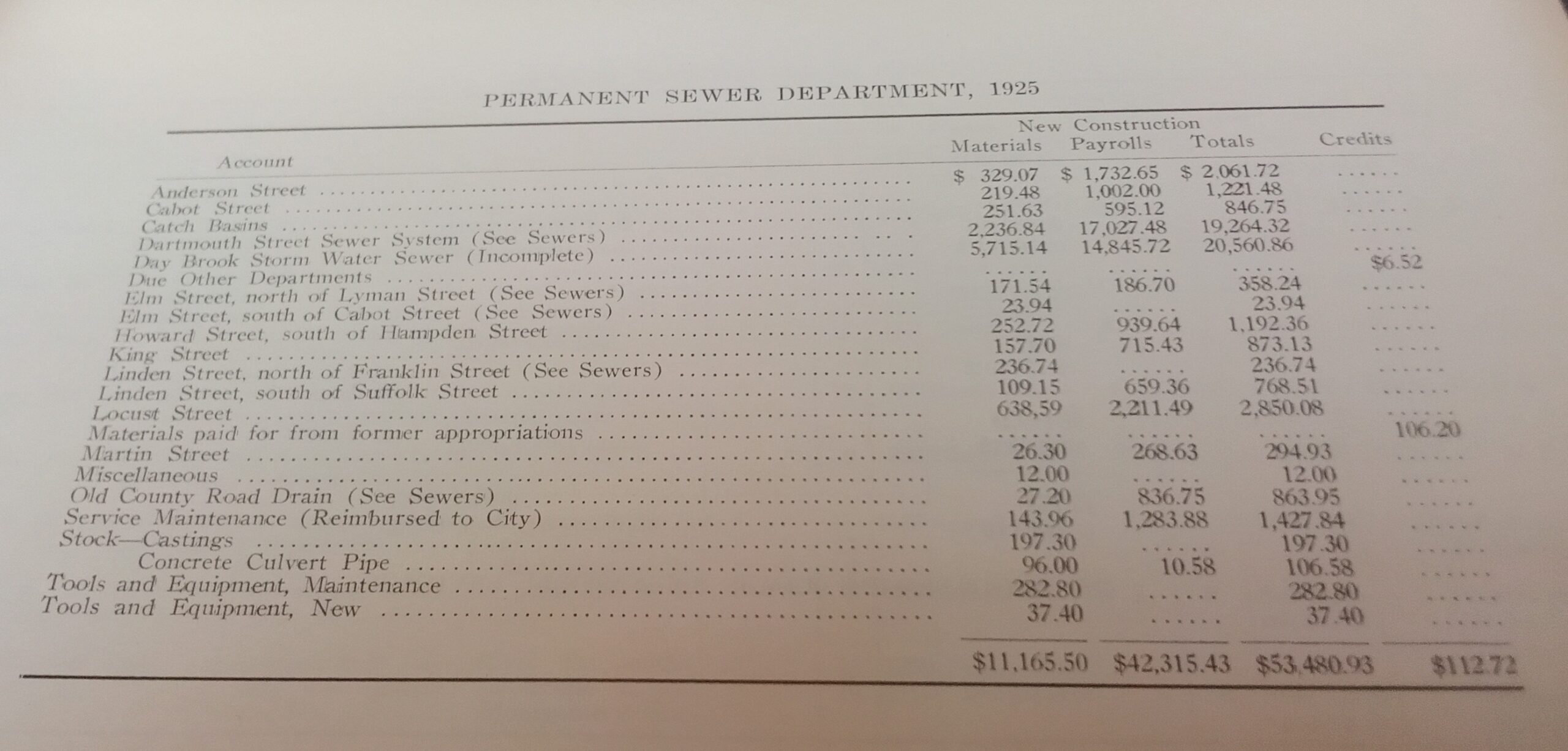
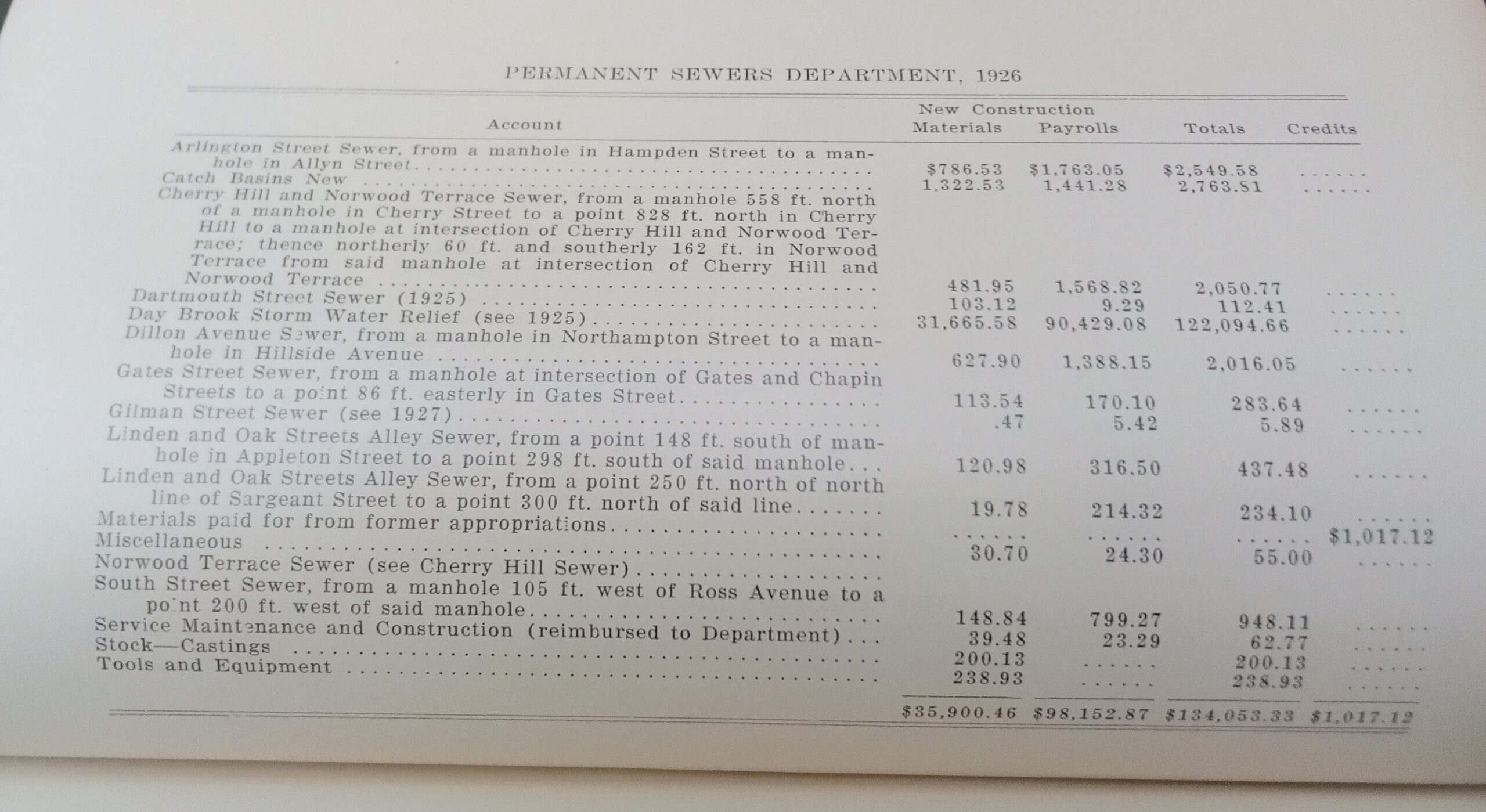
Day Brook is about 2.5 miles long from the top of Crafts Hill to its end at the Connecticut River. The segment from Norwood Terrace to just past MacKenzie Field was placed underground from 1925 to 1926. This is 4883 feet long or about 0.9 miles. It is not yet know when the next segment from just past MacKenzie Field to the Connecticut River was placed under ground.
The Day Brook project cost $20,560.86 in 1925. The Day Brook project cost $126,094.66 in 1926. The two year project was thus $146,655.52. That would be about $6 million in 2023 money.
The diameter of the lines were 36, 42, 51, and 54 inches which is very wide for sewer lines.
1925 information from the Holyoke annual municipal register.
1926 information from the Holyoke annual municipal register.
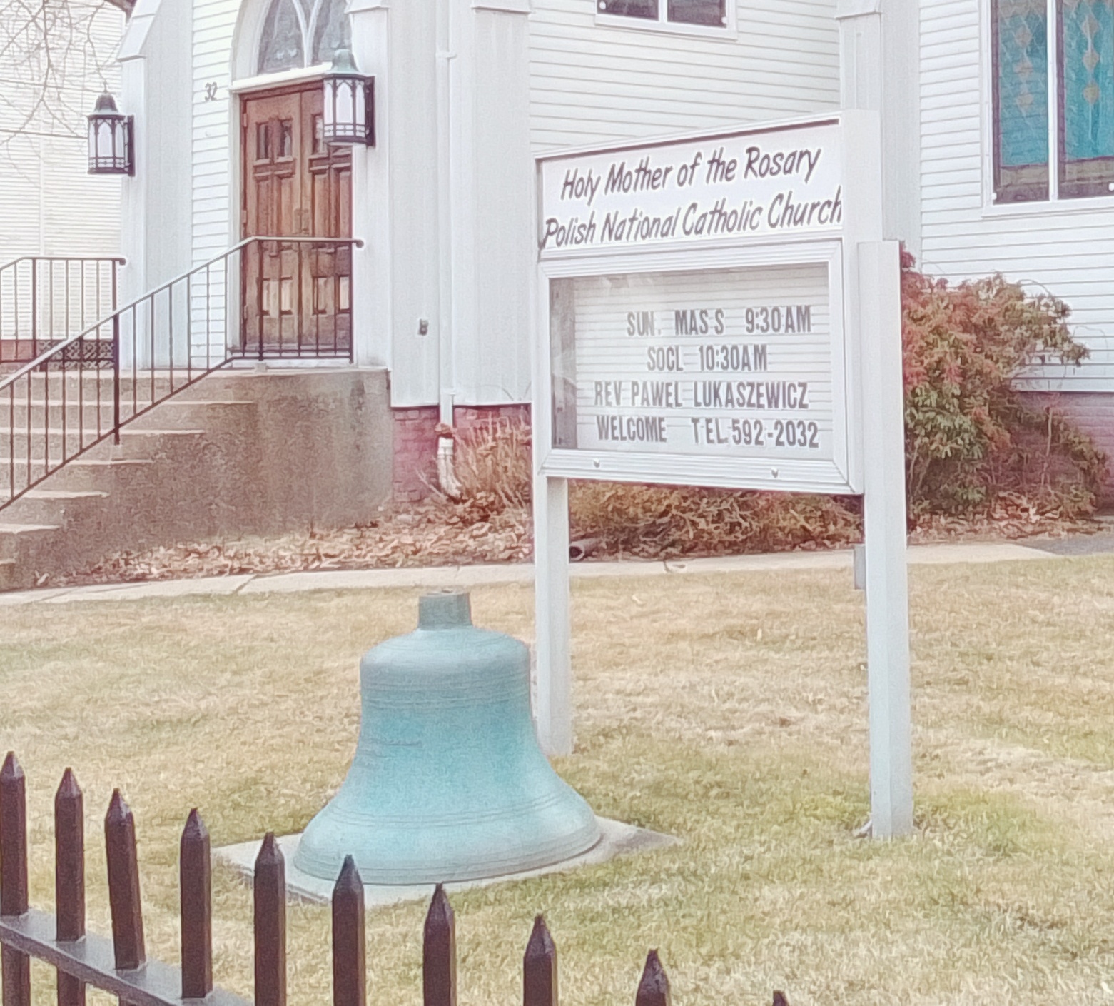
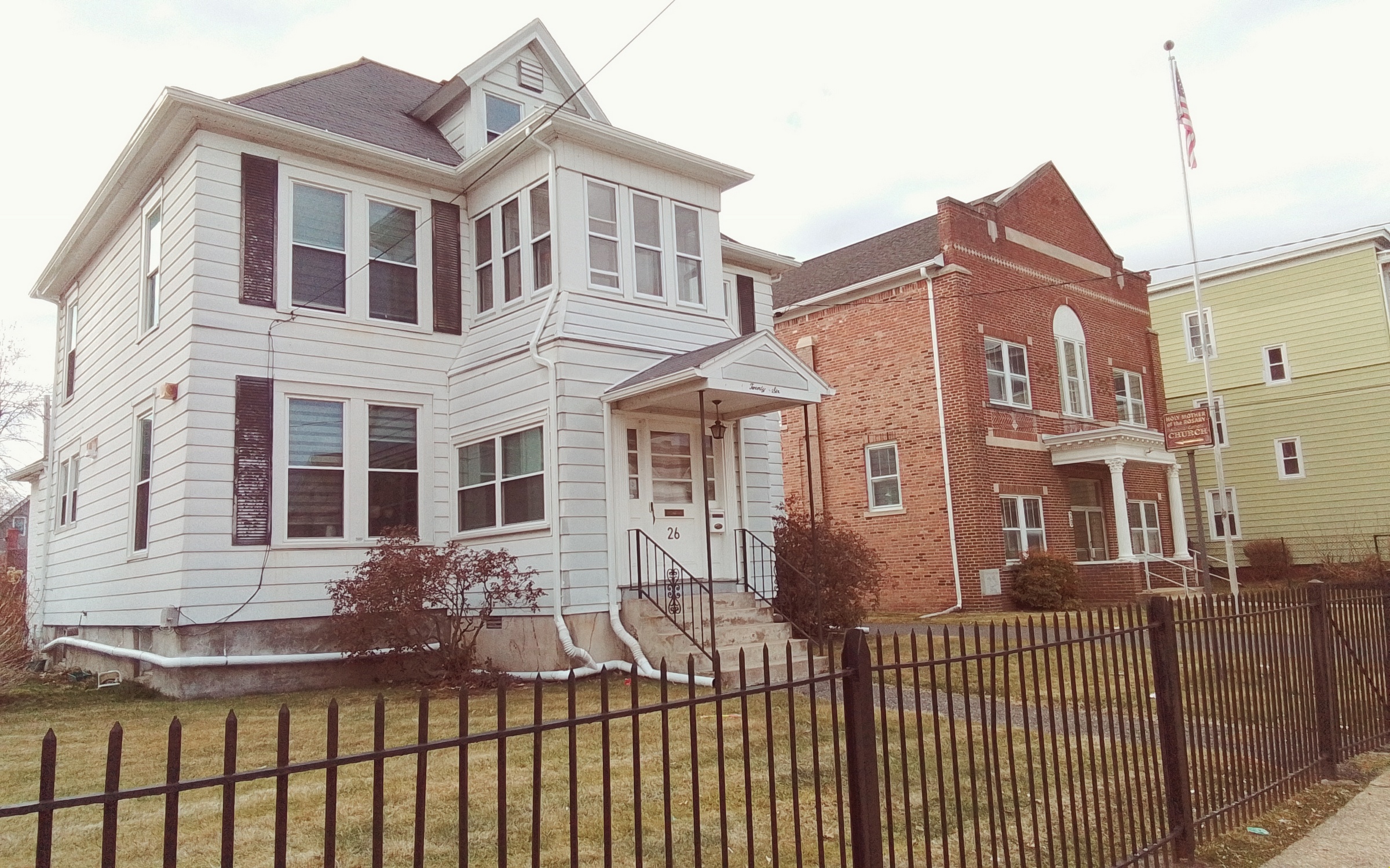
Holy Mother of Rosary Church
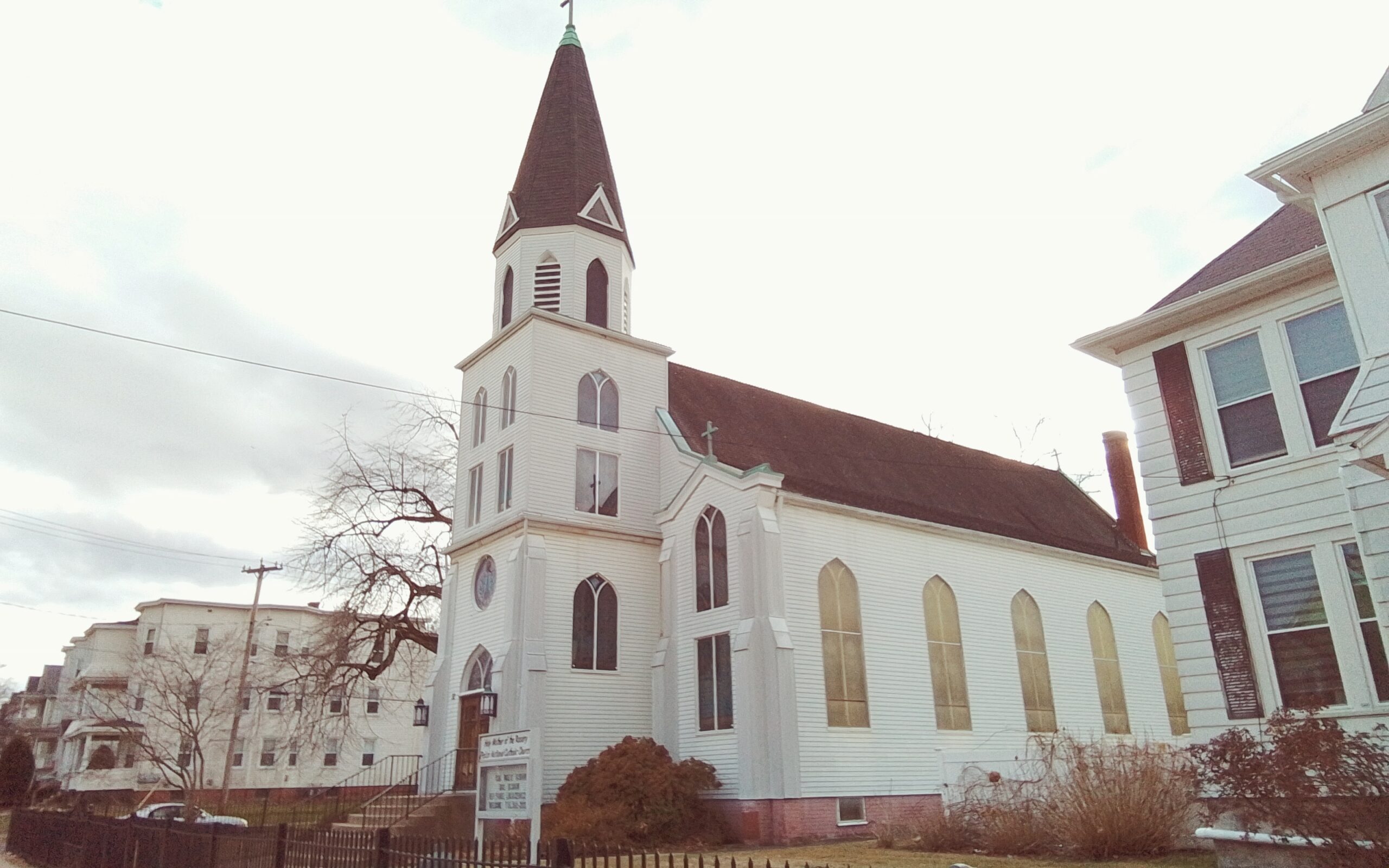
The Holy Mother of Rosary Church was chartered in March of 1897. Its first mass was in October of 1898.
The initial thoughts of having a new parish were from 1896. Land was purchased on Bell Street on January 5 1897. Plans were formulated on Jan 11 of that year. The first pastor was named on Jan 17 of 1897. Masses and ceremonies were held at the Daniel Twarog house at 21 Chicopee Street. There was a ceremony for the installation of the church bell on September 29 1901.
At first Independent Polish Roman Catholic Church of Holy Mother of the Rosary was used as the name but on June 7 1911 the name was changed to Holy Mother of Rosary Polish National Catholic Church.
In 1917 a building behind the present rectory was bought and used as a social hall.

Polish National School
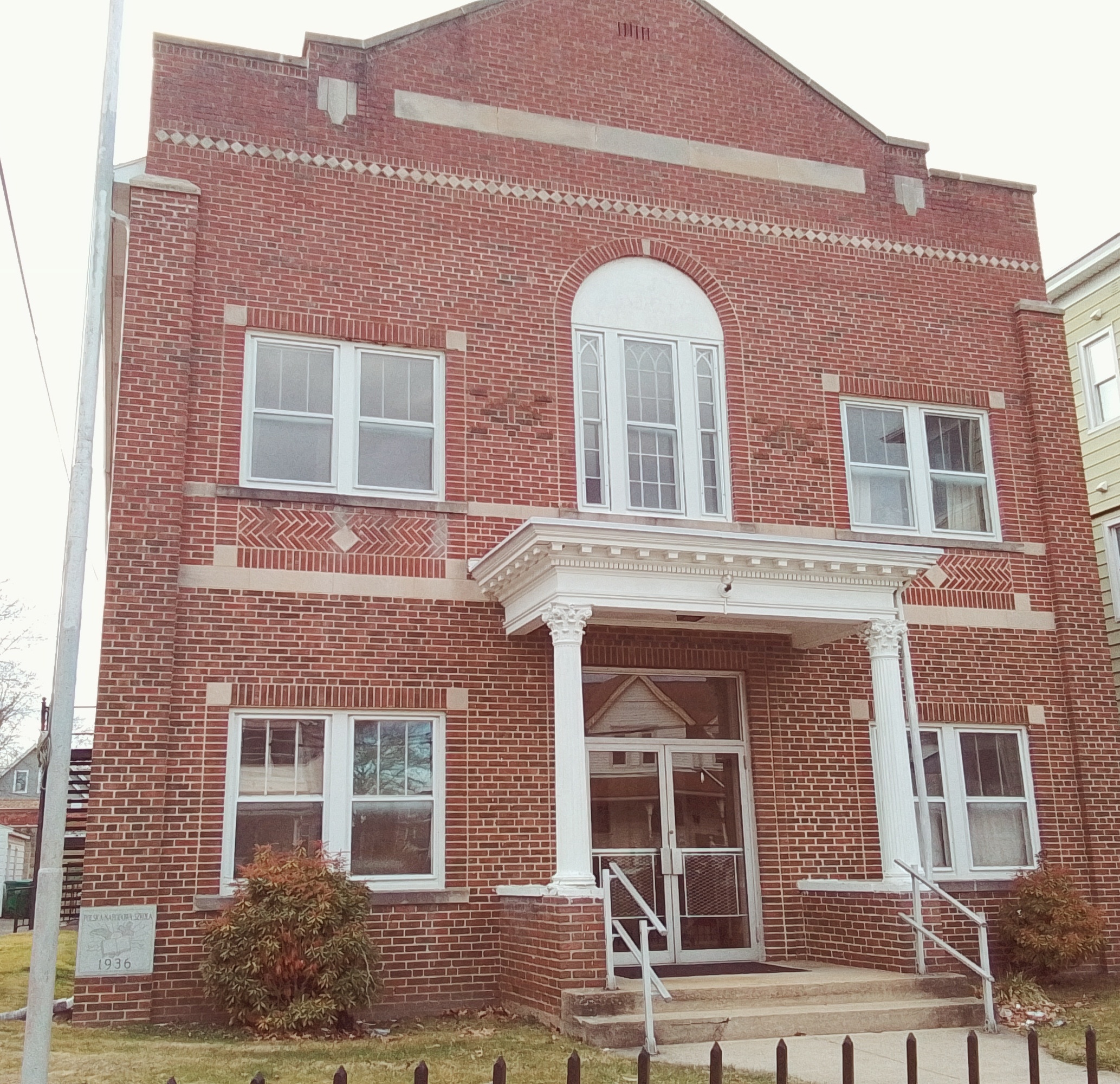
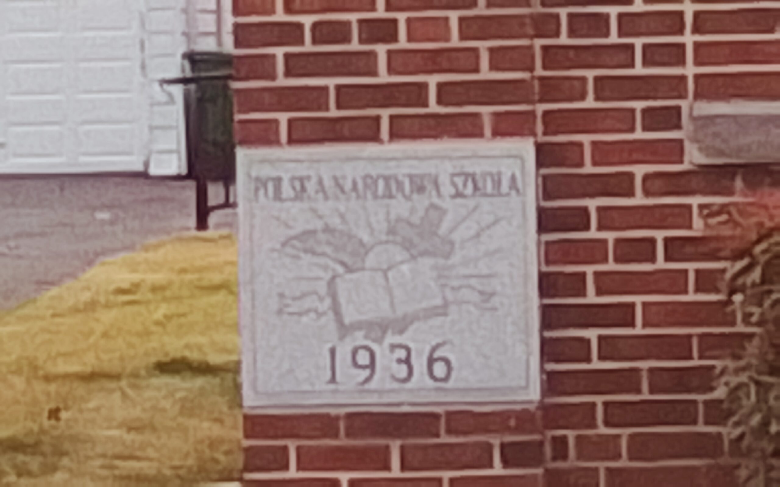
The parish school hall had its cornerstone blessed on June 20 1937 and dedicated on September 26 1937. The School of Christian Living was started Oct 31 1954.
first pastor and then bishop – Walenty Peter Gawrychowski – FINDAGRAVE
pastor Rev Robert M Nemkovich from February of 1968 onwards
Holy Mother of Rosary Church had a fire on April 9 1933.
This church owns the cemetery Holy Mother of the Rosary Cemetery.
Town Farm at the Chicopee Almshouse
The Chicopee Almshouse has an interesting story HERE at starting at page 7. This was on the land that is now at and near the northeast corner of Ondrick Drive and East Street extending to Crestwood Street..
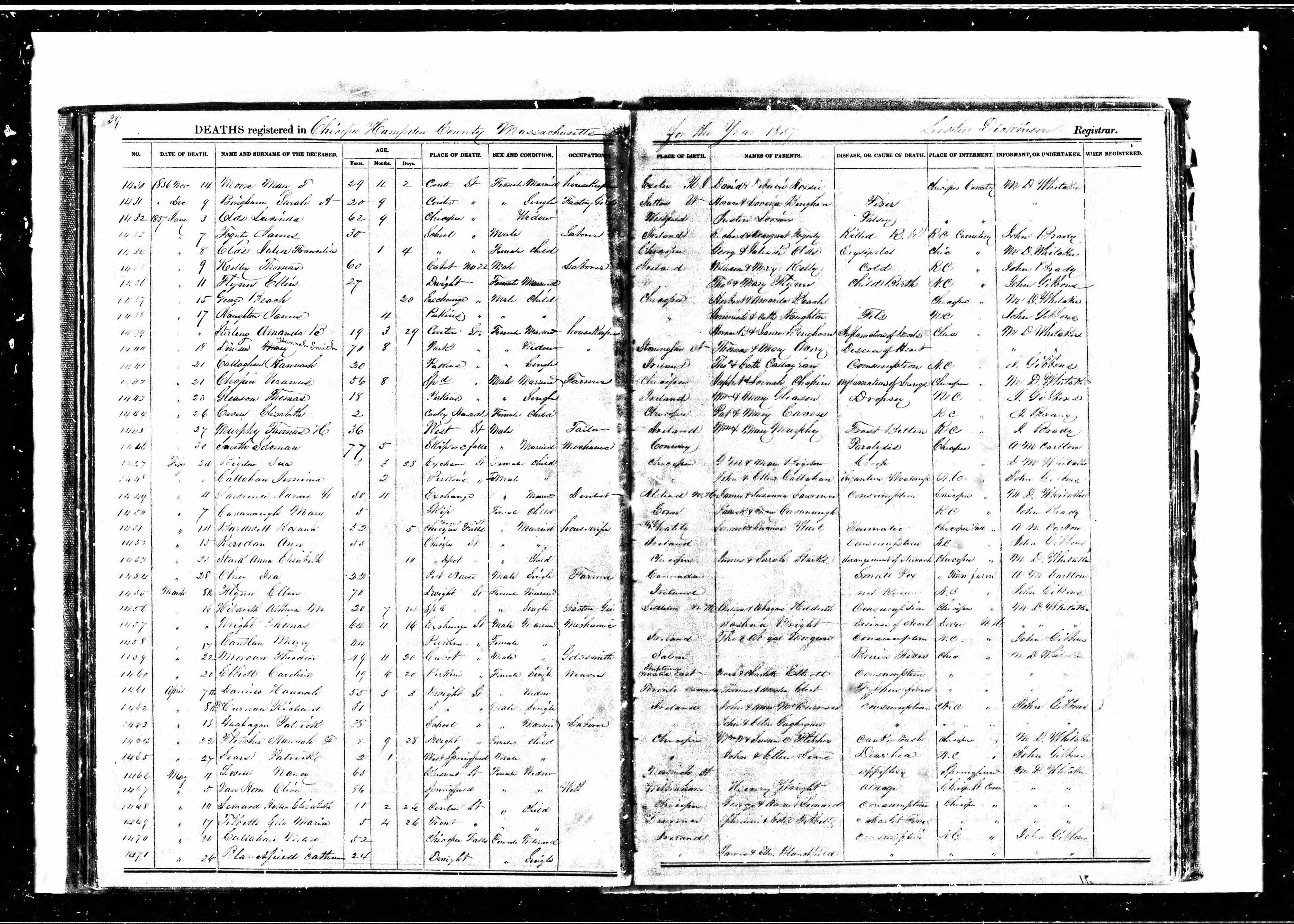
Ira Olney died Feb 28 1857 at the Town Farm at the Chicopee Almshouse. She died at a pest house there of small pox and was buried onsite.
Then Harvey Reed died Dec 20 1859 at the Town Farm at the Chicopee Almshouse. He died at a pest house there of small pox and was buried onsite.
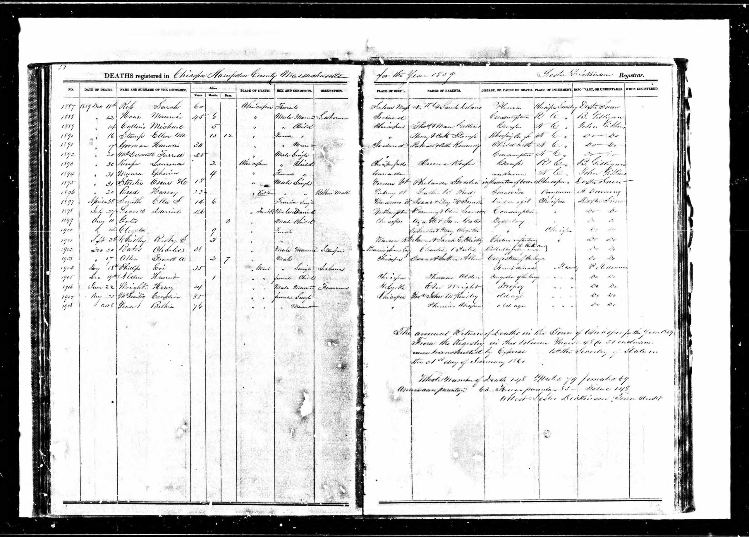
Only three burial happened at the Town Farm at the Chicopee Almshouse. It is not know if the burials are still there. The other burial was a child but I cannot find a record of that burial.
Saint Mary’s Church
Saint Mary of the Assumption Church is located in the Willimansett neighborhood of Chicopee. It was dedicated May 18 1941. It lies on Davitt land.
Holyoke Richardsonian Train Station
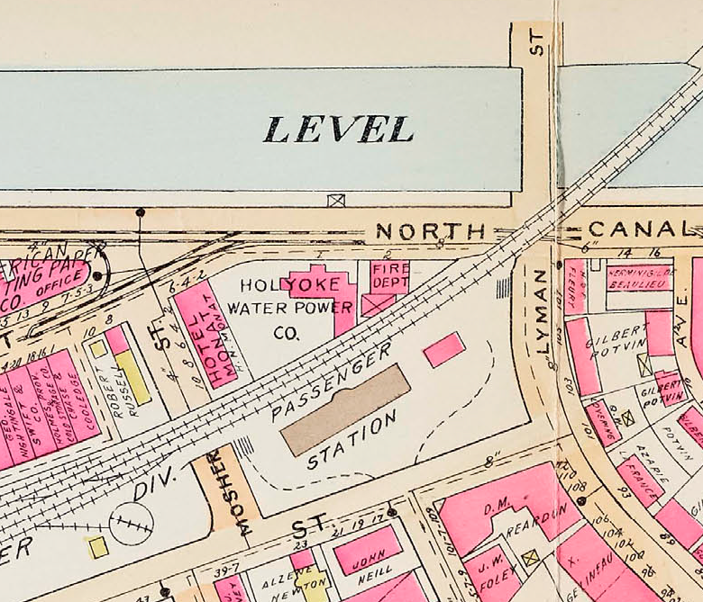
Holyoke Richardsonian Train Station is bounded by Lyman, Bower, Mosher, and Canal Streets. This is an outside sidewalk tour.
Connecticut River Railroad Passenger Station was built in 1884 and finished in 1885. (The first day of use was February 1 1885.) Henry Hobson Richardson designed this station. The station is 154 feet long and 38 feet wide. The overhang of the porch is 15.5 feet. The outdoor pillars are of yellow pine. The dark brown trim in the architecture is of Longmeadow brownstone. The light masonry is of Milford granite. There is curbing around the perimeter of the grounds and this is up to 8 feet high at the maximum. It is cut from Dummerston Vermont granite.
Inside any wood finishing is of oak. The floors are pine. Any masonry trim plus the fountain is of Knoxville marble. The stairwells have oak balustrades.
As a passenger walked out of the train station toward Bowers Street they would have seen in the 1920s the Immaculate Conception Church in the distance down Ely Street. What a site that would have been! This walking tour brings you back to what life would have been like from 1885 to 1965 when this train station was active. It would have brought many immigrants into Holyoke. The station was surrounded by some very active streets.
Within the lot of the railroad station there is a Boston and Maine Railroad Express Office. It was built between 1896 to 1910 since it does not appear on the Sanborn map of 1895 but does appear on the 1911 Richards map.
stop 1 – Bowers Street
Of great interest is that the Three Star Theatre was across the street from the station. Read a little about it at the LINK. Also across Bowers Street was a line of stores and houses.
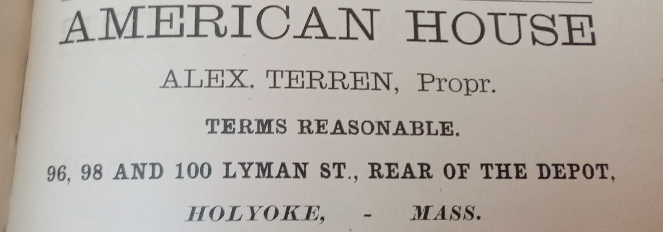
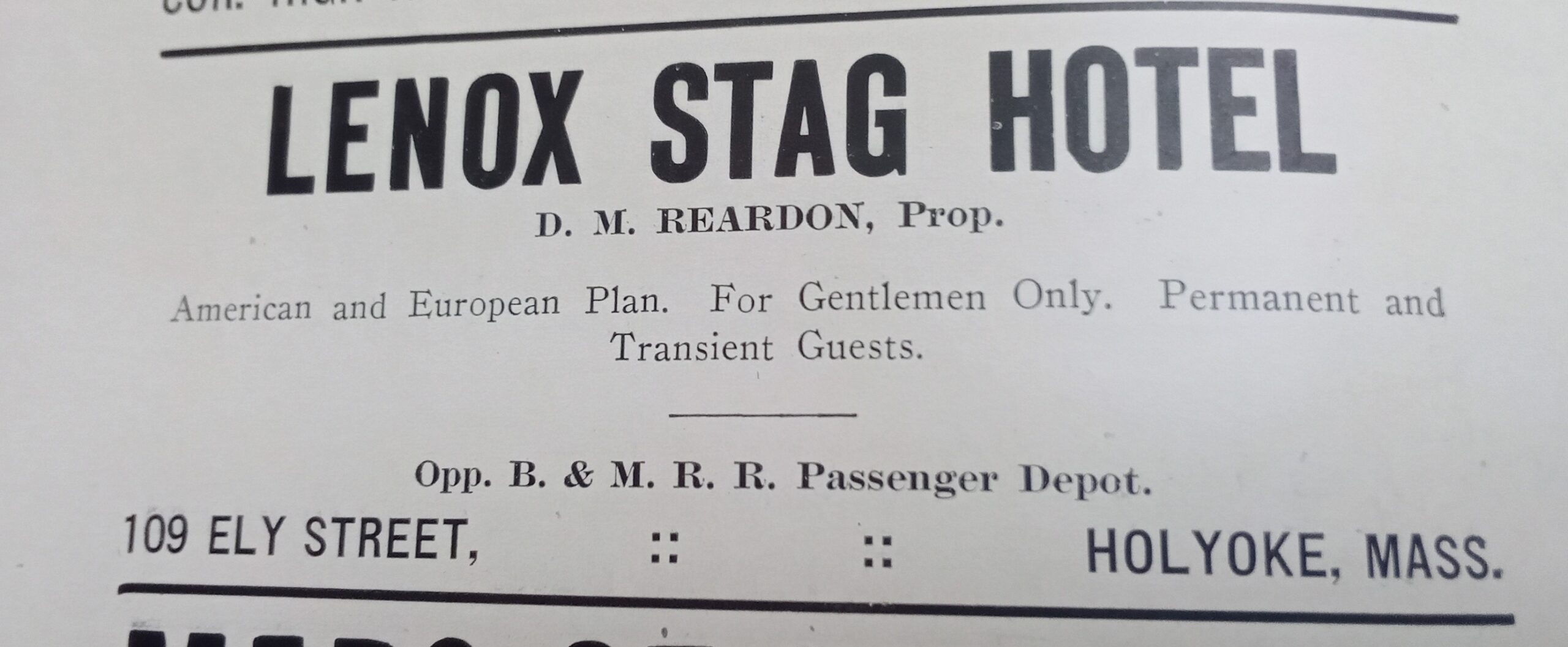
The American House was at the end of Bowers (officially at 96-98-100 Lyman Street) from at least 1887 to 1895 (in 1894 it was called the Daley Hotel). Alex Terren (Therrien) was the proprietor. The Lenox Stag Hotel was across the street for the entire block in at least the 1910s.
The most fascinating fact about the Bowers Street land is that when it was graded from 1868 to 1870 many Native American burials were found. Mosher and Bowers MAP.
stop 2 – Potvin Tenement Houses
Across the station alongside Lyman Street many apartment buildings were constructed. Behind these structures there was a street that is not there any more called Potvin Street and then the 2nd of three trolley barns for the Holyoke Street Railway. TROLLEY
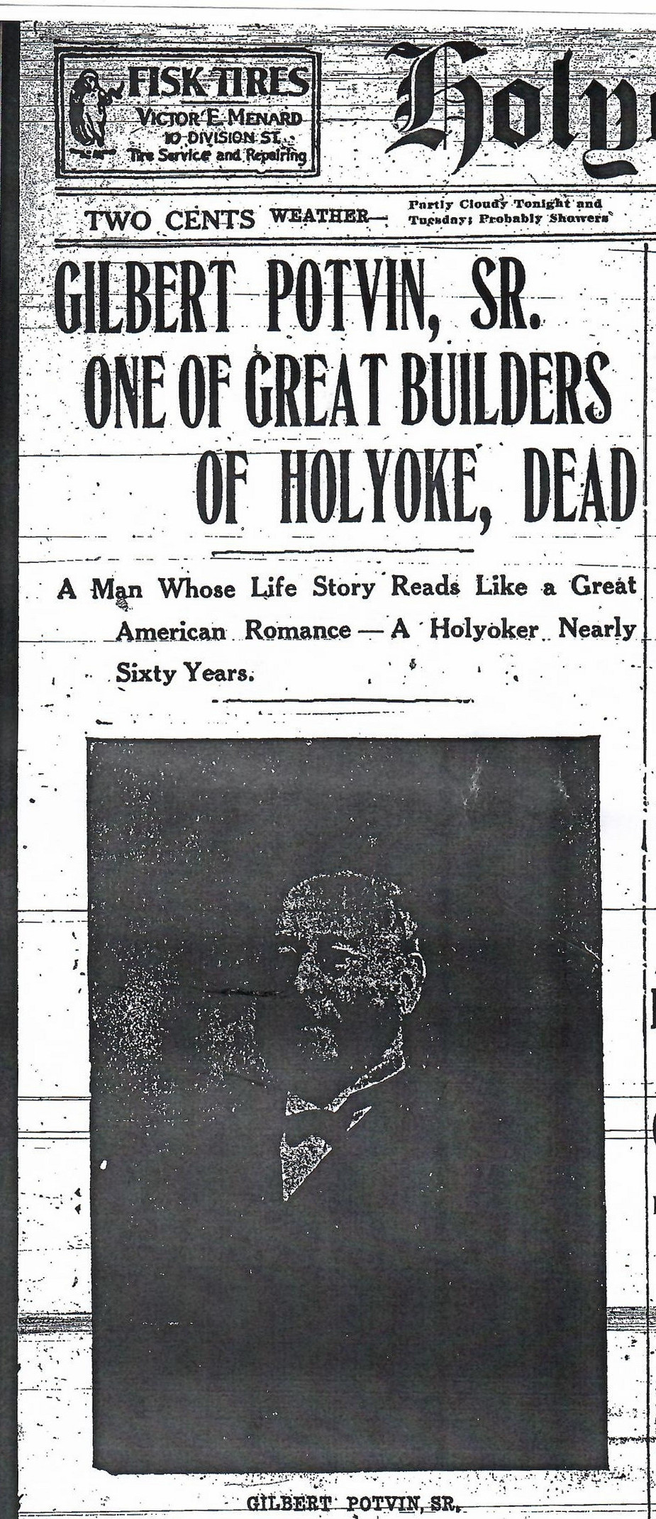
The tenement houses across Lyman were all built in the same style and by the same owner. Gilbert Potvin (FINDAGRAVE) had the Lynch Construction Company built 13 tenement houses along Lyman here and in a row onto the adjacent streets to form a long series. All were attached to the closest one by an elevated walkway on each floor. These wooden walkways lasted from the construction in 1880 until at least 1895. (They were on three Sanborn maps but not that in 1915 – at that point windows are in their place) Each building was 4 stories high and had the same dimensions.
stop 3 – Connecticut River Line Railroad Bridge

You can see the Connecticut River Line Railroad Bridge built in 1927 and completed in 1928. In the distance to the northwest is the Whiting Paper Mill and the Boatlock Station.
stop 4 – Juncture of North Canal and Main Streets
Now on to Canal Street and the Second Level Canal. The Lyman Mill dominates this section of Canal Street. You can read a great deal about the Second Level Canal at this LINK.
On the eastern side of Canal Street there was in order left to right a fire station, the Holyoke Water Power Company, and the Second Baptist Church.
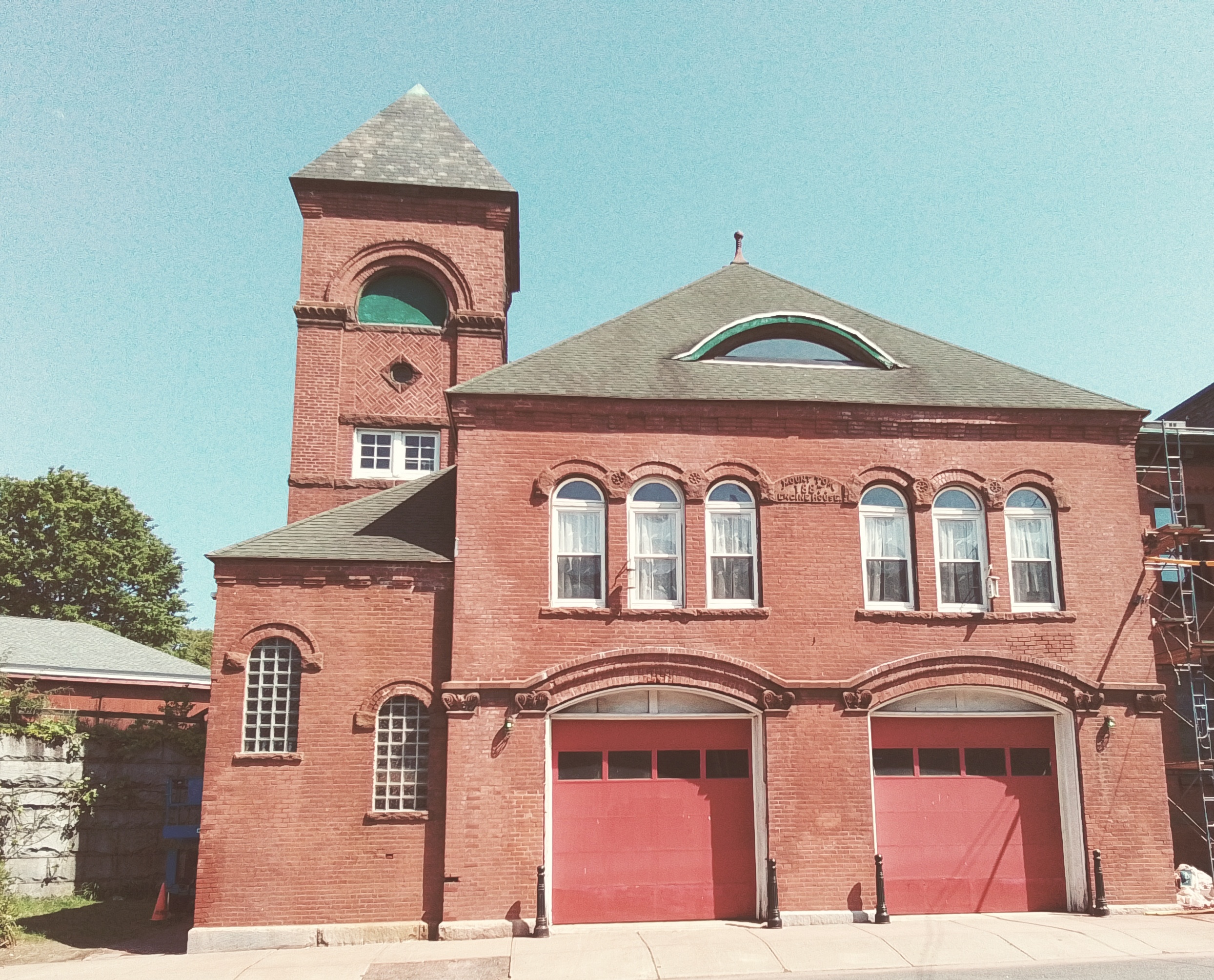
The Mount Tom Fire Station is first in this series.

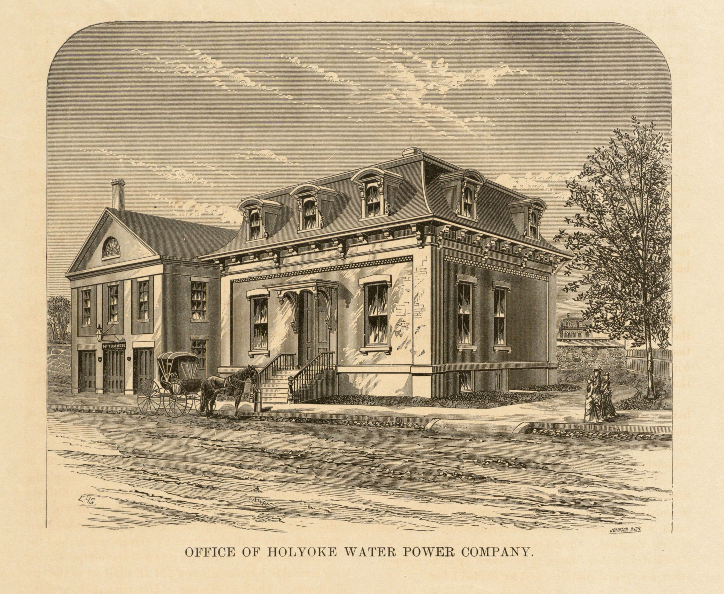
The administration building of the Holyoke Water Power Company is on this city block of Canal Street. It was built in 1871 as a Second Empire style building. In the early 1880s the French roof was raised off of the 1 story building and a second floor added. In the late 1880s a side and back addition were made.
The Second Baptist Church was built here in 1855 as a meeting house. In 1863 a fire destroyed the meeting house. In the new church, exterior was clad in brick and the steeple was 50 feet high. It was dedicated April 20 1865. Another Second Baptist Church was built on Appleton Street. The cornerstone was laid August 9 1884 and the church was dedicated October 20 1885. This Second Baptist Church at the juncture of Main and Canal was to remain part of the church system as a mission church.
The parish of the Holy Rosary Church met at the Second Baptist Church during 1886 and 1887. The Rosary Church was built on Mosher Street in 1888. The life of the Second Baptist Church at Main and Canal since by 1895 it had been removed. The church was removed in the 1880s or 1890s so that a building that faced onto Mosher Street could be expanded.
stop 5 – Hotel Monat
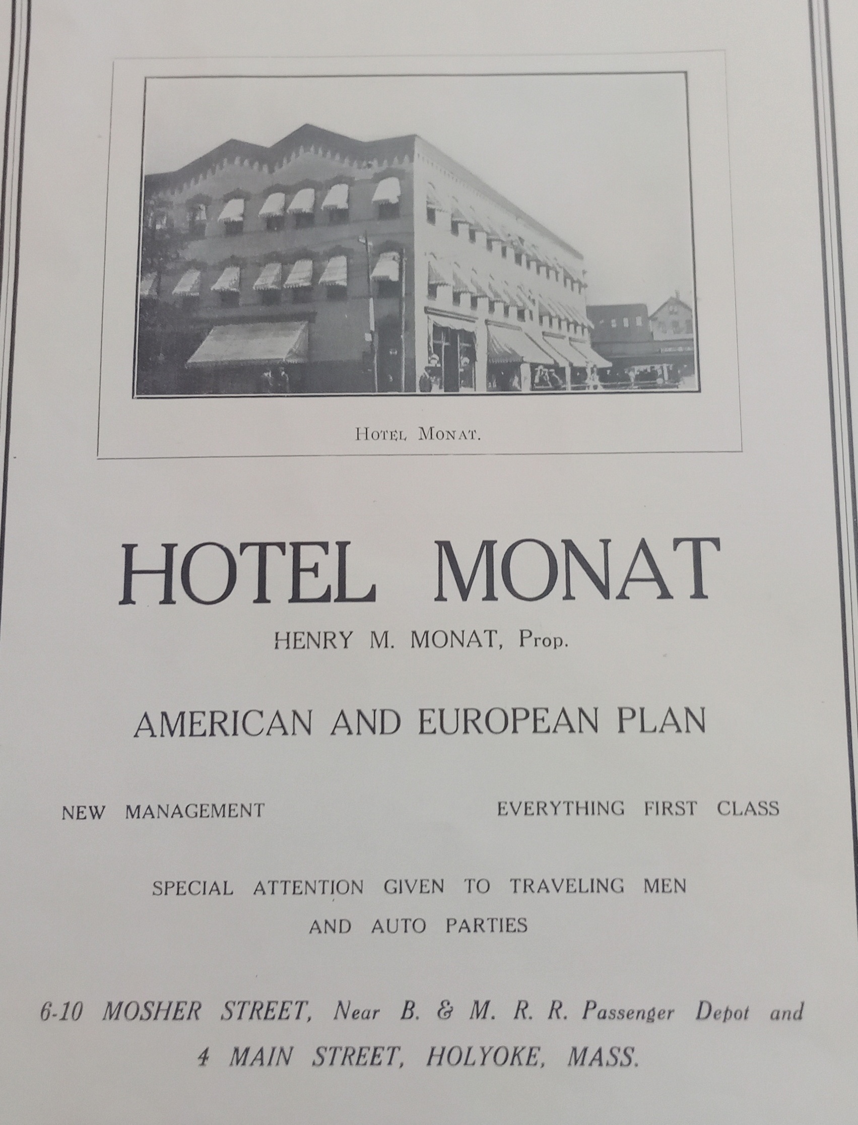
This building on Mosher Street was built in 1884. It was three floors high and had stores on the ground floor (fruit, barber, and a bar) and a chemical company on the second floor. By 1895 it now had a hotel on the upper stories and was called the Norris House. The Hotel Monat came into this building and expanded it backwards. By 1949 the Hotel Monat had two restaurants – 4 Main and 2 Mosher. The establishment was owned by Henry Monat.
Across the street from the Monat was the Robert Russell building. This area would become an auto repair shop in the 1910s with wood buildings and then masonry buildings. At the southwest corner of Mosher and Bower Streets, there was a railroad turntable.
Sanborn maps
1895 map A – map B – map C
1915 map A – map B – map C
1949 map A – map B – map C
1956 map A – map B – map C
Westfield
Cemeteries
Churches
Our Lady of the Blessed Sacrament Church
Saint Casimir Church
Canals
Crane Brothers Paper Mill Canal
Van Deusen Whip Mill Canal
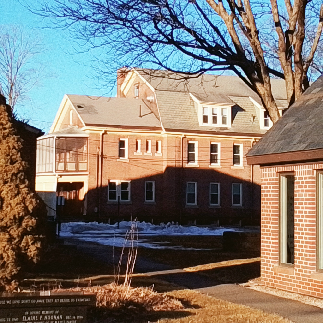
Saint Mary’s Church Campus
Saint Marys Church Campus
Church – Bartlett Street
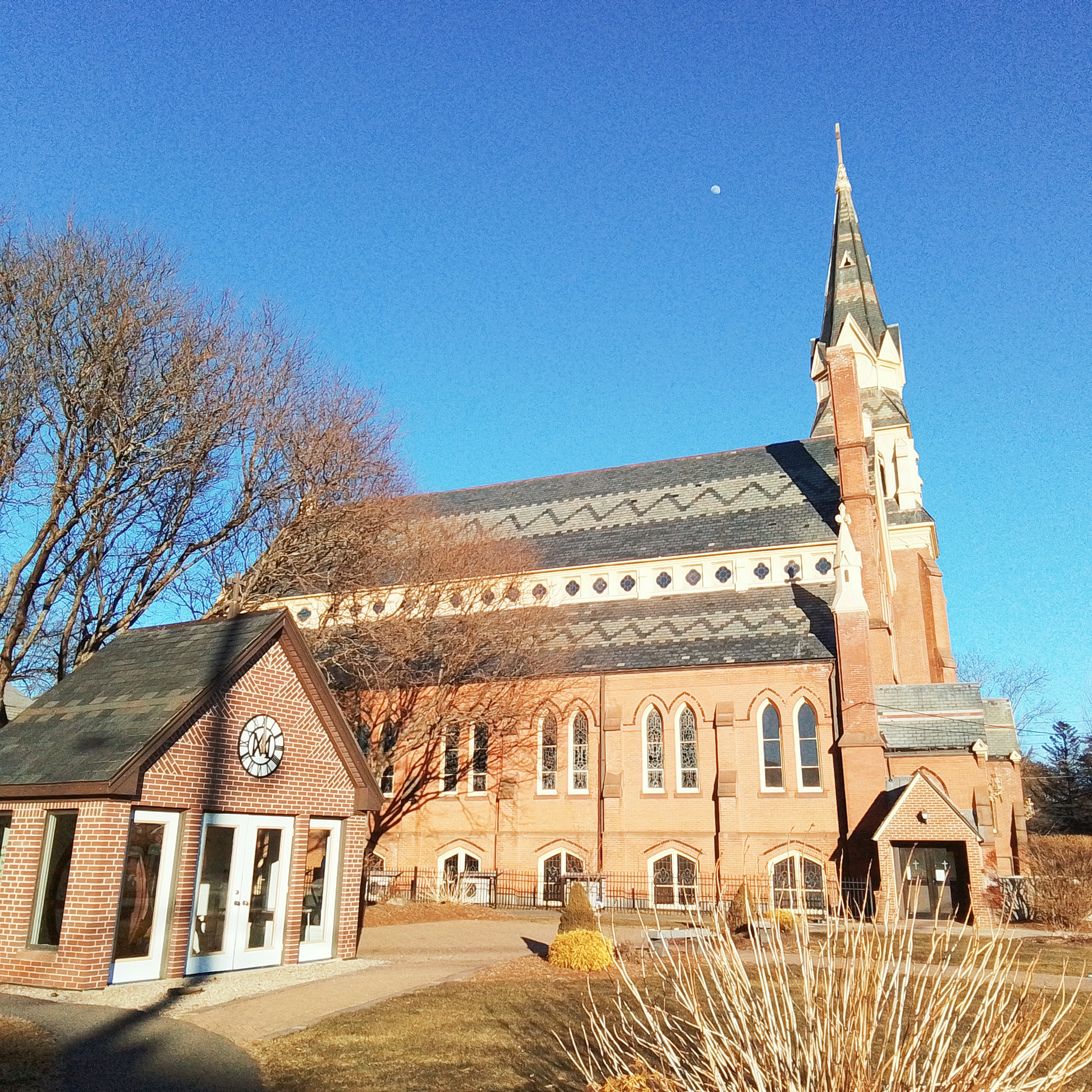
The second Saint Mary’s Church was made in 1885 as a neo-Gothic style. The first Saint Mary’s Church was opened in December 1854 and burned in 1881.
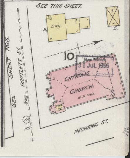
Sanborn 1889 map
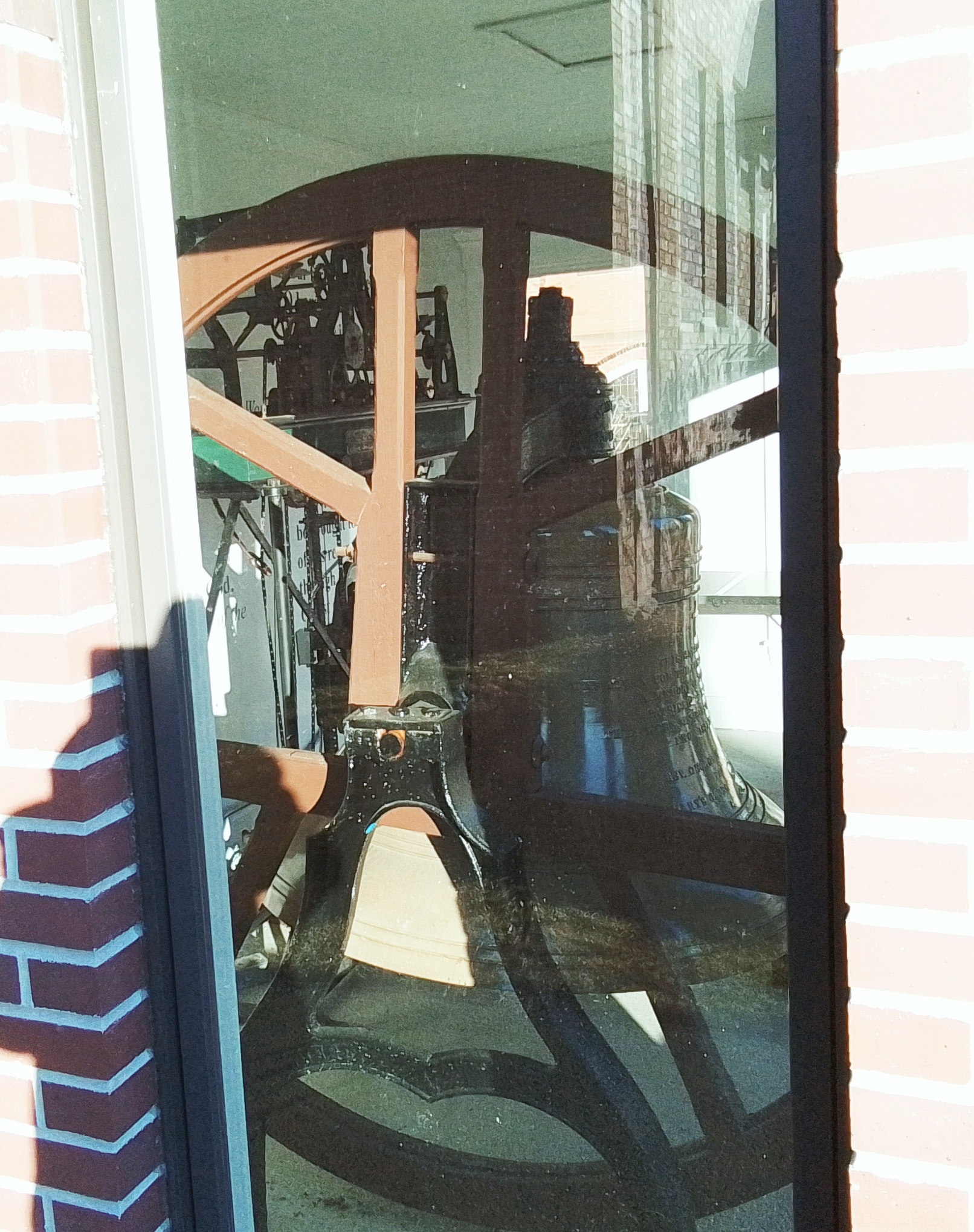
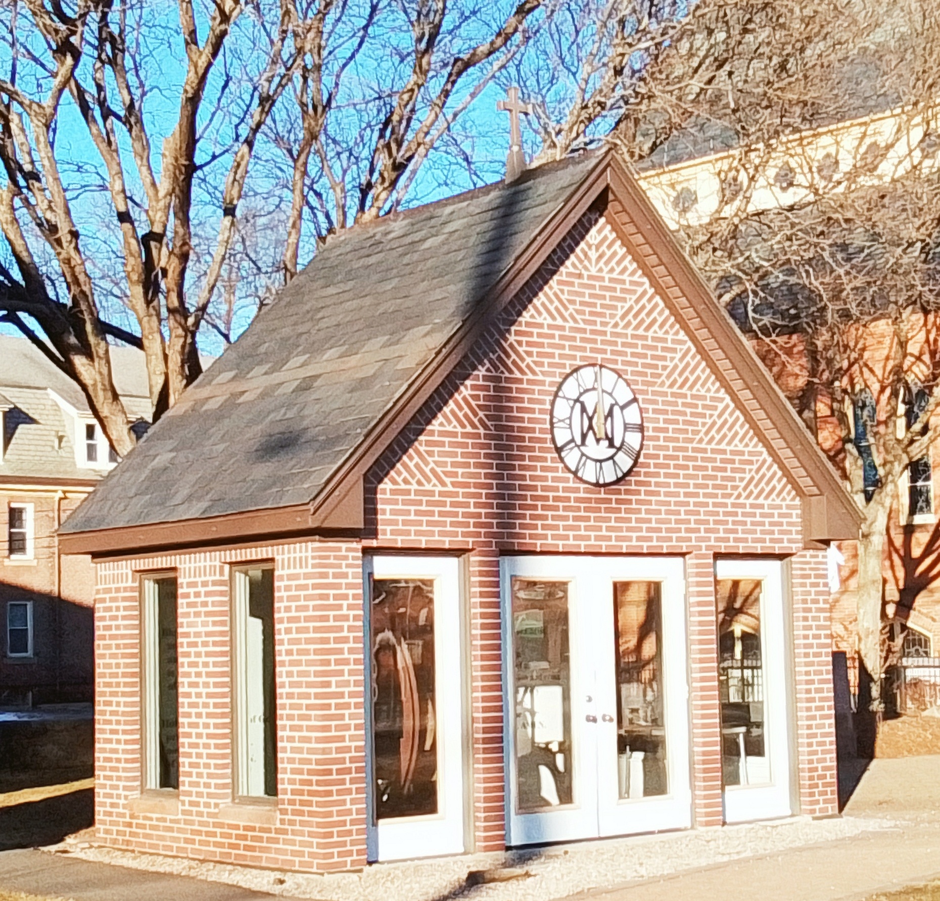
Saint Mary’s Churchbell
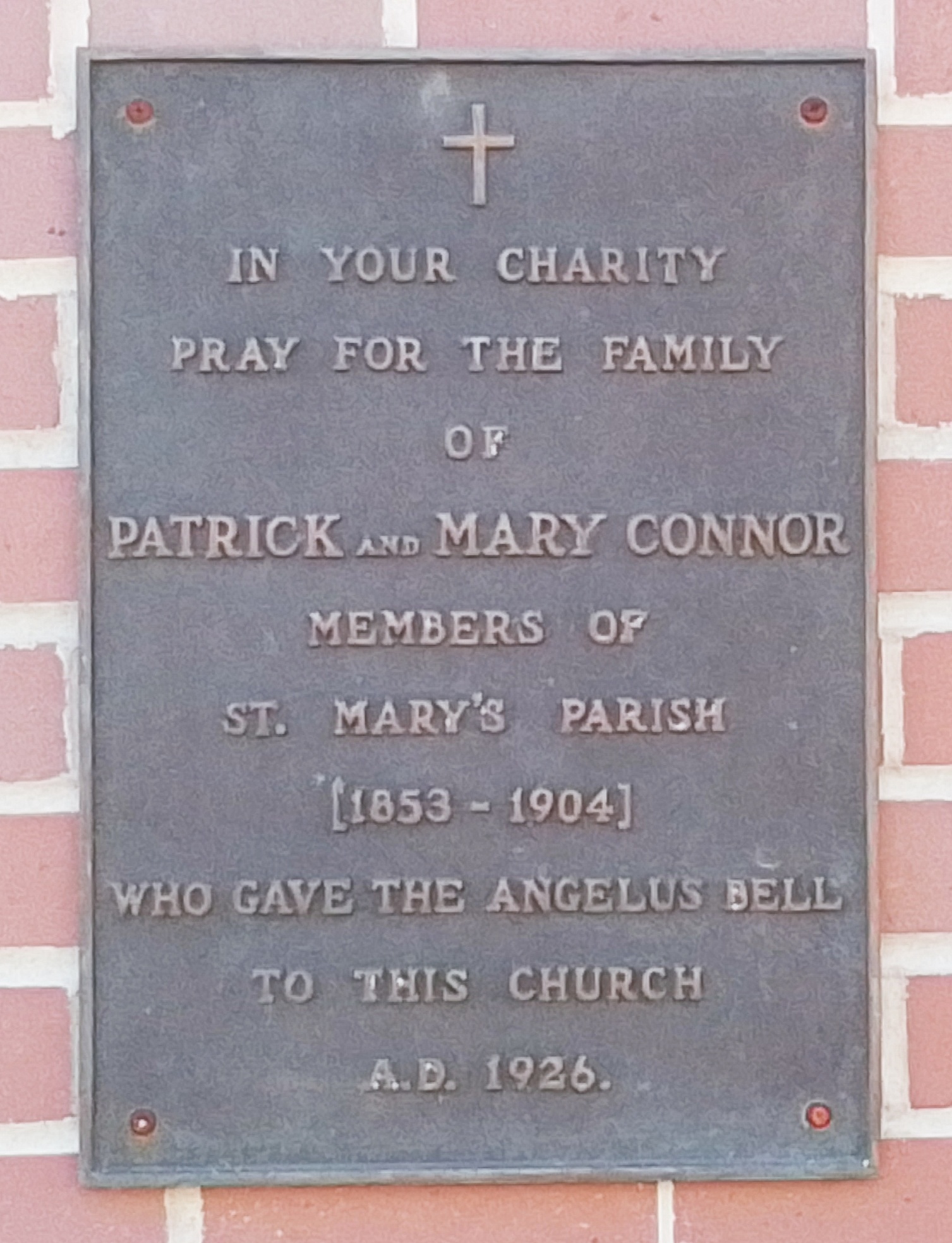
Patrick Connor – FINDAGRAVE
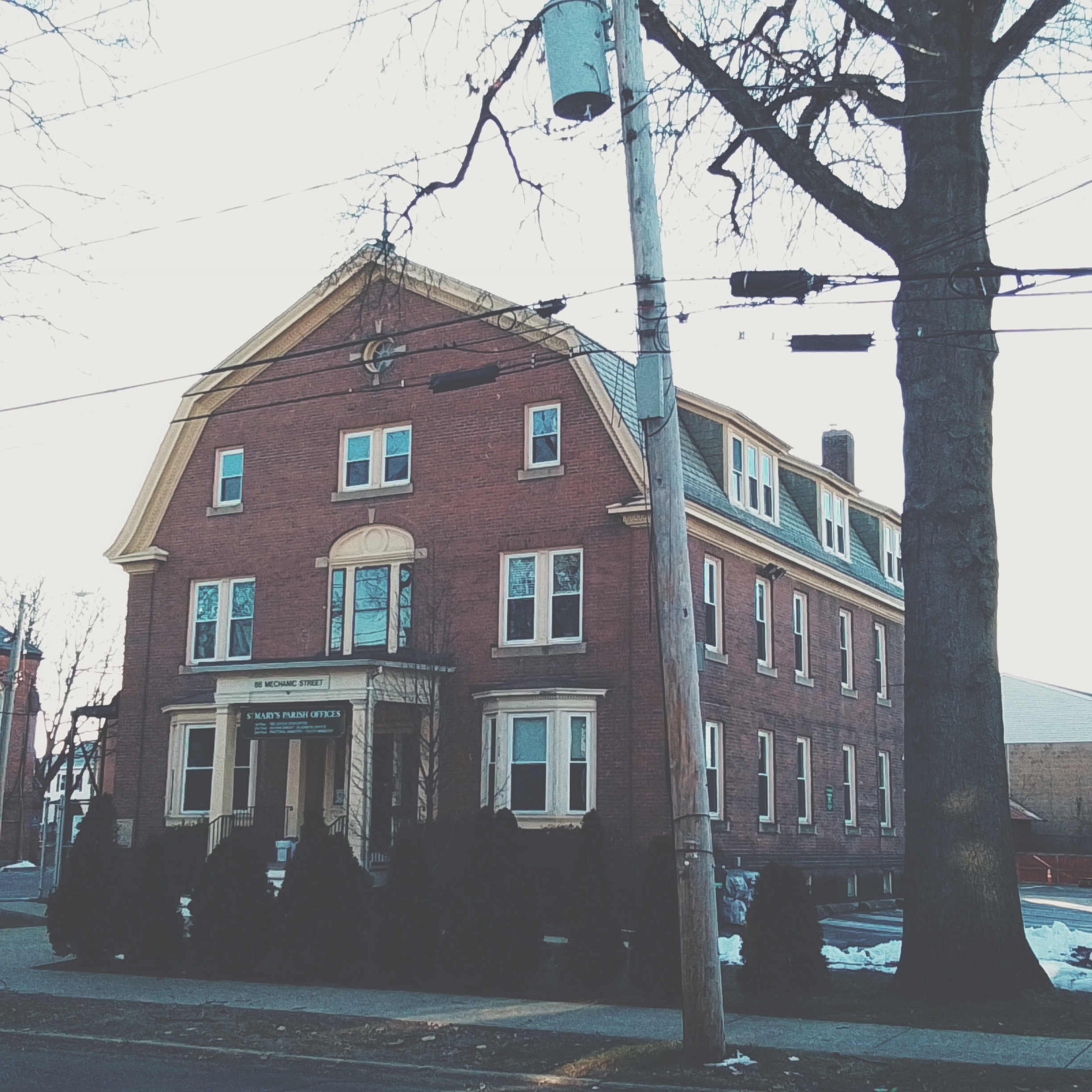
Convent – 86 Mechanics Street
Saint Mary’s Convent was made in 1909 in the Colonial Revival style.
Saint Mary’s Parish School – 35 Bartlett Street
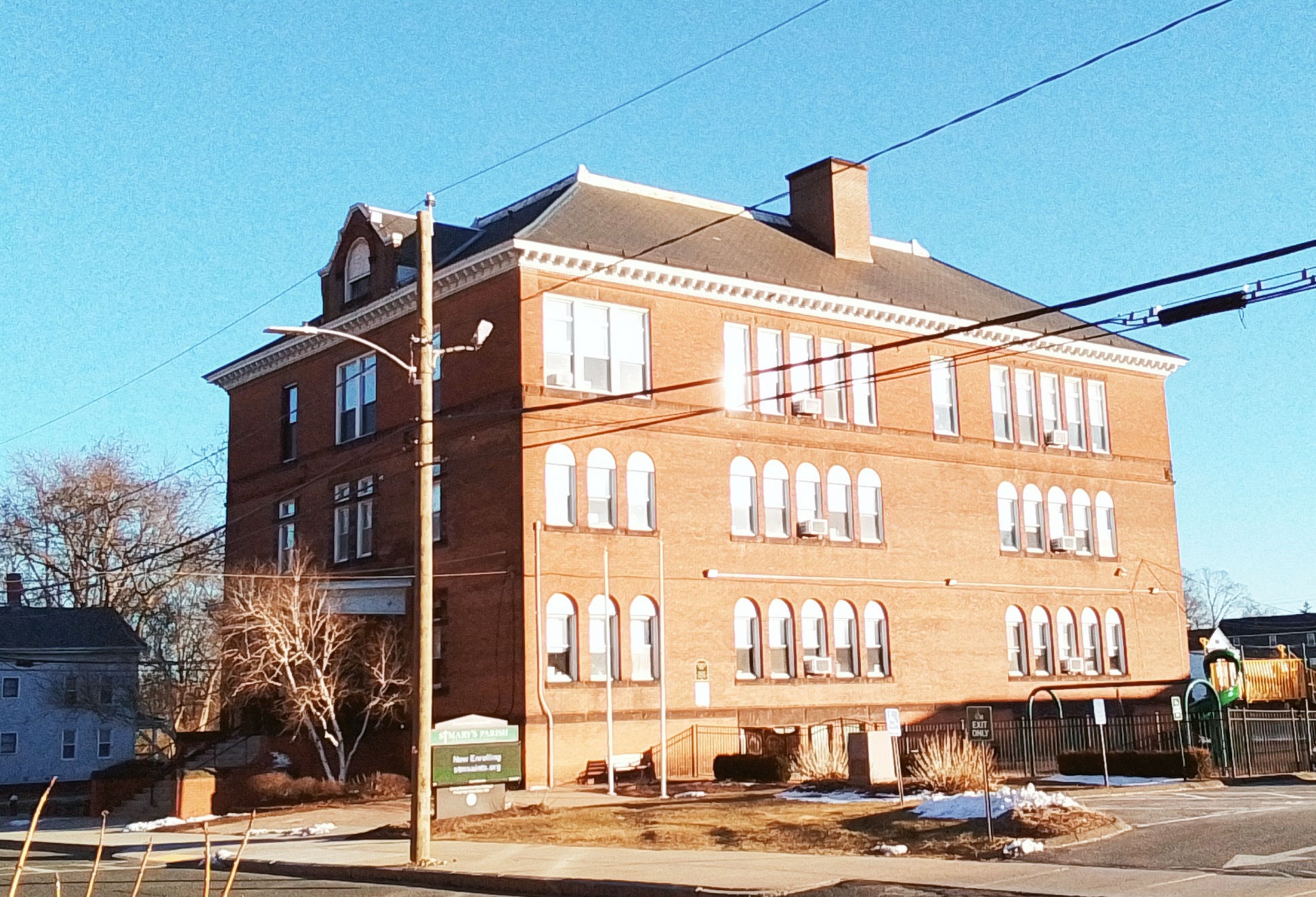
The school was constructed in 1898.
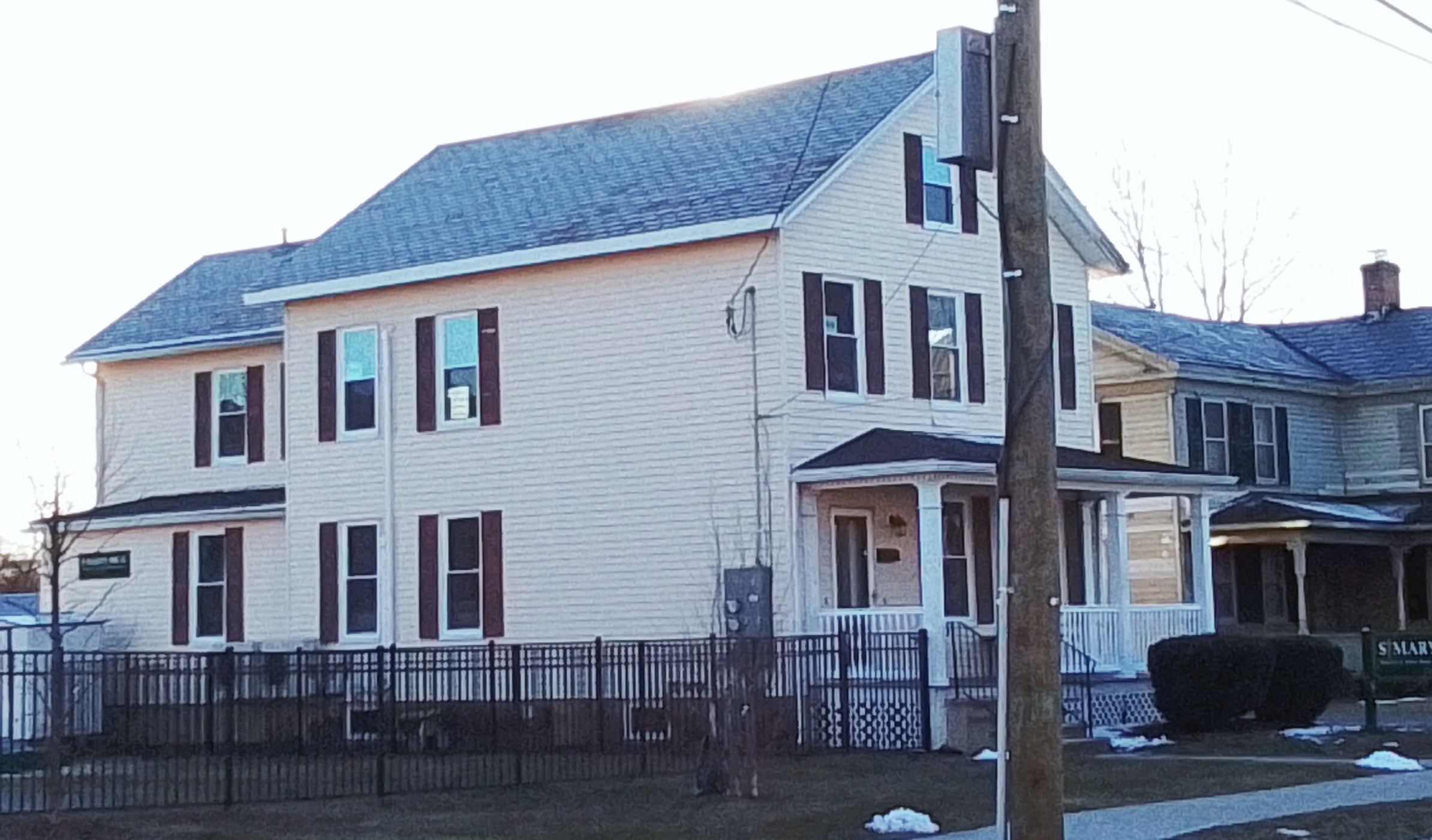
Parish House – 24 Bartlett Street
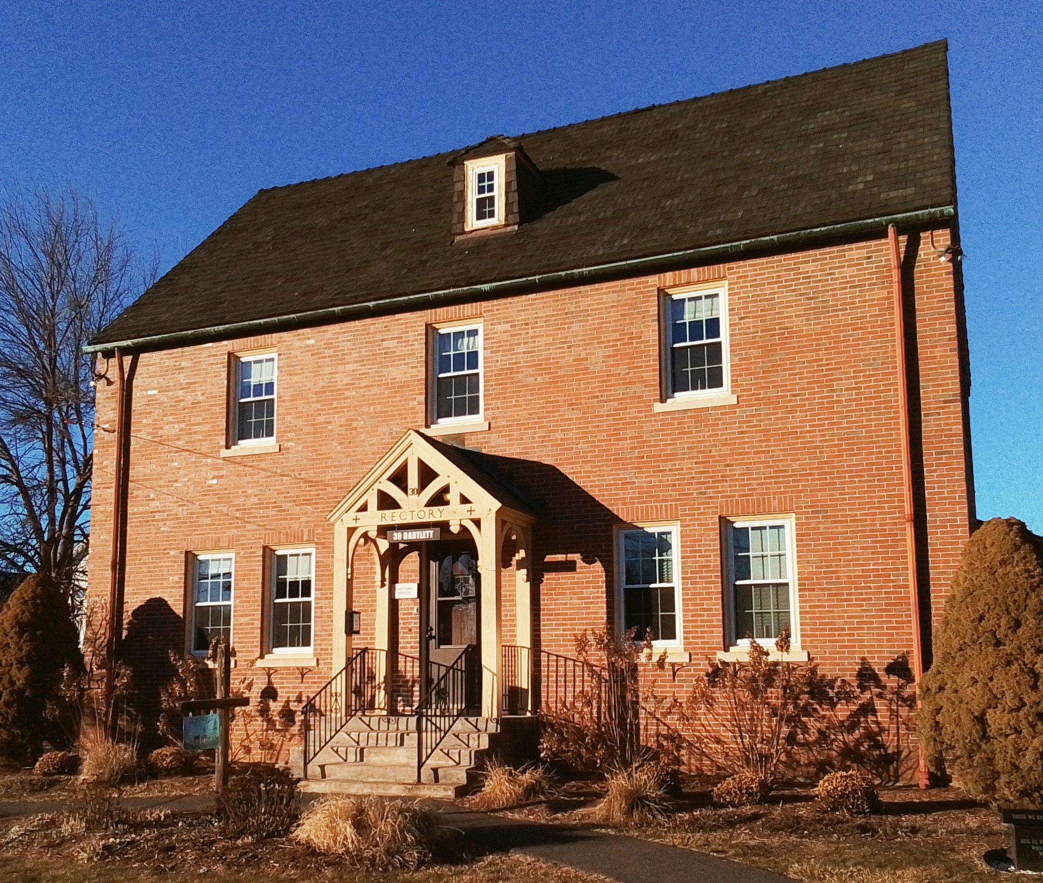
The Saint Mary’s Parish House was made about 1894.
Saint Mary’s High School – 27 Bartlett Street
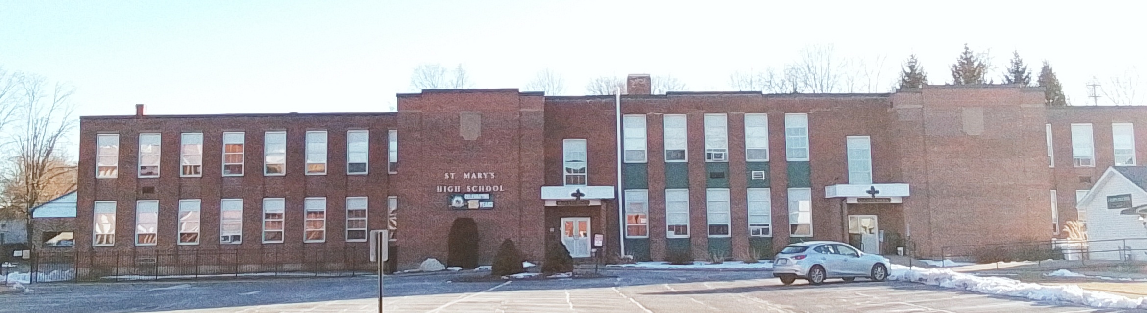
Saint Mary’s High School was made in 1922. This is the former Westfield Trade School. The parish purchased in 1963.
Saint Mary’s Preschool
Saint Mary’s Cemetery – LINK
The cemetery most likely opened in 1862.
PASTORS:
| pastor | start | end | FINDAGRAVE |
| M X Carroll | 1862 | FINDAGRAVE | |
| FINDAGRAVE | |||
| FINDAGRAVE | |||
| James Donohue | 1891 | 1908 | FINDAGRAVE |
| FINDAGRAVE | |||
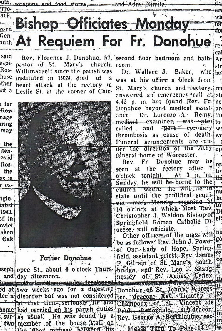
| Florence J Donohue | 1923 | 1939 | FINDAGRAVE |
| Patrick Dowd | 1946 | 1951 | FINDAGRAVE |
| FINDAGRAVE | |||
| George Shea | FINDAGRAVE | ||
| FINDAGRAVE | |||
| FINDAGRAVE | |||
Father Matthew Total Abstinence, Mutual, and Benevolent Society – 1892 – 14 Bartlett Street
Sanborn map
1884 hard to find