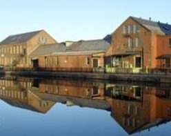
Hopefully, you have enjoyed your time along the Holyoke Canal System and have benefited from this booklet. Any suggestions on improvements, please write to me. All pictures were taken by the author and all maps were drawn by the author and thus he holds the rights to them.
Material was researched using maps, city directories, vital records, and published histories. These include the Richards Atlas of Holyoke, the George Walker Atlas of Holyoke, and Sanborne Insurance maps. The city directories of Holyoke and South Hadley were used from the 1860s to the 1980s. Family trees of the Newton Brothers and Skinner family were used. Books such as Picturesque Hampden and History of the Holyoke Water Power were used for information. The Sanborn maps of that era help a lot too.
Nothing is better to learn about the canals then to just walk or bike around the area. Details can be seen at such a slow pace. Use this web page’s DESTINATIONS and maps to orient yourself.
2018 was the first year of this web page and the associated booklet. In 2019 both were improved. For example, most pages had a vocal section added. 2020 the pages were made more interactive. They were expanded greatly and more accurately in the year 2021 with many more tours on Holyoke topics. In 2022 I expanded the tours into Chicopee and more in depth research into South Hadley. During 2023, I made videos for each stop on every tour that I have given. Also, I made podcasts of each tour and beyond. In 2024 I will expand to Granby, Easthampton, and Amherst.
