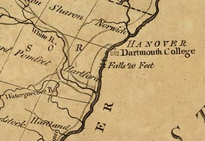
The Olcott Falls Canal is in Lebanon New Hampshire. It is found in the small village of West Lebanon. It is opposite the village of White River Junction which is in Hartford Vermont. It is the 6th of the six navigational canals of the Connecticut River that you meet as you go from south to north on the river. It is the 5th one of the six built. It was completed in 1810 and lasted until the 1850s. It is only a few feet in length and had five locks to lift it 40 feet. This canal is located about 2 to 3 miles north of White River Junction of Vermont.
On October 21 1795 Vermont granted permission for the canal. On June 12 1807 New Hampshire granted permission for the canal. It bypasses the Olcott Falls by using the New Hampshire side of the river. Mills Olcott completed the canal with locks in 1810. It was profitable the first years. When the railroad was built along the river, the canal fell into disuse.
Once a boat is past this falls, then they could approach the base of the Fifteen Mile Falls. This Fifteen-Miles Falls was never canalized since the falls is 20 miles long and has a drop of about 180 feet in height. This long falls is in Barnet Vermont. Boats could now navigate the Connecticut River from Hartford Connecticut to Barnet – 220 miles above Hartford.
The Sumner Falls Canal in Hartland Vermont is the 4th of the six navigational canals of the Connecticut River that you meet as you go from south to north on the river. The Sumner Falls Canal is between Hartland and North Hartland Vermont and 7 miles south of White River Junction. It is the 4th one of the six built. It was completed between 1803 to 1809 and lasted until 1856. It is only a few feet in length and had but two locks to lift it 12 feet.
The Ottauquechee River is to the north of the Sumner Falls Canal. The Water Quechee Falls is just three miles south of the tributary river and that is were the canal is.
October 22 1794 Vermont grants approval for the canal and then on December 1796 New Hampshire grants approval for the canal. Perez Gallup was the first owner and his Vermont land was alongside the canal. It had several owners through the years with the last being David Sumner. The locks and a saw mill were carried away in 1856 and never rebuilt. Remnants of the locks are still in place.
Watch a video from Jay Boeri about the Sumner Falls Canal – external LINK.
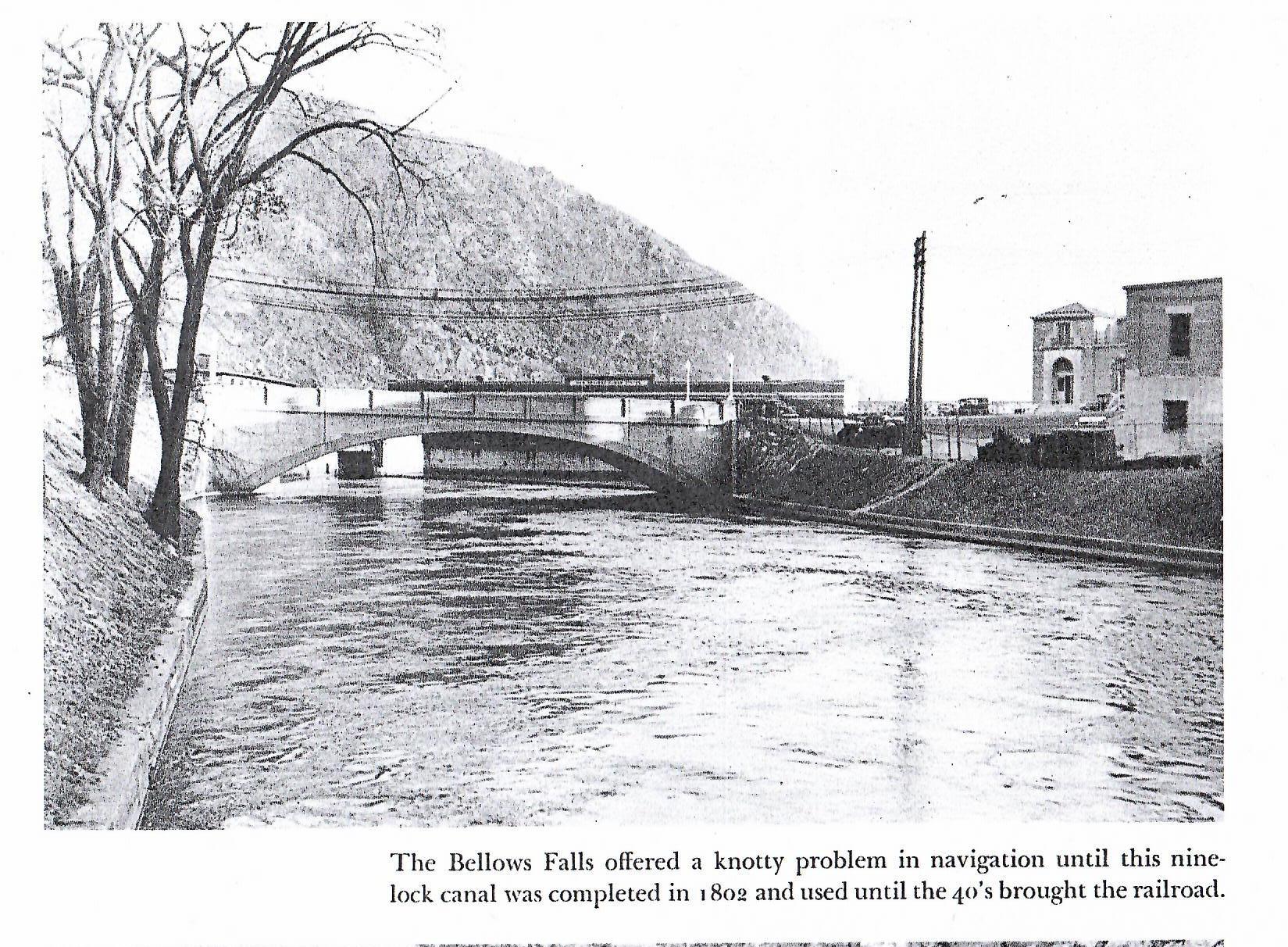
The Bellows Falls Canal in Vermont is the 4th of the six navigational canals of the Connecticut River that you meet as you go from south to north on the river. It is the 3rd one of the six built. It was completed in August 1802 and lasted until 1858. It is a half mile in length and had nine locks to lift it 52 feet. Its cross section was 22 feet by 4 feet but is now 75 feet by 17 feet. That is since in 1866 it was turned into a power canal that was wider and deeper.
The Atkinson Brothers of London England came with money and will power to build this canal. The canal was commissioned in 1791 and was the first commissioned canal in the USA.
During the construction of the canal one mill was already in place to use the canal as a power canal also. At least one mill of the many that came later still exists – the Frank Adams Grist Mill.
The Turners Falls Canal in Montague Massachusetts is the third of the six navigational canals of the Connecticut River that you meet as you go from south to north on the river. It is the 2nd one of the six built. It was completed in 1798 and lasted until 1856. It is 3 miles in length and had ten locks to lift it 55 feet. It was 14 feet wide.
Christopher Colles started a survey of the canal on July 3 1792. He had surveyed the South Hadley Canal on May 21 a few months before. Benjamin Prescott of Northampton was the designer.
In 1864 the canal started being used as a power canal with hydromechanical turbines. This was under the guidance of Alvah Crocker. From June 9 1886 onward, hydroelectrical turbines would start. Many mills would use this power canal – John Russell Cutlery, and more. Residential areas would develop too – the Patch, and more.
The Turners Falls Power Canal has taken over most of its length since 1904 when construction began on the new power canal system. Construction ended in 1929. There are two dams – the Montague Dam and the Gill Dam. There is one gatehouse – the Turners Falls Gatehouse (1903 to 1904). There are seven bridges over the canal – 2 are footbridges and 2 are railroad bridges. Turners Falls Power Station number 1 was constructed from 1904 to 1906. The dimensions are 2.7 miles long, 125 feet wide, and about 15 feet deep. Turners Falls Power Station number 2 was constructed from 1912 to 1916 and would be capable of generating 48 MW.
The Canalside Rail Trail (EXTERNAL LINK) is now alongside the canal.
The Enfield Falls Canal in Windsor Locks Connecticut is the first in geographical order of the six navigational canals of the Connecticut River that you meet as you go from south to north on the river. It is however the last one of the six built. It was started in June of 1827. It was completed in November 1829 and lasted until the 1970s. It is 5.25 miles in length and had four locks to lift it 30 feet. It was 70 feet wide and thus large ships could pass through. The Connecticut River Banking Company (Hartford) was founded in 1825 in order to finance the canal.
A power canal would replace the navigational canal and would have many mills between it and the Connecticut River. The New York, New Haven, and Hartford Railroad would also pass through being just to the west of the canal. When the bike path was put in it would NOT pass over these rail lines. It would rather be placed over the former tow path. TRAIL MAP of the bike path.
The navigational canals of the Connecticut River were made to allow transport of goods from Long Island Sound to upper Vermont without portage. At the end of the canal days, one could go from Old Saybrook Connecticut to the Wells River in Vermont 280 miles upstream. This was a difference in elevation of 500 feet.
LINK to my Patreon pay per view video on this topic.
The Skinner house at 1155 Northampton Street is hard to see from the road. This was built in the French Provincial style. The front lawn is visible from Northampton Street. There were two ponds on the property and they were each changed into a reservoir.
William Skinner had this home made for his family. The landscape was designed by Olmsted Brothers from 1917 to 1922. The estate itself is called the Dogwood.