
- free public tours of the Wyckoff Park area come up about every 5 years
- private tours can be scheduled – RATES for one, two, or three hours – Also a one hour indoor presentation can be given.
- booklets of this TOUR and of the Olmsteds in Holyoke are available
- A self-tour is available for anyone using the maps and text seen below. – LOCATION
Wyckoff Park Neighborhood Walking Tour is a great way to see the homes and landscapes as designed by the Olmsted Brothers of Brookline. For a summary of their work in Holyoke see this LINK. You will notice in this park that there are winding streets, skewed arrangement of lots, and houses of various designs.
For information about any stop, click on the title of that stop.
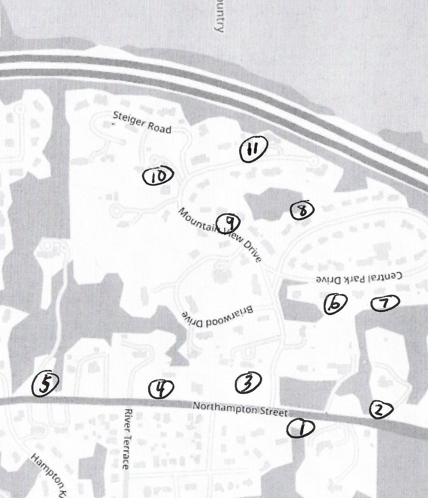
stop 1 – Lewis Wyckoff house
[See link just above.] House is at 1040 Northampton Street (LOCATION)
Stop 2 – Edward Towne house
[See link just above.] House is at 1021 Northampton Street (LOCATION)
Stop 3 – James Wakelin house
[See link just above.] House is at 1067 Northampton Street (LOCATION)
Stop 4 – Mount Tom Golf Course Gates and Donald Ross home
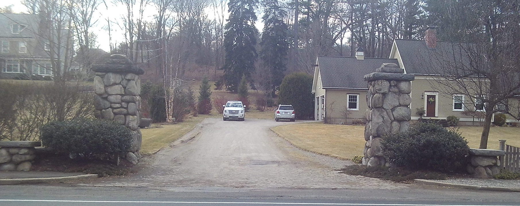
The entrance gate to the golf course is on the highway. The Mount Tom Drive started here in 1911 and was greatly improved in 1922 by the Olmsteds. The trolley house to its side still has its base in place. The clubhouse was from 1911 to 1956 at what is now called Briarwood Drive. The pillars of the entrance gate were a gift from Joseph Skinner.
Briarwood Drive was added in 1956. The golf course entrance road was at this gate but is mostly gone. From here it did run from the middle of Briarwood up to the front of Steiger’s home.
The Mt Tom club house was from 1901 to 1911 at the top of the knoll were the William Anger home is. What a sight that most have been.
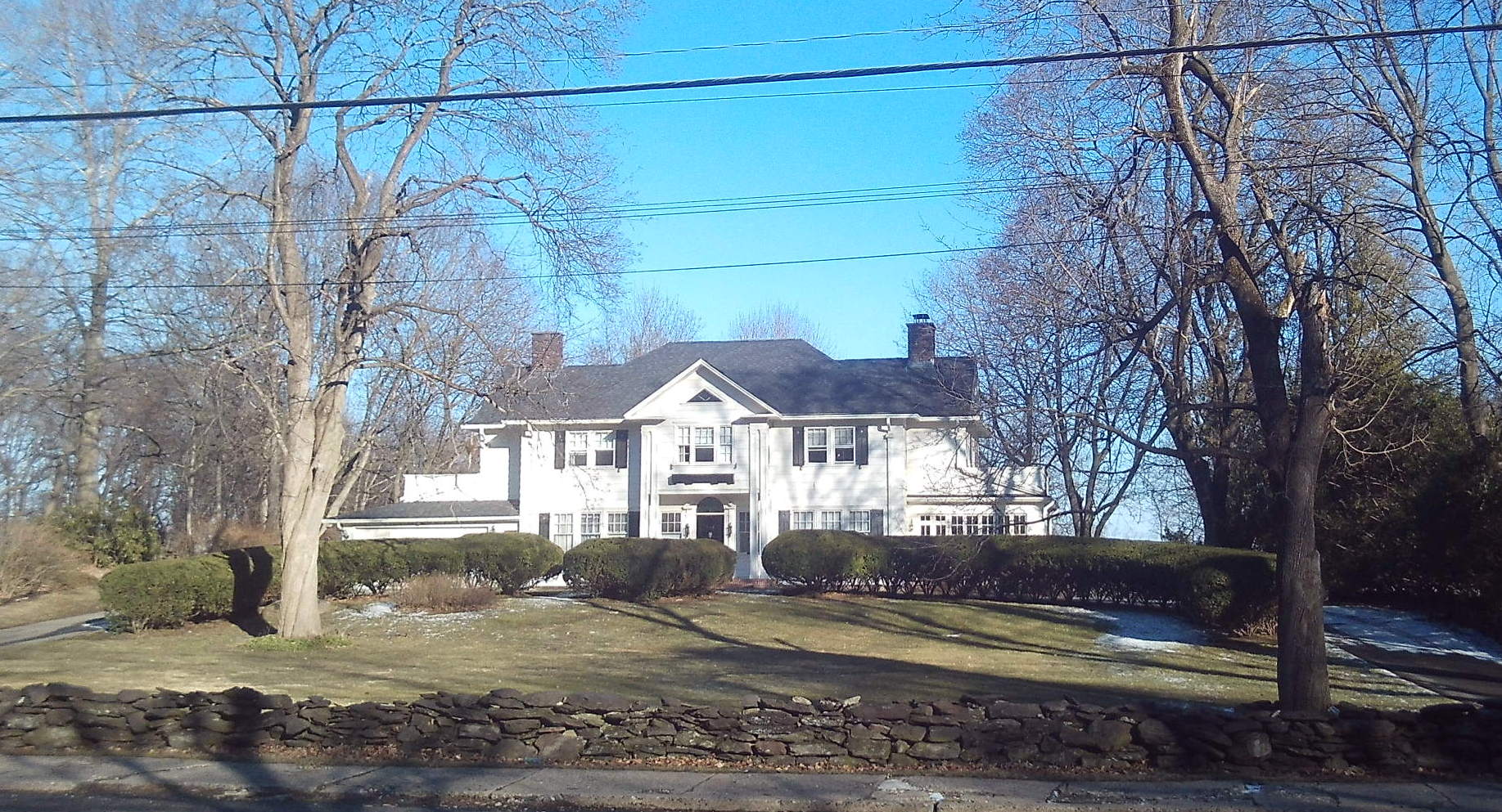
Directly across the street is the former home of the golf course designer Donald Ross at 1108 Northampton Street. He redesigned the Mt Tom Golf Course in Holyoke at the request of Lewis Wyckoff. Apparently he did this twice – once in 1914 and then in 1922. The Wyckoff Park Developers helped to pay for this second redesign (1922) since it was they who promoted the neighborhood that forced a move of the course westward.
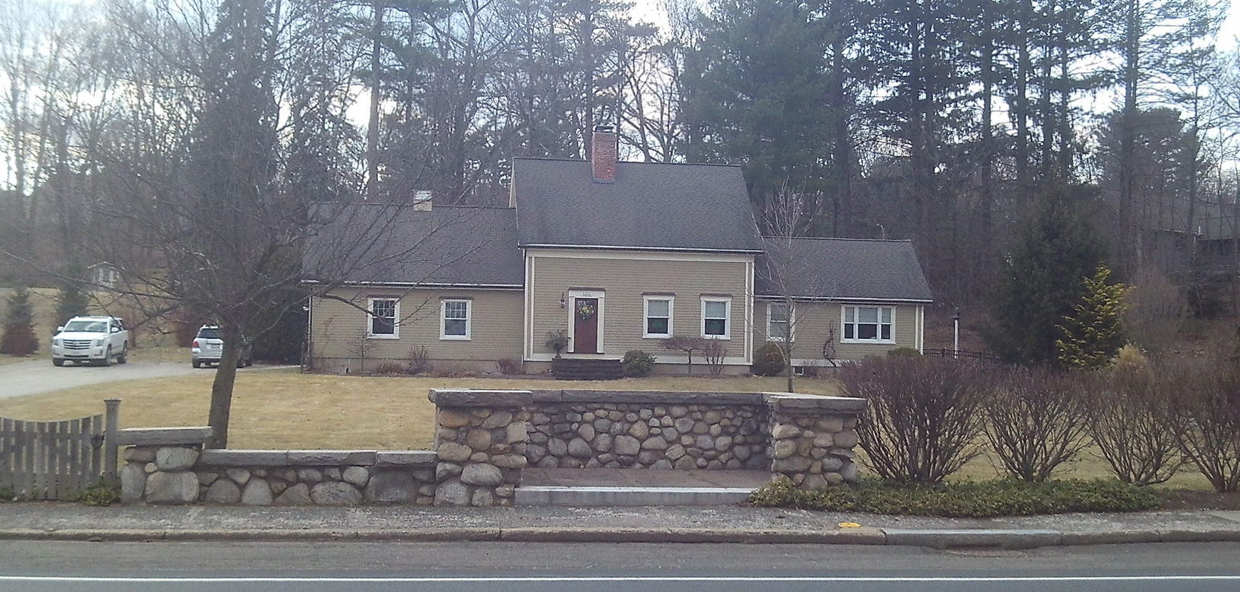
Stop 5 – William Skinner house
[See link just above.] House is at 1155 Northampton Street (LOCATION)
Look across the street at the Nathan Avery home (1150 Northampton Street) (LOCATION). He was mayor of the city from 1904 to 1910 and also head of the parks department. He ordered the Olmsted report on the parks and then on the streets of the city.
Stop 6 – Joseph B Woodruff house
[See link just above.] House is at 28 Central Park Drive (LOCATION)
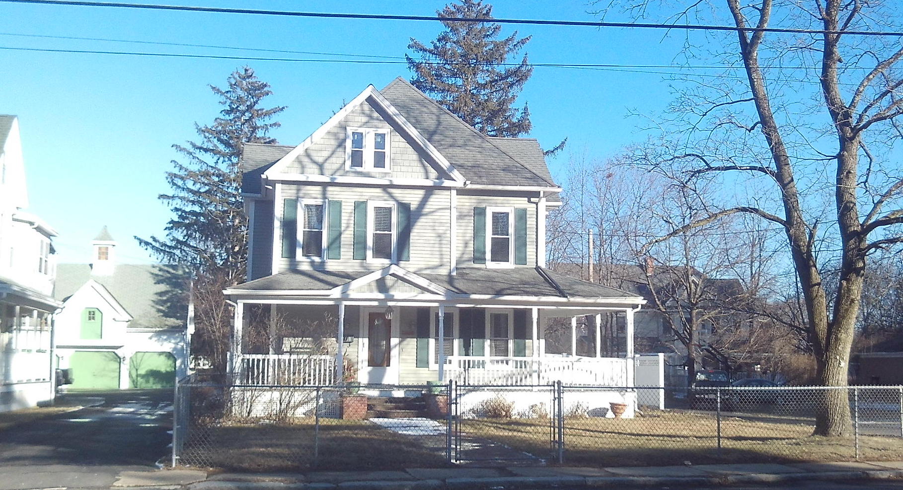
Stop 7 – Edward Twing (Otto Dreikorn) house near the highway
[See link just above.] House is at 62 Central Park Drive (LOCATION)
Mystery Stop – 118 Central Park Drive
The home at 118 Central Park Drive (LOCATION) is also in the Tudor revival style and has a nice landscape. Is it an Olmsted design in which the plans have not yet been found?
Stop 8 – Edward Twing house near the golf course
[See link just above.] House is at 198 and 208 Central Park Drive (LOCATION)
Stop 9 – Steiger Walking Path Gates
House is at 125 Mountain View Drive (LOCATION)
From your route on Central Park Drive turn right onto Mountain Park Drive. A couple of houses up see the wonderful stone gate. This is on the first of five adjacent lots that Albert Steiger bought in 1924. He made this gate as part of a walking path from the former clubhouse in the Briarwood Drive area to the first hole about 150 yards uphill.
[Now use the stop 9 link above.]
Stop 10 – Albert Steiger house

The Steiger house is at 170 Mountain View Drive (corner of Steiger Road) (LOCATION). Read of the business HERE. Albert Steiger owned a lot of land behind his house. He would often walk from his home across either a trail or the golf course road to the road around Whiting Street Reservoir and then around that and back. Both this old trail and this old road has been discovered in recent years. See stops 12 and 14a at the Whiting Street Reservoir tour.

On April 5, 1955 Steiger Road is built and perhaps finished by October.
[Now read the stop 10 link at the title above.]
Stop 11 – Mount Tom Country Club
House is at 200 Mountain View Drive (LOCATION)
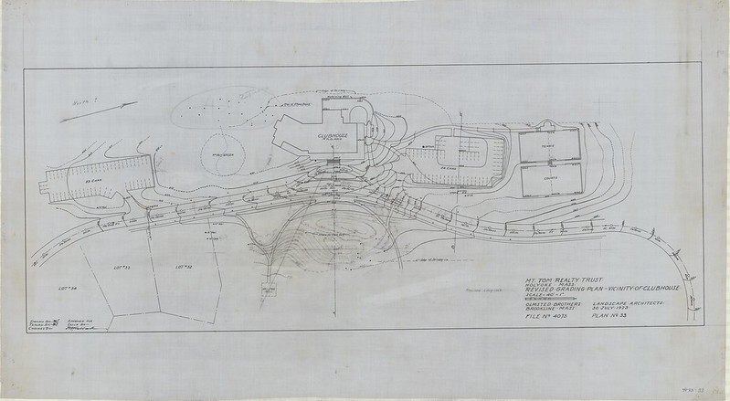

The clubhouse was to be made anew at the top of Mountain View Drive as part of the 1922 Olmsted design. In the summer and fall of 1956 this was finally done. However, the landscape was done according to the Olmsted plans earlier than that.
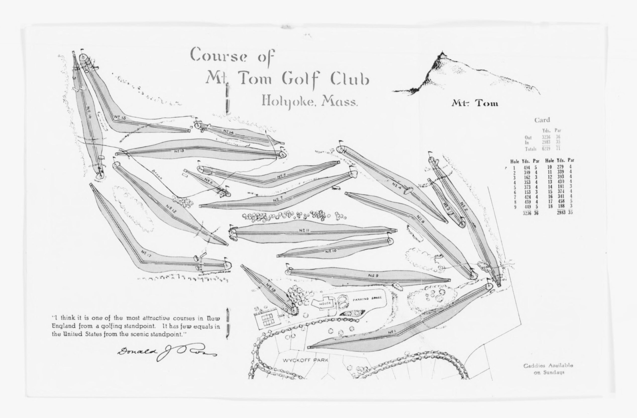
The Mount Tom Golf Course was redesigned in 1922 when the neighborhood was reworked. The design is shown above. See that the hole 1 is between Central Park Drive and the top portion of Mountain View Drive.
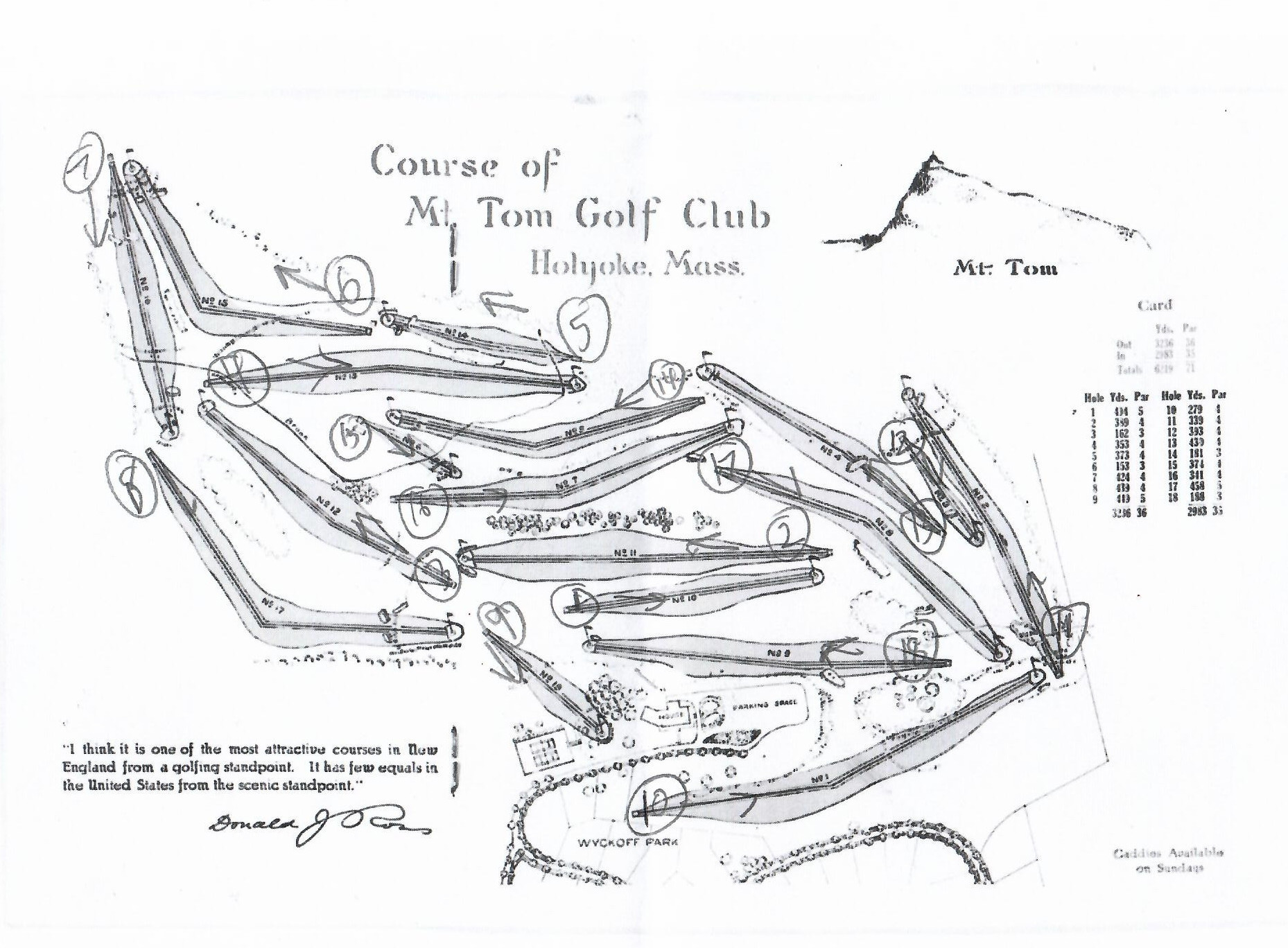
In 1956 the course was renumbered such that holes 1 to 9 became holes 10 to 18 and holes 10 to 18 became holes 1 to 9. See the added renumbered course just above.
In 1963 the neighborhood had to be reworked once again. Interstate 91 was coming in and so the easternmost holes needed to be reworked to be placed into the land to the south. Albert Steiger had given land to the Holyoke Water Works in 1929. This land was sold to the golf course in 1963 so they could build the newer holes to the south. The 4th clubhouse was split in half and two houses were built in adjacent lots on the top of Mountain View Drive. The 5th clubhouse was made on the entrance from Easthampton Street.
Sanborn map analysis: