Smith Building

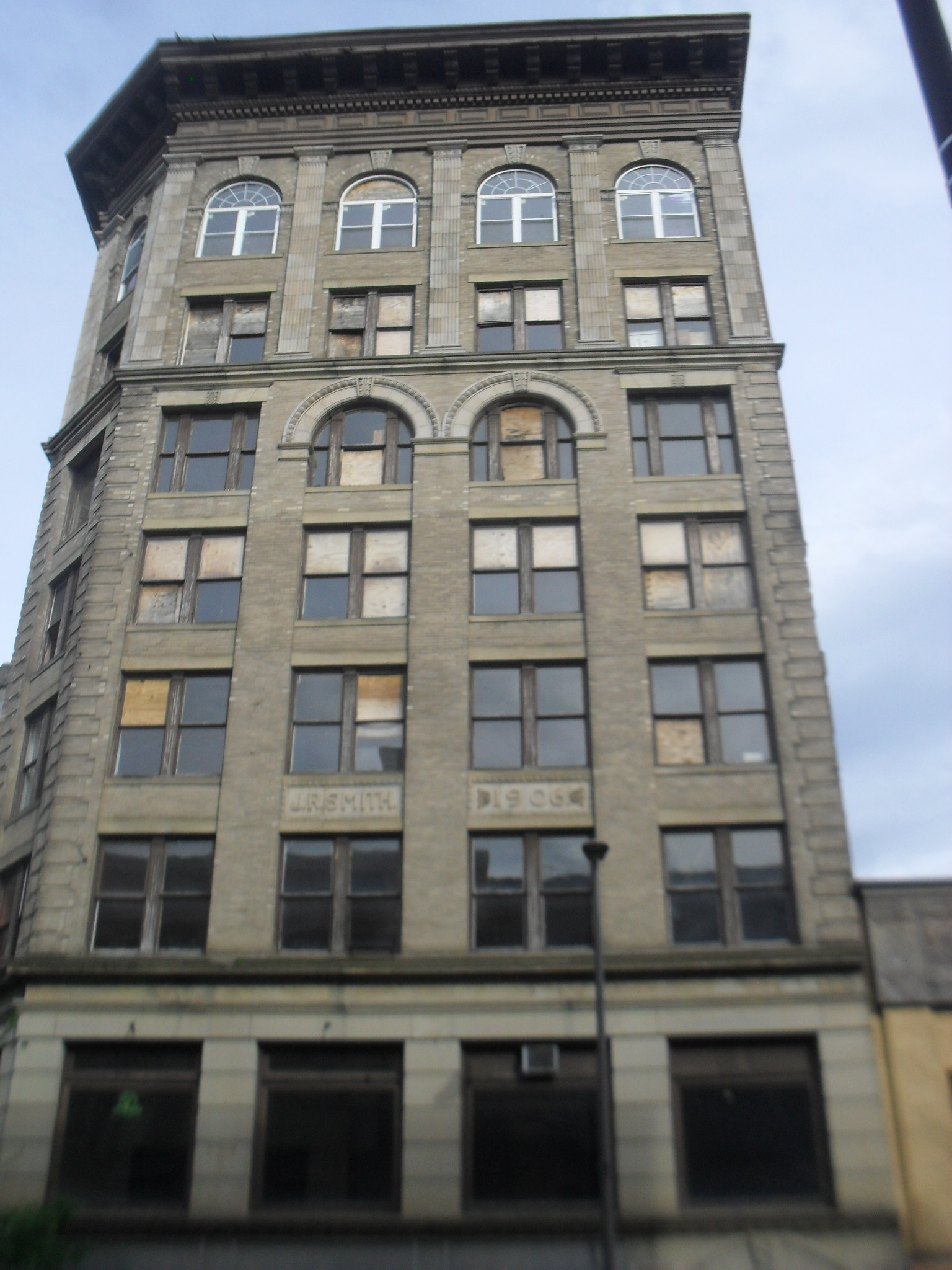
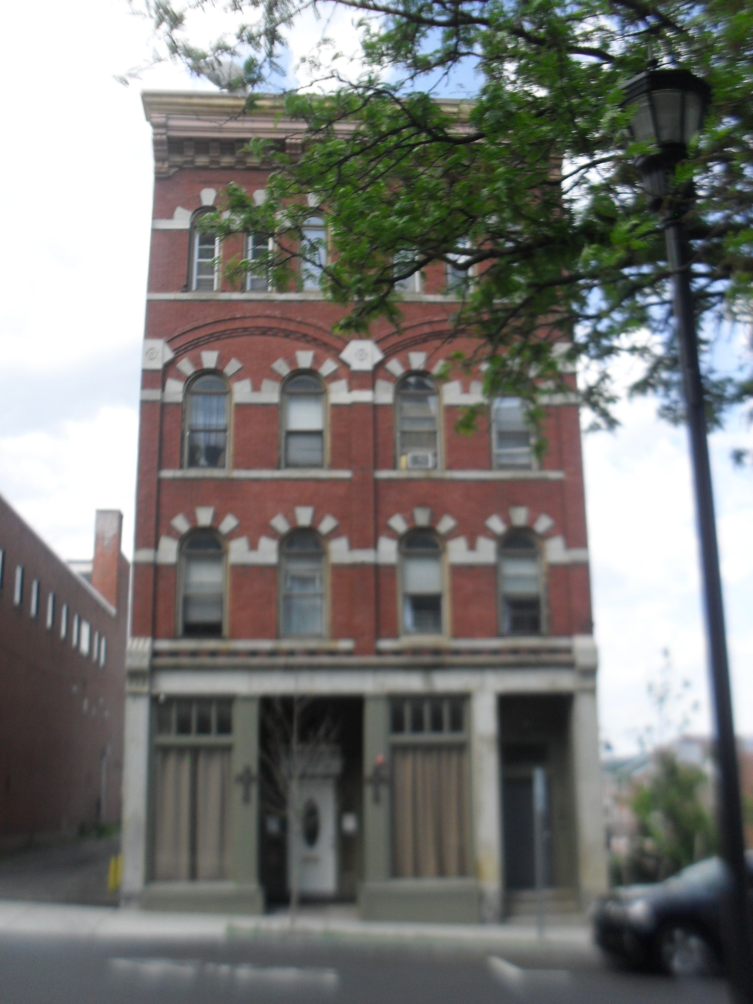
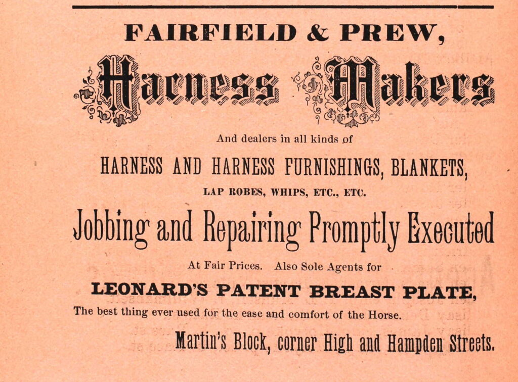
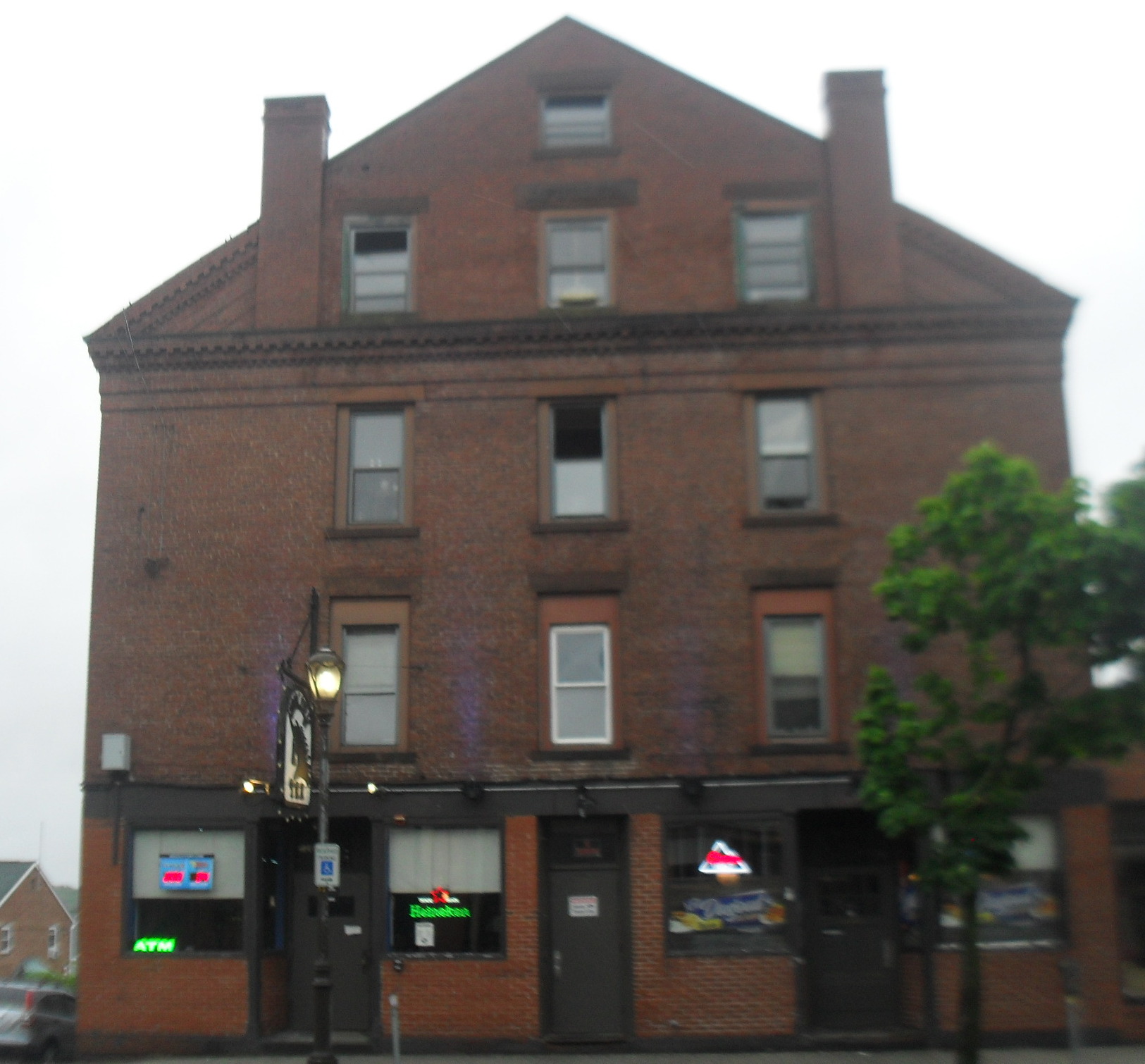
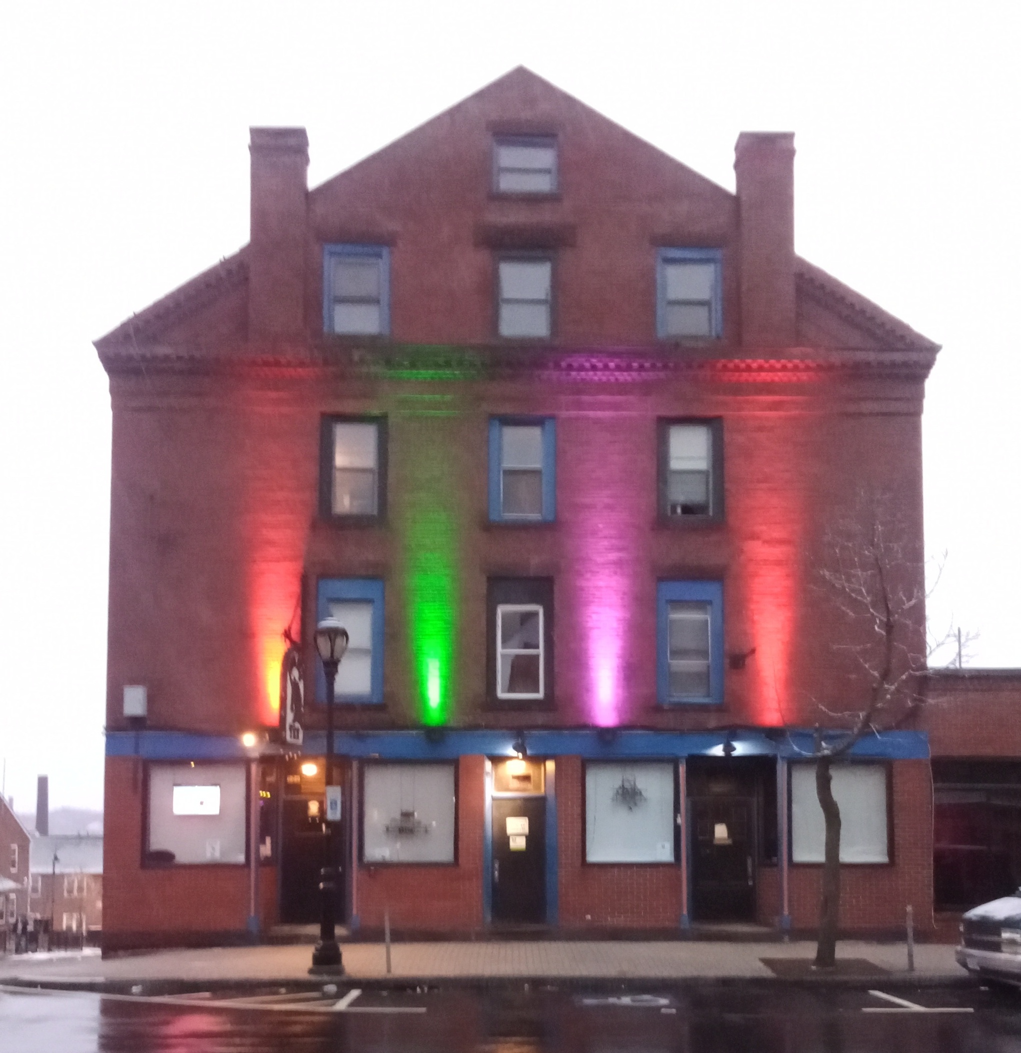
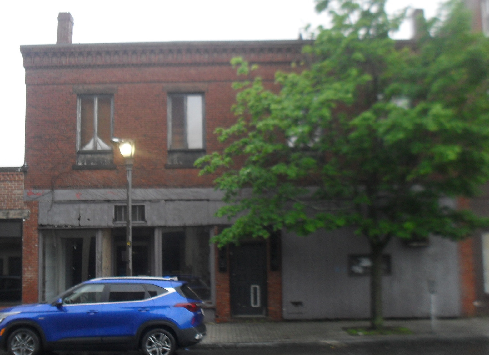
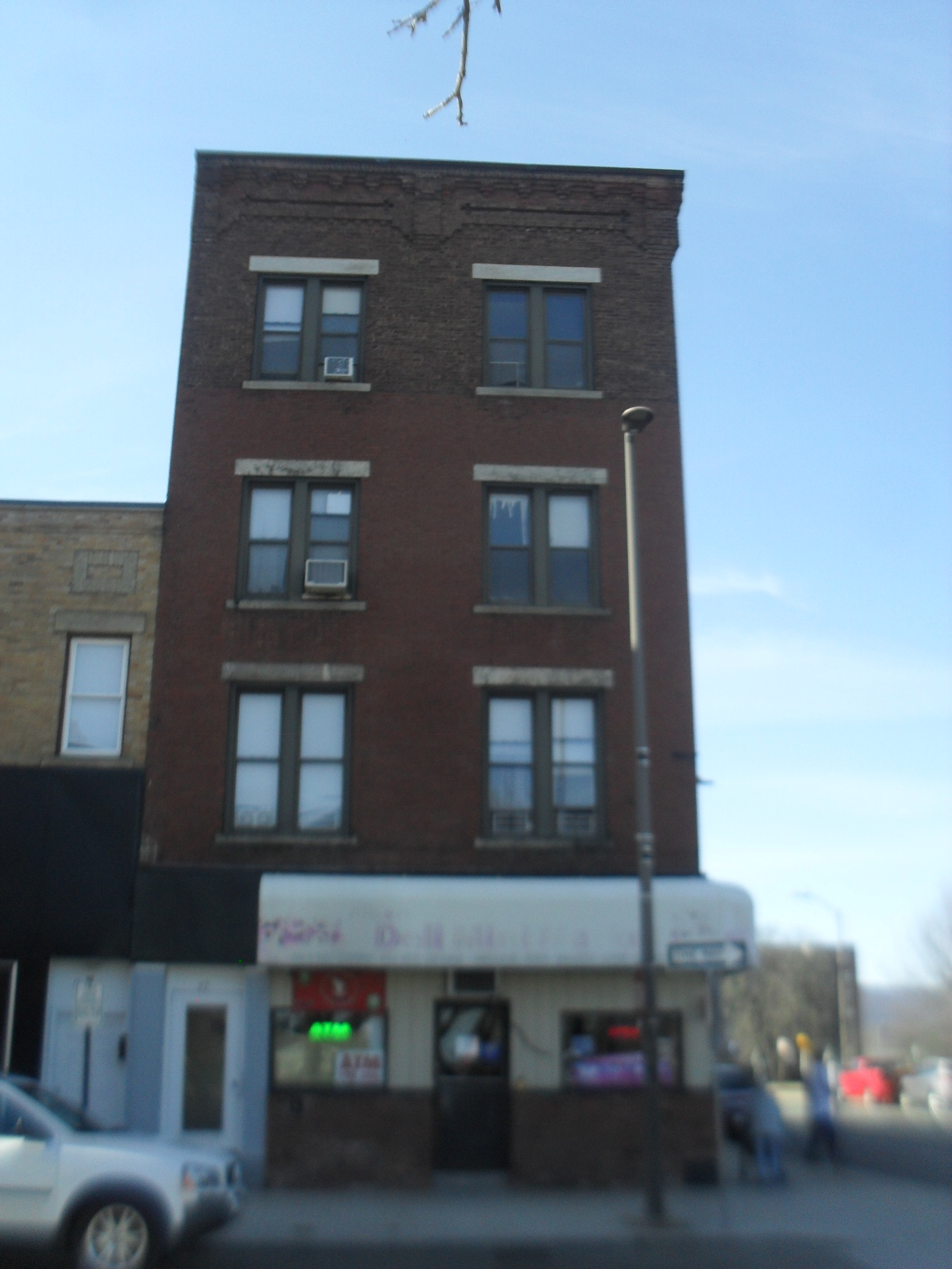
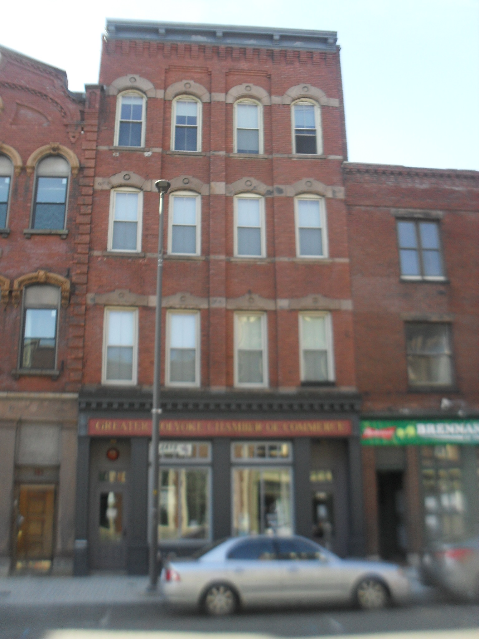
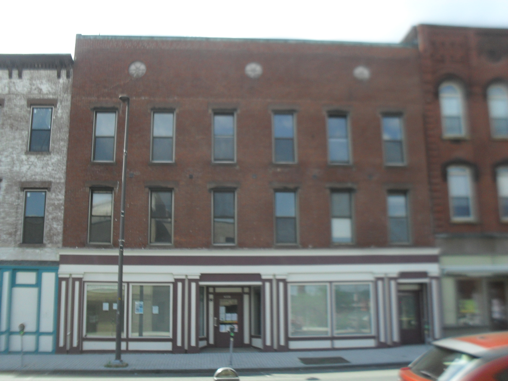
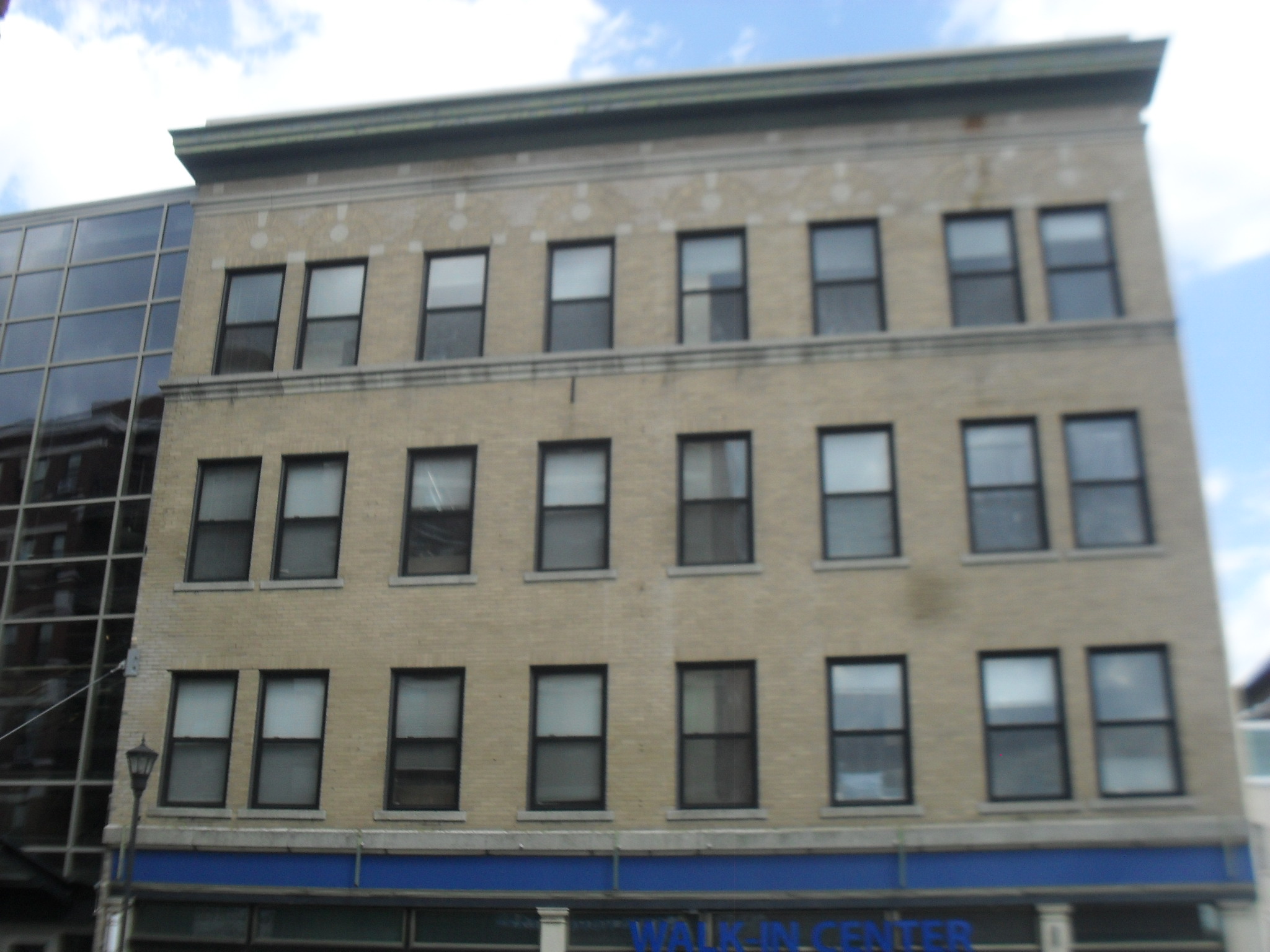
The Smith Building located at 270-276 High Street. It was built in 1906 in the American Renaissance style. J R Smith was the first owner and ran his old time produce and grocery store from here. Later G J Prew would buy it.

Postcardcard B

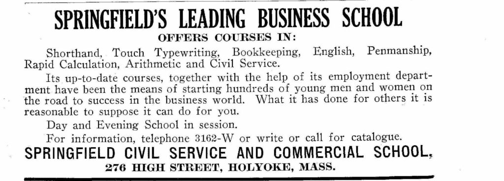
The Springfield Commercial School was here in 1915.

This image has an empty alt attribute; its file name is 9697609-1024x368.jpg

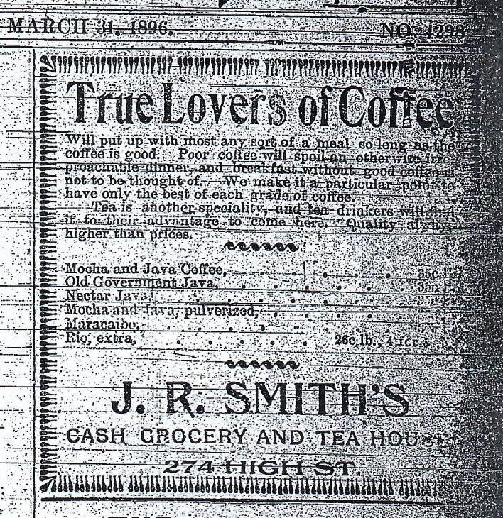
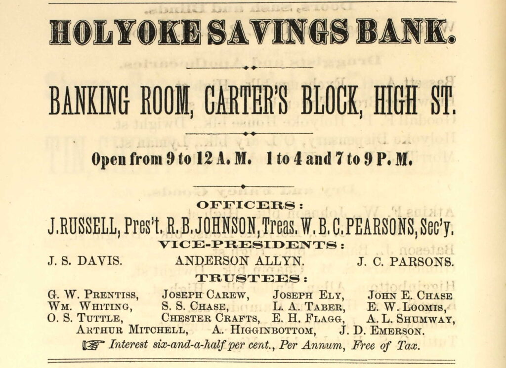
The previous building was called the Hubbard and Tabor. In 1896 J R Smith was one of the tenants.

This image has an empty alt attribute; its file name is sheets_0006-Copy.jpg

This image has an empty alt attribute; its file name is 9487584-Copy-1024x381.jpg

Sanborn map analysis

Sanborn 1884 map

Sanborn 1889 map shows two 4 story buildings here

Sanborn 1895 map shows the same

Sanborn 1915 map states that it was built in 1905

Sanborn 1949 map

Sanborn 1956 map

John Fuller’s Building and Block

The John Fuller’s Building is at 126-130 High Street. It was built in 1850. It was the City Hotel in the beginning of its existence.

In 1915 the building is being called the Polish Hotel. Now it is residential and retail.

In the 1960s it is Hotel Nonotuck. On May 5 1968 there is a fire there.

The John Fuller Block at 140-144 High Street was built in 1857. Likewise the 134-136 High Street double structure is most likely a Fuller building.

In 1869 Buckley the Furnace man was here.

This image has an empty alt attribute; its file name is 41199_2221301230_7640-00135-1024x779.jpg

Higginbottom dry good and clothing was there in 1869 perhaps in one of the one floor sturctures.

This image has an empty alt attribute; its file name is 41199_2221301230_7640-00136-1-578x1024.jpg

1871 ad for rooms and articles

This image has an empty alt attribute; its file name is 41199_1220706242_4072-00166-1024x716.jpg
This image has an empty alt attribute; its file name is 41199_1220706242_4072-00179-Copy-1024x783.jpg

1883 ad

Sanborn map analysis:

Sanborn 1884 map

Sanborn 1889 map

Sanborn 1895 map

Sanborn 1915 map

Sanborn 1949 map

Sanborn 1956 map

Gallaudet Block

The Gallaudet Block is a very old building by Holyoke’s standards. It was built in 1847 when this was still West Springfield. It is at the 95-97 High Street block. Look at the brickwork as you go up the building. It was once three stories in height but now is four.

In the late 1860s Michael Finn the brickmaker took over and also started to sell produce.

This image has an empty alt attribute; its file name is 41199_2221301230_7640-00143-Copy-1024x886.jpg

97 High Street was where Julia Lewandowska started her medical practice in 1911. She was a natural speaker of Polish of which she was the first in Holyoke. her specialty was with mothers and children. In about 1914 she married and her named became Julia Bauman.

In 1922, the AW Smith Drug Store was here. Also one of the ten postal substations of Holyoke was here – number 7.

Sanborn map analysis:

Sanborn 1884 map shows a hardware dealer is there and that the building is already 4 floors in height

Sanborn 1889 map same

Sanborn 1895 map

Sanborn 1915 map

Sanborn 1949 map

Sanborn 1956 map

Royal Theater

Movie Theaters of Holyoke

The Royal Theater at 99 – 101 High Street was made in 1915 as both a stage theater and a movie theater. It started out as a silent movie venue but when sound was added they added audio. Now it is a store and apartments. It lasted until 1939 when it must have experienced economic pressure from the other theaters.

Sanborn map analysis:

Sanborn 1884 map shows a fruit dealer is there

Sanborn 1889 map same

Sanborn 1895 map

Sanborn 1915 map shows that is being built in that year

Sanborn 1949 map a furniture store is there

Sanborn 1956 map

Dougherty’s Block

The Dougherty’s Block at 177-179 High Street was made in 1885. James Dougherty had his construction office on the ground floor. The rest of the space was leased office space and apartments. See that nice advertisement from Louis Hopp clothier.

This image has an empty alt attribute; its file name is sheets_0003-524x1024.jpg

Fire Engine and Hose and Ladder House was here early on.

Sanborn map analysis:

Sanborn 1884 map

Sanborn 1889 map

Sanborn 1895 map

Sanborn 1915 map

Sanborn 1949 map

Sanborn 1956 map

Colby Carter Building

The Colby Carter Building at 203-209 High Street is from 1850. Colby sold spaces here for other business occupants. Later it became Carter Block. The Masonic Temple of Holyoke would start in this building.

This image has an empty alt attribute; its file name is 41199_2221301230_7640-00142-1-641x1024.jpg

In 1869 the Johnson Insurance Company was here but soon would move to the north by one building block.

Also in 1869 the Tuttle and Moore Grocers were here.

This image has an empty alt attribute; its file name is 41199_2221301230_7640-00004-603x1024.jpg

Likewise again in 1869 Holyoke Savings Bank was here.

This image has an empty alt attribute; its file name is 41199_2221301230_7640-00119-1024x746.jpg

In 1940 it is being called Lyman’s Block.

Sanborn map analysis

Sanborn 1884 map shows an undertaker is here along with a grocer

Sanborn 1889 map shows the Masonic Hall on the 3rd floor

Sanborn 1895 map shows the Masonic Hall on the 3rd floor

Sanborn 1915 map

Sanborn 1949 map hall on 3rd floor and sign painter on 2nd floor

Sanborn 1956 map still a hall on 3rd floor and sign painter on 2nd floor

Saint Jerome’s Temperance Society Building

The Saint Jerome’s Temperance Society Building at 236 1/2 Maple Street and at 230 Maple Street was made in 1888. They stayed here for many decades and then sold to Sears and it was a department store. Later McAuslan expanded into this space.

The Saint Jerome Total Abstinence Mutual Benevolent and Literary Society was housed here and the men formed into many groups – sports books music and more.

Sanborn map analysis:

Sanborn 1884 map

Sanborn 1889 map

Sanborn 1895 map

Sanborn 1915 map

Sanborn 1949 map

Sanborn 1956 map