The Wright Building and Block is at three locations along this strip. That is, at 96-100 High, 102-104 High, 106-108 High, and 110-120 High Street. They form a continuous group of structures. Stephen Wright built all four in the 1869 to 1870 era in the Italianate style. When he died 28 June 1888 he was a rich man.
In 1882 to at least 1900 the southernmost block (118 to 120) was being called the Perry’s Building and the 106 to 108 portion was being called the Prew’s Building.
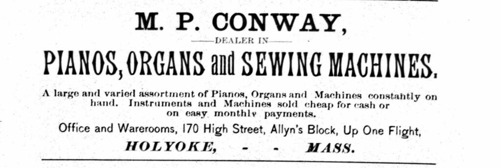
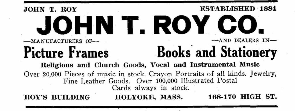
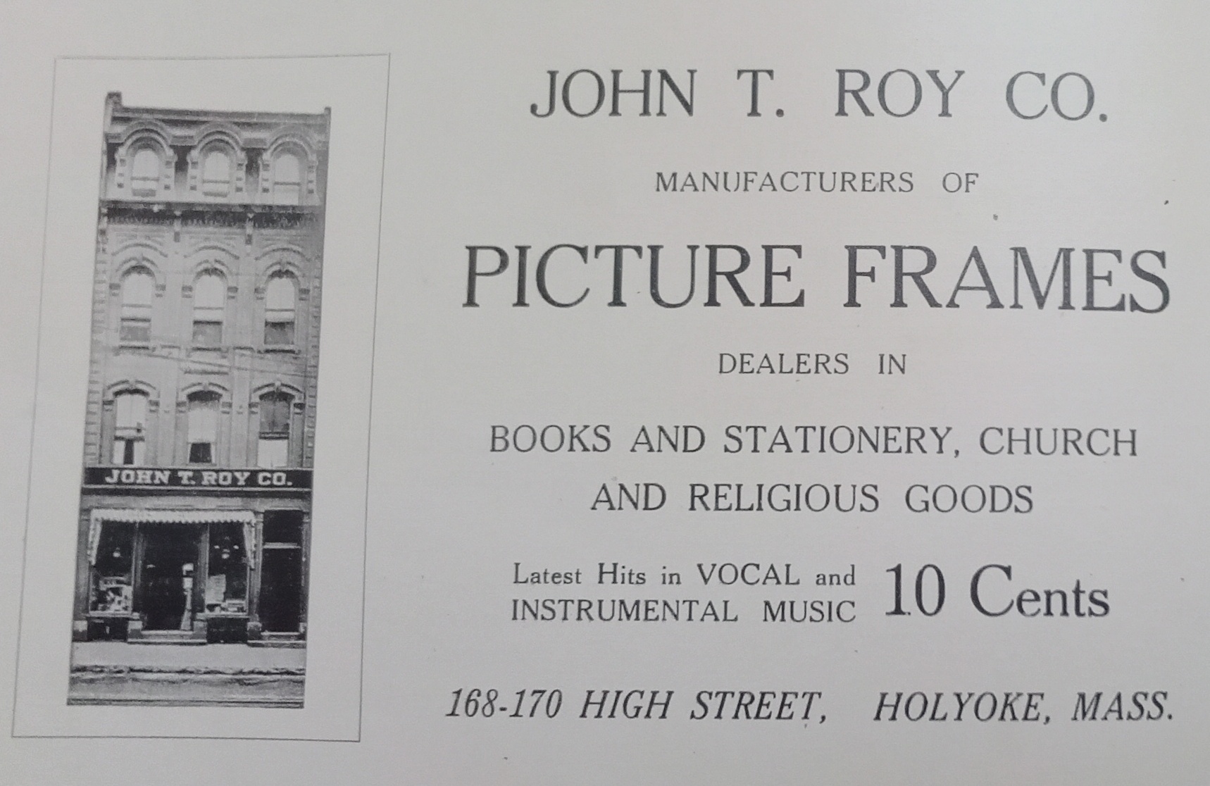
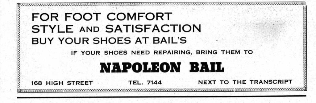
The Allyn Building is at 164-170 High Street and has served many purposes through the years. It started in 1871 in the Italianate style. It once housed the City Boot and Shoe Store.
In 1885 the M P Conway Piano Dealer was here too.
By 1915 this building and the one just north of it are being called the Roy’s Building and the Roy’s Block.
In 1940 the building is being called Bail’s Block.
By 1885 there are two more Allyn Blocks. There is one at 278 and 282 High Street and then there is one at 253 and 257 High.
The Cunningham Block is at 302-308 High Street. Also called the Thime’s and Cordes’ Block.
Frank Cordes the sign painter was based here. Cordes did murals and sign painting. Some of his work might still exist but this is hard to verify. The Hampshire County Courthouse has his murals in the old part of the building in front. He also made some murals in Connecticut. In 1883 he was at 239 High.
That block is gone and the People’s Bank is here.
The Toggery was at 302 High Street and was a men’s clothing store.
This is also part of the South Hadley Heritage tour. Navigate back to the tour page HERE.
The Old Meeting House is the first one in what would become South Hadley. It is still there and all the other meeting houses built after that are gone. It is now used as a restaurant.
When this cemetery started in 1836 it was called the Cabotville Burial Ground. In 1878 it changed to Maple Grove Cemetery. The Grape Street Primary School is seen at the top of Auburn Street. It was built in 1861. FINDAGRAVE
The Mosman family lived at 119, 122, and 123 Grape Street.
To family historians, the town and city of Chicopee used MG to denote burials within this cemetery from the inception of Chicopee in 1848 onwards. MG means Maple Grove Cemetery. Thus Maple Grove Cemetery has had this name in an unofficial form for much longer than the timeframe that I have given above.
stop 2 – Elisha Bullens
Notice the very many family plots in this cemetery. Many have raised ground around the family plot. Also many have iron railings around the family plot. There is a good chance that the many iron railings are due to the Ames Mill being nearby. The Bullens family plot is a good example of the use of the iron railings. Note also the raised ground around many of the family plots. This might be a nice touch but after a century it will lead to many overturned gravestones due to increased solifluction in the soil. In 1978 about 60 thousand dollars was spent on fixing the cemetery but now it is getting back to its former state. FINDAGRAVE
stop 3 – Mosman family
The Mosman family lived in the two homes on Grape Street directly behind the gravestone. They also lived in the house directly across Grape Street from there two houses. Silas was a blacksmith at the Ames Mill. His grandson Melzar Mosman made Civil War monuments around Massachusetts. FINDAGRAVE
stop 4 – James Ames
James Ames and his brother Nathan brought the Ames Company to Chicopee. FINDAGRAVE
The Valentine School and the Robinson School are directly behind the James Ames gravestone.
stop 5 – Mary Bates
Mary Bates has her gravestone embedded into a tree. Fine example of what NOT to do to keep a cemetery looking good. This is however what happens to items left near trees for a long time. FINDAGRAVE Trees grow from its top tip and all end of branches and also grow outward in the trunk and branches, but they never grow up and out at the same time from any given area. Thus this stone will never be lifted.
stop 6 – Le Roy
Not much is known about this plot. It seems to be for a single burial and at that for a person named Le Roy. The name Le Roy appears on the front bottom, the front middle, and the back middle. FINDAGRAVE
The iron fencing is very close to the burial. The fence being around a single burial is a sign that they were attempting to stop graves robbers. See this LINK for a wonderful story on grave robbing. I do not know of any medical schools that were nearby so it is not known why this is so closely guarded.
6A-B – Old Burials and the Town Cemetery
In the oldest section of the cemetery, there are burials from the 1830s.
This old section also has a large, empty-looking northern edge. This might be a potter’s field section. Thus these are pauper’s graves. In the town burial records, this section is denoted with a burial of Town Cemetery. In the 1840s to 1860s town burial records, the burials here are called either Cabotville, Maple Grove, or Town Cemetery.
stop 7 – John Chase
John Chase was the agent in charge of the Cabotville Canal including getting the canal, dam, housing, and mills built. He was also the agent in charge of the Holyoke Canal System including getting the canal, dam, housing, and mills built. His large obelisk is still in place and in great shape but his small tombstone is fallen. FINDAGRAVE
stop 8 – Alton Phillips
Alton Phillips was a Civil War soldier from the North who died during the course of the war from his injuries. He died the 4th of May 1863 in Culpeper, Virginia. FINDAGRAVE
Nearby is George Croshier who also died during the course of the war from his injuries. FINDAGRAVE
stop 9 – Chapin
Look at the burial location of the Chapin stone. Thus this is a cenotaph. FINDAGRAVE
stop 10 – John Spier
John Spier is buried in the SE section of the cemetery. There are three repaired stones in this fashion in this cemetery. FINDAGRAVE
stop 11 – Nathan Ames
The brothers Nathan and James Ames came to Chicopee to start their factory. The Ames Mill produced cannons and swords. FINDAGRAVE
Some of the other families that have fence around their lots are Wardwell, Streeter, Smith, Howard and Ball, Cutler and Brown and Meade, Miller, Burnett, Charter, Merrick, Brigham, Taylor, Babcock and Jacobs, Phillips, and Denison.
stop 12 – neighborhood
This cemetery is near Springfield Street which is a very historic street in Chicopee. Follow my other tours in this area of Chicopee.
Burial Grounds of Chicopee throughout its History is a presentation format of the cemeteries of Chicopee. Before 1851 the Catholics of Chicopee would have been buried in Saint Matthew’s Cemetery of Springfield. Before 1739 the Protestants of Chicopee would have been buried in Springfield Cemetery of Springfield.
LINK to my Patreon video for the Catholic cemeteries of Chicopee.
LINK to my Patreon video for the Protestant cemeteries of Chicopee.
To find a burial site of a person, use the town copy of the death records on ancestry. From 1848 to 1881 the cemetery is listed.