
- This is one of many Olmsted designs in Holyoke. Read about the rest at this LINK.
- Parks of Holyoke
- Private GROUP TOUR (COSTS) is two hours long for this Elmwood Park and Neighborhood walking tour. Also a one hour indoor presentation can be given.
- A free public tour comes up every five years.
- A self-tour is available for anyone using the maps and text seen below. – LOCATION
- A booklet is available for this tour in either B & W or color, go HERE for the information needed to buy it.
Elmwood Park of Holyoke is called the park that disappeared. Still if one looks they will see its remnants everywhere. Its land was purchased by the city over decades to make a unified park and then soon afterward it started to be divided up again.
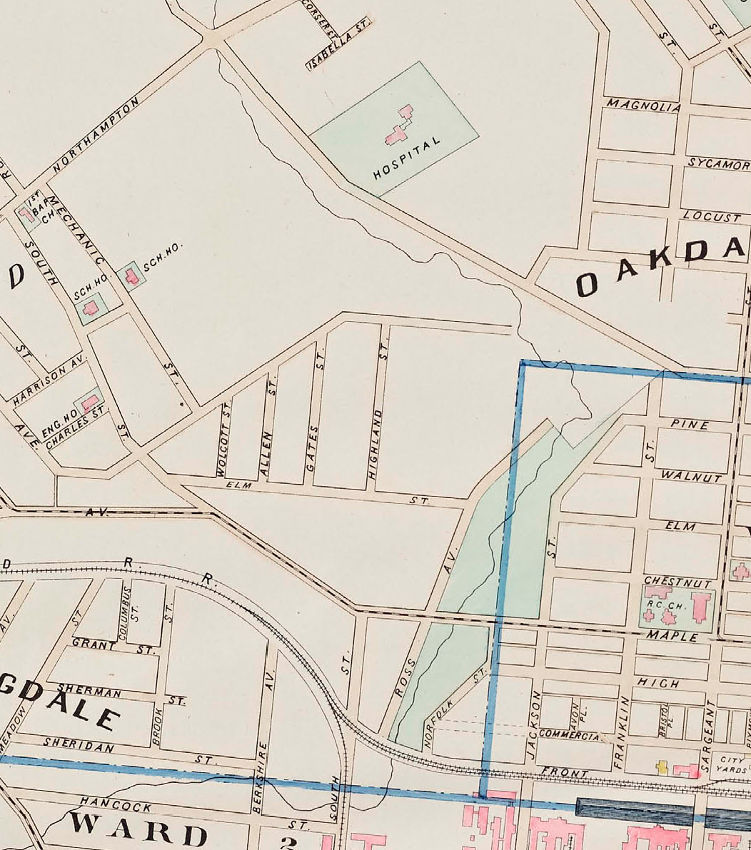
The first mention that I can find of Elmwood Park in the annual city registers is that of the year 1899. In that year, the edge of the park along Jackson Street was graded, a walk built, and a tree belt seeded. Before that from 1895 to 1899, it is called Dingle Park in the city annual register. They are both fine names – there were 5 dingles in Elmwood Park at its height but only one in its infancy. The 1894 Richards map also has the park but without a name. This is the earliest ever reference to the park. The Holyoke TT references the park in 1895 and then onward more often.
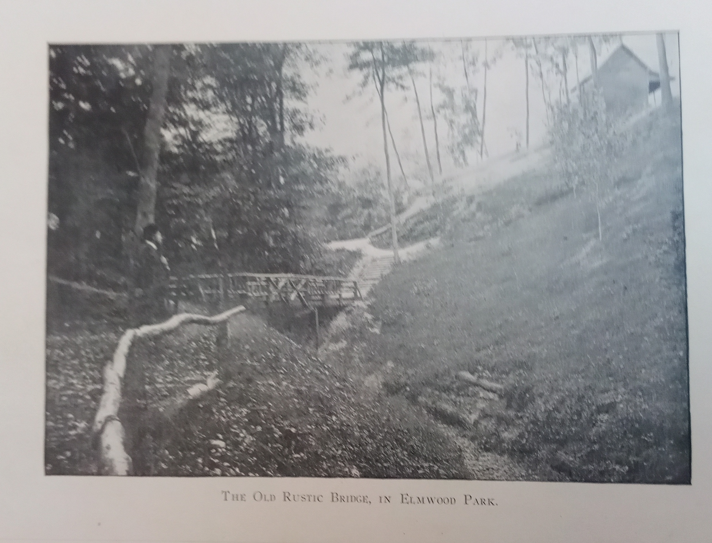
In 1901, 100 trees, 500 shrubs, and new flower beds were added to the park. A new rustic bridge was added across the ravine. The Maple Street entrance was graded more. New walks and new settees were added.
From 1901 to 1909 design plans were drawn up for the park by the Olmsted Brothers of Brookline. These PLANS were extensive. The first image at the link is the 1902 look of the park before the design and any work was done.
In 1935, Elmwood Park received a beautification effort. The Beech Street Park portion of Elmwood Park got lily ponds, a rustic bridge, a stone lookout, steps, and a wall.
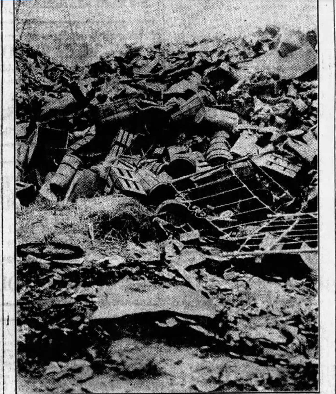
Hurricane Diane of 1955 caused major damage to Elmwood Park. The entire Dingle Drive was washed out and MacKenzie Field was entirely gone.
Park at the Fitzpatrick’s Ice Rink
stop 1 – Fitzpatrick’s Ice Rink


There was a McKinley Street were the ice rink is now. This is a good place to PARK since it is open a lot. This was NOT part of Elmwood Park.
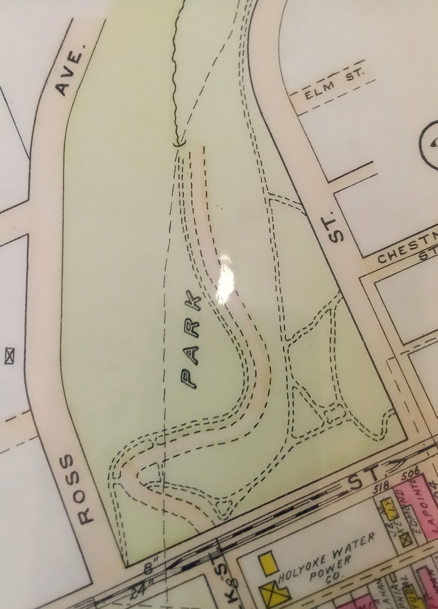
stop 2 – Ross Street and the Dingle
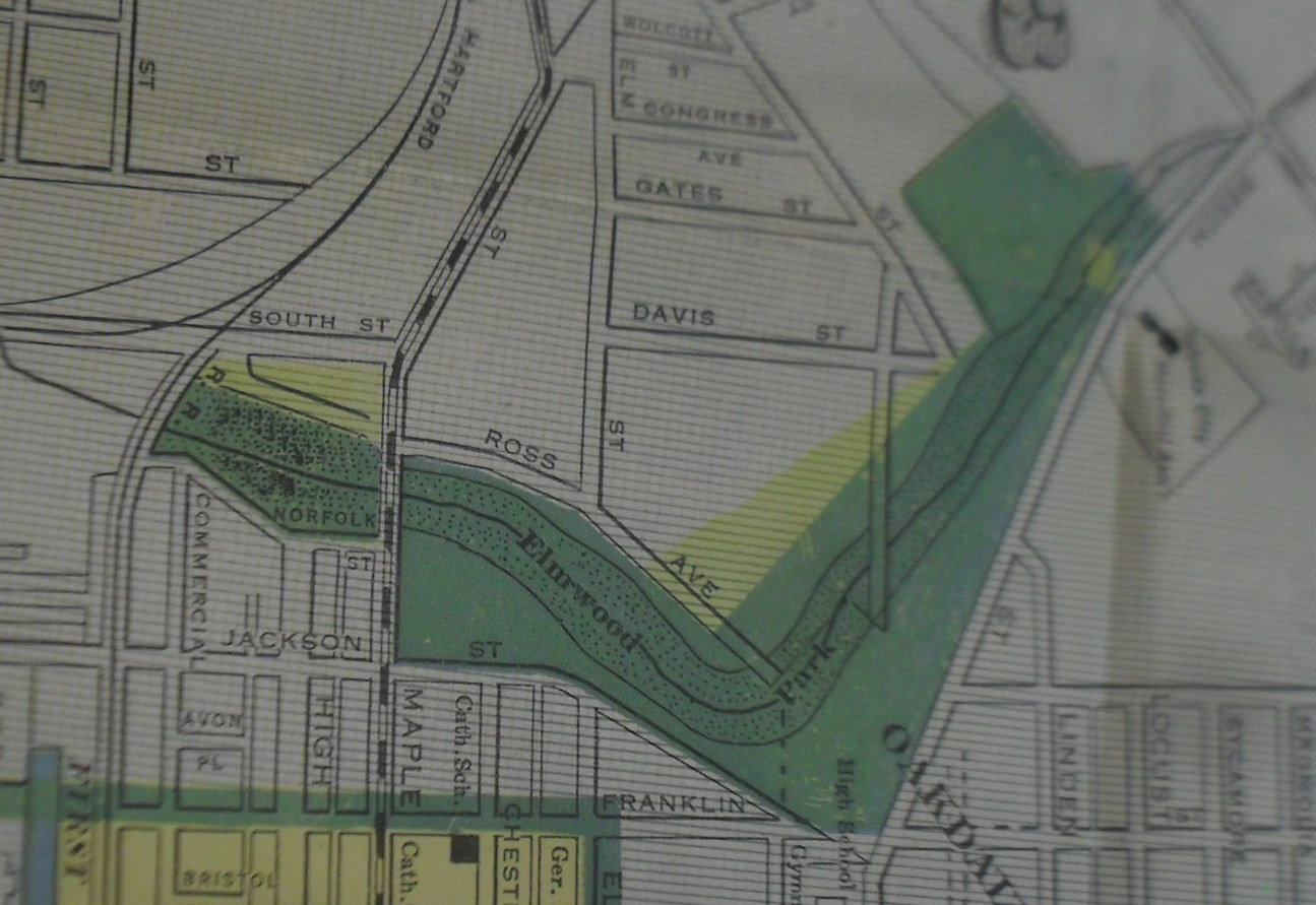
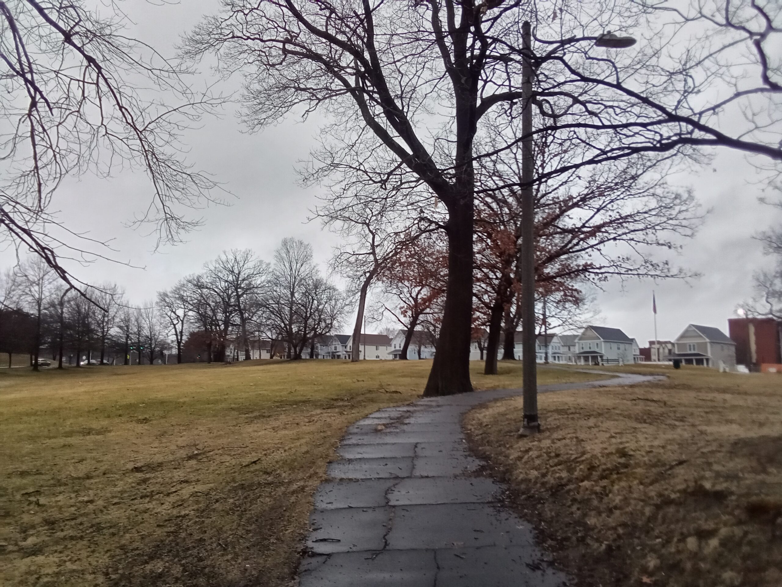
This is the lower area of the Elmwood Park. It was replaced by the Interstate 391 terminus. The Ward 6 pool, the original Sheard Park, and the Dingle were down there. Ross Street’s remnant is visible but only its lower section. The upper section went into the park. Many would call the upper part of Ross Street – Dingle Drive.

Into this part of Elmwood Park in 1934 the ERA (Emergency Relief Administration) had terraces built. These were mostly along Jackson and Maple Street. The ERA had other projects around the city. The ERA lasted from 1933 to 1935 and it was at that time replaced by the WPA.
stop 3 – Sheard Park
Sheard Park (LOCATION) is named after William Sheard of Holyoke who died in 1944 in Germany during WW2. This was the last remnant of Elmwood Park. The steps lead into the park. It was renamed Sheard Park when that park was removed by the interstate in 1980. There is a rock with a plaque at the eastern corner of the park. His FINDAGRAVE page.
The William J Sheard Memorial Playground was made in 1961 as a playground and in 1962 officially dedicated to him. The park before that was called Poor Park. This Poor Park and then Sheard Playground was at the area now bordered by the end of the interstate and the parallel streets Maple and High. For safety, the area was enclosed by a fence.
stop 4 – Churchill neighborhood
The Churchill neighborhood (LOCATION) has many buildings in it. Mostly there are churches galore. See my tour of the Sacred Heart Church.
stop 5 – Roberts Sport Field
Roberts Sports Complex (LOCATION) includes the Roland Pouliot Pool and the Morneau Tennis Courts. This area was once called Alumni Field. This field was formally dedicated on November 18 1967 at halftime during a game between Holyoke High and Holyoke Catholic High School. This was the home football field for both schools and had been since the start of that season. Before they were both at MacKenzie Field. Holyoke High School has had a football team since 1891. Holyoke Catholic High School had a football team since 1947 and their constituent schools – Rosary, Sacred Heart, and St Jerome – might have had teams before that.

stop 6 – John Young Field
The John Young Field (LOCATION) was dedicated on May 18th 1986 to John Young a softball advocate.
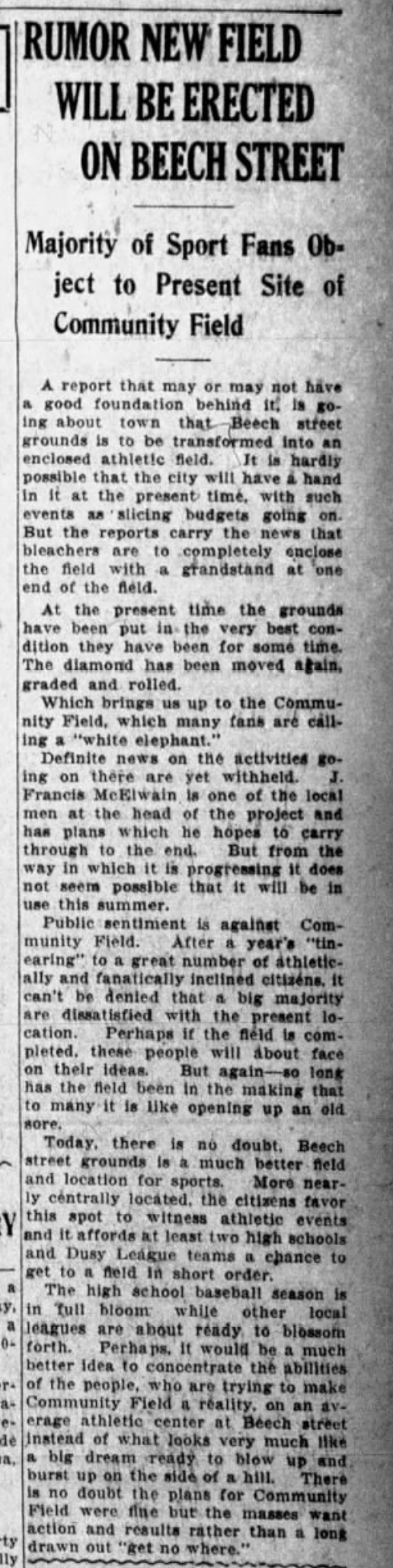
The land was originally called Ranlet Parcel. It was purchased in 1908. This field was in 1917 given by the parks division of the city over to the playgrounds division. It was called the Beech Street Grounds or the Beech Street Playground.
This was considred to be an extension of MacKenzie Field. A softball diamond was built in the northeast corner of MacKenzie starting in 1953 and ending in 1954. Lights were added to this softball diamond in 1954.
stop 7 – Oakdale Neighborhood
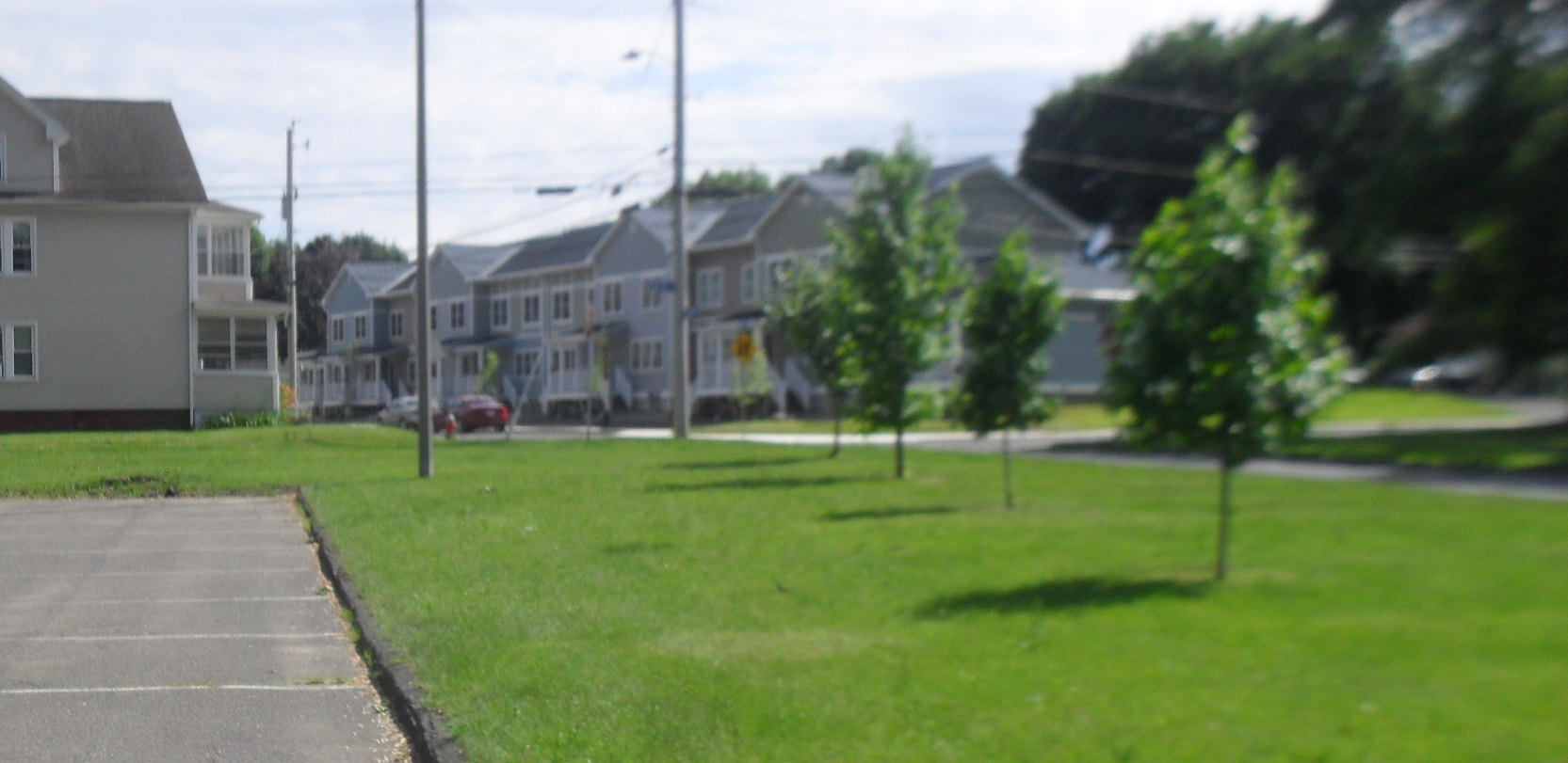
Oakdale (LOCATION) starts on the other side of Beech Street. It was formed as a streetcar suburb in the late 1890s.
stop 8 – MacKenzie Field
Once called the Ball Tract, the Range, and the Beech Street Grounds, now it is called MacKenzie Field. (LOCATION) It was dedicated with that name on Labor Day September 4 1939 to honor John MacKenzie for his heroism on the USS Remlick on December 17 1917.
Before that it was graded over many years with one such year being 1929 when the Parks Department commented that it needed very much work and that the dingle area near it was ugly. Starting in 1930 the park was made into a sports recreation area. 2 diamonds, 2 football grids, 1 soccer field, a basketball court, and a golf range were added. It was made in 1932 as a sports complex. Then the WPA Works Progress Administration came to Holyoke to perform many projects and this was one of them. They the WPA built the stadium and the shelter house.
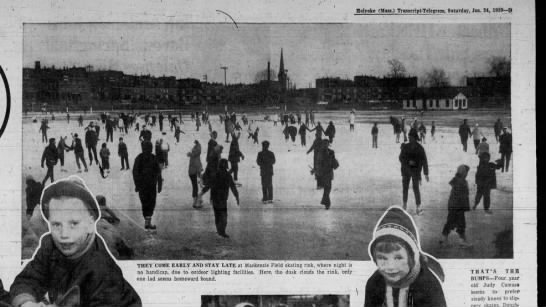
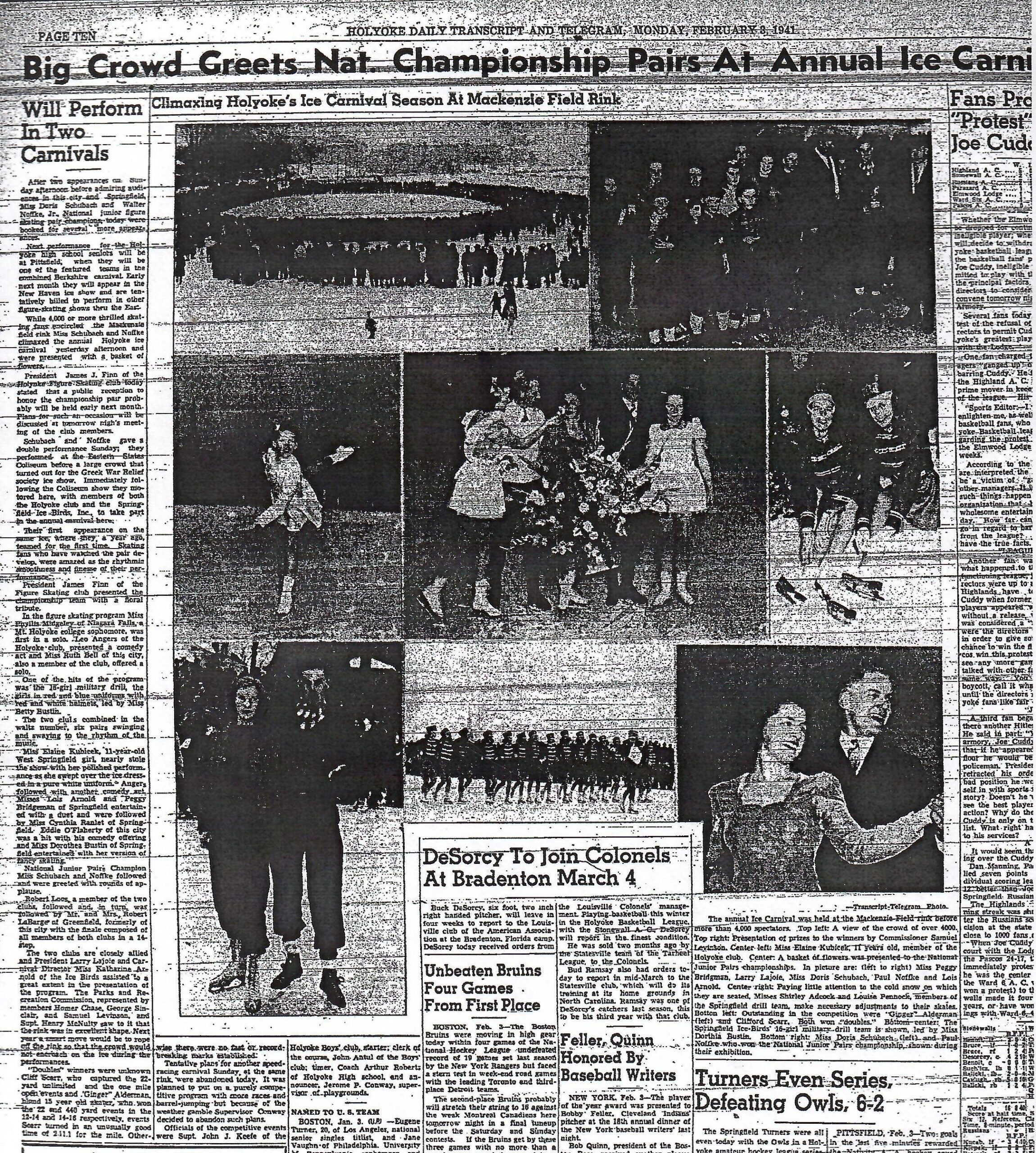
In 1935 the Beech Street Playground had figure and speed skating exhibitions that attracted 1000s of fans that would line the rink. The annual Ice Carnival was attended by the Holyoke Figure Skating Club among other groups in and outside the city. The largest crowd might have been at the Jan 21 1939 and the Feb 2 1941 editions where 5000 people attended.
In 1940 MacKenzie Field had a baseball diamond (last week of May), a quarter mile cinder track (along with long jump and pole vault areas), and some tennis courts added to it (these had been started in 1937 and completed three years later). Also an iron fence was added to the field with a base of fieldstones. In 1941 basketball courts were made at the field and this would be a staple of the area for many years. In 1942 MacKenzie Field was changed from a park into a playground a move which allowed fares to be charged. Finally in 1946 MacKenzie Field is finally fenced in. In 1947 night baseball started at MacKenzie Field.
By that year both Holyoke Catholic HS and Holyoke HS are using MacKenzie Field as their football stadium. In 1949 the back portion of the field was given to the city by Holyoke Water Power – this would become Alumni Field. In 1955 pro football came to Holyoke at this field. The team was called the Holyoke Knights from 1955 to 1958 and the same team was renamed to the Holyoke Merchants from 1959 to 1961. That is 7 straight seasons of pro football. The Holyoke Knights and Merchants would play their home games at MacKenzie Field. In 1965 and in 1973 Holyoke had minor league teams – the Bombers and the Pioneers.
From 1977 to 1982 the Holyoke Millers played their home games here. View a documentary about the team HERE.

stop 9 – Holyoke High School
This is the third location of Holyoke High School. (LOCATION) The first location was on Elm Street were the Holyoke Juvenile Court is located. It lasted from 1862 to 1898. The second location was between Beech Street and Pine and between Sargeant and Hampshire. This lasted from 1898 to 1964. In 1964 this newest high school was built. 38 acres were taken from parkland to construct the HHS grounds.
stop 10 – Holyoke Hospital
There have been many hospitals in Holyoke over the years. City Hospital was built in 1890 by the leading industrialists of the city. The hospital had land both in front of and in back of the hospital buildings. There it made winding dirt paths. It also held land across Beech Street. This was acquired by the city in 1907 as an addition to Elmwood Park. Holyoke Medical Center WEB page. (LOCATION)
stop 11 – Yankee Pedlar

The Yankee Pedlar (LOCATION) has gone through many changes in its history. Read the excellent BOOKLET by People’s Bank. The home was built in 1882 by John Hildreth. In 1955 Eugene Tambori turned it into an inn.
stop 12 – Crosier Field
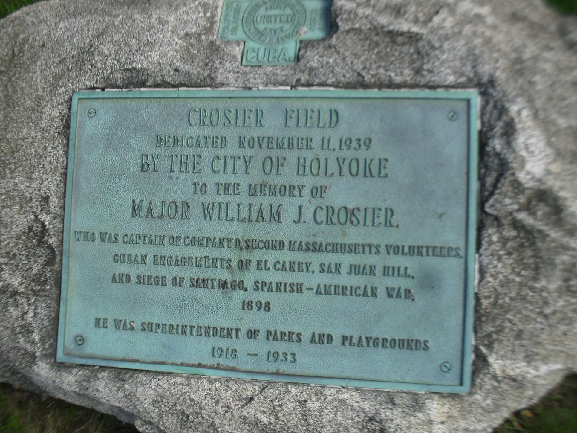
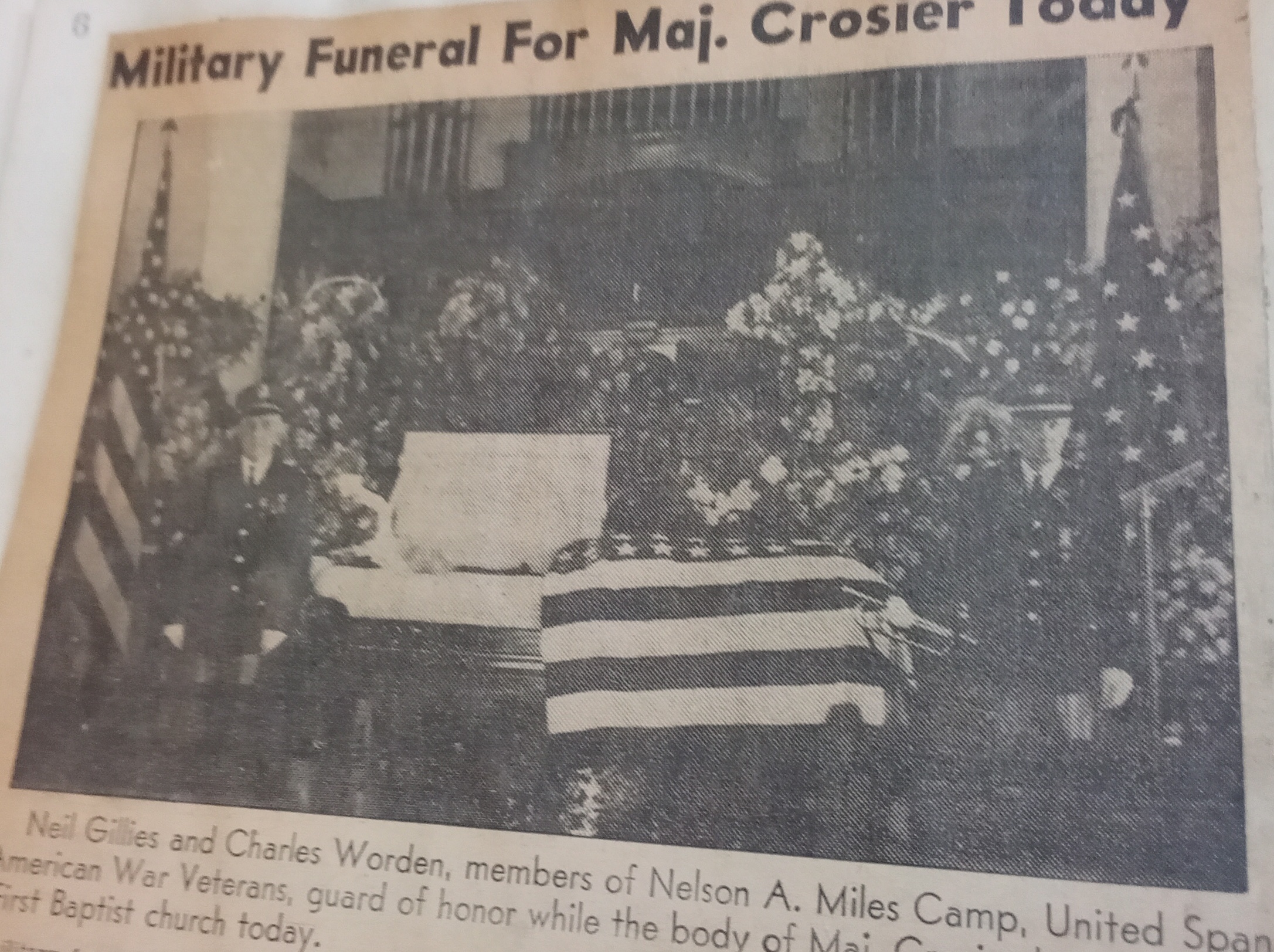
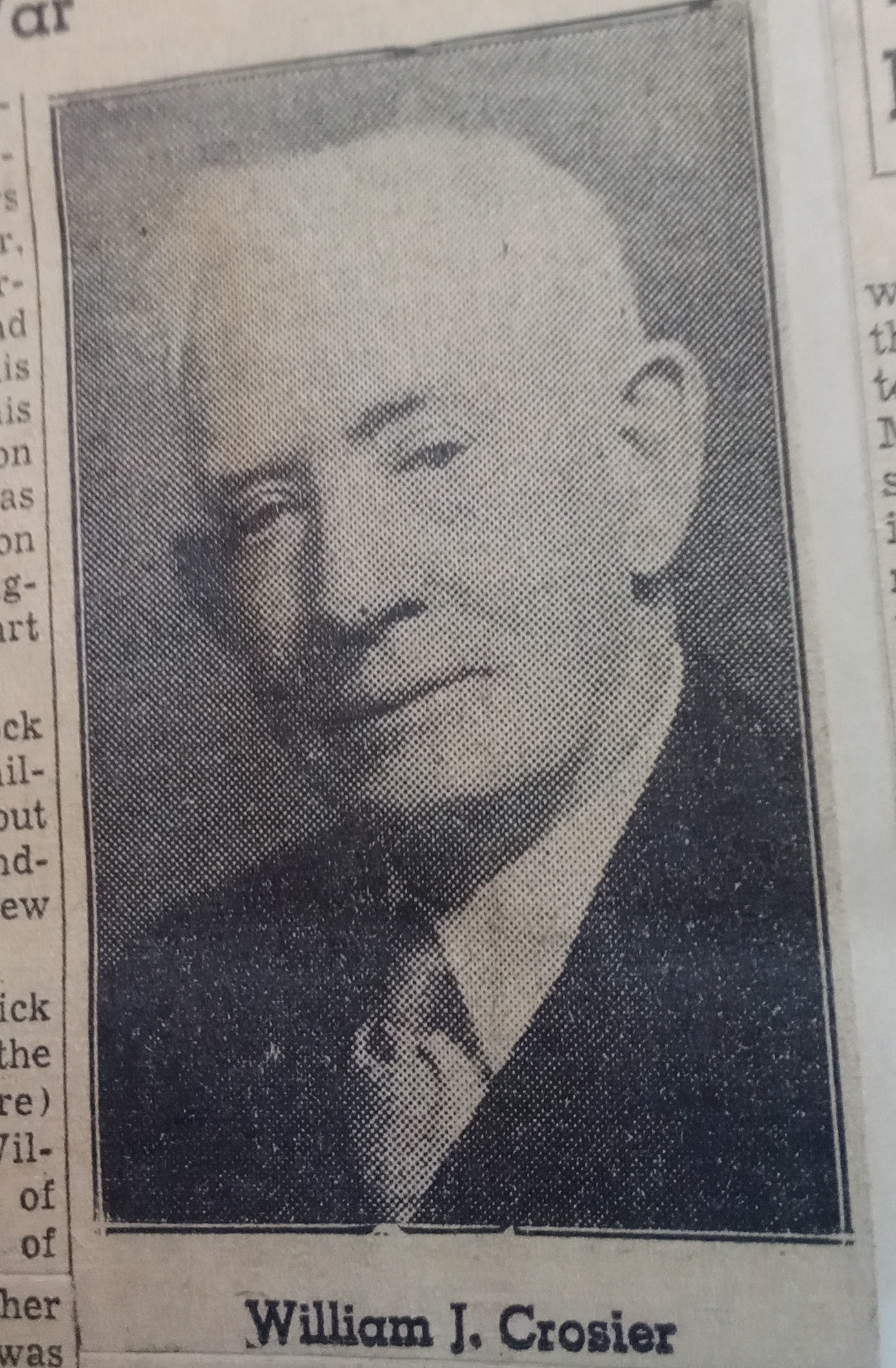
Crosier Field (LOCATION) was once called Soldiers’ Field and also called Elmwood Field. The first official name was given on July 4 1932 at a dedication ceremony – it was named Soldiers’ Field. It was renamed and rededicated on Armistice Day 1939 to Crosier Field – named after William Crosier (March 25 1860 to January 5 1938). Crosier was the leader of a military group that fought in the Spanish American War. He was superintendent of the parks of Holyoke from April 1 1918 to September 15 1933.
In 1932 the maple trees along the western edge of the park were planted to honor the Spanish American War deaths. Two stones at the northwest corner of the park explain these facts. William Crosier (FINDAGRAVE) bought and planted the maples from his own pocket. Along this western edge of the play area there once was a steep contour right up to the road. The maples were added to the new tree belt that was added there. Along the northern edge of the park there are a row of trees that honor the WW1 deaths of Holyoke and these were planted by a veterans group.
A brownstone drinking fountain was gifted to the park in 1932 by Ellen Ives to honor her brother Dwight Ives. In 1942 a shelter house was added to the field along with a baseball backstop. Too many baseball were being lost into the dingle. In 1950 a sanitary building was added. (At some point two pillars were added to the northwest corner of Crosier Field. This would serve as a symbolic entrance. I cannot find the year it was made.)
Elmwood Park covered the east portion of the park and went all the way to Carlton Street. There it bordered Carlton Street School.
It is now both a neighborhood park and a schoolyard.
stop 13 – Carlton Street School
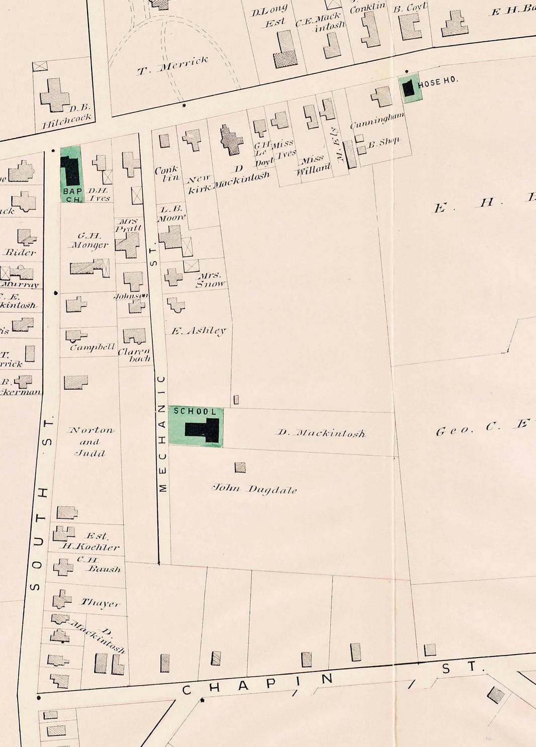
The Carlton Street School (LOCATION) was built in 1865. Carlton Street was once called Mechanic Street. See the location of the school in the Walker map below. The Ball land would become the Soldiers Field (Crosiers) and the Ewing land would be Elmwood Field. See the Dexter Hose House in the map also.
In 1908 the entrance from the Elmwood area was purchased so people could get into the park from near the school. This area used to be part of that very large Dingle that defined Elmwood Park. In 1910 a baseball field was finally made in this Elmwood Field.
In 1917 a great deal was done to fill in the Carlton Street end of the Dingle. This part of the juncture of Peck, Crosier, and Carlton was called the Elmwood Playground.
Farther up the area was the South Street School. This school was built in 1894. This school was renamed in 1904 to the Elmwood School.
stop 14 – Peck School
The Peck School (LOCATION) was built at the elbow of the Dingle area. It was made in 1967.
A roadway was built through here in 1935 starting at the Elmwood entrance down to the dingle onto the Beech Street Extension. It was called Dingle Drive.
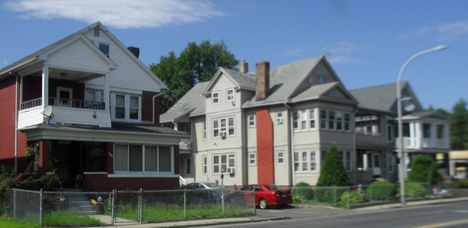
stop 15 – Elmwood neighborhood
Along Beech Street it seems that Elmwood (LOCATION) is a new neighborhood but actually it is very old. Chapin Street has at its northern end as small street that bears to the right. This tiny street once lead into Elmwood Park and was considered to be its main entrance. After going downhill it meets the Day Brook. At that stream a bridge was built. One could cross the bridge and walk on a dirt road to Pine and Beech Streets.
Due to its wild nature, the Day Brook has been placed nearly entirely underground. Read about it HERE (PDF). Day Brook was placed underground for its full length through the Elmwood Park in the year 1926. The brook was causing too much trouble in the western Oakdale section of the city. It would flood very often. The stream was placed into the waste drainage system of Holyoke. This means that during floods there might be backups in the sewage system. When Day Brook passes through Community Field, the banks of the stream are made very high. The wastewater treatment plant of Holyoke is able to handle the high levels of most days but once a year it cannot. Then wastewater is sent directly to the river before treatment. Most of this elevated level of water is caused by the diversion of water from the Day Brook into the sewer pipelines.
stop 16 – Parkview Street
This is the northernmost of the five parallel streets that are to the north of South Street. It is also the newest of those 5 streets. It has a fine view of the Mount Holyoke Range to the north and a fine view of the Mount Tom Range to the west.
Humans need structures, but they also need ample open spaces close by. Is it enough to only value and preserve lands that are far away from inner neighborhoods? It appears that the original Elmwood Park could have been the ‘Central Park’ of Holyoke where people of many backgrounds and incomes could have enjoyed even today. But politicians always contend with the ‘pull’ to DO SOMETHING! Too often, the ‘do something’ leads them to target park and playground spaces – those areas dedicated to public recreation for the purpose of promoting and encouraging physical activity; stress relief; socialization; contemplation; peacefulness; nature; teamwork; nature; plants; color; imagination; rest; and the value of sharing space with others. Are parks the result of the works of nature/God that are tweaked by humans so that we can safely use them for a variety of activities? Are school buildings, and other structures entirely designed and brought into being by man? In today’s culture, buildings appear to be more valuable to society than parks and playgrounds. Less than 100 years ago, the culture of Holyoke coveted the expanse of Elmwood Park. By the 1950’s, the political culture changed so much that Elmwood Park was treated as undeveloped land that was ripe for new buildings and highways; parkland was not considered to be as valuable as it used to be. Maybe in the distant future the culture will value ‘virtual’ experiences more than face-to-face experiences. Maybe the dwindling population numbers will lead to fewer and fewer taxpayers. Maybe the prices of sustaining massive school system budgets will be viewed as unnecessary with the option to go ‘virtual’. I’m certainly don’t believe virtual/online schooling adequately meets the needs of most students. Cultural mindsets change. I won’t be around if it happens. Few, if any of us, might be around to witness the change where the politicians and other influencers come to see this light: reduce and/or destroy the urban parklands and the culture will suffer. No amount of 21st Century school buildings, new roads, housing developments built to replace dedicated urban park space has improved the urban human condition as much as celebrated. Look at and explore the density of the inner city Holyoke’s, Springfield’s, etc. and try to convince people that the past 100 years of urban parkland removal has provided the benefits expected, without unexpected consequences. Imagine if the dense urban neighborhoods had a Holyoke version of a ‘Central Park’ where Elmwood Park used to be? It’s too bad that we can only see remnants of the former park. Maybe someday, a park will rise from its footprint that has been taken over. Maybe someday, there will be guided and self guided tours through a re-established park to show a chunk or a set of concrete steps where the Peck School was or where Holyoke High used to be. Maybe someday, the culture will once again place a high priority on urban parkland for the social, physical, mental well-being that adequate urban parkland has proven to provide. But unless people see the light and attempt to understand the negative consequences resulting after the takeover and destruction of great amounts of urban parkland, there probably will never be another ‘Elmwood Park’. There has to be motivation to envision it and to see that it does happen – someday.