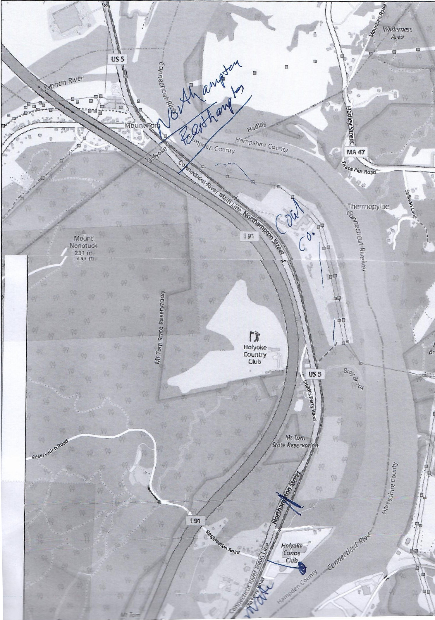
The Shoreline of Holyoke – Easthampton border to Holyoke Canoe Club
This area is all private land. It is walkable if you can get out to the dirt beaches.
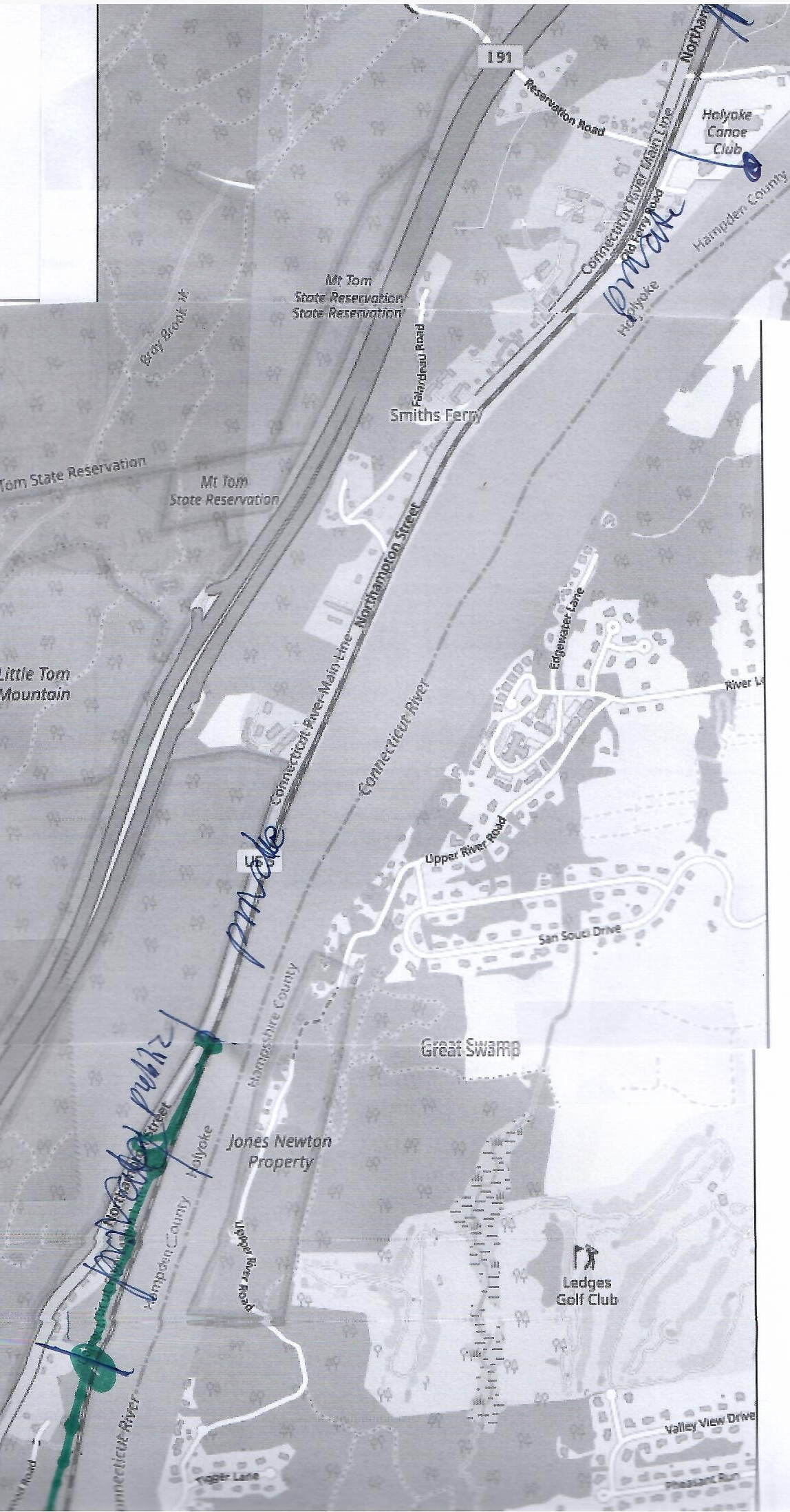
The Shoreline of Holyoke – Holyoke Canoe Club to Brookwood Road
This area is all private land. It is walkable if you can get out to the dirt beaches.
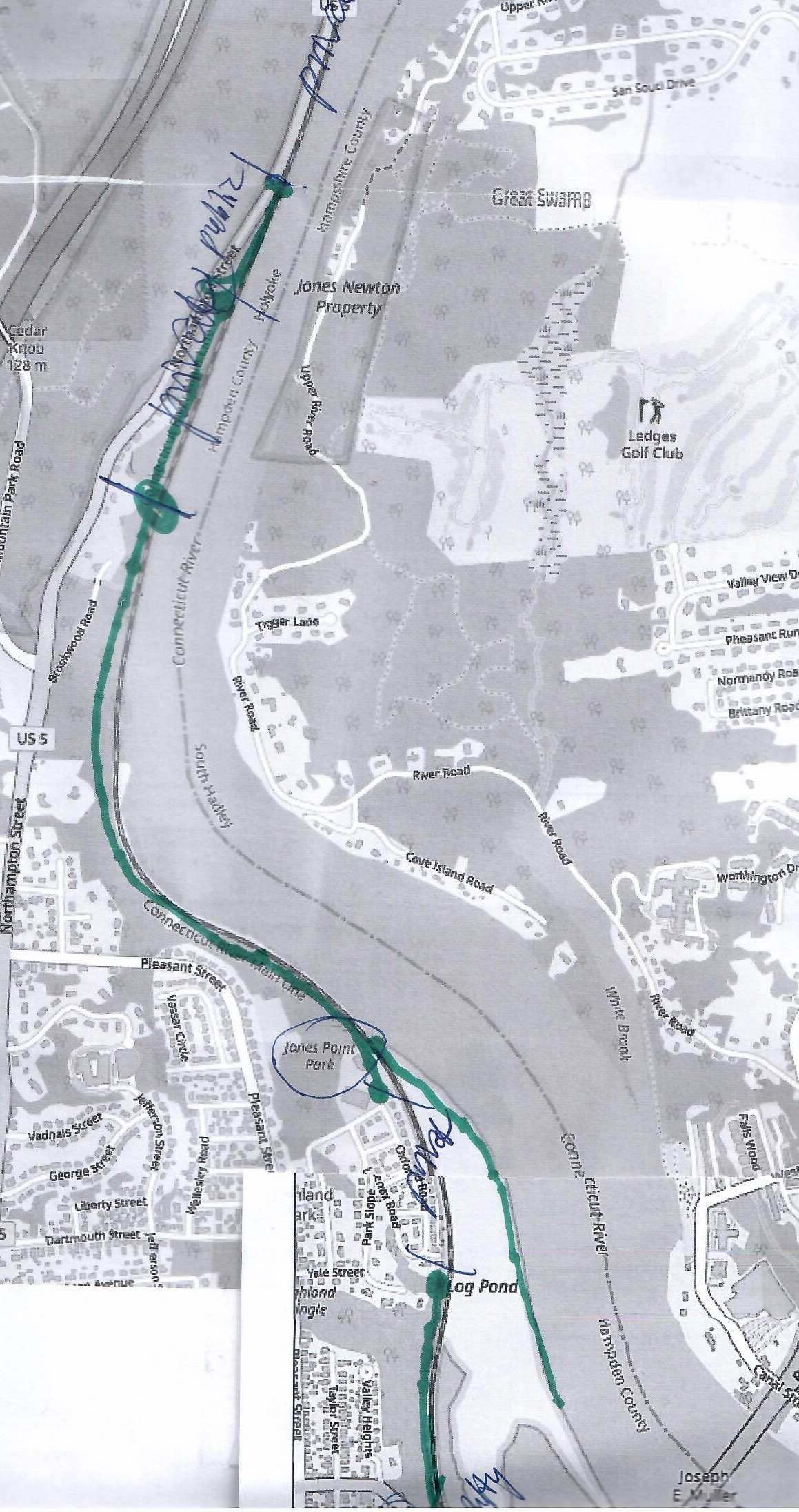
The Shoreline of Holyoke – Brookwood Road to Log Cove
From Jones Point Park one can walk either north to the Dinosaur Tracks or south to Log Cove.
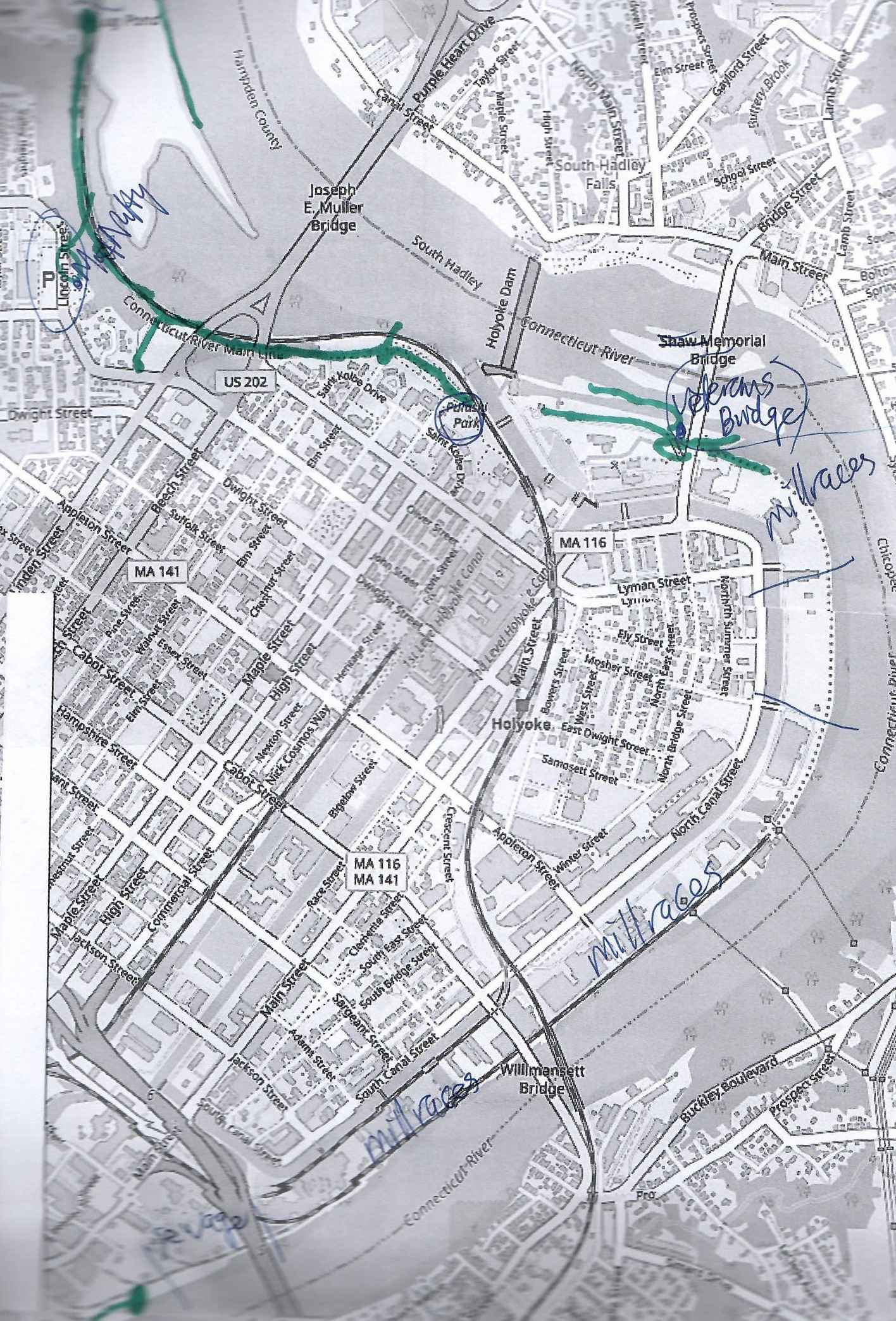
The Shoreline of Holyoke – Log Cove to Interstate 391
Here one can get in at McNulty Park and either walk north to Jones Point Park or walk south to Pulaski Park. Likewise, one can get in under the Vietnam Veterans Bridge and walk north to the large Holyoke Dam or walk south to the first millrace behind Valley Paper. Farther advance is very hard since each mill has a millrace blocking your way.
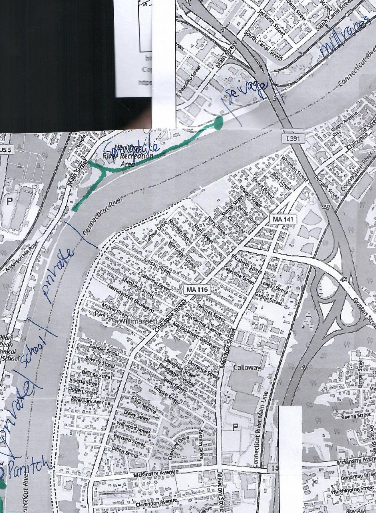
The Shoreline of Holyoke – Interstate 391 to Holyoke Rows
The best intake area is at Springdale Park. A walk north is possible but the sewage plant stops one at some point. A walk south is not possible since there are homes here.
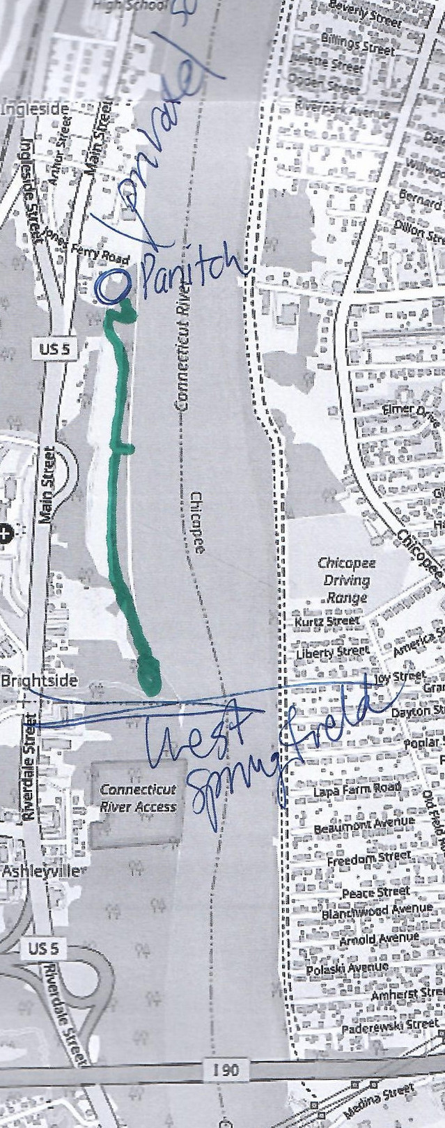
The Shoreline of Holyoke – Holyoke Rows to West Springfield Border
From Holyoke Rows a walk south is possible through the Land of Providence on trustee land to the southern border of Holyoke.