Before there was a park here the land was called the Patch. Life was harsh for the early settlers who suffered during cholera and more. Once it took on a parklike quality it was informally called Kerry Park. Then Prospect Park became its official name. Lastly, Pulaski Park. It most have been quite the quaint park since in 1887 goats roamed freely around Prospect Park. Enough damage was done to the point that they were considered a problem. Work has very often been done on the park. The early 1910s Olmsted based work on the park was not the only work since in 1887, for example, 67 trees were planted within the park. Some of those trees might still exist. There were once plans to extend Prospect Park to Highland Park (Jones Point Park). Read at this LINK.

The park was bought from the Holyoke Water Power Company in 1884 to become a true city park. The park is 1,106 feet along Prospect Street and 132 feet deep from there. It is 3 acres in the beginning. In 1885 an ornamental pump was installed to deliver water to people within the park. This was better than the method the year before when park goers would walk down the slope to a pump near the dam. They had to cross the tracks and the railroad company was not happy about that.


- This is part of the Holyoke Heritage Trail so after visiting here get back onto the trail.
- This is one of many Olmsted designs in Holyoke. Read about the rest at this LINK.
- Parks of Holyoke
- Private GROUP TOUR (COSTS) is one hour long for this Pulaski Park and Neighborhood walking tour. Also a one hour indoor presentation can be given.
- Booklets are available for purchase at this PAGE.
- A free public tour comes up every five years.
- VIDEO introduction to the park
- A self-tour is available for anyone using the maps and text seen below. – LOCATION
Stop 1 – Holyoke Canal System and Dam

See the canal tour stop for this location at this LINK.
Canal and Gatehouse from the park – LINK
Stop 2 – Prospect Park as an Olmsted Park

LINK for the Parapets in Pulaski Park (Holyoke)
Stop 3 – Pulaski Park Memorial LINK
Stop 4 – Holyoke Ice Company
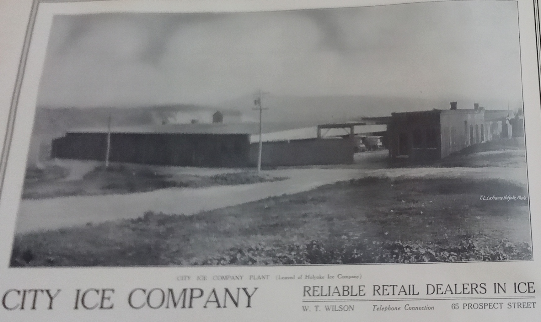

The Holyoke Ice Company started at this location in about 1900. They harvested ice from Ashley Reservoir and from Log Cove from 1900 to 1940. Refrigeration changed the company since people needed less ice but the company still existed until 1990.

The land at the corner of Pine, Prospect, and Lyman was purchased in 1924 for a new outdoor pool.

Stop 5 – Prospect Heights Neighborhood
The neighborhood around the park has grown up during the 170 years since it started. There is urban renewal in many places and some old buildings. The building at the southwest corner of Lyman and High Streets is the Gallaudet House. (95 High Street) It might predate the official existence of Holyoke itself. High Street tour and Maple Street tour
The first reservoir for water for Holyoke was in a large vat at the eastern side of Maple Street between Street Kolbe and Lyman Streets. This vat had walls that were 15 feet high and 40 feet thick.
Stop 6 – Mater Dolorosa Church
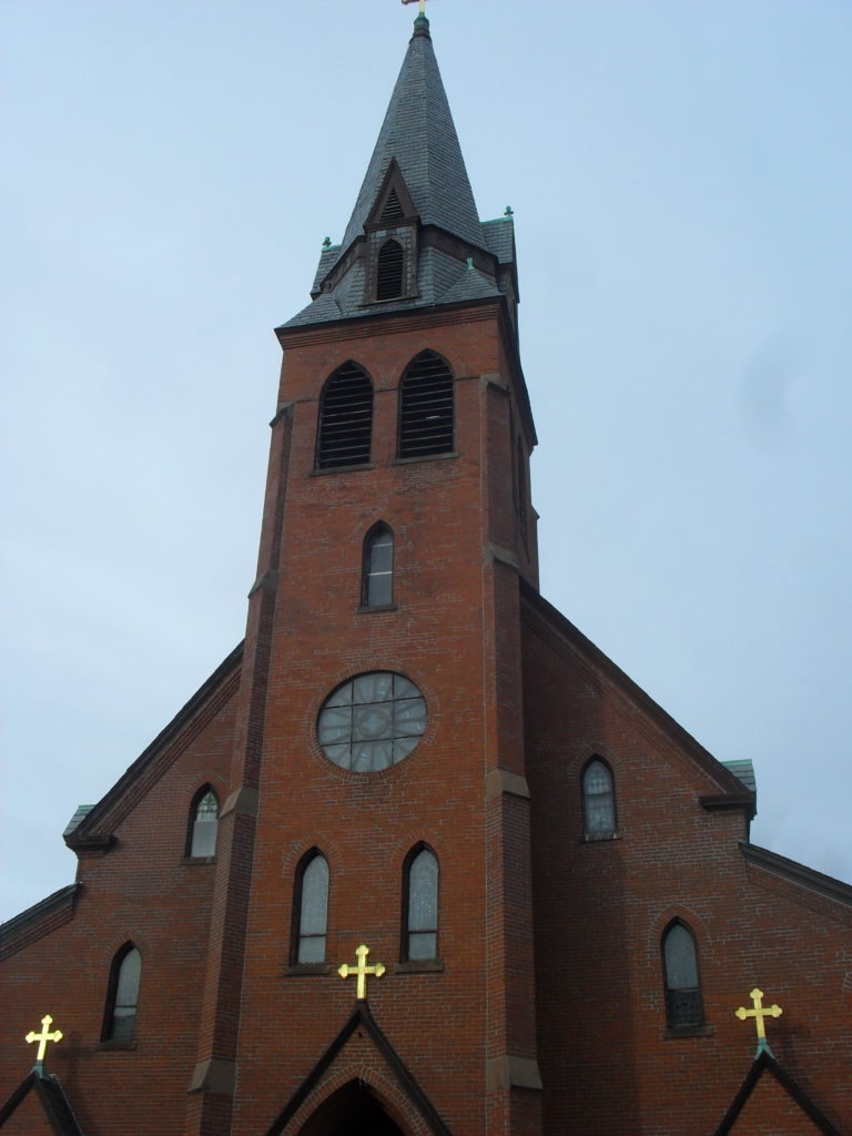
See my tour on the church at this LINK.
General Tadeusz Kosciuszko Park is nearby. It was dedicated May 21 1999. LINK
Stop 7 – Union Coal

The Union Coal Company was located in the eastern edge of this long park. It served the people of Holyoke from the 1890s to the 1940s. Prospect Streets had its eastern end near here and in fact the driveway of the businesses to the south now use what was Prospect Street.
Stop 8 – Feldman Park

Feldman Park was added to encourage young people to enjoy themselves in this area. Water park and skate parks were added. LOCATION


Stop 9 – Perpetual Help Church
The Perpetual Help Church was built where the Mater Dolorosa School is now. It was a four story building that served all the needs of the people in the area. There was a chapel church convent and school. Read more at the Mater Dolorosa LINK and read about its Chestnut Street church at this LINK.

Sanborn maps of the park:
Sanborn 1884 – does not help
Sanborn 1889 – does not help
Sanborn 1915 and map B
Sanborn 1949 and map B
Sanborn 1956 and map B

Views outward from the Park:


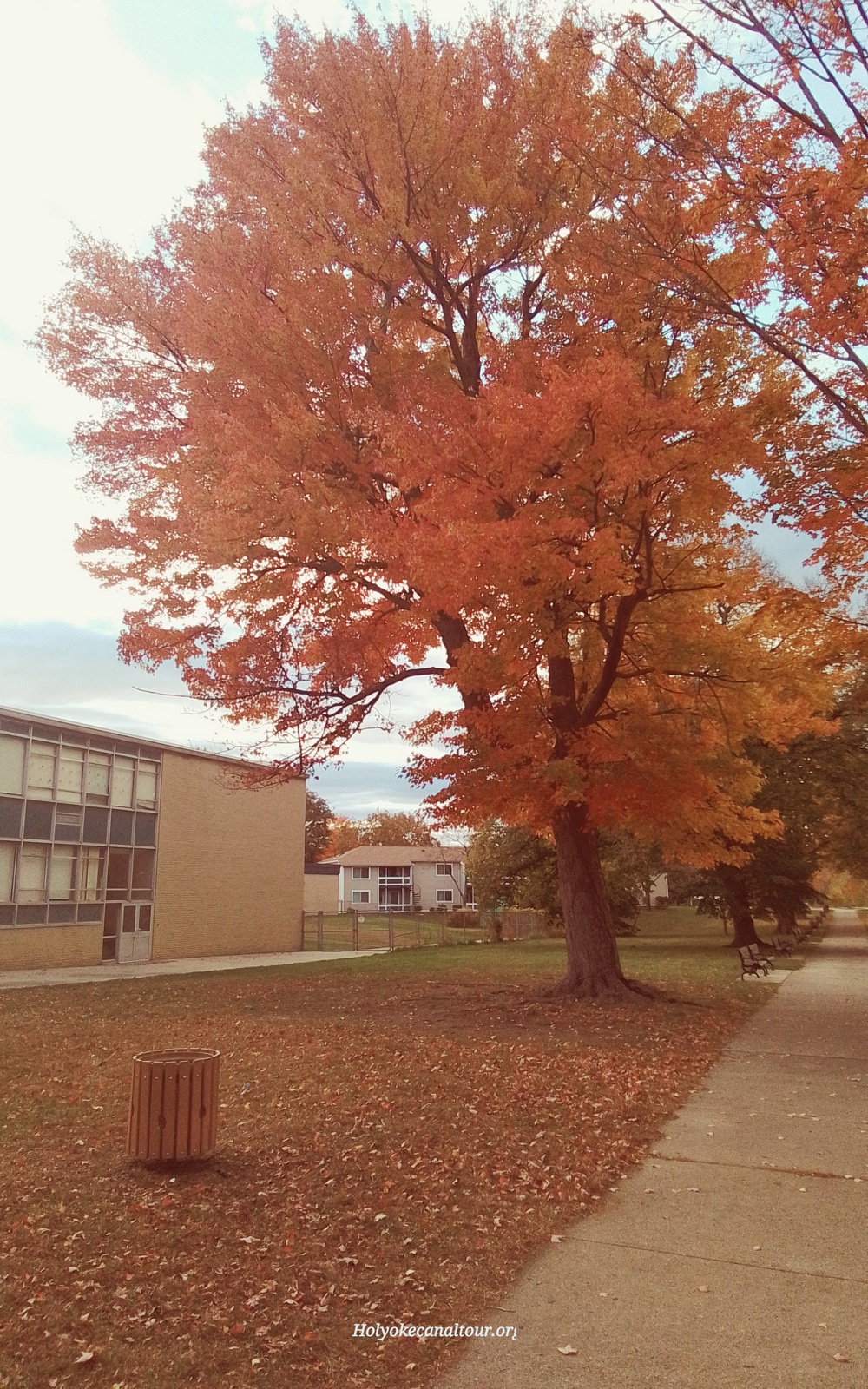
Trees of the Park: