
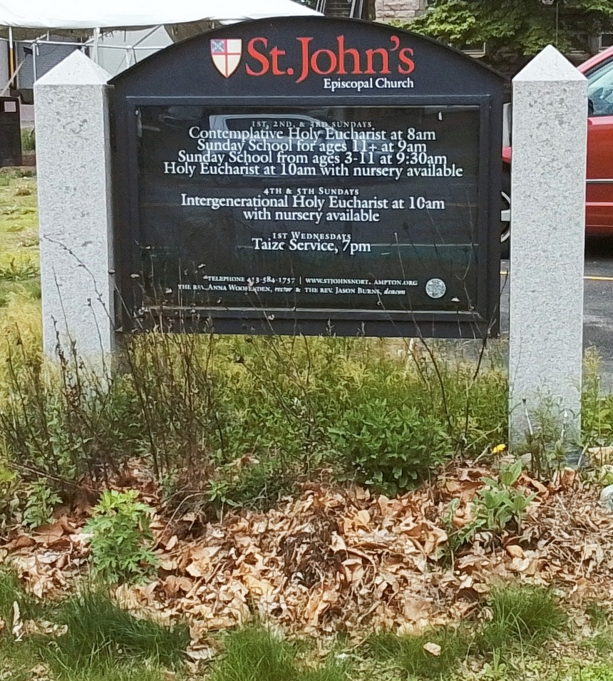
Saint Johns Episcopal Church was at first on Bridge Street near Market Street from 1829 to 1893. The congregation started in 1826. In 1893 this new church was built on Elm Street.
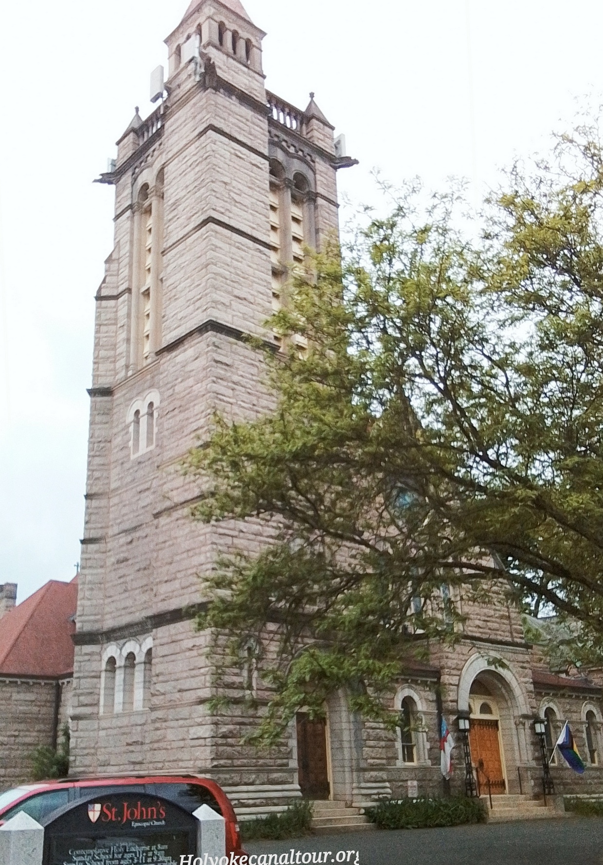
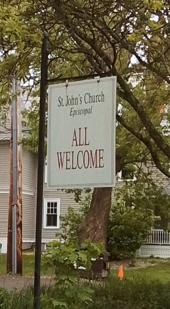
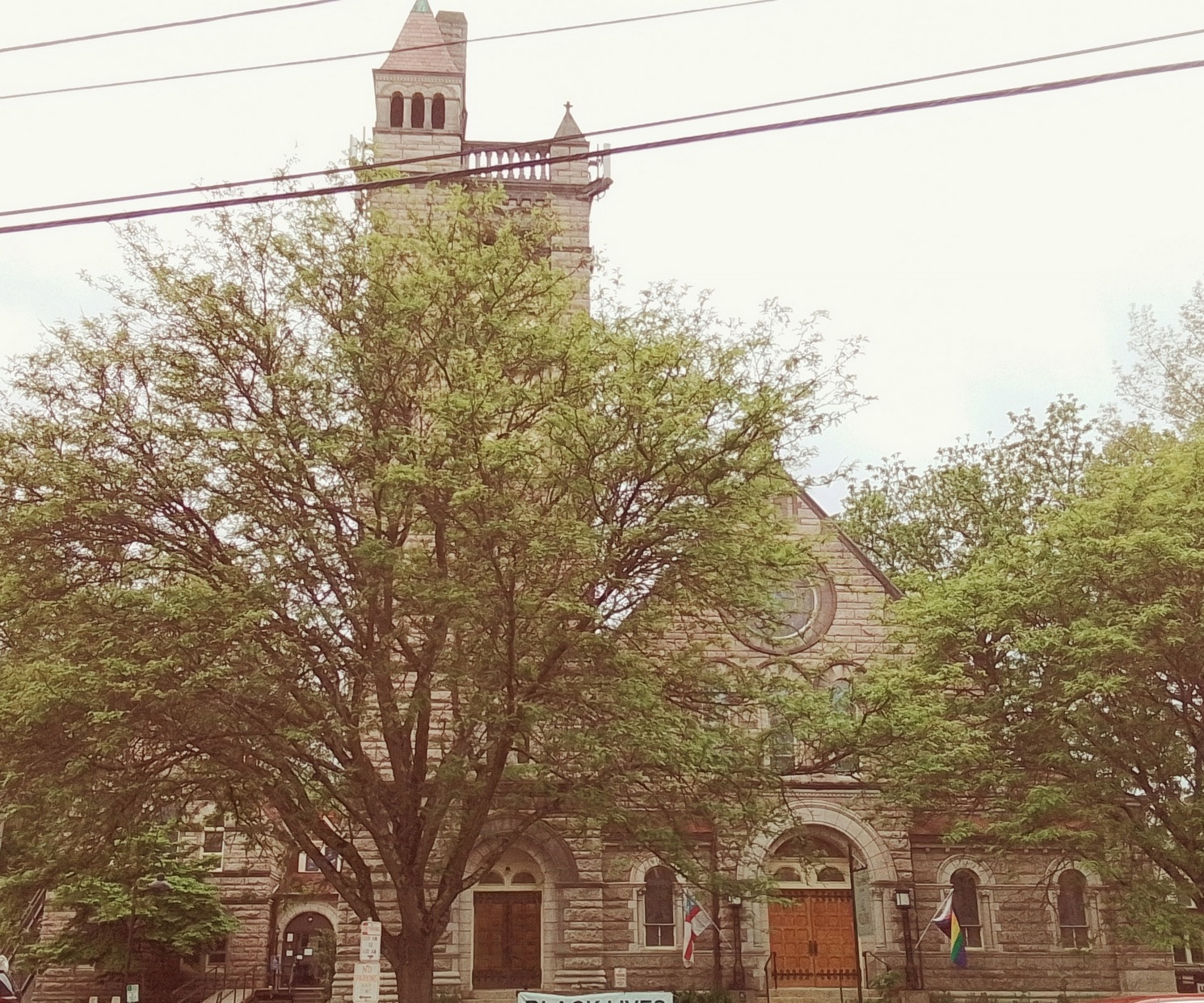


Saint Johns Episcopal Church was at first on Bridge Street near Market Street from 1829 to 1893. The congregation started in 1826. In 1893 this new church was built on Elm Street.
Blunt Park serves McKnight, Bay, and Pine Point. Current amenities include an ice rink and a pool. Blunt Park was made in 1928. The front of the park used to be part of the almshouse.
Springfield Central High School
Ellis Elementary School
Edgewood Park – a residential neighborhood
Isolation Hospital and later City Health Department – earlier between 1870 to 1930 the City Farm and the Almshouse were here.
Bay Path Cemetery is the almshouse cemetery and was the city farm cemetery. It is the potters field of Springfield and that is one of its many names – Springfield Potters Field. It is also called the City Farm Cemetery and the Almshouse Burial Ground. It is on Blunt Park Road close to Roosevelt Avenue or in other words close to the entrance of the park. The burial ground is in the park itself. It started about 1873 and ended most burials in 1930. This is since the almshouse was taken down then but also since cremations of paupers became more common. In 1926 the name was changed to Bay Path Cemetery. The cemetery was finally dedicated as such in 1933 (June 7).
Death certificate will read death at the City Home Hospital and burial at the Almshouse. Hospital was at 1400 State Street. There are numbered pins (from the year 1932). in this cemetery but no gravestone inscriptions. There are 896 burials here. Last burial was in 1951 and cemetery closed in 1954. It started in the aforementioned year since in 1873 the Almshouse and Farm opened. The first burial here was on December 12 1873. Some of the burials made before 1875 were outside the area of the city farm and these were soon moved to within the burials ground. There are three crypts within the cemetery where stillborn babies have been placed. Each of these crypts can hold 1000 burials.
In 1981, a new gate, crypt cover, sign, and 10 trees were added.


Bay Path Cemetery
1873 – 1954
Blessed are the Poor in Spirit
For Theirs is the Kingdom of Heaven
Matt. 5:3
Rededicated 1981 Springfield Historical Society


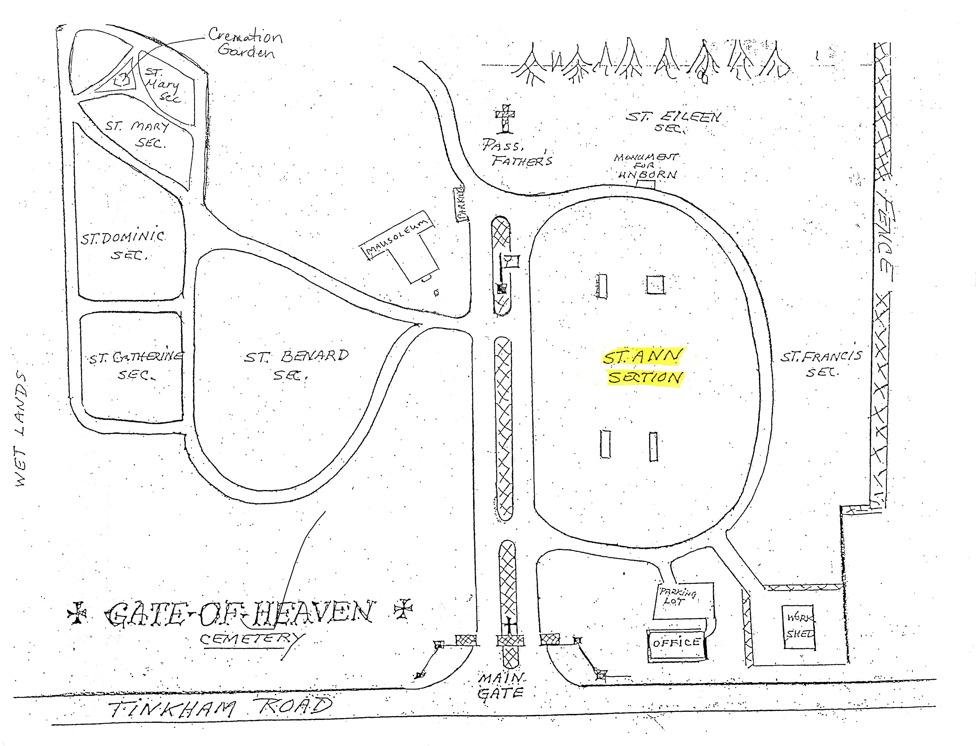
Gate of Heaven Cemetery is from 1971.
GATES

Gates
Mausoleum Chapel


Administration

Priests Section


LAND


Baby Section


Saint Catherine of Siena Catholic Church is from 1963.


Rectory


Maplewood Cemetery FINDAGRAVE is from 1816. The first name was Sixteen Acres Cemetery. The cemetery was added to in 1882. This is most likely the oldest cemetery in the city that was never moved. There once was a hearse house in its southeasterly corner. A hearse was used from the 1882 era to 1908.


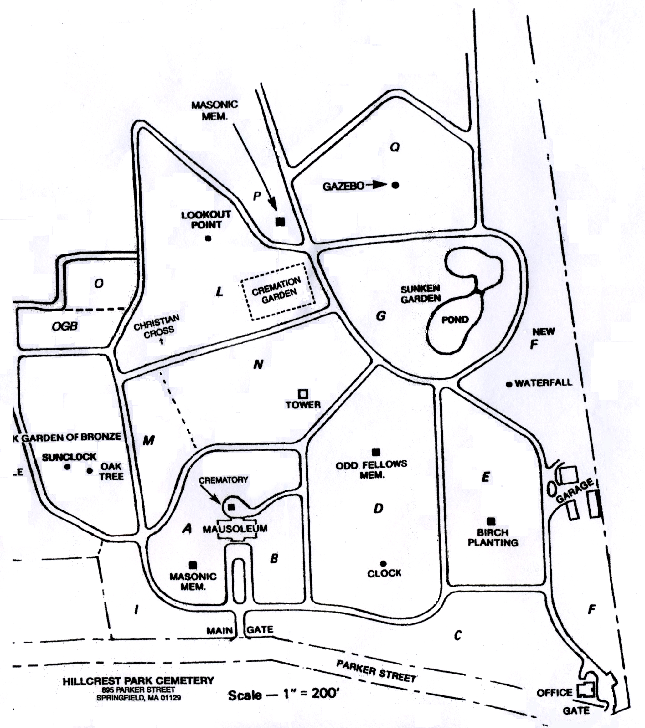
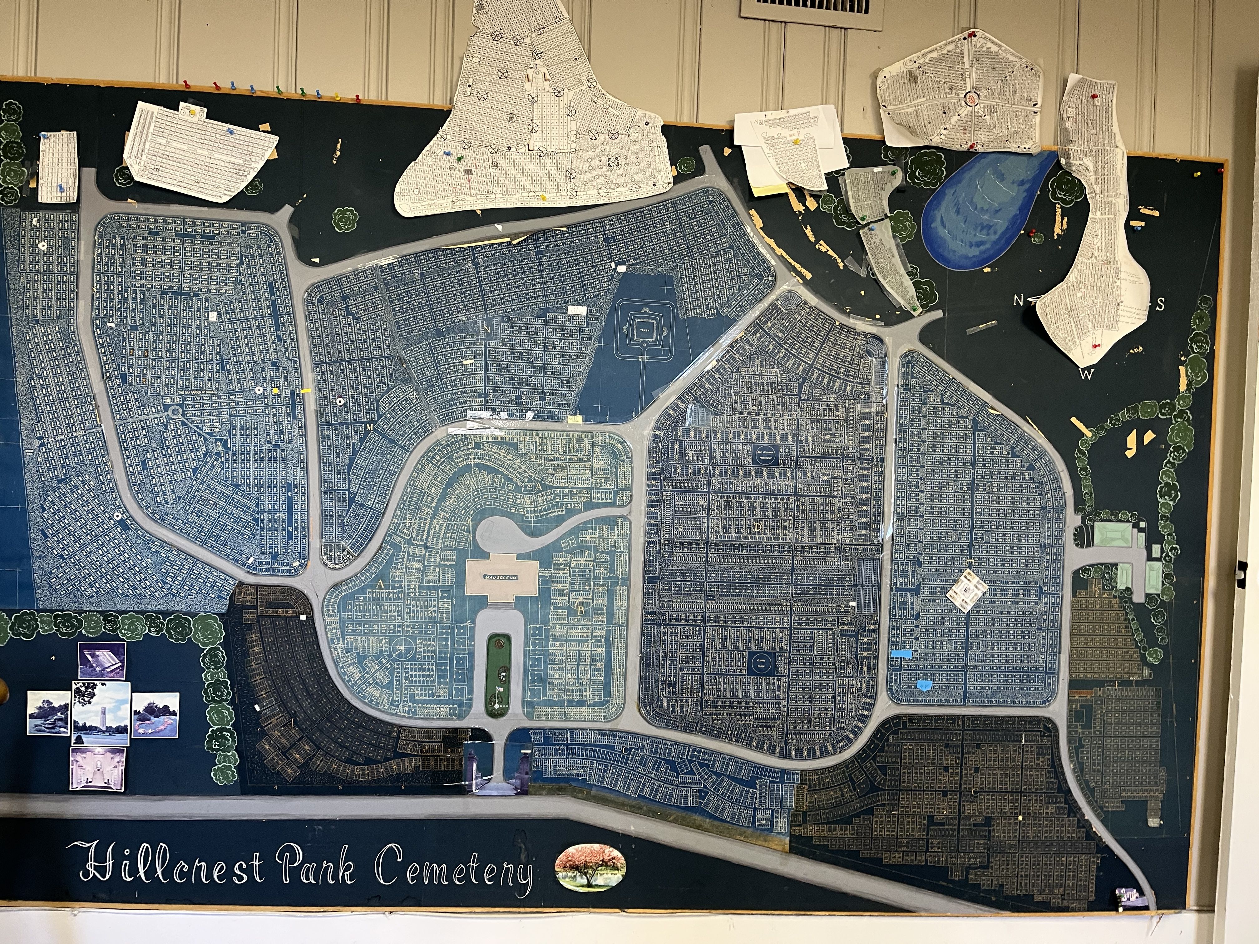
Hillcrest Park Cemetery is at 895 Parker Street opposite Sunnybrook Road. This cemetery is an Olmsted designed one. Letters
The Olmsted family and cemeteries and memorials EXTERNAL LINK

MAP of the cemetery

Main Gate (section I)


Mausoleum, Crematory, and Masonic Memorial (sections A and B)


Office, Gate, Floral Clock, and Odd Fellows Memorial (sections C and D)


Birch Trees, Waterfall, and Garage (sections E and F)

Summer Garden, Pond, and Gazebo (sections G and Q)

Tower (sections M and N) – The tower is from 1936 and was made from the funds of Frederick and Anne Swindells.


Garden of Bronze, Sunclock, Oak Tree (sections K and O)
Christian Cross, Cremation Garden, Lookout Point, and Masonic Memorial (sections L and P)
SUBNEIGHBORHOODS
Ambrose Street Area
Apremont Triangle Local Historic District – Hillman and Bridge Streets
Entry Dingle Heights – Bronson Terrace and Olmsted Drive – Park Edge Avenue
Federal Square Historic District
Forest Park Heights Historic District
Kenwood Park
Kimberly Terrace – Kimberly Ave and Burton St
Maple Hill Historic District – Pine and Maple Streets
McKnight Historic District – Princeton Dorchester Lafayette Florida St and Bowdoin Street
Prospect Park – Dorman School Area – Alice Cloren Samuel Street
Rushville – Hobson Street Area
Spring – Pearl Streets Area – Spring and Byers
Spruce Street Area

Chicopee Falls United Methodist Church

1828 to 2007
on June 2 1842 the church was dedicated
Glen Arden
This is an Olmsted designed sub-neighborhood just north of the Longmeadow Country Club Golf Course. The neighborhood and course were laid out by the Olmsted firm. Donald Ross laid out the golf course.