
Priests Circle at the Saint Mary’s Cemetery of Northampton


Priests Circle at the Saint Mary’s Cemetery of Northampton

Babies’ Section of Saint Mary’s Cemetery of Northampton
The baby section includes those children that were never baptized and the land is not made holy. This is the middle of section M.
Reinternments from the Old Saint Mary’s Cemetery (Northampton)


Patrick Moyce
The gravestone and burial for Patrick Moyce has been moved from Hinsdale Massachusetts to this cemetery.
| pastor | starts | ends | burial |
| Patrick Moyce | 1866 | 1872 | FINDAGRAVE |
| Michael E Barry | 1872 | 1889 | FINDAGRAVE |
| John Kenny | 1889 | 1917 | FINDAGRAVE |
| Thomas Cummings | 1917 | 1961 | FINDAGRAVE |
| FINDAGRAVE | |||
| John T. MacPherson | 1967 | 1973 | FINDAGRAVE |
| FINDAGRAVE |

Slough Hill School is also known as the Hatfield Street School. It is at 52 Hatfield Street in Northampton. It is from 1877.
Saint Mary’s Cemetery of Northampton is around three sides of the house.
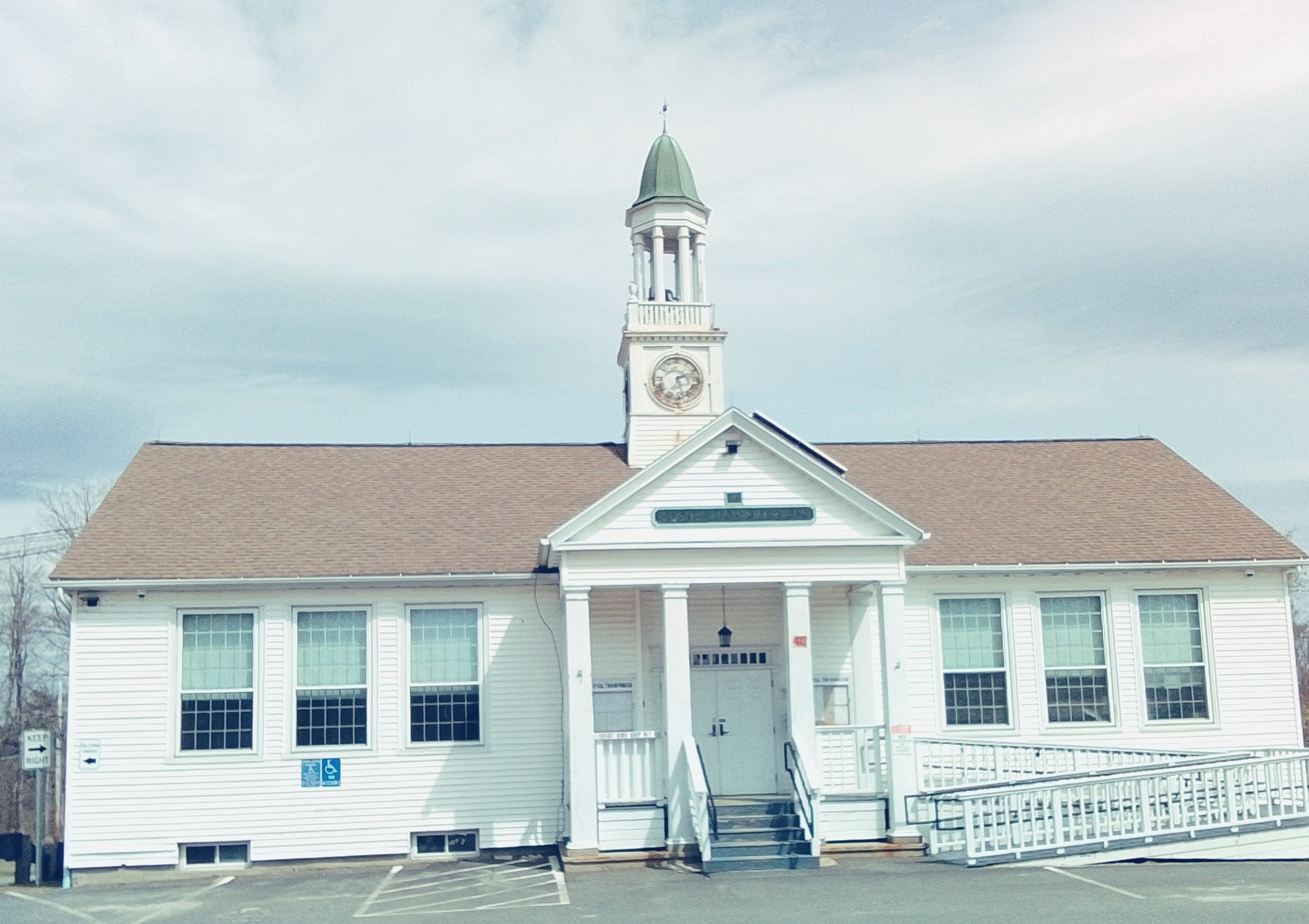
Goshen Center School is at 42 Main Street. It is from 1922. It is now the Goshen Town Hall. The library is nearby.
John Williams Tavern and Post Office is at 2 Williams Drive and is from 1779.
Williams became a Baptist and had the church and parsonage built with the parsonage being now at 1 Williams Drive. The church was destroyed by fire in the 1870s. It was replaced by a barn in 1875 and is at 12 Cape Street.
Williams Boltwood House (external link)

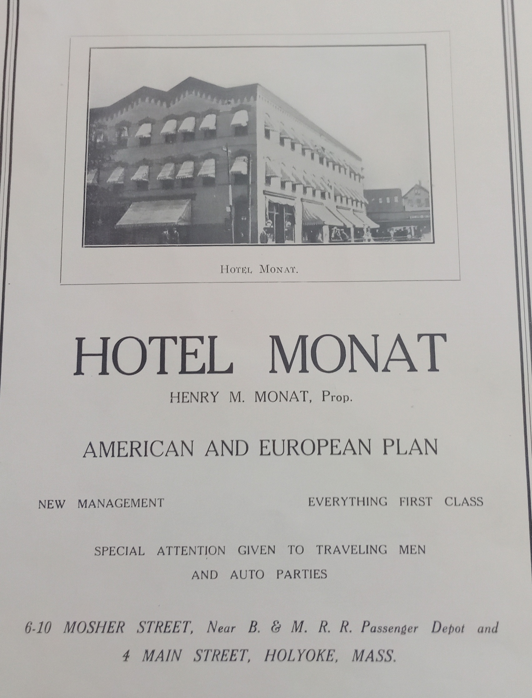
Hotel Monat in Holyoke
This building on Mosher Street was built in 1884. It was three floors high and had stores on the ground floor (fruit, barber, and a bar) and a chemical company on the second floor. By 1895 it now had a hotel on the upper stories and was called the Norris House. The Hotel Monat came into this building and expanded it backwards. By 1949 the Hotel Monat had two restaurants – 4 Main and 2 Mosher. The establishment was owned by Henry Monat.
Across the street from the Monat was the Robert Russell building. This area would become an auto repair shop in the 1910s with wood buildings and then masonry buildings. At the southwest corner of Mosher and Bower Streets, there was a railroad turntable.

