Highlights on the remainder of High Street

Highlights on the remainder of High Street.

Gingras’ Block at 45 to 49 High Street

Doyle’s Block at 50 to 52 High Street

Frank Octo was at 63 to 75 High Street. He sold parlor stoves.

Corde’s Building at 83 to 85 High Street

1883 ad

This image has an empty alt attribute; its file name is sheets_0003-Copy.jpg

Sanborn 1895 map for Octo Block

——————————————————————————-

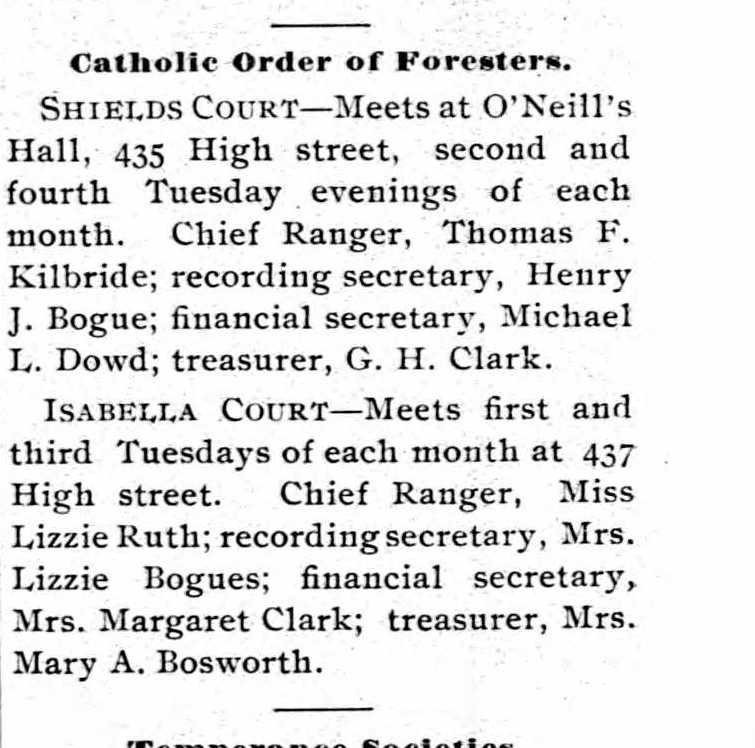
435 to 439 High Street was a block called the O’Neil Block. It is where the Cuban Market is now and is a good starting point. This was a three story building. This was the Red Men’s Hall for the Improved Order of the Red Men. In 1900, there were a multitude of other fraternal groups that used this building. One such group was the Catholic Order of the Foresters.

Coughlin’s Block at 401 High Street

Sullivan and Wesely at 488 to 494 High

Shea’s Block at 515 and 518 High

This image has an empty alt attribute; its file name is 9703448-Copy.jpg

In 1900 also the Caledonia Benefit Club meets here. Likewise, the Ladies’ Catholic Benevolent Society.

Sanborn map analysis:

Sanborn 1884 map

Sanborn 1895 map

Sanborn 1915 map shows it as a 4 floor building with store fronts

map B

Sanborn 1949 map

Sanborn 1956 map

Pottin and Kinney Block

The Pottin and Kinney Block is at 348-356 High Street.

In 1907 it is the Johnson Book Store with a parent company in Springfield.

By 1930 it had become the Jacobson Block.

That block is now two separate modern blocks.

As for firms at that location, there was the Booth Meat Company at 354 High Street.

This image has an empty alt attribute; its file name is keys_0001-649x1024.jpg

Sanborn map analysis:

Sanborn 1884 map

Sanborn 1889 map shows three 4 floor buildings in a row

Sanborn 1895 map

Sanborn 1915 map shows three 4 floor buildings in a row

Sanborn 1949 map shows a 4 floor building with a stone faced facade

Sanborn 1956 map shows that it was built in 1955 and is one floor for two separate buildings

Pease Building

The Pease Building at 349-355 High Street has historically been three one floor buildings in a row. In 1922, it is being called the Isenburg Building.

In 1920 there is the Hatch Cloak firm at 349 High and the Kelton Meat Market at 355.

From at least 1922 to 1927 Holyoke City Market was at 355 High Street.

Sanborn map analysis:

Sanborn 1884 map nothing there

Sanborn 1889 map

Sanborn 1895 map

Sanborn 1915 map shows a one floor structure there

Sanborn 1949 map shows a two floor structure there

Sanborn 1956 map shows a two floor structure there

Reservoir System after the 1955 Hurricane

Whiting Street Reservoir after the Hurricane of August 18 and 19 1955

This image has an empty alt attribute; its file name is whitings_0011-740x1024.jpgThis image has an empty alt attribute; its file name is triplets_0001-1006x1024.jpg
This image has an empty alt attribute; its file name is whitings_0012-1024x925.jpg
This image has an empty alt attribute; its file name is whitings_0010-1019x1024.jpg

  • mains from Ashley and McLean breeched at corner of Beech and Northampton Streets
  • White Reservoir berm collapsed
  • Intake Reservoir filled with sediment
  • Carmody Reservoir had the southeast corner of its embankment washed away
  • Manhan was under construction so not much happened
  • Whiting Street had $55,000 in damage to the berm
  • Ashley had damaged roads, culverts, and guard rails
  • Bray Reservoir Dam breeched and damages estimated at $30,000

Lynch Brothers Block

The Lynch Brothers Block at 313-319 High Street was a two and four floor block.

In 1922, at 313 High was Brown’s Bootery.

By 1930 it had become the next home of the YMHA and the YWHA.

In 1883 at 317 High was Lamay Paper Hanging.

Sanborn map analysis:

Sanborn 1884 map it is a 4 floor structure with some tiny buildings to its side

Sanborn 1889 map shows the same

Sanborn 1895 map

Sanborn 1915 map

Sanborn 1949 map shows a two and four floor block

Sanborn 1956 map shows a two and four floor block

291 to 299 High Street

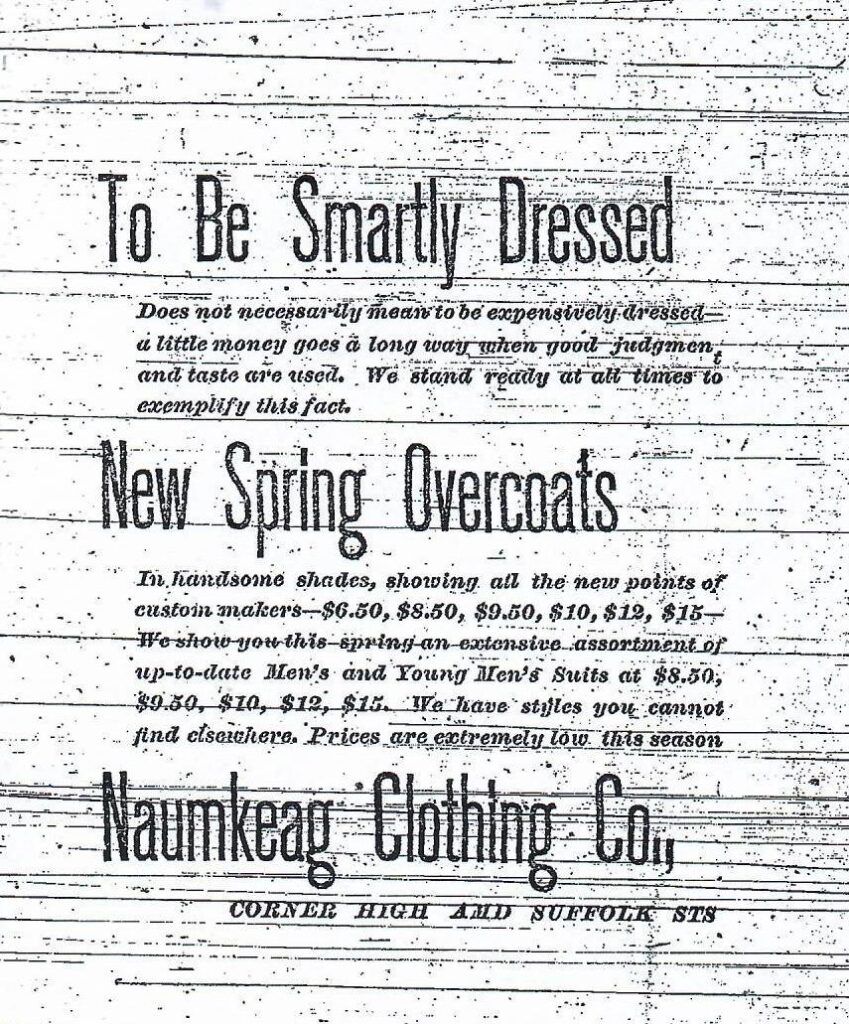
This building area is now a small building. In the 1885 city directory the L’Esperance Building was at 291 to 299 High. It was the home of Naumkeag Clothing. It was ornate but the facade is replaced.

LINK

This image has an empty alt attribute; its file name is sheets_0006-849x1024.jpg

From 1912 to 1940 it is being called the Gallup’s Building and was built in 1910.

1931 ad

Sanborn map analysis:

Sanborn 1884 map shows nothing is there

Sanborn 1889 map shows a one floor building

Sanborn 1895 map shows a one floor building

Sanborn 1915 map shows a 2 floor building

Sanborn 1949 map shows a 2 floor building

Sanborn 1956 map shows a 2 floor building