AUDIO for stop A
[Park your car at the northern end of Maple Street in the circle. Walk diagonally right or northeast to the parapet wall.]

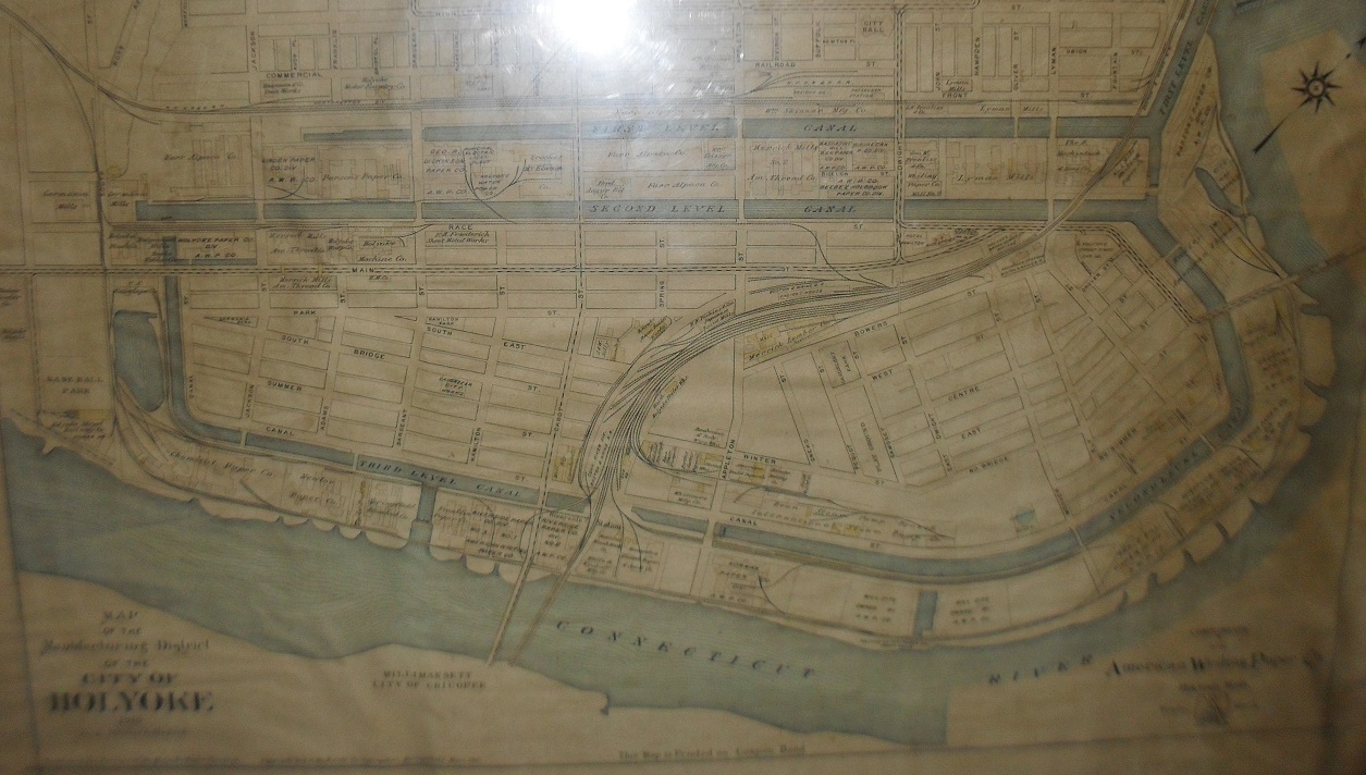
The Holyoke Canal System was built between 1847 to 1893 from water diverted from the Connecticut River. Philander Anderson designed the canal to operated as a three-tiered canal. Millraces or water tunnels would flow below the mills to power water turbines. Sixty percent of the canal was finished by 1853 and since that year until the 1920s, the Holyoke Canal System was the most powerful human-made structure in the world surpassing at that point the Lowell Power Canal. The second Niagara Canal Power Station usurped it in that latter year. This destination guide will help you better understand the functions and the history of the canal system. Some points along it are quite beautiful while others are more utilitarian. Get great views of the Connecticut River, Holyoke Canal gatehouse, and Hadley Falls Power Station, the South Hadley Library, and the first level canal at this old park. Pulaski Park was designed by the Olmstead Brothers and still retains their basic pattern. The retaining wall was built from 1904 to 1905. This has restricted greatly the freedom to roam down to the river. Once the Holyoke Canoe House was down this bank.
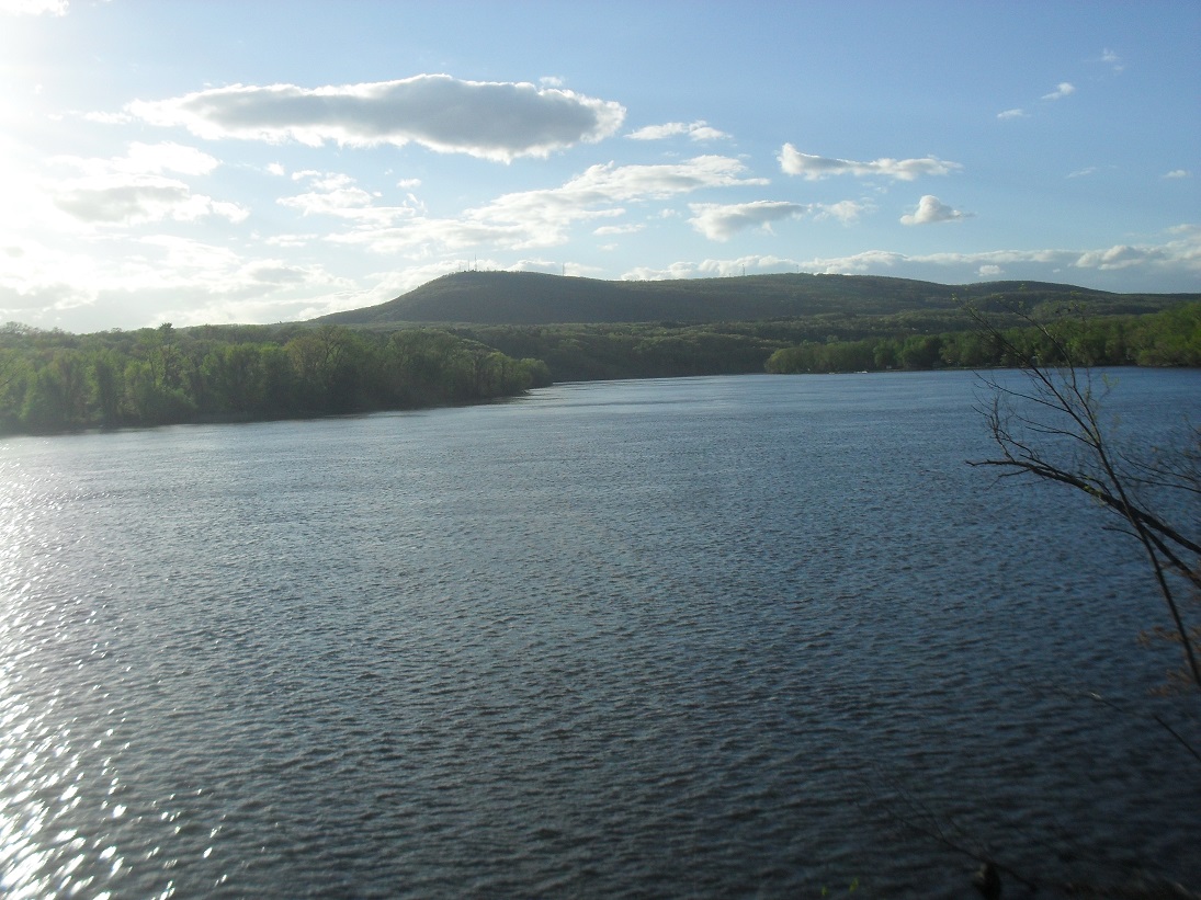
The park is now on the National Register of Historic Places as are a few other buildings and structures along the canal. The canal itself is in the National Register. The Hadley Falls Workers’ Housing and the South Hadley Canal are also. The park is listed in that register as Prospect Park which was its second name. Its first name was Kerry Park. The Connecticut River is now an American Heritage River. Only 14 rivers in the USA are Heritage Rivers and the Connecticut is the only one whose entire length has such a designation. Great efforts have been made to return it to a natural state physically and biologically. Before the dams were placed here, the Great Falls with a 60 foot drop were the second largest along the 410 mile length of the river. The Vietnam Veterans Bridge to the southeast is the third bridge at that location. The first was a wooden bridge placed there in 1871. The Mount Tom

and the Mount Holyoke Ranges spread out to the north of there.
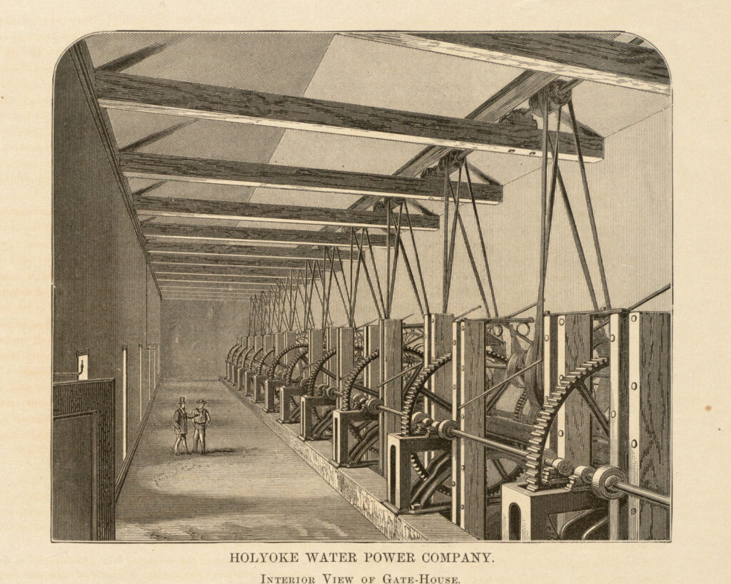
The canal entrance is controlled by a large gatehouse. It has 12 large gates powered by a rack and pinion gear system on each gate. The gates can be raised individually to any height between 0 to 25 feet. Thus the level of the canals can be controlled down to one inch in height. If you are in the middle edge of Pulaski Park you can see the outline of the 12 gates if you look at the gatehouse. If you are in the east edge of the park, then you can also see the gates from the other direction. The velocity of the water changes during the seasons as the velocity of the river changes.
In the summer and fall of 1849, the Patch section of the Hadley Falls area of Ireland Parish was hit by cholera. Drought hit during the summer of 1849 and instead of drinking rainwater from buckets, people were drinking from the Connecticut River. Coffer dams had stopped the water. Cholera was not understood at that point. The water had developed the cholera and the people were drinking it. 1200 Irish immigrants were living in the Patch. 300 of them would die here in that year. They were buried in the only Catholic cemetery in Western Massachusetts – St Matthew’s Cemetery in Springfield. An enormous potter’s field was started there.
The first few years of the canal digging had many other adventurers. Philander Anderson the designer and the general agent for the canal system was attacked by a group of 350 Irishmen. They wanted higher wages. One man threw a stake at him. It passed through his jaw and neck leaving a scar. He lived but would die in 1852 in Missouri. FINDAGRAVE
Sanborn maps of the gatehouse area:

