
Clement Mill formed in 1882 out of the International Screw.


The Clement Street Bridge from 1894 is nearby. EXTERNAL LINK


The Clement Cutlery Works was a high level cutlery mill.


Clement Mill formed in 1882 out of the International Screw.
The Clement Street Bridge from 1894 is nearby. EXTERNAL LINK
The Clement Cutlery Works was a high level cutlery mill.

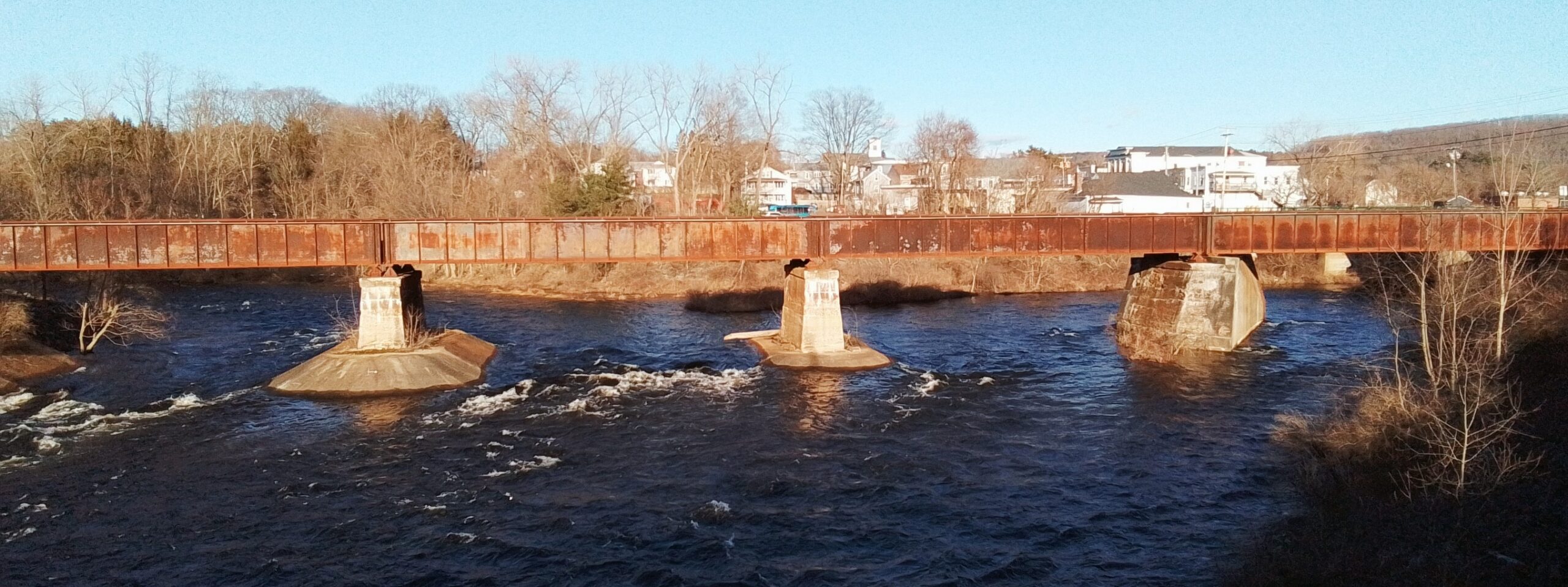
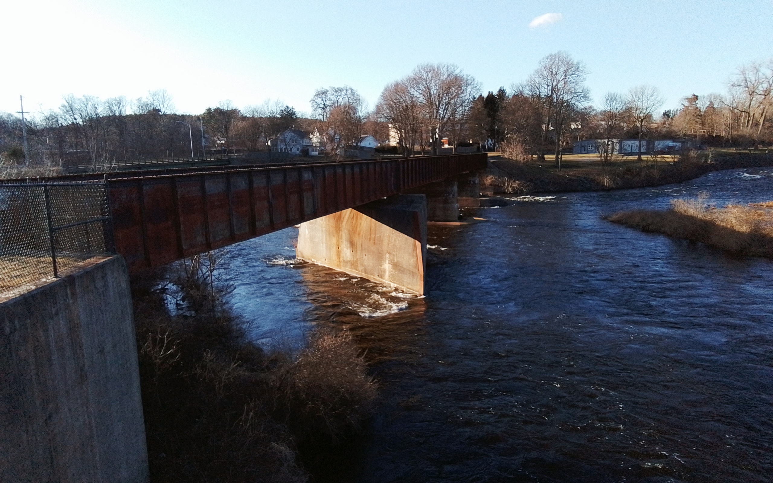
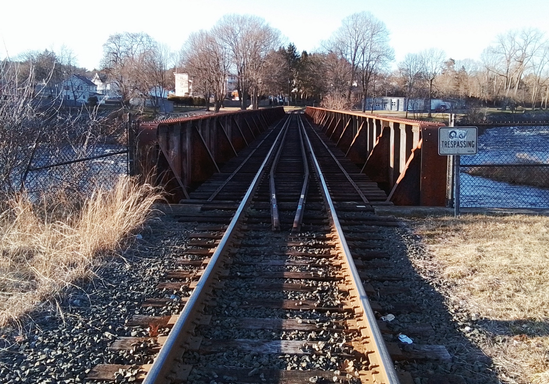
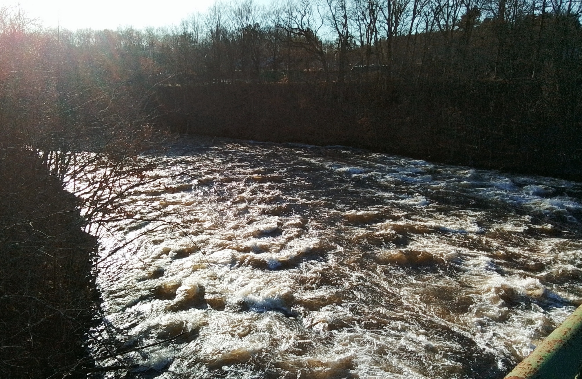
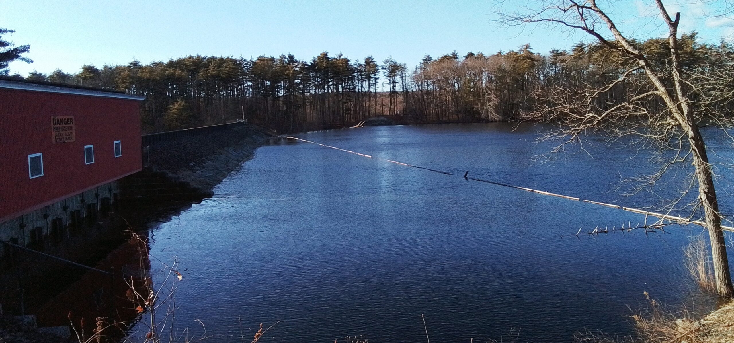
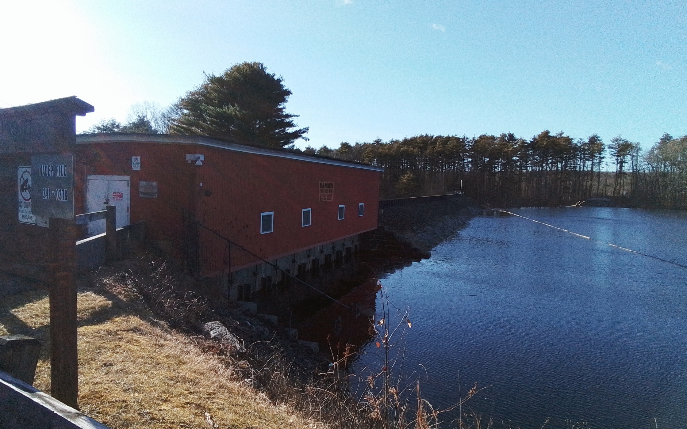
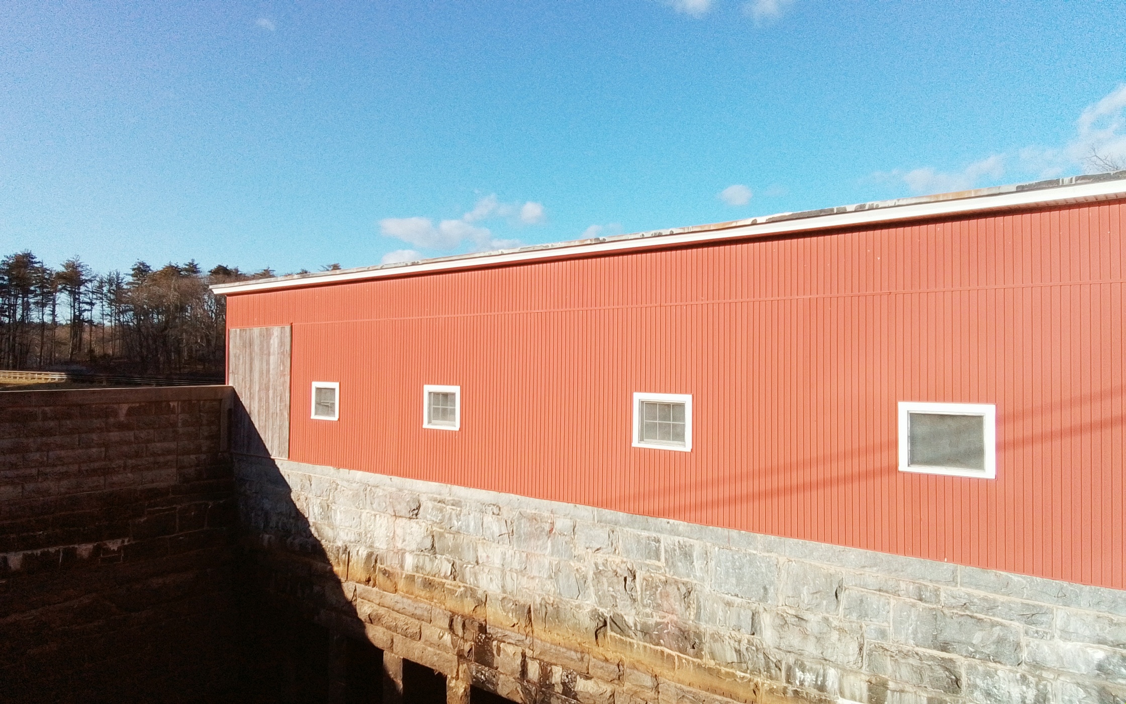
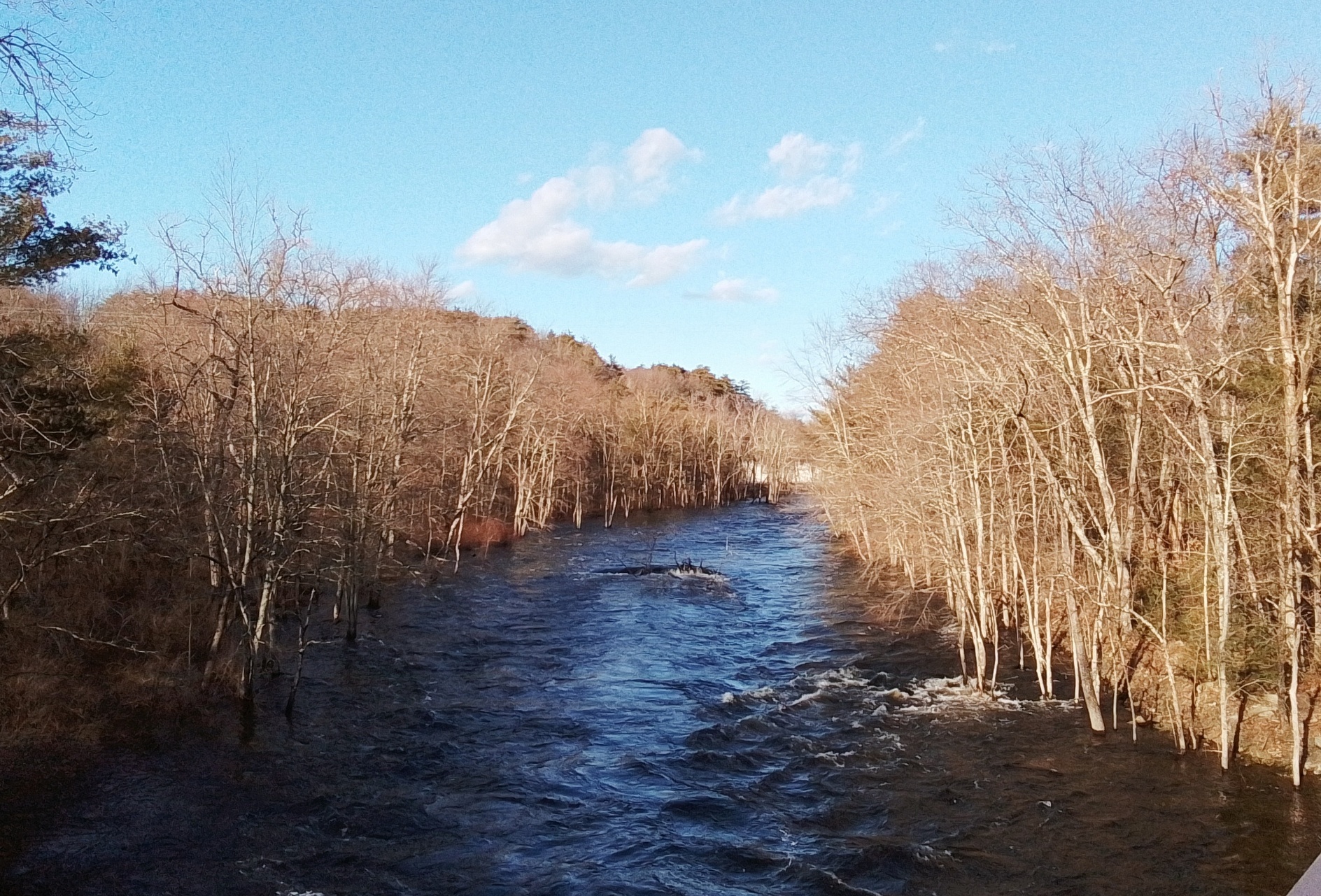
Northampton Cutlery Canal

The history of the mill area can be found at this EXTERNAL LINK. The Northampton Cutlery Canal ran from 1871 to 1987. Worker homes are at Riverside Drive and Lexington Avenue. The information from the table below is from the Macris database. Page 5 of the NTH421 from this database has a nice schematic of the evolution of the building. Bay State Hardware Company Worker Housing is nearby on Riverside Drive.
| mill | starts | ends | |
| Northampton Paper Mills | 1836 | 1848 | |
| Hampshire Flax and Hemp | 1848 | 1850 | |
| Bay State Tool Manufacturing | 1854 | 1858 | |
| Bay State Hardware Company | 1858 | 1870 | |
| Riverside Cutlery Company | 1870 | ||
| Northampton Cutlery Canal | 1871 | 1987 | |


Sanborn map analysis


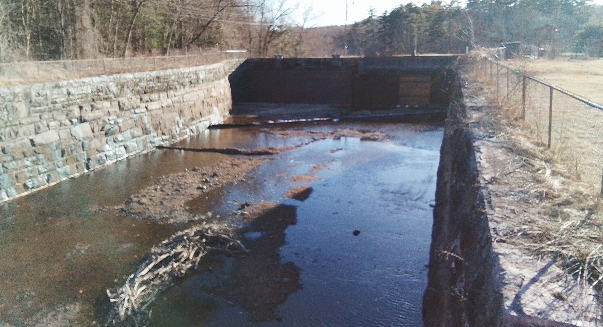
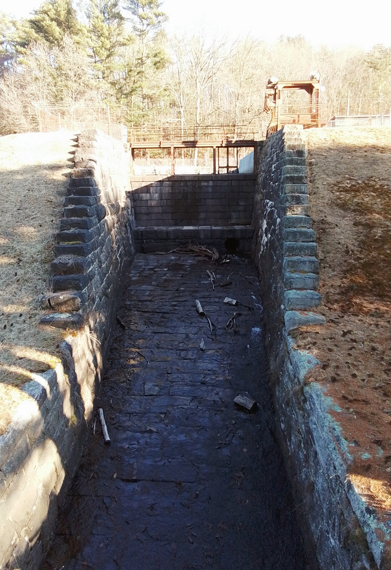
Gatehouse


Nonotuck Silk Canal (Northampton) is on Nonotuck Street in Florence. It powered the Nonotuck Silk Mill. The mill later would be called Corticelli Silk Mill. The silk mill was made in 1838. The mill also made machine twist.


Sanborn 1884, 1889, and 1895 maps – NOT

Hryniewicz Park
Frank Alphonse Hryniewicz at FINDAGRAVE and FINDAGRAVE


| person | death | burial | |
| Merrill L Simonds | 1918 | France | FINDAGRAVE |
| Edward T Goodreau | FINDAGRAVE | ||
| Joseph Zuhoski | FINDAGRAVE | ||
| Frederick F Gwozdz | FINDAGRAVE | ||
| Ephraim F Gendreau | 1918 | France | FINDAGRAVE |
| Alpherie Gaudette | 1918 | FINDAGRAVE | |
| Morris R Livezley | FINDAGRAVE |
History of the Canal – EXTERNAL LINK
The Three Rivers Canal was dug in 1826.


The Otis Mill Canal was in the Three Rivers village of Palmer Massachusetts.
Quaboag River – LINK
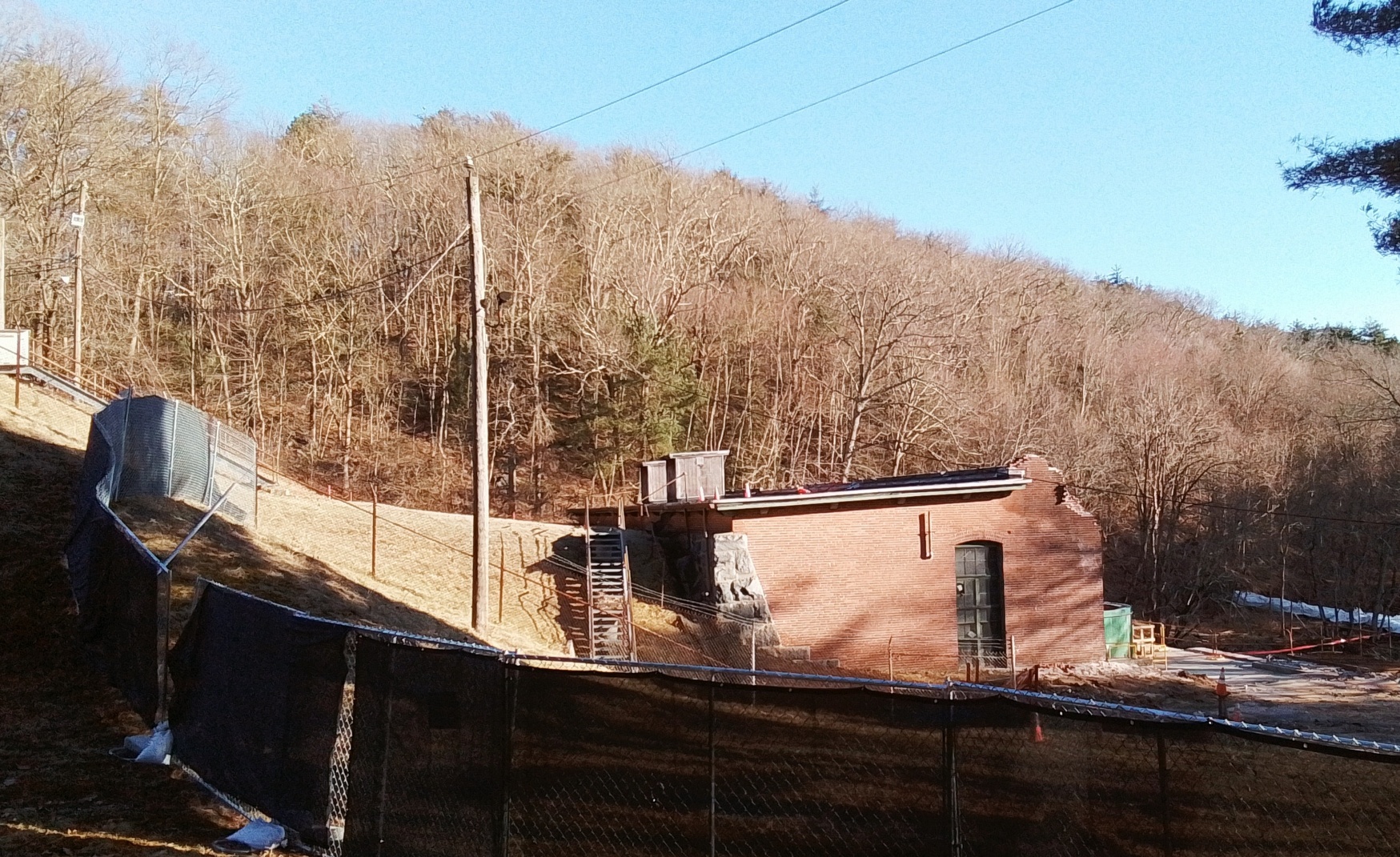
Red Bridge Canal
Gatehouse
Dam
The Red Bridge Dam is 51 feet high and 827 feet long.
Impoundment of Water
Power House
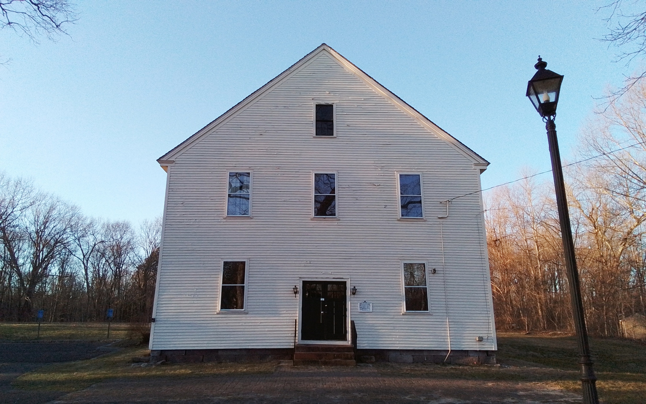
Ludlow Center Historic District
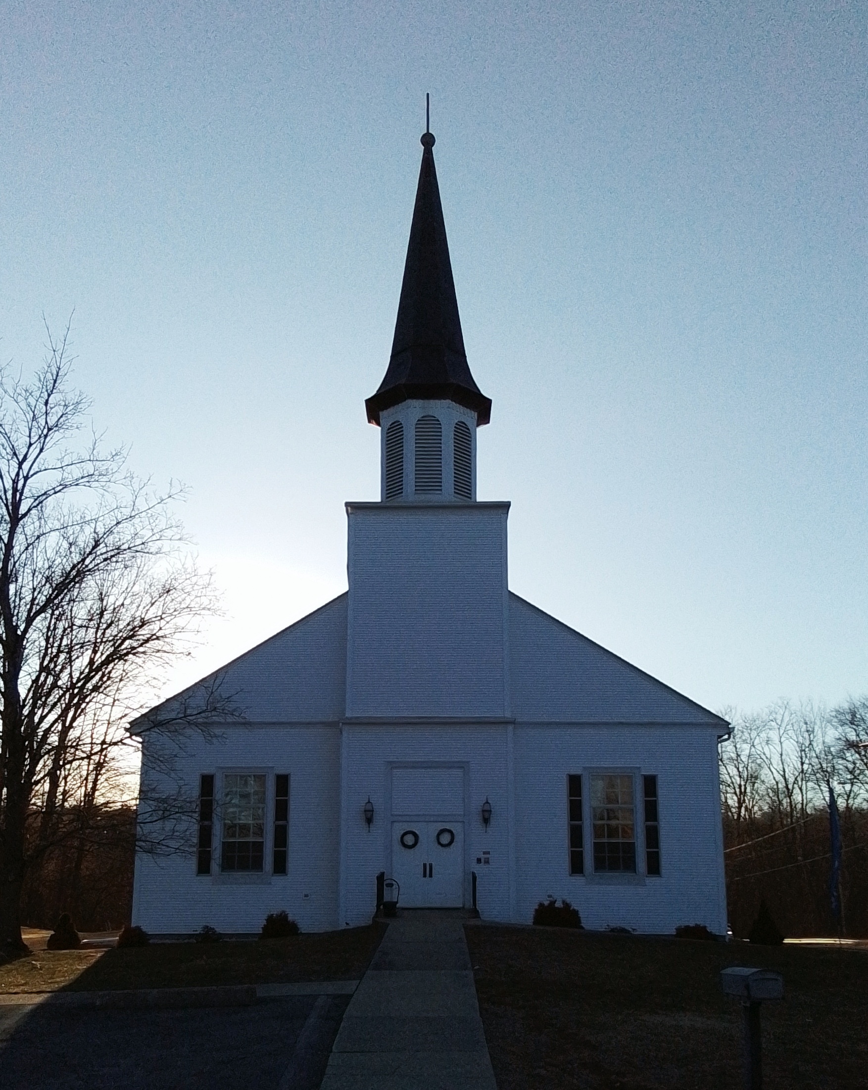
First Church of Ludlow – Internal LINK
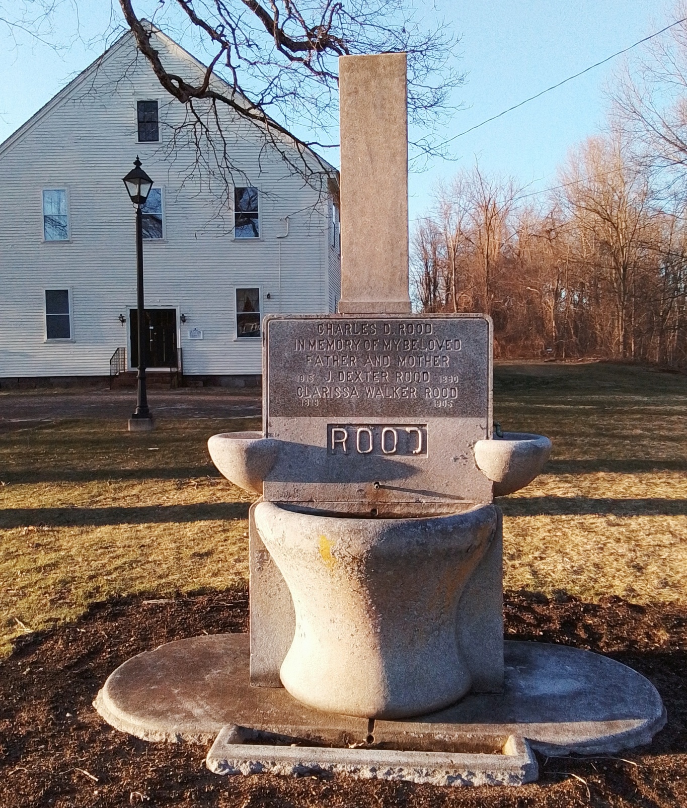
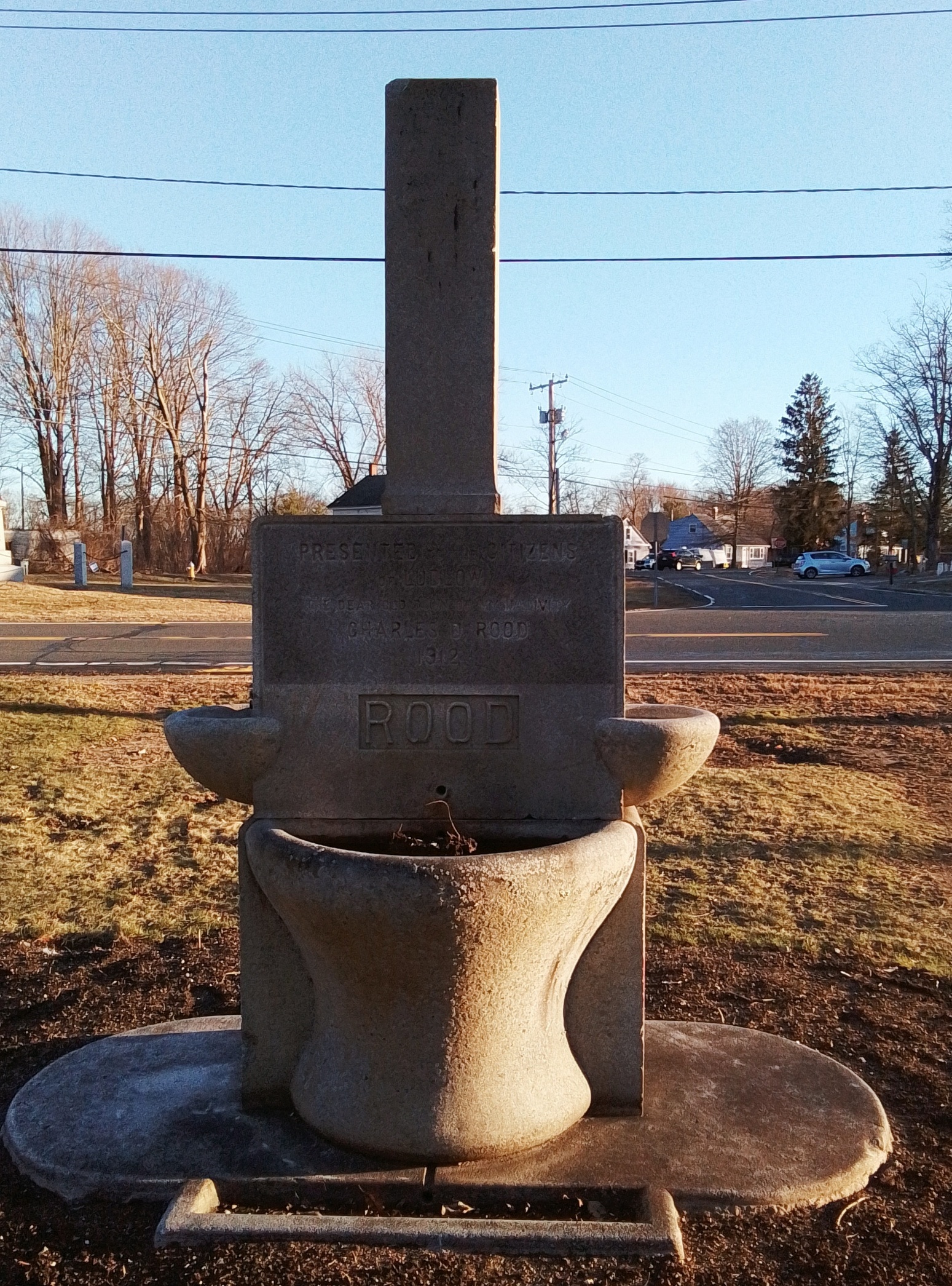
Rood Memorial
Charles D Rood / In Memory of My Beloved / Father and Mother
1815 J Dexter Rood 1890 / 1819 Clarissa Walker Rood 1906
Joshua Dexter Rood – Joshua’s parents are both in the nearby Fuller Cemetery
Charles Dexter Rood – Joshua and Clarissa are his parents
Church
1859

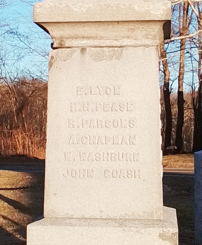
Soldier’s Monument
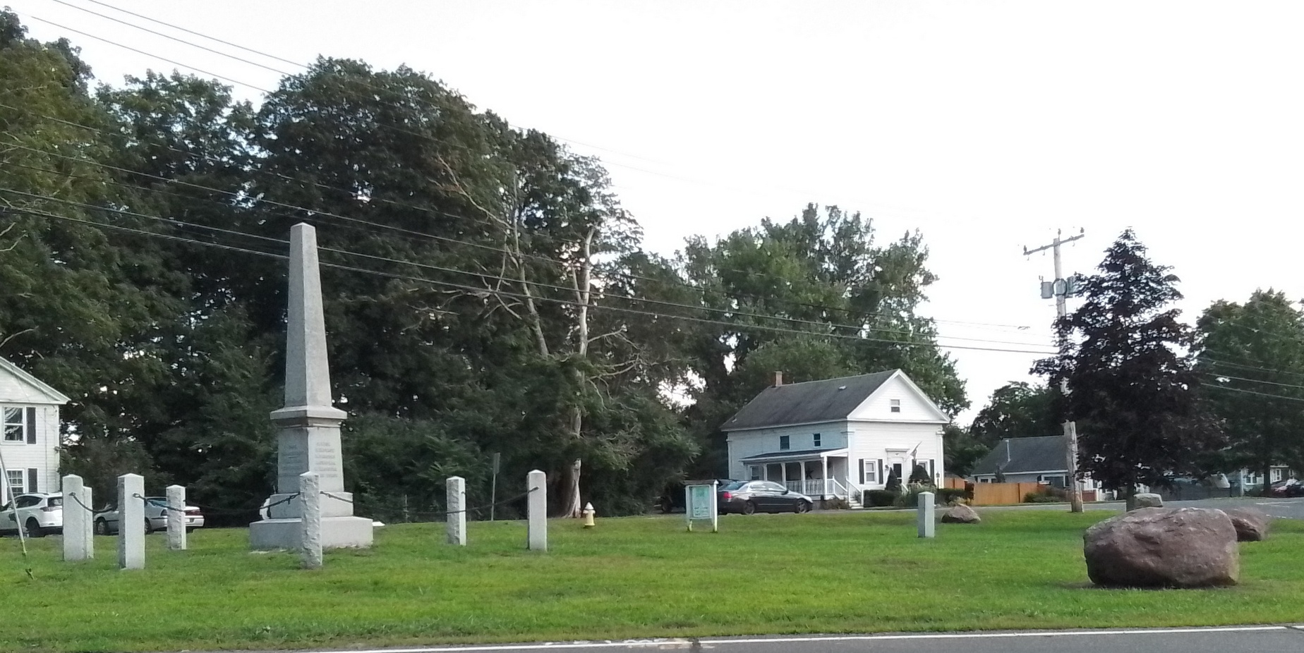
1867
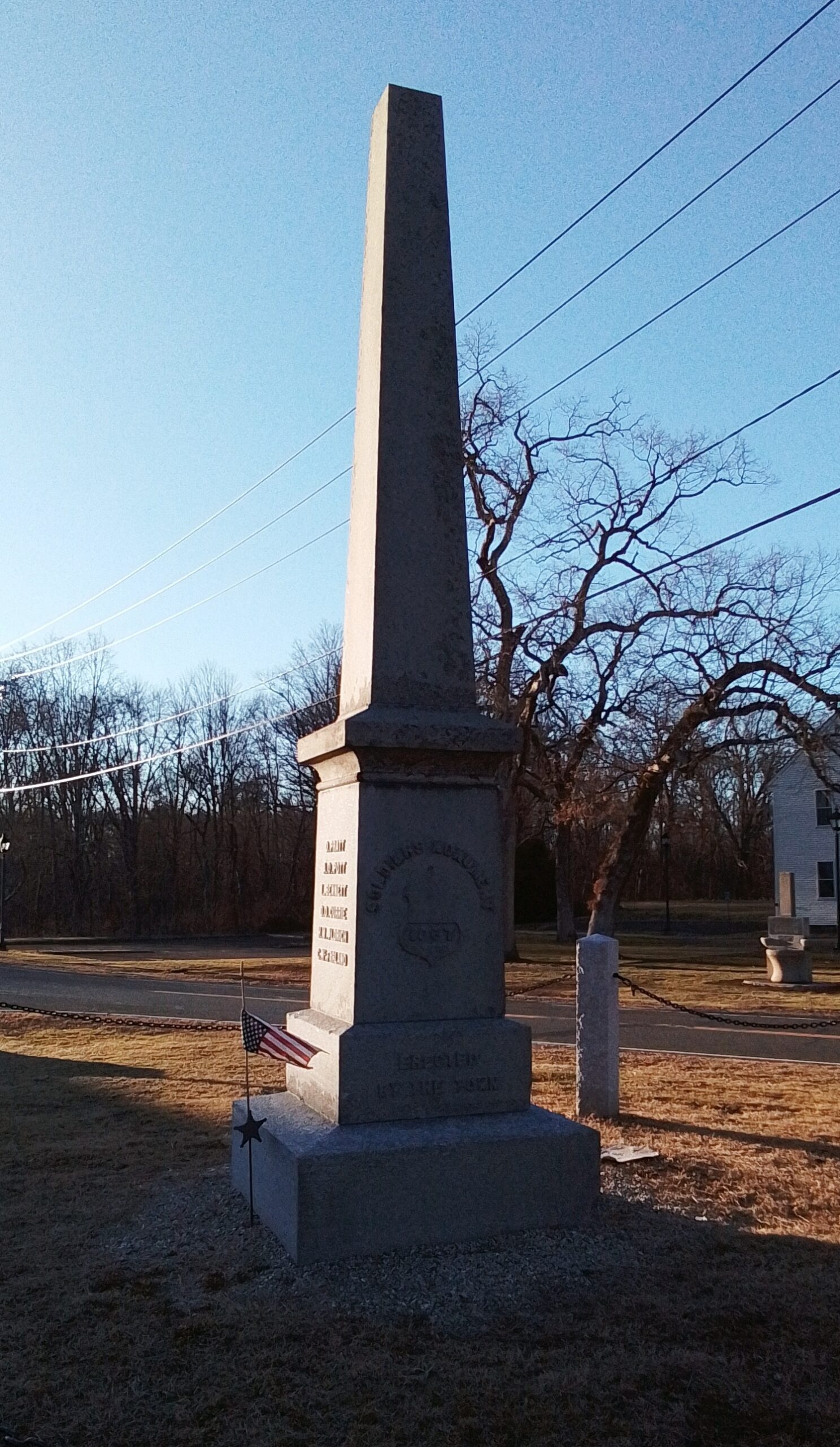
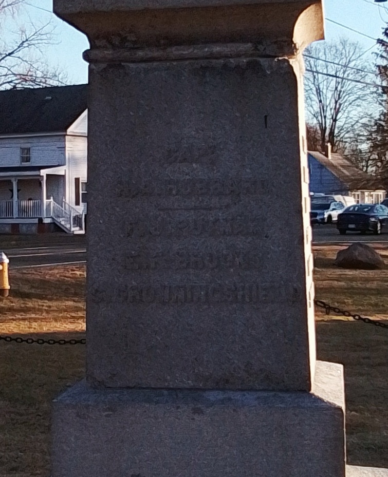
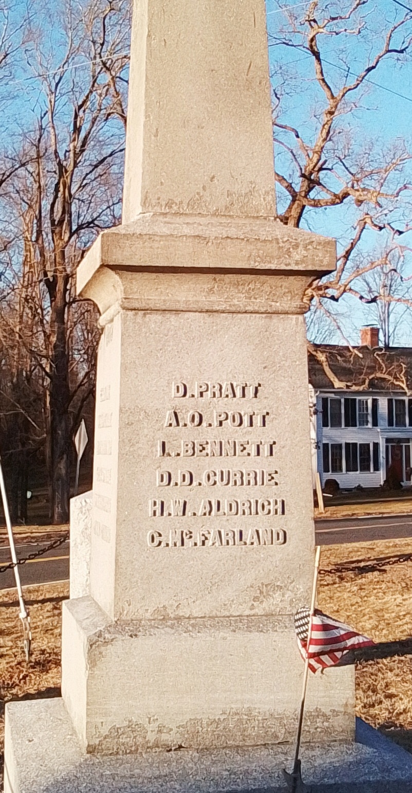
| military | death | death place | burial |
| Daniel Pratt | 1864 | Andersonville | FINDAGRAVE |
| Anthony O Pott | 1864 | FINDAGRAVE | |
| Lyman Bennett | 1862 | FINDAGRAVE | |
| Daniel D Currier | 1864 | Wilderness, VA | FINDAGRAVE |
| Hiram W Aldrich | 1864 | Andersonville | FINDAGRAVE |
| Charles McFarland | FINDAGRAVE | ||
| Henry Hubbard | 1864 | Roanoke Island, NC | FINDAGRAVE |
| Flavius Putnam | 1864 | Andersonville | FINDAGRAVE |
| Edward Brooks | 1864 | New Bern, NC | FINDAGRAVE |
| Ebenezer Lyon | 1864 | Andersonville | FINDAGRAVE |
| Henry Rood Pease | 1863 | Portsmouth, NC | FINDAGRAVE |
| Robert Parsons | 1862 | Hagerstown, MD | FINDAGRAVE |
| Augustus Chapman | 1864 | Andersonville | FINDAGRAVE |
| William Washburn | 1864 | Andersonville | FINDAGRAVE |
| John Coash | 1864 | Andersonville | FINDAGRAVE |
| Caleb Crowninshield | 1864 | Andersonville | FINDAGRAVE |
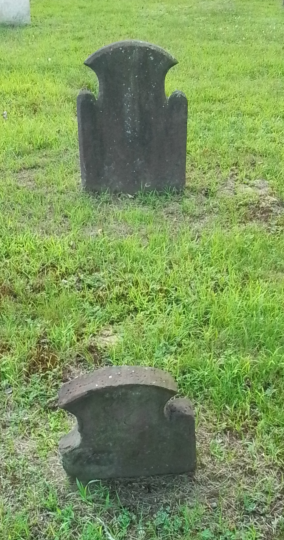
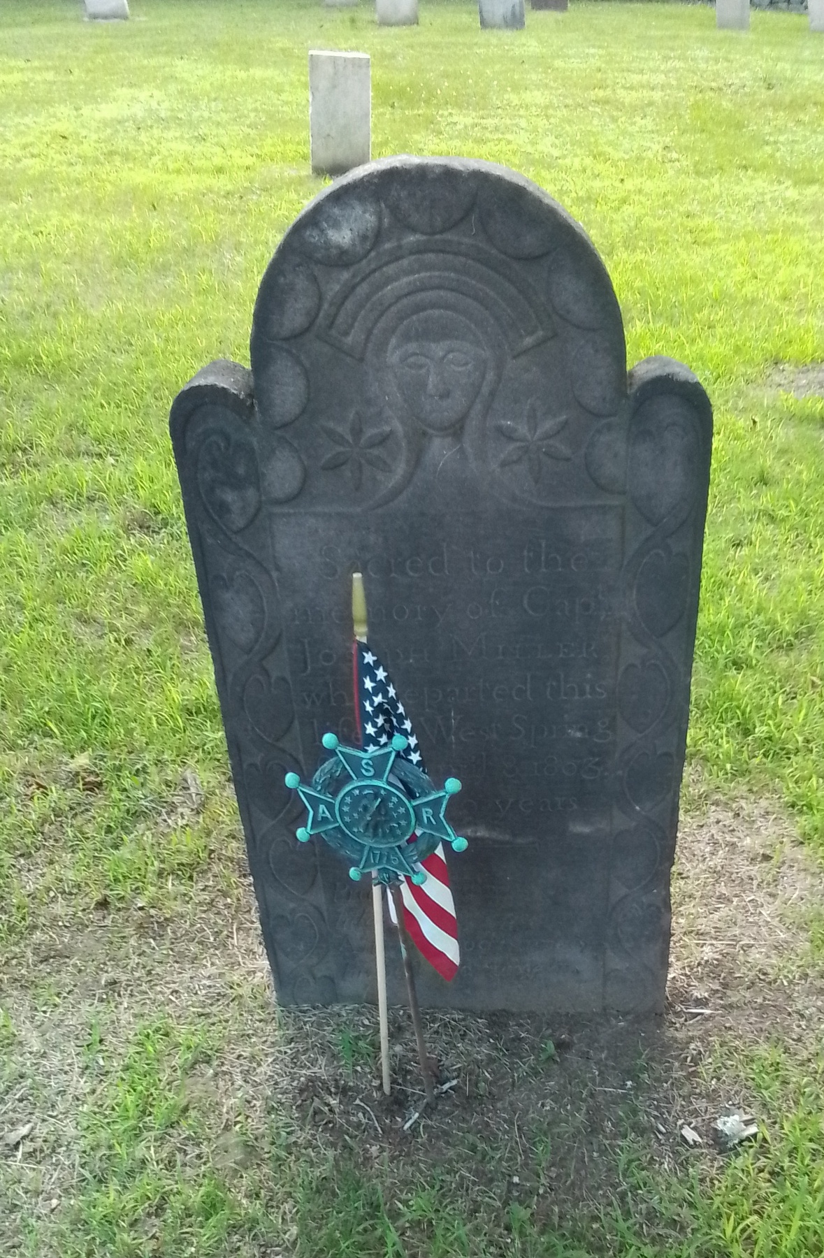
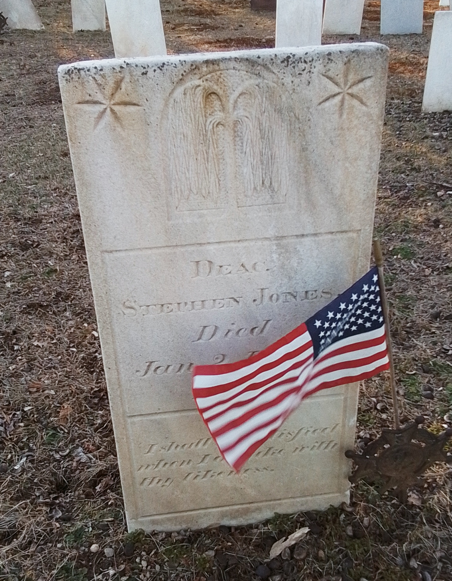
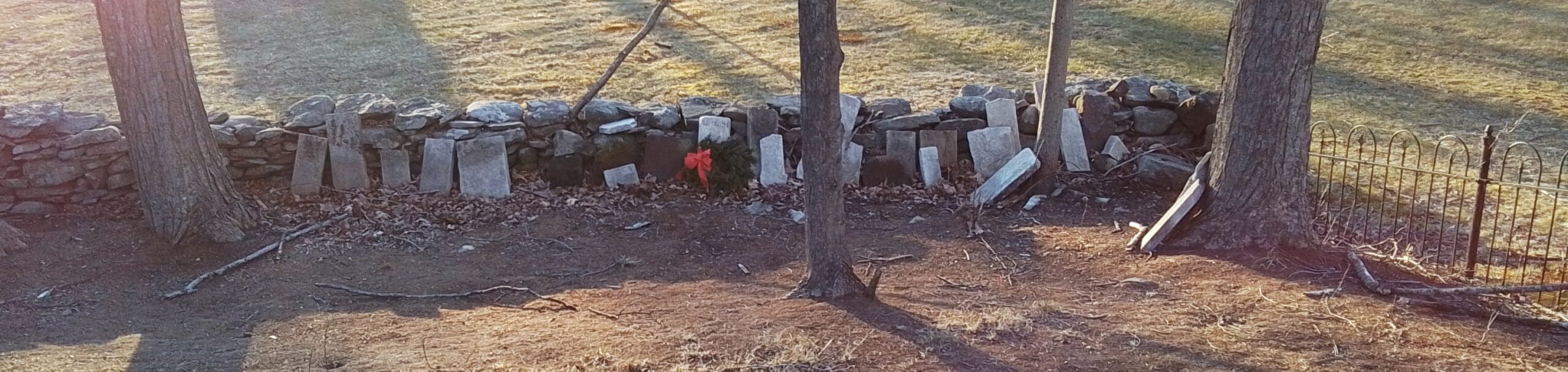
Fuller Cemetery
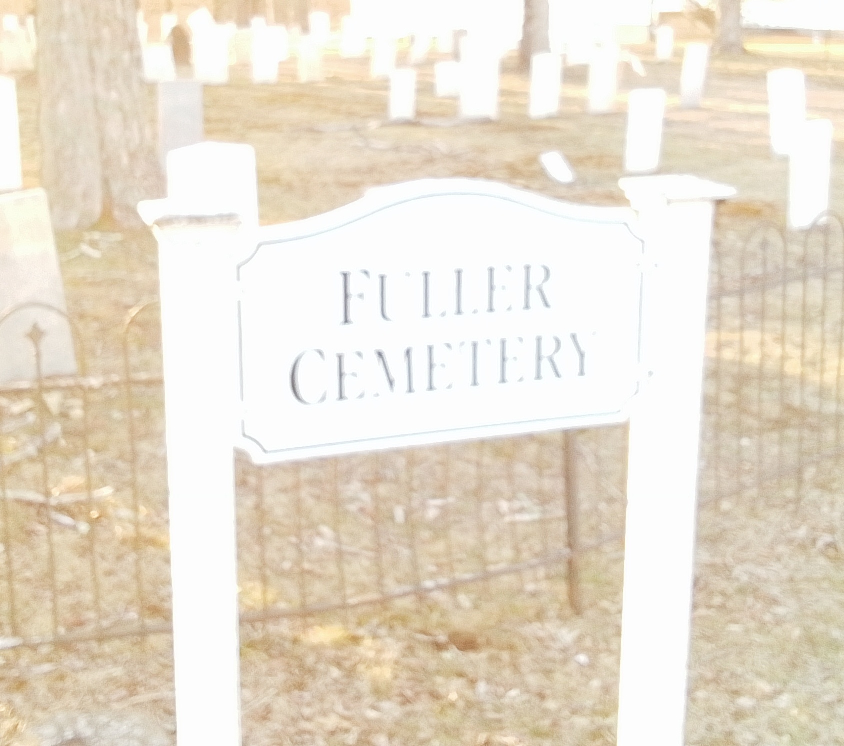
Fuller Cemetery was made in 1786 and was given to Ludlow in 1794. A hearse and a hearse house were stationed alongside this cemetery.

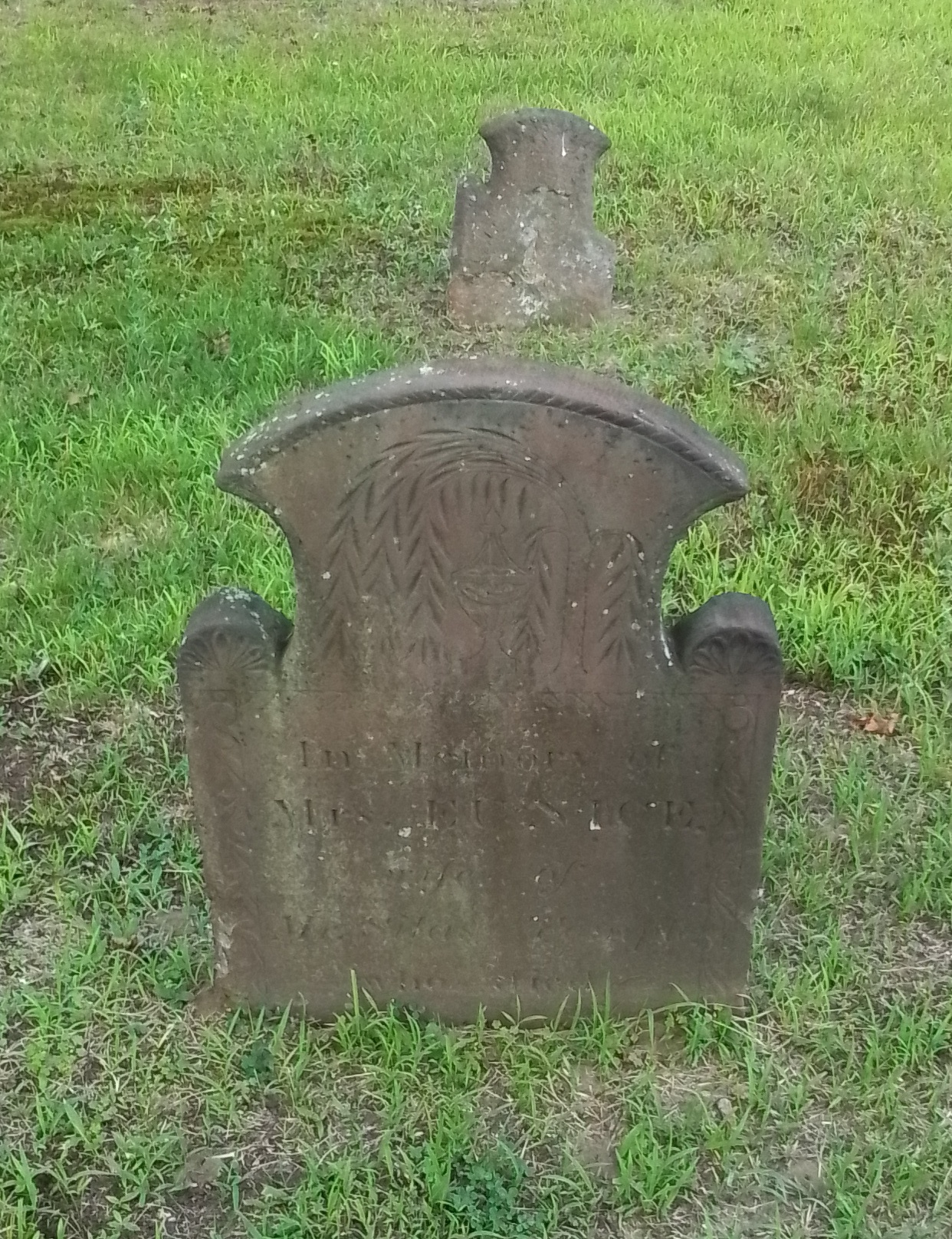
EUNICE TEMPLE – FINDAGRAVE
This is a rare example of a gravestone set never being moved at all. For post-1776 burials, the headstone should point directly to the west and the footstone should face directly to the east. Eunice Temple’s stones both face outward from the burial. Her body is on the correct east – west axis.
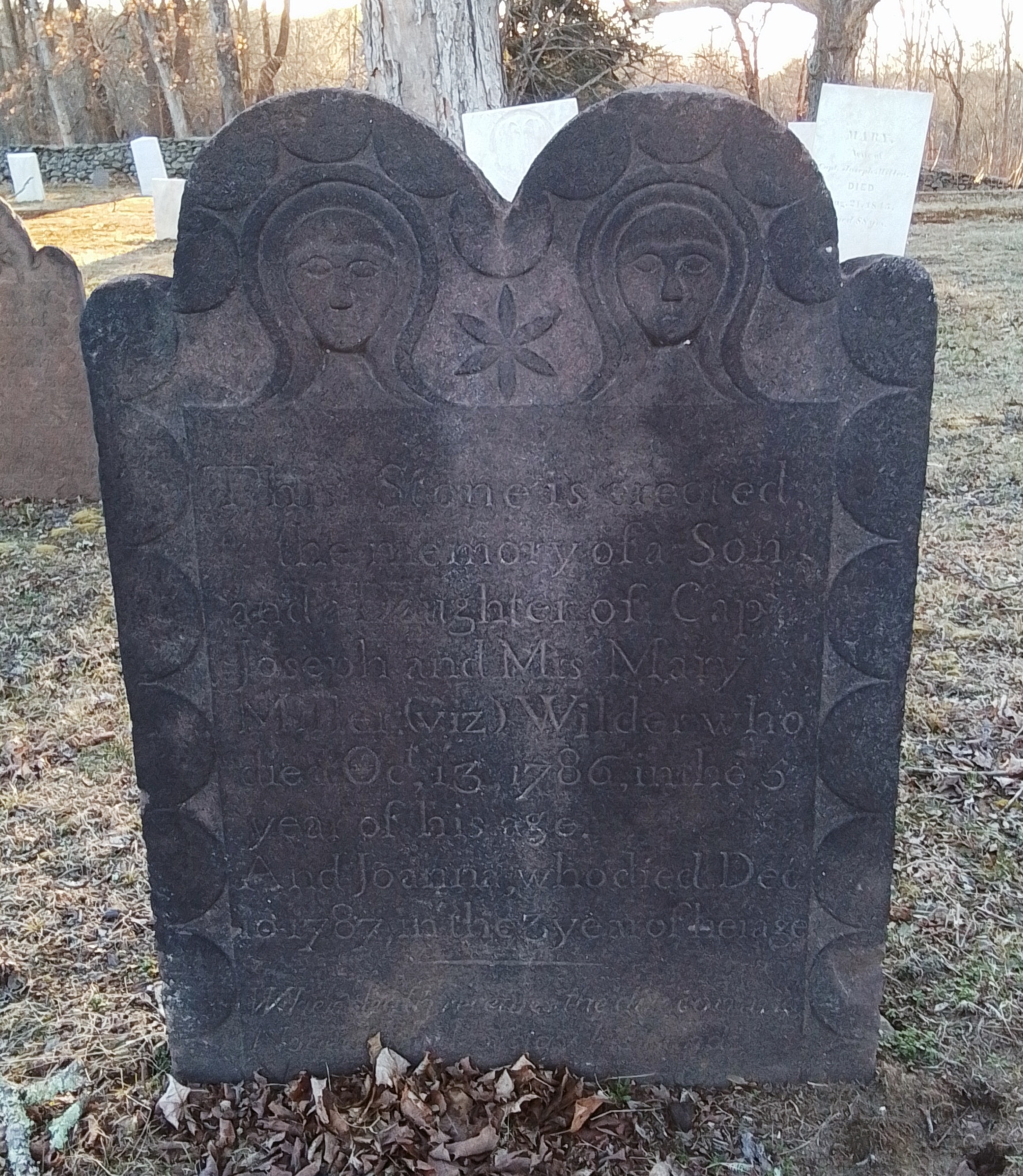
Joseph Miller
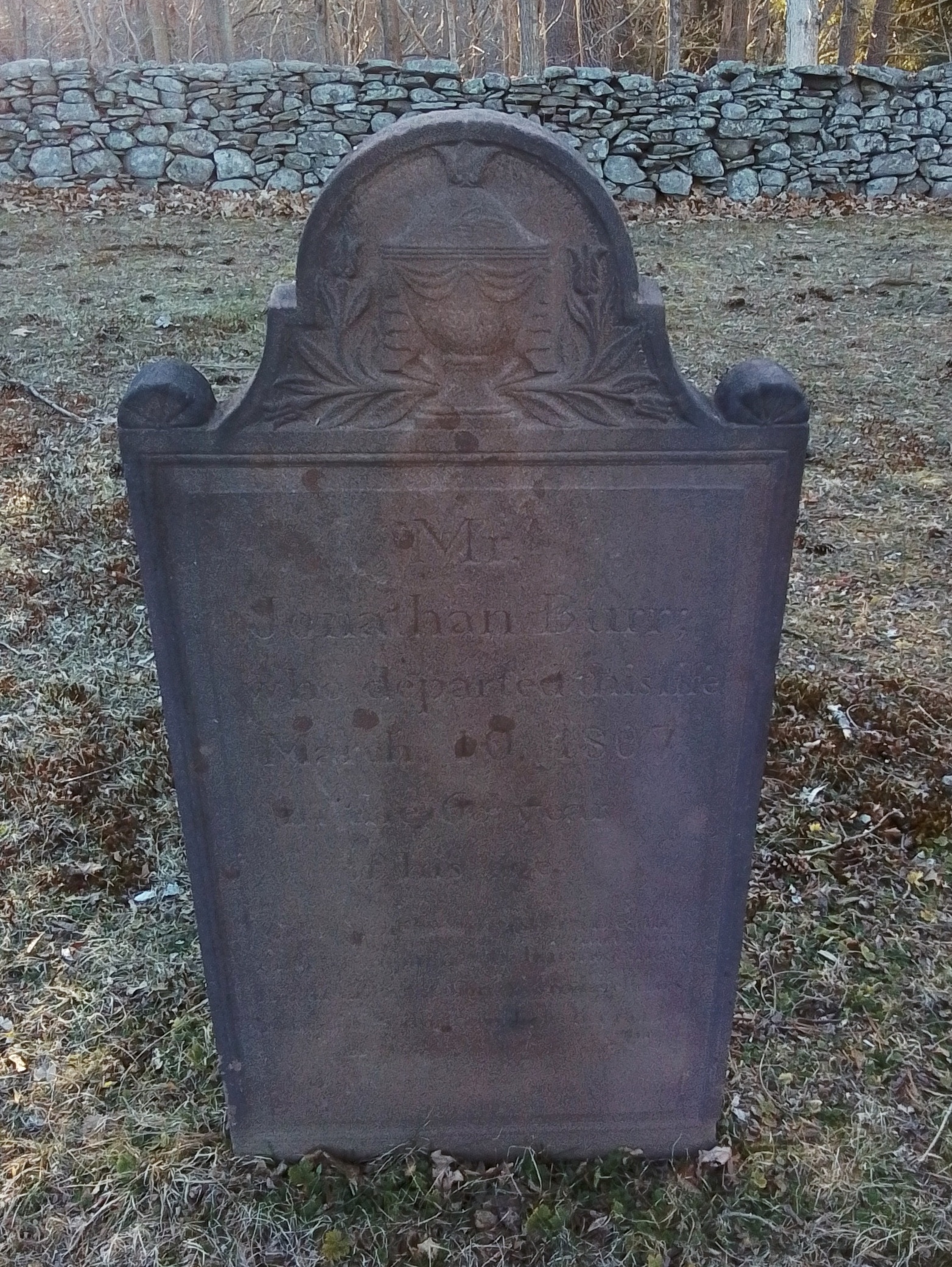
Jonathan Burr – FINDAGRAVE
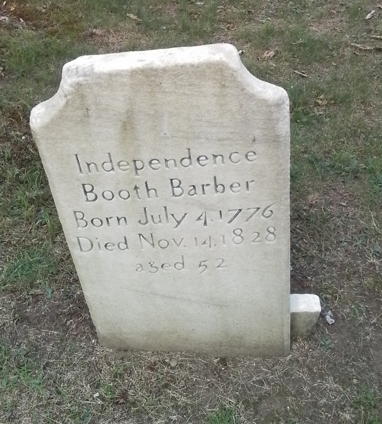
Independence Booth
Pease family
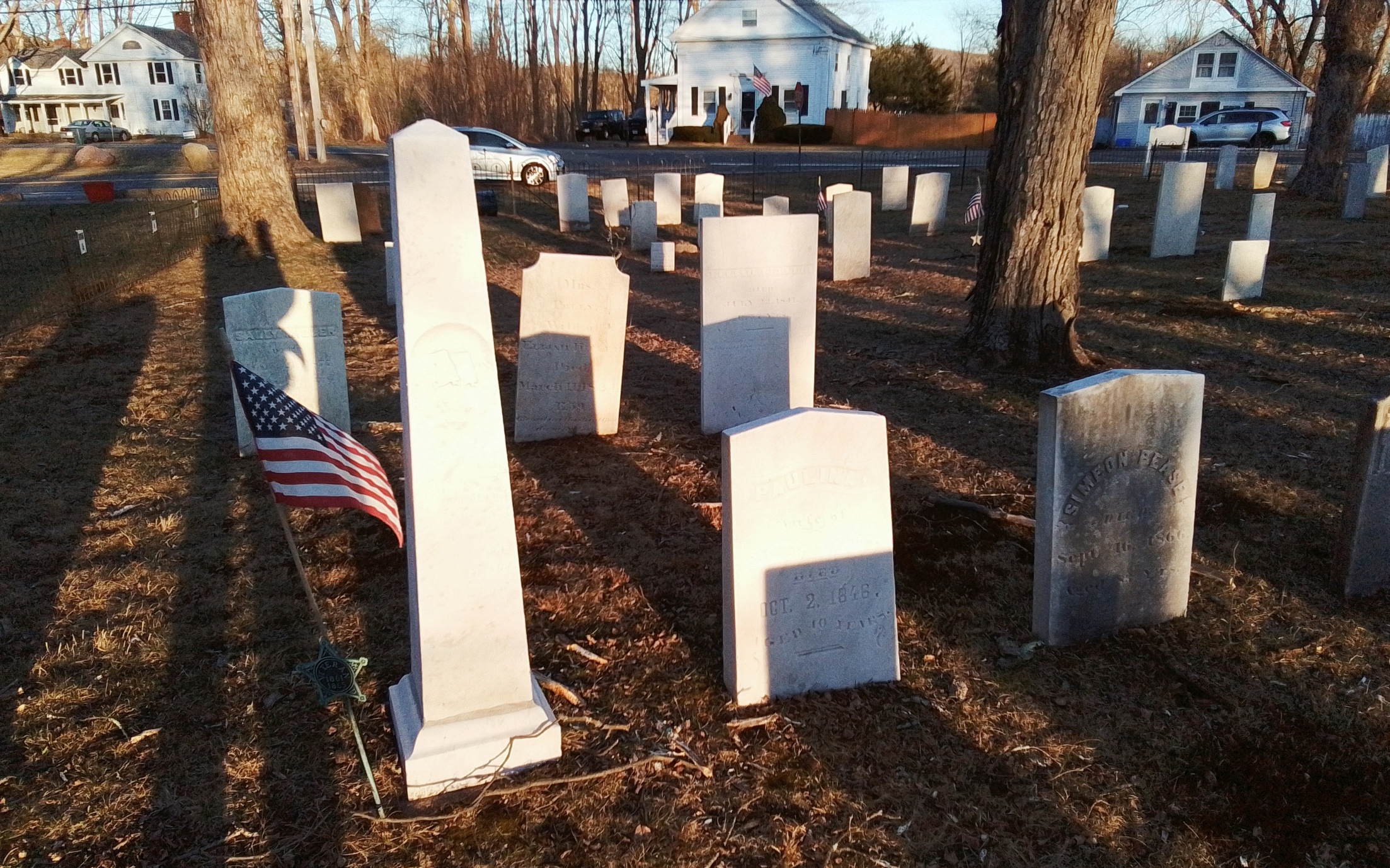
Headstones
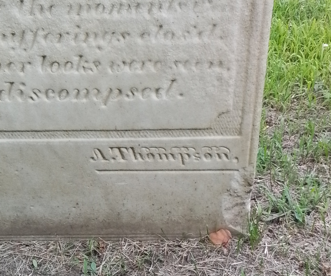
Some headstones are signed.
Footstones
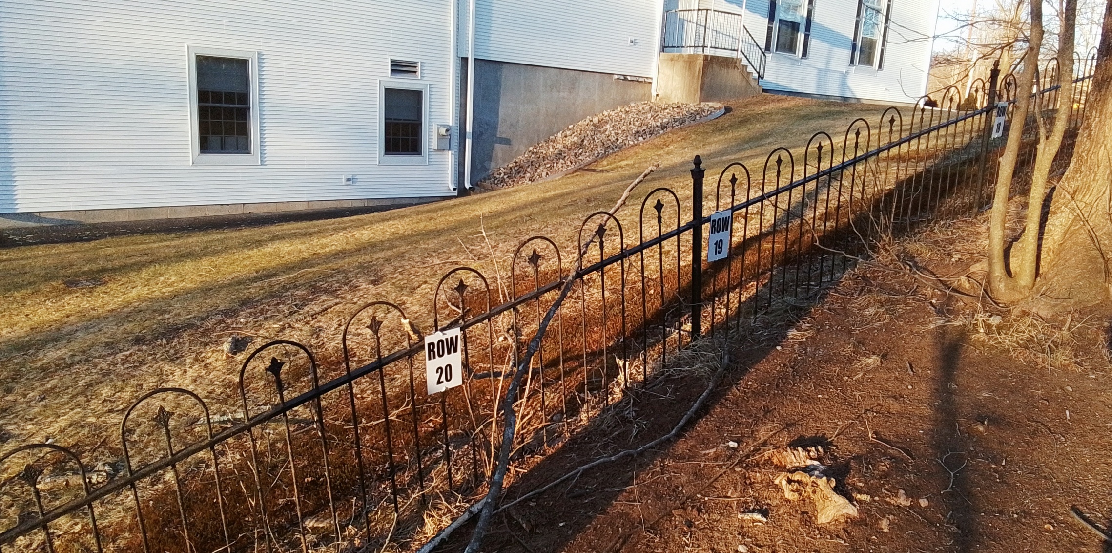
Fence and Row Signs
Ware is defined by Quabbin Reservoir
CANALS – LIST
Churches – LIST
Cemeteries – LIST
Church Street Historic District
Ware Center Historic District
Ware Millyard Historic District
other
Ware–Hardwick Covered Bridge
Grenville Park – 1907
Ware Town Hall – 126 Main Street 1885 – replaces one at the site beforehand – Romanesque Revival
Ware Business District – Main Street between West and South Streets
Casino Theater – 121 Main Street 1908
Social Science Club – end of Pleasant Street 1915 – group started in 1885 to help other woman of the community
Young Men’s Library Association Building – 37 Main Street 1881 Ruskinian Gothic style
Grenville Park – made in 1907 from the designs of Arthur Shurcliff from the benefit gift of the parents of Grenville Gilbert
Ware High School – Church Street 1893


