- Tour booklets of this reservoir can be found HERE.
- Reservoirs of Holyoke
- Private GROUP TOUR (COSTS) can be either one, two, or three hours long for this Whiting Street Reservoir walking tour. Also a one hour indoor presentation can be given.
- The reservoir is NOT handicap accessible and by Massachusetts laws does not have to be. Any attempt to open the land up more will allow motorcycles to trespass.
- A free public tour comes up every year in the autumn on the Saturday of Columbus Day weekend.
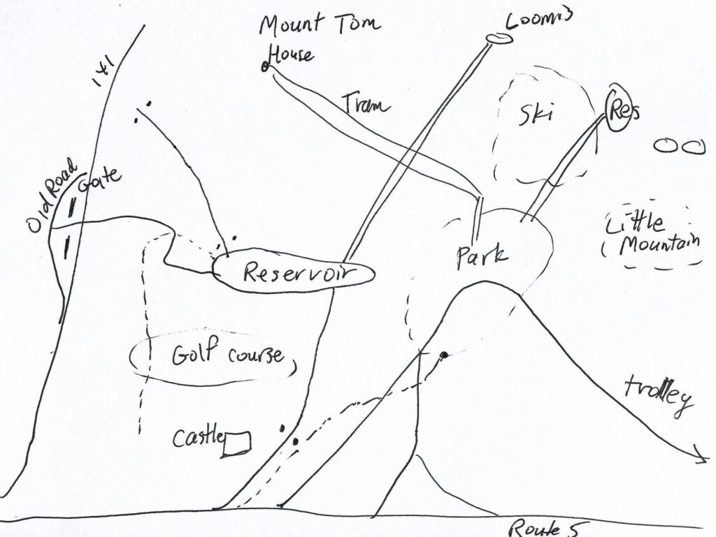
- A self-tour is available for anyone using the maps and text seen below. – LOCATION
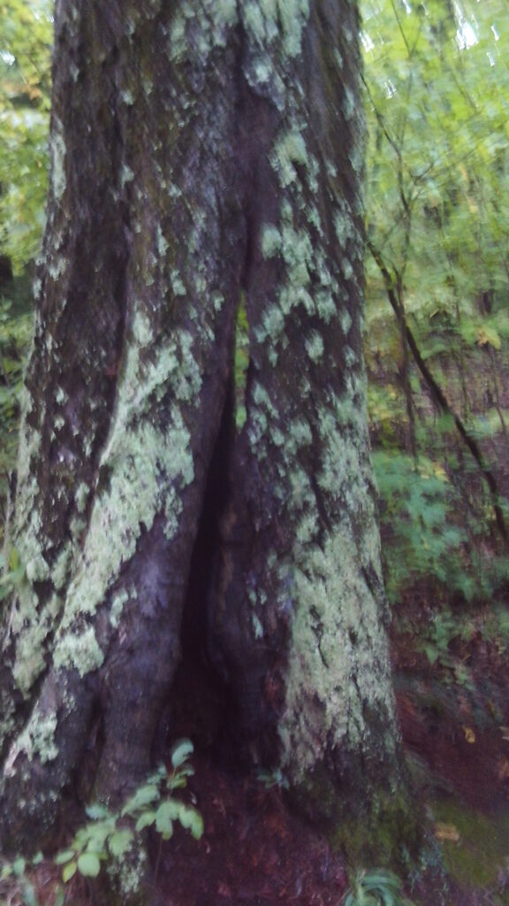
Whiting Street Reservoir was made from the watershed of Roaring Brook in 1888. It is made of a sandstone dam with a dirt berm. The entire area is full of history but the greatest view is that of being in the shadow of the Mount Tom Range. The reservoir system of Holyoke is vast. Read about the WHOLE system.
A group has been formed by the city of Holyoke to examine the future uses of this reservoir area. See their video presentations at YOUTUBE.
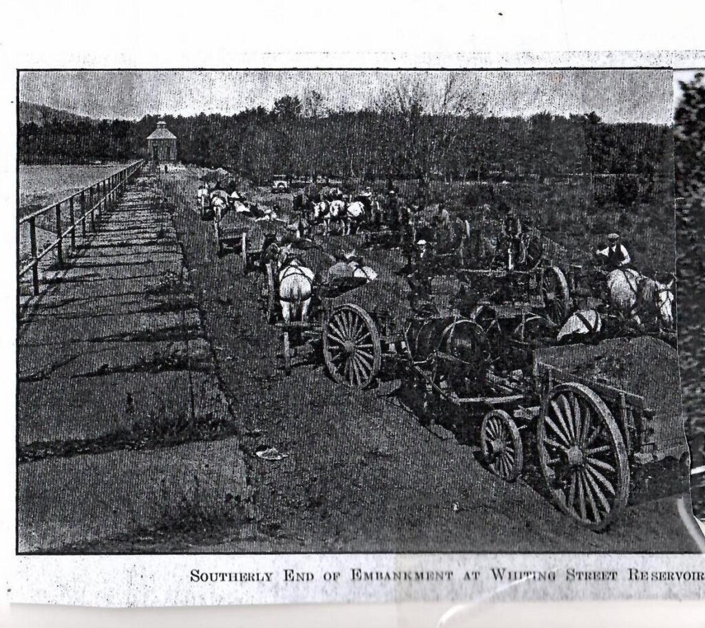
The packed dirt road that surrounds the reservoir was put in in 1897 both to help maintenance workers and to allow visitors to visit the many sites around the reservoir. In 1912 it was widen to allow for vehicles to pass. It has always been well maintained by the HWW. Whenever there has been a problem the next day the situation was fixed. Large improvements were always looked into the done. In 1938, there was a resurfacing of the road with trap rock dust.

This was the first dam-based reservoir of Holyoke but its third dedicated source of water. The water of the reservoir served as a drinking source for Holyokers until into the early 1990s. Now it is just a backup source. Below is my historical and geographical tour points. Use the maps.

Each stop can be extended into a bonus tour since the trails lead onto more trails and sites. One such important trail map is that of the Mount Tom Reservation.
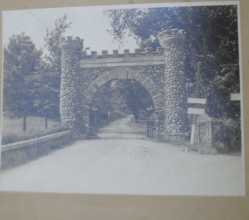
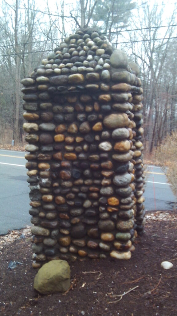
1 – Reservoir’s Old Gate

At the crossing of Kenilworth Road and Mountain Park Road there is an old road leading west. (In the inset map just above, it is the black line above the upper RED line and is marked “Road to Reservoir”). (LOCATION) It starts about 70 feet into the driveway of the Kenilworth Castle Condos.) This is the remnant of the entrance to Whiting Street Reservoir. It once led to the reservoir but in 1963 when the interstate highway was put in, the Reservoir Road was partially taken out. The Kenilworth Castle was to the south. The stream nearby is the end of Roaring Brook which soon crosses Northampton Street and empties into the Connecticut River. This entrance had a large castellated gate from 1912 to 1963 but it has mostly been removed.

In 1914 an iron pipe fence lined both sides of the road from this gate to the reservoir. In 1918 this entrance road was paved with bituminous macadam. The iron gate across the road was added in 1919. By the next year 1920 the gate was being used a lot to restrict driving whenever needed.
| gateway | still there and see also image to the left | upper Roaring Brook after it comes out from the interstate area | |
 |  |  | |
| garden area | flower plot on top | ||
 |  |
Part of a surface pump and some walls are still here. This road is the property of Holyoke Water Works so you may walk up it but it only leads to a fence on the interstate highway. Another dirt road leading north was constructed in 1915 to lead to Mountain Park. This road was paved in 1928. (On the inset map, this is the UPPER RED line.) The tar road that you drove in on, going to the park and reservoir was made in 1965. (On the inset map, this is the BLUE line.)
In 1912 also a pipeline was lain from the castle area near this gate to the Mt Tom Country Club. This would bring water to the golf course for the first time.
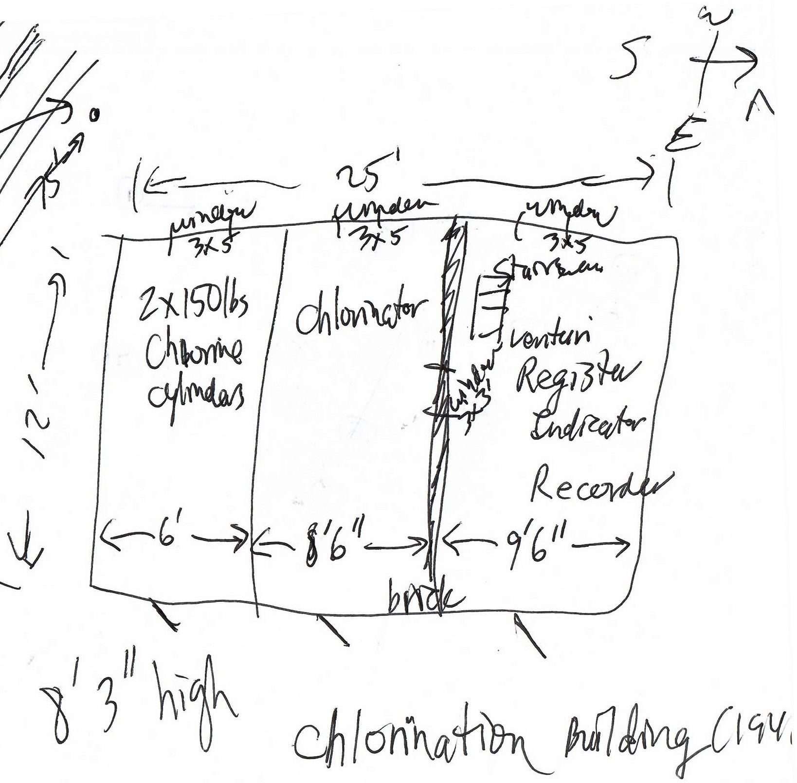
The first chlorination plant of two at Whiting Street Reservoir was put in place in January 24 of 1941 having been started in 1940. It was 100 feet north of this gate. It was easterly of the Water Works road (between the two old roads that are described above). See the schematic above for a look at its design. It had a Ross hydraulic pump that injected chlorine into the water. (In 1941, 25 pounds of chlorine was used every 24 hours.) The equipment could hold 1 ton of chlorine at a time so the tanks must have been large. The plant included a Venturi meter (January 7 1`941) and a Ventilator both of which were stored in the basement in order to stay clear of the chlorine. The plant was 25 feet long and 12 feet wide. At 8 feet 3 inches high, it also had a cellar. Each of the three segments had doors and each had a window. The northern section had a stairway down to the cellar.
This area had a large platform for a floral and bush display and the chlorination plant was to its western edge.
Christine Hurlburt was found murdered in 1968 close to this spot. FINDAGRAVE
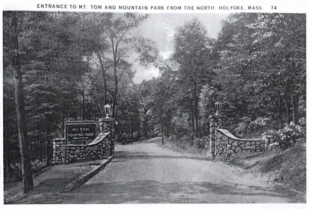
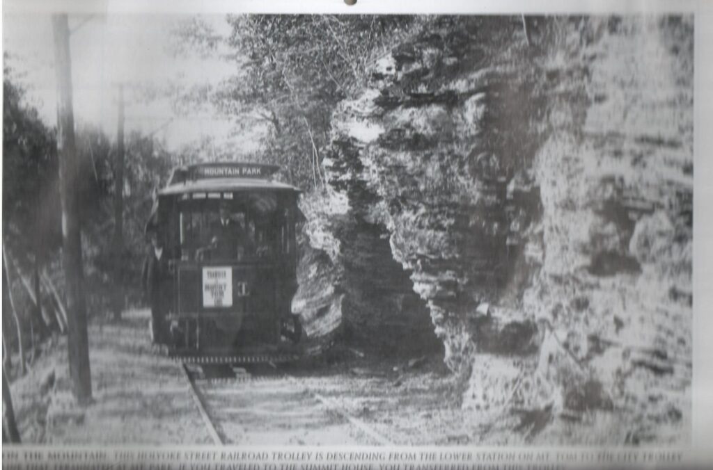
2 – Holyoke Street Railway and the Mountain Park Entrance
The old road and trolley line to Mountain Park Amusement Park came through this point. (LOCATION) The trolley line from Holyoke was put in in 1897 (taken out in 1939) and the access roads from Holyoke and Northampton were put in in 1929. There are two entrance gates located on the highway. One was for car traffic leading south and the other for cars travelling north into the park. (In the inset map, the double entrance RED line at the bottom is the road into the amusement park area.)
| road from highway to Mountain Park | trolley piers | gateway from highway |
 |  |  |
Pictures of the Gates on Northampton Street.
If you look carefully to the east of Mountain Park Road, you can see the support piers for the trolley to elevate the cars over a gully. The tar roads for cars was a bit more to the north. Read much more about the trolley lines at HOLYOKE TROLLEY. (On the inset map, the trolley line is in deep black and is between the blue and the lower red lines.)
3 – Crossroads
This is the intersection of three roads – Aerator Road (part of Whiting Street Reservoir Road), Mountain Park Road, and Mount Tom Ski Area Road. (LOCATION)
It is obvious what they led to. The ski area is only a mile away from this point. The Mount Tom Ski Area Road also leads to an access road to climb the mountain. The trolley bed at one time passed close to here. The road to the reservoir was made in 1963 and is called Aerator Road.
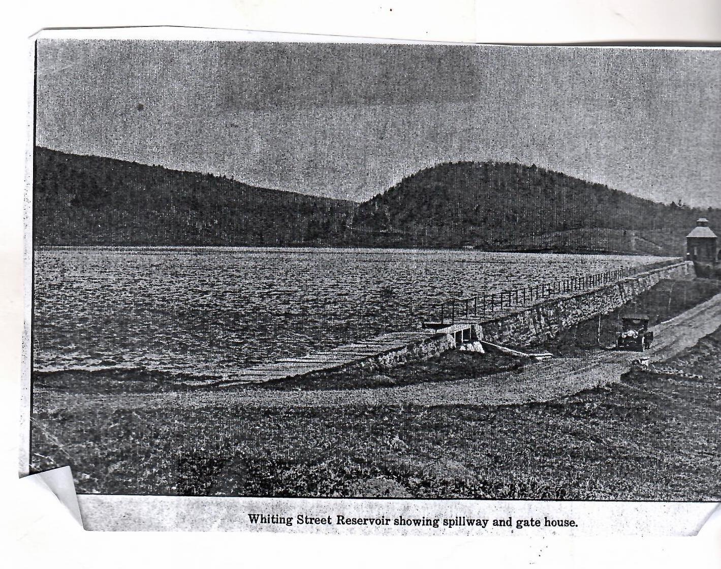
4 – Intake Reservoir and its Dam
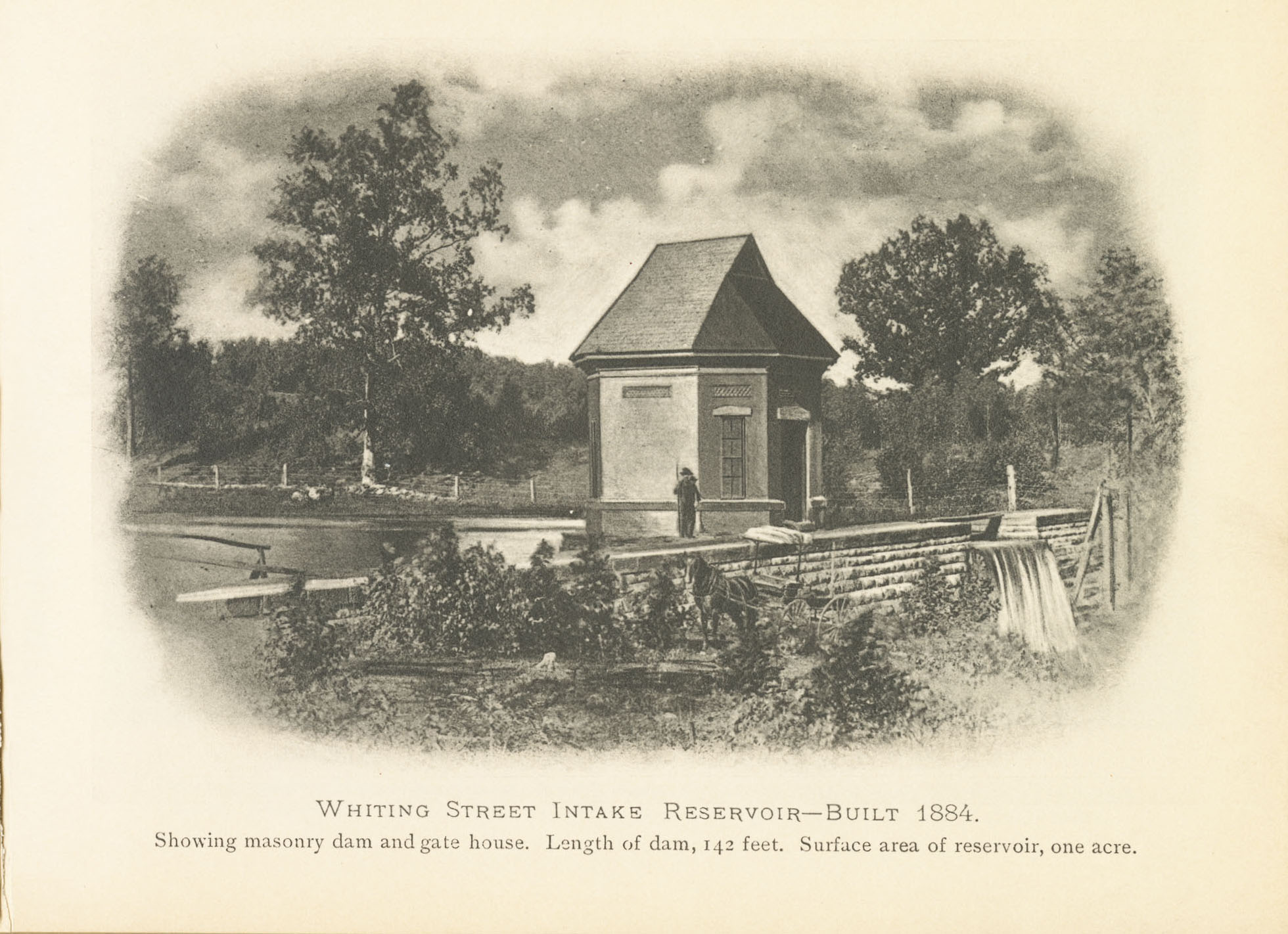
(Image is courtesy of the Holyoke History Room at the Holyoke Public Library. It is from a booklet called “Souvenir by the Holyoke Water Works”.)
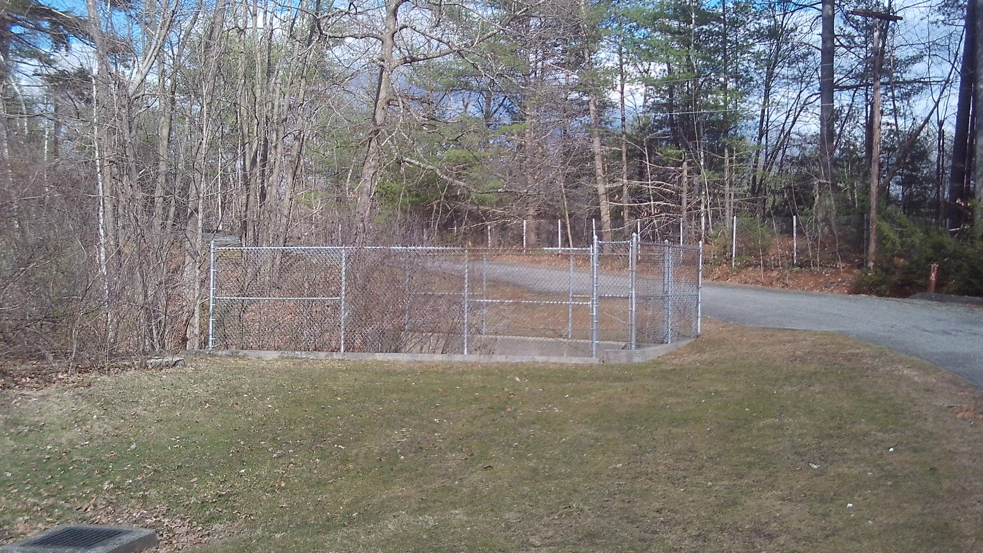
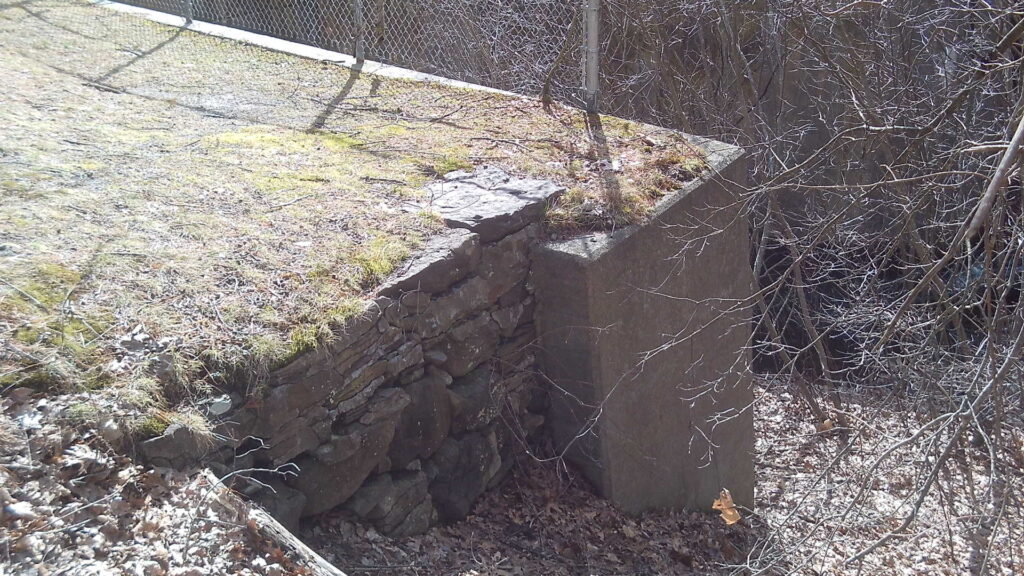
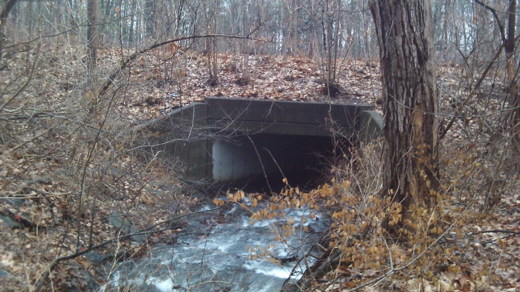
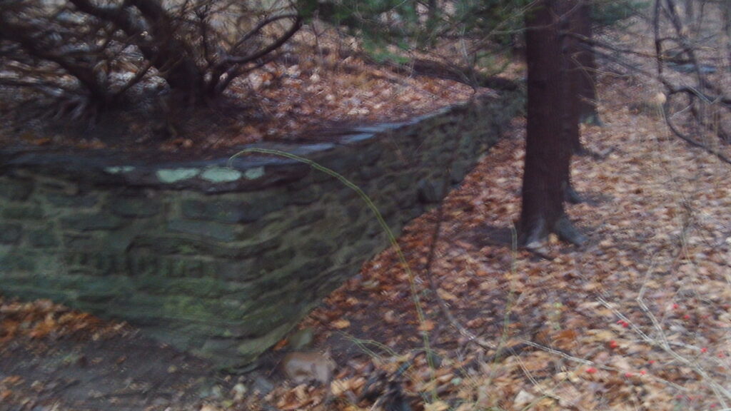
Roaring Brook passes under Aerator Road and is visible on both sides. Orient yourself by using the picture just above. This fenced area is the Intake Dam and its spillway. (LOCATION) It now has a culvert under the interstate. Walk toward this fence. Then walk to the left of the fence. The Intake Dam runs northeast to southwest below your feet. The octagonal gatehouse run along a separate foundation to the northwest.
The dam of the Intake Reservoir is 141 feet 9 inches long and 15 feet high. It is 12 feet thick at its base and 7 feet thick at it top. There was a small spillway on top that was 2.5 feet down. The water in Whiting Street Reservoir is 32 feet higher than in the Intake. (Whiting Street Reservoir is at 390 feet above sea level and thus Intake is at 358.) The intake was built from 1884 to 1885 with Mt Tom sandstone. After the larger dam was built, it served as a location where sediment in calm water could settle. The larger dam water was also once a year used to hose out the sediment in the Intake.
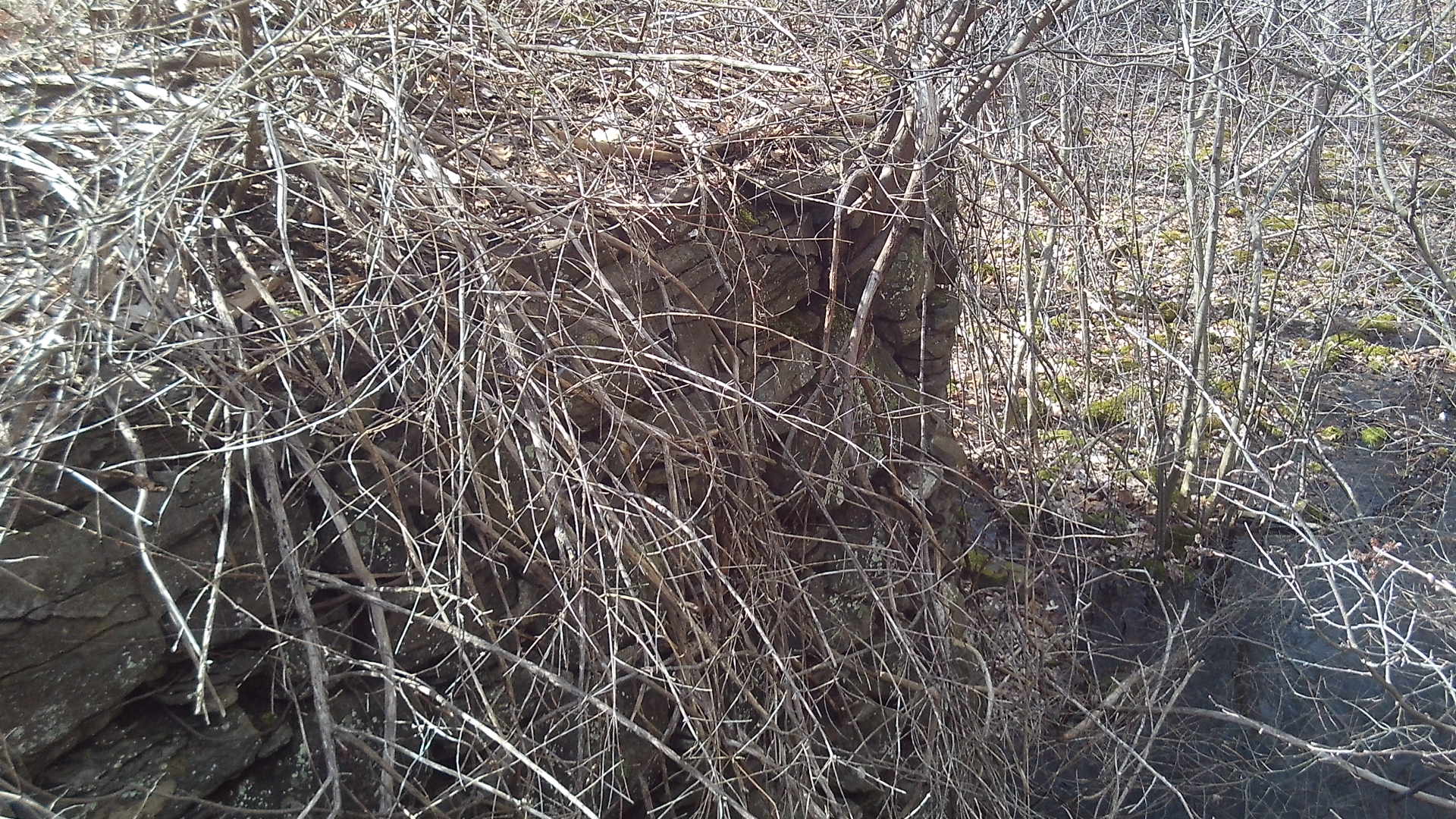
The octagonal gatehouse (18 by 14 feet) was added to the top of the dam at some point in the late 1800s. In 1919 it was rebuilt due to a fire (in 1917). This new gatehouse was built on the berm behind the modern chlorination structure. You can find its foundation about 50 feet south of the chlorination building. This gatehouse was also a guard house and was finally removed between 1965 to 1976. In 1913 the watch person at the Intake was deputized as a Holyoke police officer. See the wonderful picture at the start of this stop.
Not only did the Intake area need to be very secure but it also needed to be very clean. Brush was cleared away at a distance of 2.5 miles from the dam. Then barbed wire fencing was used to enclose 2 acres.
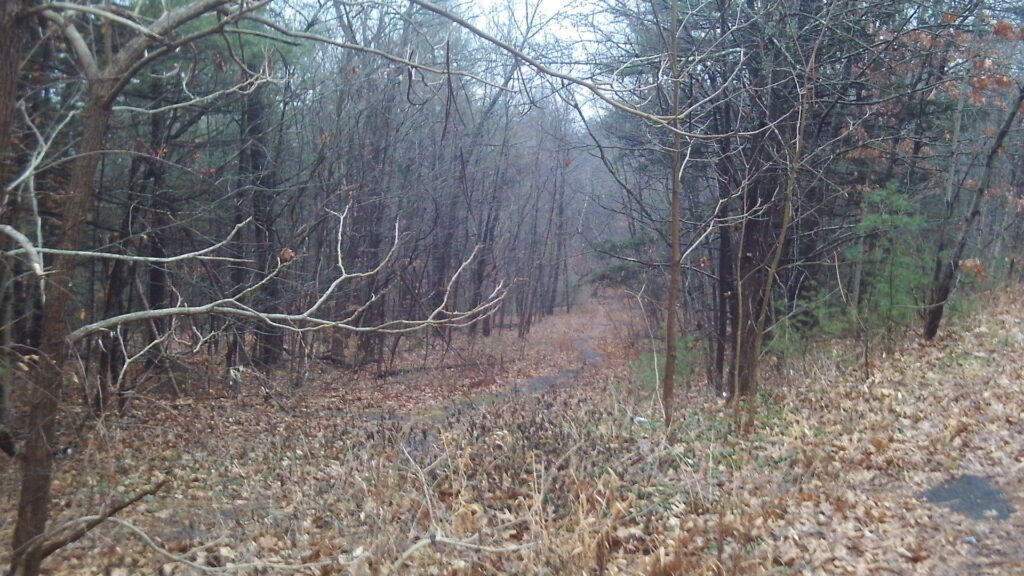
The modern road comes from the north and goes to the west but the old road comes from the southeast. Look in that direction between the modern chlorination plant and the brook. You will see a grass road that is about 30 yards long. This once lead to Northampton Street.
4A – Fluoridation and Chlorination station
Notice the fluoridation and chlorination station to the south built in 1965 and 1970. This is the second chlorination building along the road with the first being built in 1941 but removed in 1965. There is a municipal pipe below your feet that leads to the downtown Holyoke, the Highlands, Smith Ferry and the Flats. The grassy knoll to your south is the location of the former chlorination station. Its foundation is apparent at two locations if you look carefully. The original entrance road is at the midsection of the knoll. There was also a barn in the middle western edge of the knoll for supplies.
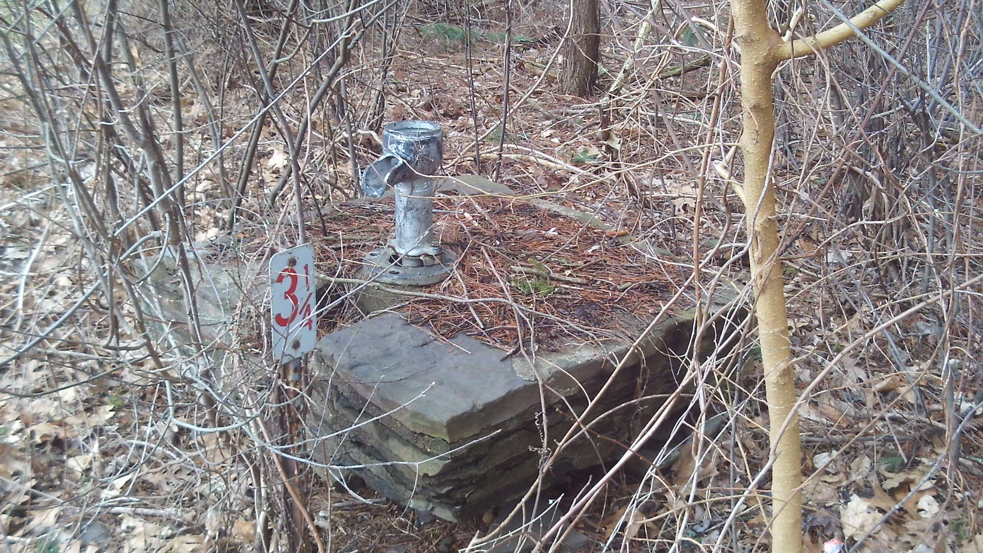
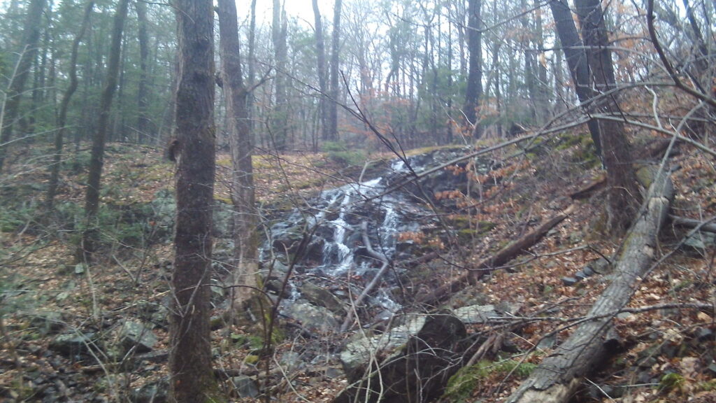
5 – Hastings Brook and the Sluiceways
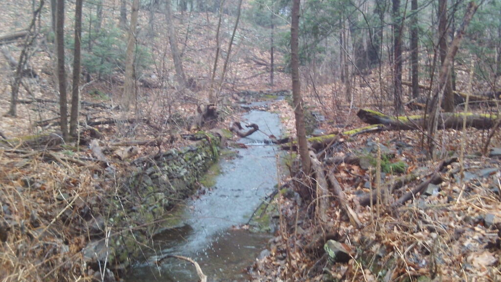
Hastings Brook (LOCATION) is found at the crossing of a brook over a small footbridge. This brook at one time caused much problems with the water being piped into Holyoke. It used to flood when either the brook or the spillway was very active. Its suspended load of silt and clay would get into the Intake Reservoir and cause the water to have a high turbidity. This problem was alleviated when a small dam was placed under the crossing.
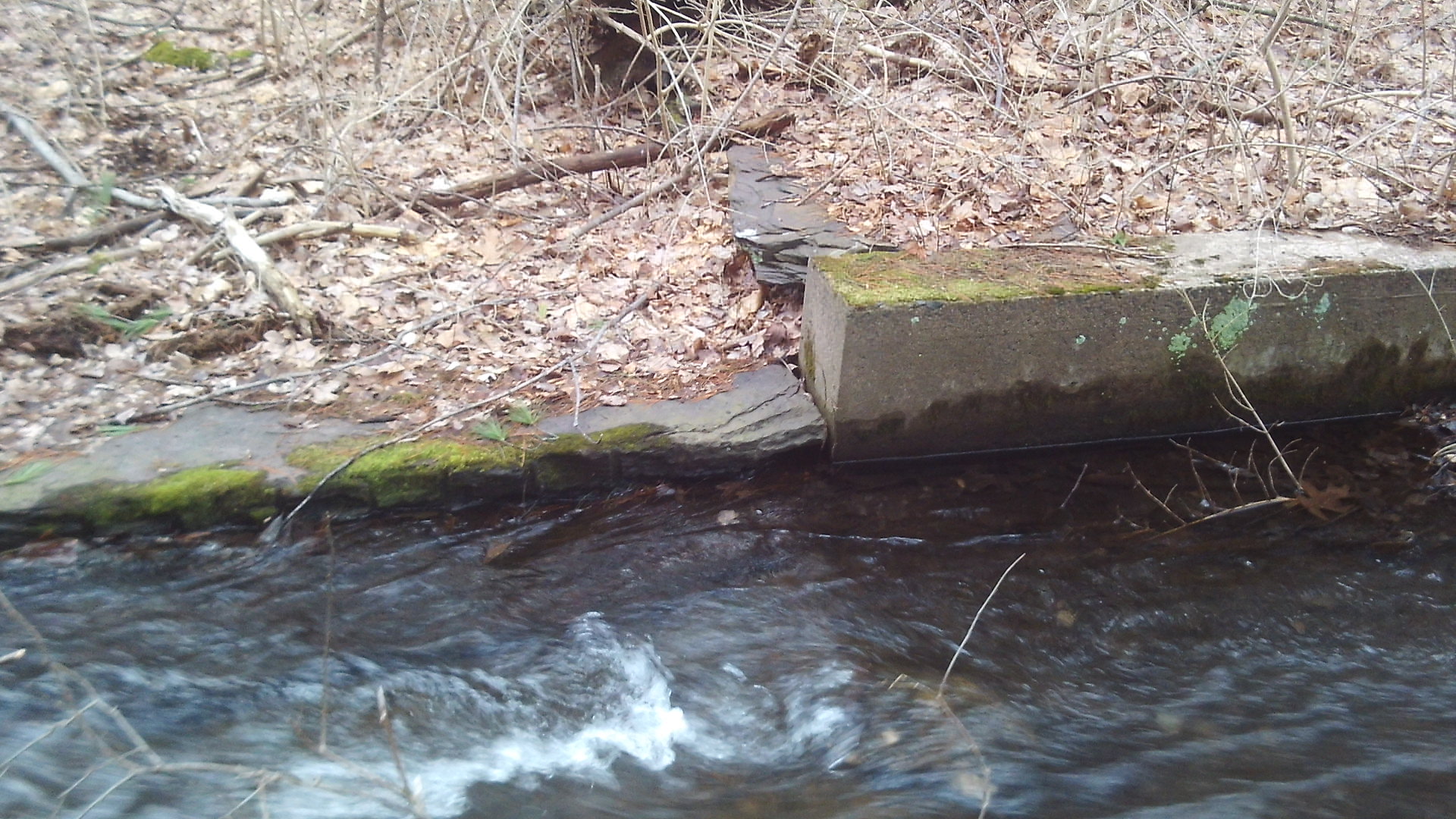
The sluiceway was extended in 1935 and in 1938 to join the other sluiceway that ran from the aerator to the Intake Reservoir. In 1939 the year after the New England Hurricane caused great damage, a 36 inch pipeline was added for the 488 feet from the Hastings Brook to the Intake Reservoir. A tiny dam was added at the juncture of the two. It would release water at the bottom of the Intake in a very settled made.
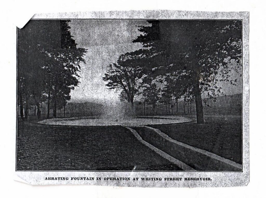
6 – Fountain
There is a concrete canal from both the control house and from the emergency spillway. They meet in the brush and then go the east where we just were. The two pipes from the control house are deep under ground. It leads to its surface point in one of these channels. There was an aerator with a fountain on the grass near this point. (LOCATION) It was put in in 1909 as a help to kill certain bacteria. Oxygen in water does help it taste better. Some parts of the aerator are still visible if one looks carefully. A 1906 sluiceway joins the fountain to the Intake. Also in 1906 a pipeline was added that could carry the water directly from the reservoir to downtown. This pipeline was used for a few months that summer.
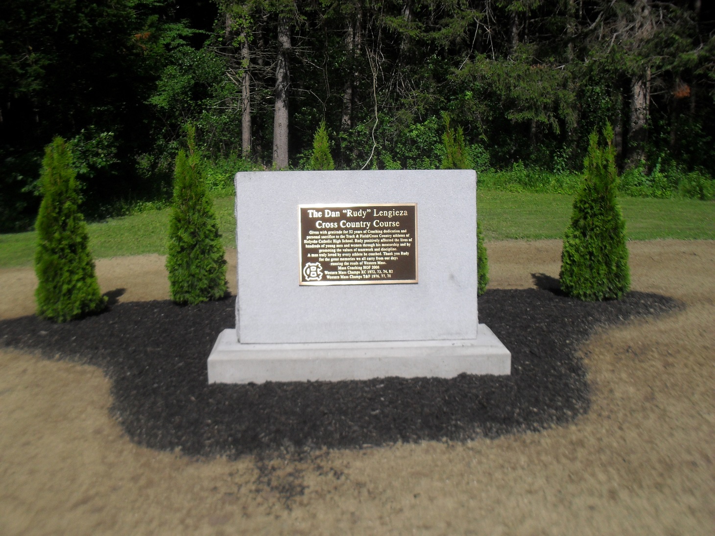
The cross country course around the reservoir was used by high school runners from 1970 to 2015. It was renamed in honor of Daniel Lengieza – the coach of Holyoke Catholic High School cross country and track for 52 years – in 2018. Notice the plaque in his honor.
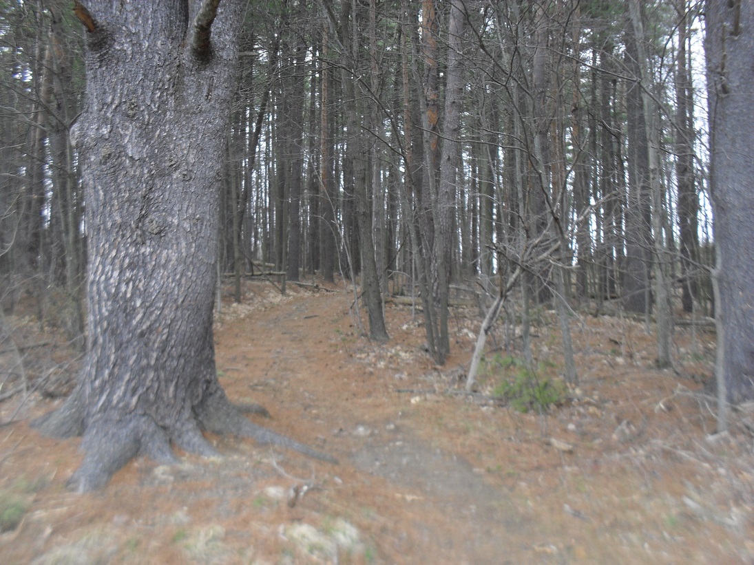
Notice that most of the trees around you are pine. These were mostly planted in the 1930s are WPA projects. Deciduous trees were removed in 1937 around the Whiting Street Reservoir since since leaves had to be raked out of the reservoirs, sluiceways, fountain, and brooks to keep the water from developing germs or a bad taste. Note that the pine trees were planted too close together and thus never developed nice crowns. As a result of the New England Hurricane of 1938, 1000 young pine trees were uprooted. The hurricane did drop 12 inches in one hour so this was to be expected.
This grassy area in front of the dam was also the location of an old barn and a shed, They are long gone but it would be interesting to determine if they were used by Whiting Street himself.
7 – Mountain Park Trail
The Holyoke Catholic High School Cross Country Course starts here. It is 2.72 miles to the end point back at the stairs near the control house. The course was used for 46 years as their home course.
Mountain Park was started in 1897 as a deer park and theater. It was a trolley park. The only road entrance to the park was via this road until 1915. About 40 feet back from this point, there was the original road that circumnavigated the reservoir – Mountain Park Trail (LOCATION). It is the only part of the road that has been detoured. It originally led to the Mountain Park area. In 1909 the entire road around the reservoir was widened and hardened. As part of this roadwork in 1909 and 1910 the new path (along the water’s edge) was put in due to the congestion of parked vehicles visiting the Park. The head of the Holyoke Water Works had had it with the Mountain Park people. In 1911 a barbed wire fence was placed between the reservoir and the Mountain Park.
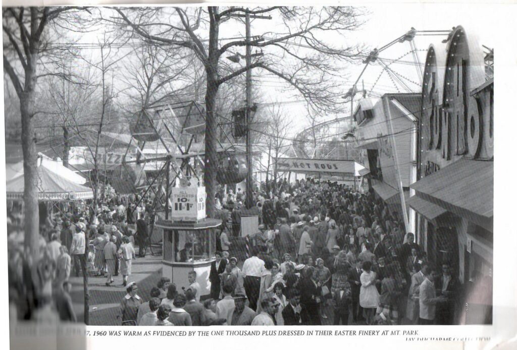
8 – Mountain Park and its Trolley Extension
Mountain Park (LOCATION) is 200 feet to your east. This side trail was once the original path. Mountain Park was a animal park and a theater area under William Loomis. An extension of the trolley passed along the road above. See the trolley MAP. The trolley ran from Holyoke to Mountain Park every half hour from 6 AM to midnight. The Holyoke Street Railway under Loomis operated the city trolley system. The Mount Tom Rail ran up the mountain. There was a third piece of the trolley route from the park to the base of the mountain.
William Loomis was a great benefactor to Holyoke. He gave his land to the Holyoke Home for the Aged. LINK
View of the drive around Whiting Street Reservoir in 1904.
The Casino has a wonderful history and you can read about it HERE. This is a link to the Jacqueline Lynch book Comedy and Tragedy on the Mountain.
In 1929 it changed to a park with many large rides such a roller coaster (under Louis Pellessier) and a Merry-Go-Round. In 1952 it changed again into an Art Deco amusement park with a midway under John Collins. Read about the Mountain Park era from this BOOK.
It closed for good in 1988. For a few years concerts were held here.
9 – Mount Tom and the Mountain Brook
 |  |  |
This path leads to the top of Mount Tom. (LOCATION) The old trolley bed is found up this trail also. To get to the mountain road walk this trail and then 10 feet along the tarred road and then a sharp left to climb the mountain. Mount Tom is 1266 feet above sea level. Climb it some day with a friend.
In 1945 electric wires were added to the roadway for developing a FM radio station on top of Mt Tom. This was called the Hampden-Hampshire Corporation.
Stop about 2/3rd up to the summit. There on July 6 1946 a B-17 transport plane crashed with all 25 men dying. There is a monument on the mountain for these military men. Beyond the mountain access road is the Mount Tom Ski Area. It started in December of 1960 for downhill skiing. Decades later an alpine slide, a wave pool, and a water slide were all put in. In 1998 all closed.
About 10 feet south of the point 8 on your map see the end of the Whiting Street Brook. Whiting Street was a farmer and investor who at his death in 1878 had left a trust fund to many communities. The reservoir and the brook are named after this person. FINDAGRAVE

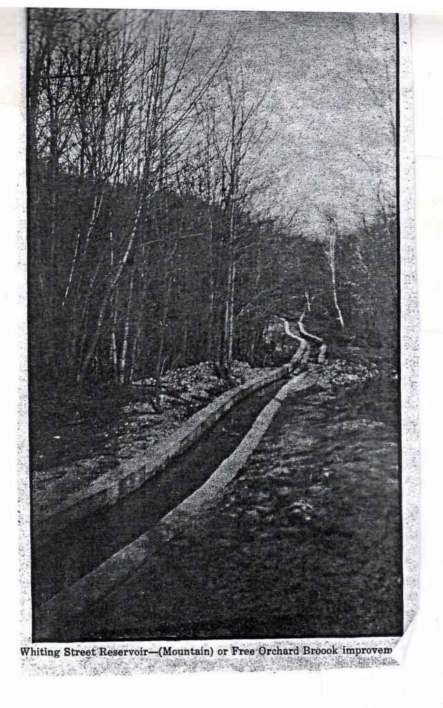
The Whiting Street Brook and its tributary the Free Orchard Brook was widened and deepened in 1888 to get the work at the reservoir into gear. The brook now has its origin at the Loomis Reservoir (aka Summit Reservoir) on the mountain. The concrete sides of the brook were added in 1911 to form a channel and the concrete bottom added in 1936 and 1937. [There are extensive trails at the Mount Tom Reservation.] Loomis Reservoir was made in 1896 to get water to the hotel on top of Mount Tom. It is 125 feet by 50 feet and 9 feet deep at its maximum.
A hotel was built at the summit of Mount Tom. To get there 120 years ago you could walk, drive a car, or take the tramway. The drive up the mountain was from a trail that is about 500 yards farther along the Whiting Street road. At that point there is a tiny trail that goes up the mountain that was once used by cars.
10 – Road to Top
About 500 yards from your last stop, there is the start of a trail system on the sides of Mt Tom. (LOCATION) This road allowed people to drive their car to the top of the mountain. This property is now owned by Holyoke Gas and Electric.
Check out this pretty 1904 image of the western edge of the roadway.
To your north across the water is a good view of Little Mountain. It has a trail map.
11 – Sheldon Avenue
Sheldon Avenue (LOCATION) was built in 1914 and is 1600 feet long and has easy grades and curves. Sheldon Avenue to Easthampton Road was once fully gated both here and at its highway entrance. These gates had swinging gates added in 1920 to prevent the public coming in when the road was soaked. By 1922 the gate was permanently locked.
It led to Route 141 but is now part of the Metacomet Monadnock Trail and which is itself part of the New England Trail (TRAIL MAP or BROCHURE). The Monadnock Trail was blazed Feb 28 1953 and led to the Metacomet Trail.
The road was named after Jesse Sheldon a water commissioner. The entire Mount Tom Range is a State Reservation since 1903. There are three trails that lead from the reservoir into the Reservation.
12 – Very Old Road to Easthampton Street

There are now three roads out of the southern part of Whiting Street Reservoir. The Steiger Road at stop 13 is the newest. Sheldon Road at stop 11 is the one of middle age. Between the two is the road that is the oldest. Its name is not known but it is on the map just above. You can still follow it to the highway. It is about 3/4th of a miel long.
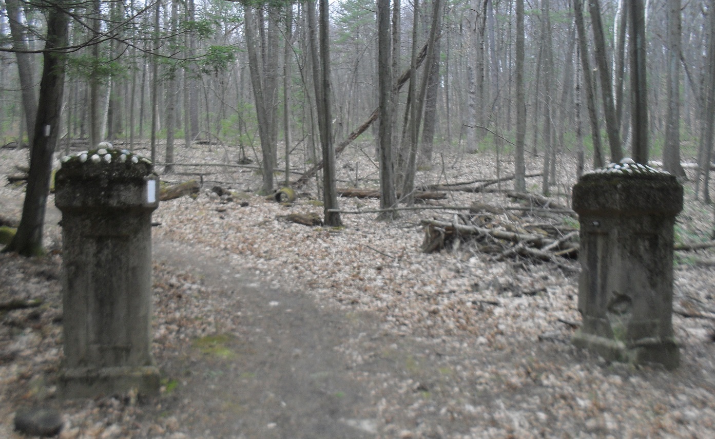
13 – Albert Steiger Road
Notice the modern Wyckoff Golf Course. The stream coming out of the golf course is Roaring Brook. This is the stream that forms Whiting Street Reservoir. It starts near Jarvis Avenue and feeds most of the water entering the reservoir. The road leading south is the Albert Steiger Road. (LOCATION) It was built in 1931 and gave the HWW a road with easy curves and winding grades.
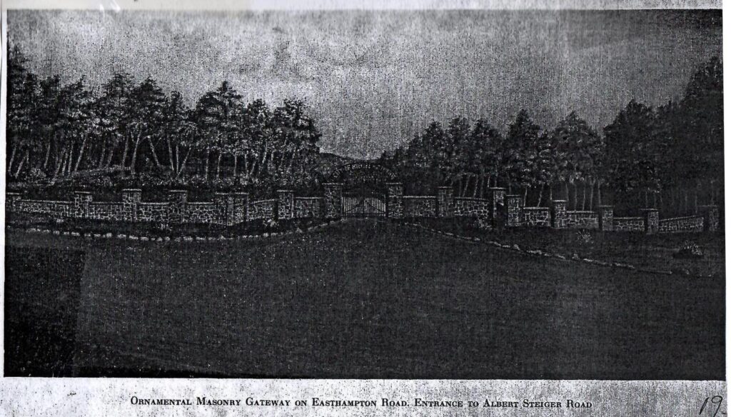
Albert Steiger deeded the land that the road is on to the Holyoke Water Works in 1929. The road was improved with side gutters in 1938 plus a resurfacing of the road with trap rock dust. However, during the Hurricane of 1938 the road and gutters were destroyed. Thus in 1939 and 1940 this road was repaired and expanded. This road meets Easthampton Road in three fourths of a mile. Just beyond that crossing is the Old Easthampton Road. There is a long ornate masonry gateway at this old road. This gate that is still there was built in 1937 as a WPA Works Progress Administration Project. PICTURES of GATE.
In the spring of 1953, the highway was rerouted and the gate became obsolete. There was talk of building a new one but it never happened.
The brook 100 yards north of this road is the Roaring Brook that feeds the reservoir. The bridge over it was replaced in 1962.
14 – Mount Tom Golf Course
This is the entrance to the old Mount Tom Golf Course. (LOCATION) The course was six holes in 1898 and then nine holes. Before 1922 it changed to 18 holes. Donald Ross changed the course in 1922 to a new arrangement. A two lane road passed from here to Northampton Street. The dirt roadway was the transport axis of the course. Also golfers from Easthampton could come from Sheldon Avenue to the course via the reservoir.
In the 1930s it was renamed to Wyckoff Golf Course. The course changed drastically in 1964 when the interstate was made to pass through it. To help the golf course to continue to exist, the Holyoke Water Works on August 24 1964 sold land at low cost to the golf course. The land on the eastern side of the highway was converted into homes as part of the Wyckoff Park.
There had been service to the homes in Wyckoff Park area earlier than the 1960s and they were fed by water pumped from Whiting Street Reservoir. At first the pump was privately owned by Trustees of the Mount Tom Realty Company. This was taken over by the HWW in July of 1935.
14a – Golf Course Trail
About 300 yards south of that golf course dirt road was the old trail from the country club. It is hard to find but use the map at the top of the page to locate it.
15 – Spillway
The spillway is only for the overflow of water. (LOCATION) It enters over the small dam and is channeled until it meets the water coming from the control house. The spillway is 78 feet from the south end of the dam. The first spillway was 16 feet and 8 inches and was 2 feet 6 inches in height. A second spillway was added to that one.
October 18-19 1955 Holyoke experienced the greatest rainstorm that has ever hit New England. 19 inches of rain fell on this part of the city within 24 hours. This was the rain from Hurricane Diane that had come up the Hudson River and then passed over the mountains of Western and Central Massachusetts. Holyoke Water Works feared that the dam would collapse during the height of the rain. It activated an emergency pipe (12-inch diameter) that is still visible in the berm of the dam (about 40 feet from this spillway). This led to Hastings Brook and then to a larger pipe (36-inch pipe) that parallels the entrance roadway. This pipe once led all water from the spillway, the emergency pipe, and from Hastings Brook 488 feet downhill into the concrete structure at the intersection with Roaring Brook. However, the Lower Intake Reservoir was overwhelmed and a flood of water cascaded down Whiting Street Road to Northampton Street. The intersection there was destroyed.
Holyoke Reservoir System after the 1955 Hurricane
About 50 feet south of the spillway is an emergency road that was put in place in 1939. This gave workers another access road from the Intake Reservoir area to the spillway area. This spillway is to be fixed in the year 2022. It will have a 1000 year floor spillway put in.
16 – Control House
The control house (LOCATION) has water pipes deep underneath it.
The pipe is even lower than the roadway below you. The view is beautiful in front of you but the important job of providing drinking water is done beneath your feet. The grass and dirt berm was added from 1929 to 1931. It was destroyed by Hurricane Diane. It was repaired the same way as in 1931 by draining the water and scooping out the dirt.
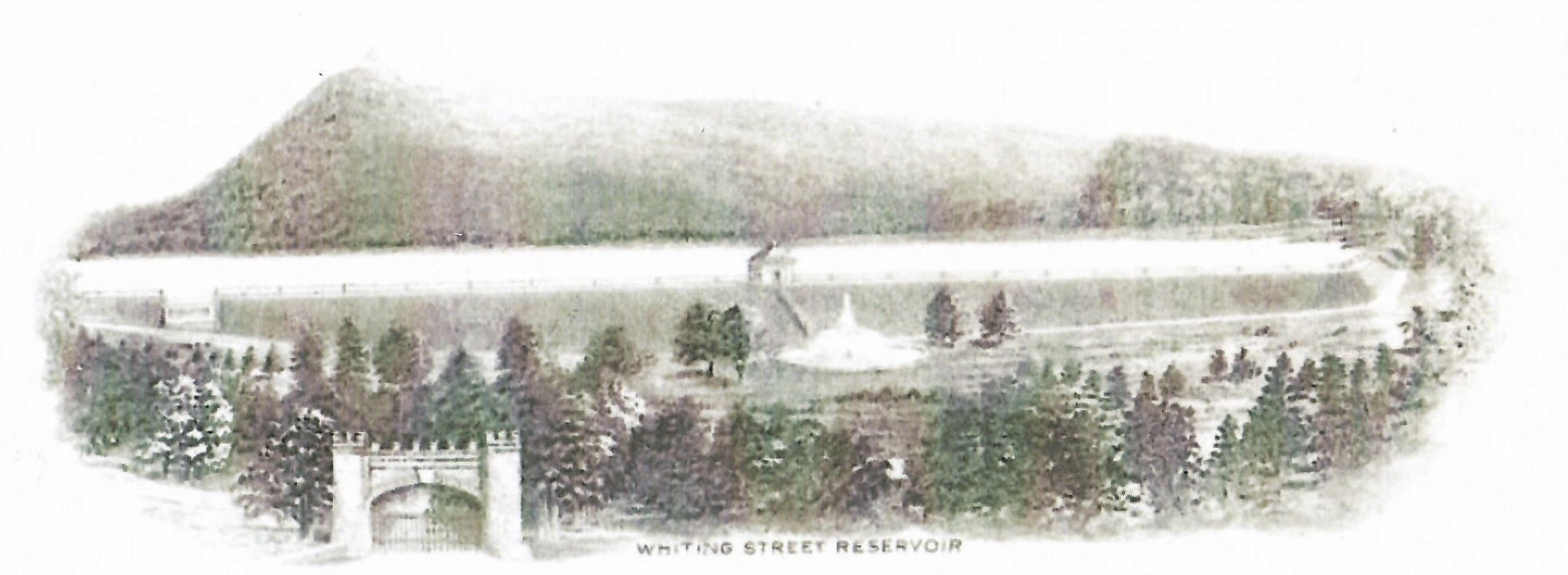
17 – The Reservoir and the Dam
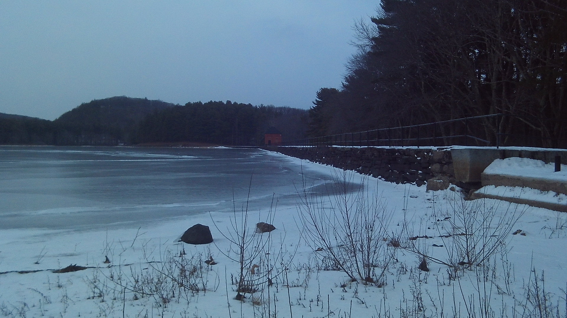
The dam is 1773 feet long, 21 feet high, and is made of sandstone and Rosendale grouted cement. The dam is made of 12 thousand perch of stone. It rests on bedrock but with some gravel. The reservoir has half a billion gallons of water and covers 114 acres. Its watershed is 1.5 square miles.
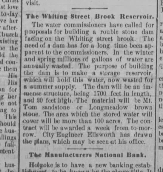
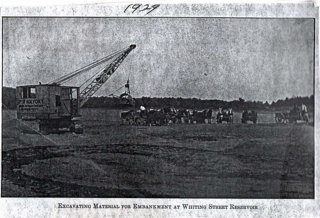
The land for the reservoir was taken in 1884. (LOCATION) The land was in Northampton but the City of Holyoke took the land from the heirs of the Whiting Street family. This family was not happy so they started a court case – Land of Whiting Street Brook v. Estate of Whiting Street. There was also an injunction against claims on Easthampton Road. All was settled in 1889. To dam a brook you also need permission and so by 1888 the Holyoke Water Works had permission from the County Commissioners for Hampshire County. Any land after that was slowly purchased by the Water Works.
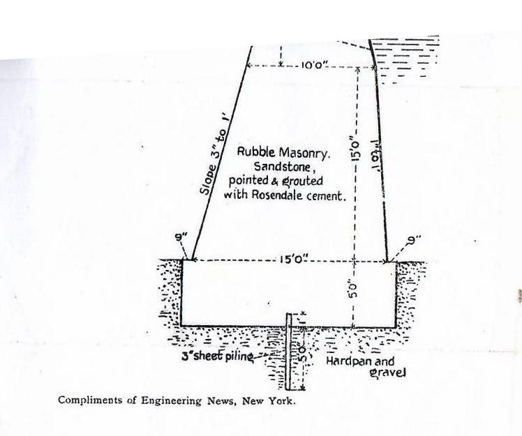
In 1887 the year before the dam was started the estimated cost of the dam was 60 thousand dollars with a height of 23 feet and length of 1850 feet. The Delaney Brothers built the Whiting Street Dam.
For the most part, the waters have been kept clean. The trees were removed from the pasture that formed this reservoir but the stumps were left behind.
There was a bacteria scare on 2 May 1944 at the reservoir and the brook. Scum was found on the water. The water was tested to determine the cause but the result was inconclusive (12 May 1944). Copper sulfate was put into the water to kill the bacteria. On Jarvis Avenue there are two dumps both alongside the western edge of that road – one of those dumps was still being used (since 1939). The Roaring Brook goes by that site so membranes have been used to separate the dumps from the brook. These membrane dikes were put up in 1944 and 1945. These worked very well where other attempts had failed so much so that in 1945 the reservoir is chemically clean. Also water near the dumps was collected in drainage ditches from an area in the hills west of the damps. Then the ditches lead to the north. Constructed was 250 feet of ditch and 40 feet of 18 foot culvert. Lastly, a duck pond and a swamp along Jarvis were filled in. These improved drainage schemes helped 50 acres of the watershed of the Roaring Brook from being polluted.
Since 1907, Whiting Street Reservoir serves both a high service and a low service domain of Holyoke. It does this by the position of the pipes. It served the Highlands (from Dwight Street over to the north) as a high service and the Downtown as a low. In 1902 the dam had its one and only leak but it was quickly filled in with gravel. Starting in 1912 a new pipeline was put in leading to Smith’s Ferry. In April 1913 the reservoir finally feed water to Smith’s Ferry. This was a promise that the city had made to the neighborhood since before its annexation of Smiths Ferry. The city now provided all services to the neighborhood.
The reservoir area is beautiful and so enjoy your stay.
Fun facts:

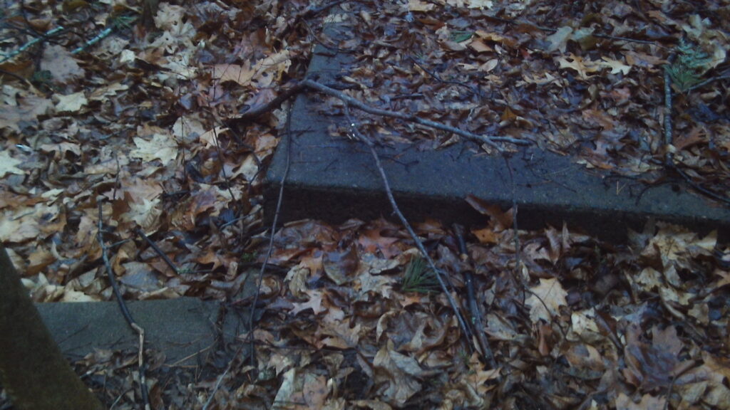
There are dinosaur footprints on one of the last flagstones to the north on the top of the dam.
Fishing was allowed in the reservoir in 1946 and 1947. For this reason and more the reservoir was considered to be a recreational center.
Rainfall amount at Whiting Street Reservoir.
Height of the water at the dam
In 1986 a turbidity problem in the surface water hit the reservoir that forced it to close soon after (in 1989). The Holyoke Water Works would have had to filter the sand and that is expensive.
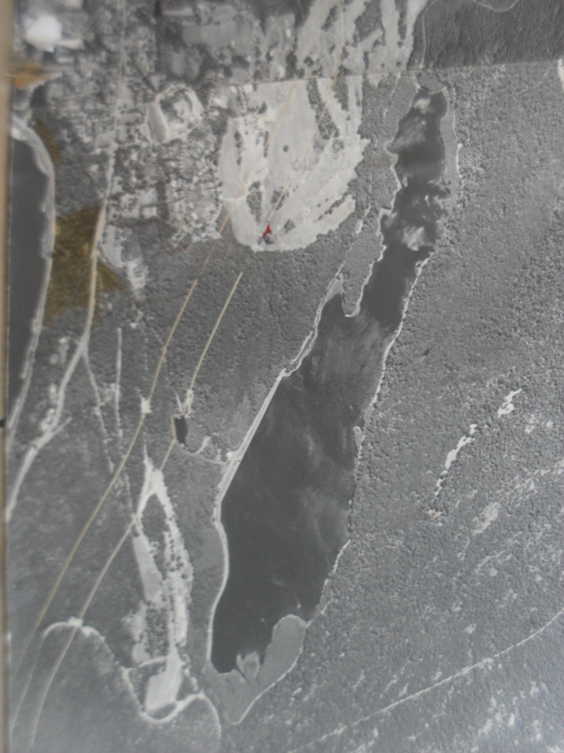
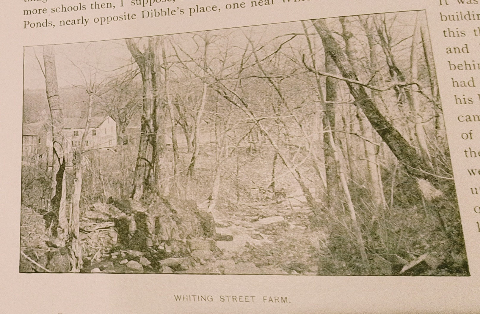
Sanborn map analysis:
Side trip:
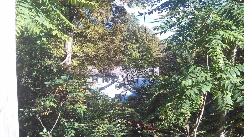
The Whiting Street home is down Brookwood Road.
Also the end of Roaring Brook is down that road and also appears at the edge of the Mountain Park old gate.

Thanks for going on this wonderful trek around the Whiting Street Reservoir.