

- This is also part of the South Hadley Heritage tour. Navigate back to the tour page HERE.
- Bridges of Holyoke
- Private GROUP TOUR (COSTS) is two hours long for this Vietnam Veterans Bridge and Neighborhood walking tour. Also a one hour indoor presentation can be given.
- A free public tour comes up every year.
- A self-tour is available for anyone using the maps and text seen below. – LOCATION
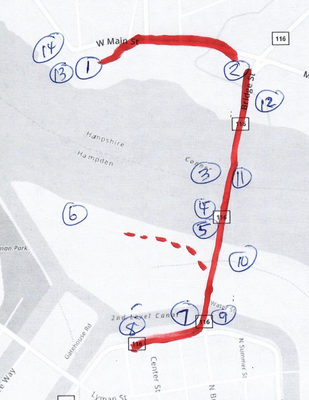

Stop 1 – Lower Riverside Park
Great views are had at this point so from May 1 to September 30 descend to the riverside and also get a good look at the South Hadley Canal lock system. The link brings you to the information about this park system.
An hourlong addition to this tour is the route of the South Hadley Canal. Read about it at this LINK.
Stop 2 – South Hadley Falls
The northwest corner of this intersection was the location of the trolley barn for the horse driven trolleys. This was the first trolley barn for the Holyoke Street Railway. The second is near the corner of Lyman and Canal Streets. The third is still there at North Bridge Street.
Stop 3 – Bridge and View of Dam
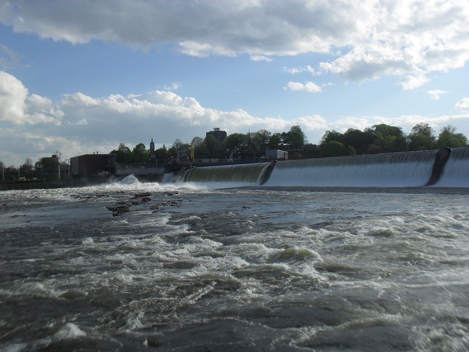
The Holyoke Dam was made in 1849 of wood. It is still in location but is now submerged. The masonry dam was put in place in 1900. The outer stones were quarried in Vinalhaven Maine but the inner ones were quarried from a site a mile downstream from here. The dam is both deflection dam for the Holyoke Canal System and also a power dam. The land below you is an artificial island.
Bald eagles are easy to find around this area. Peregrine falcons are here too. Great blue herons come here during the day to feed but return inland to overnight.
Up river in Northampton and at the marina area near the Mt Holyoke Boathouse, the Puritan Tiger Beetle is found along the sandy southern shorelines.
Stop 4 – Holyoke and Shad Park
There is a fishing location below the southern end of the bridge. It is as of a few years ago handicap accessible.
Stop 5 – Channel
The turbine channel was dug out of bedrock in 1952 parallel to the Connecticut River. It had to be made deep in order to allow the water from the turbines to flow.
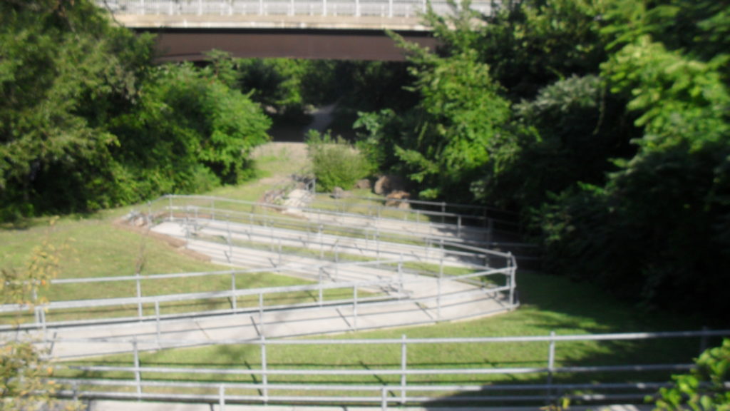
Stop 6 – Fish Lift

Wonderful views are had from any location along the road along the channel. The fish is opened only 6 weeks out of the year and the road to it is locked except for those times that the lift is open. Read about the aquatic life in this area at this LINK.
Stop 7 – Holyoke Canal System

The Holyoke Canal System is vast but you get a good look at the Second Level Canal by looking west from this small bridge. The link for this stop 7 is for the entire canal system. This is in order to give you a better idea of the vastness of the canal system.
Stop 8 – Hadley Workers Housing and Hadley Mill
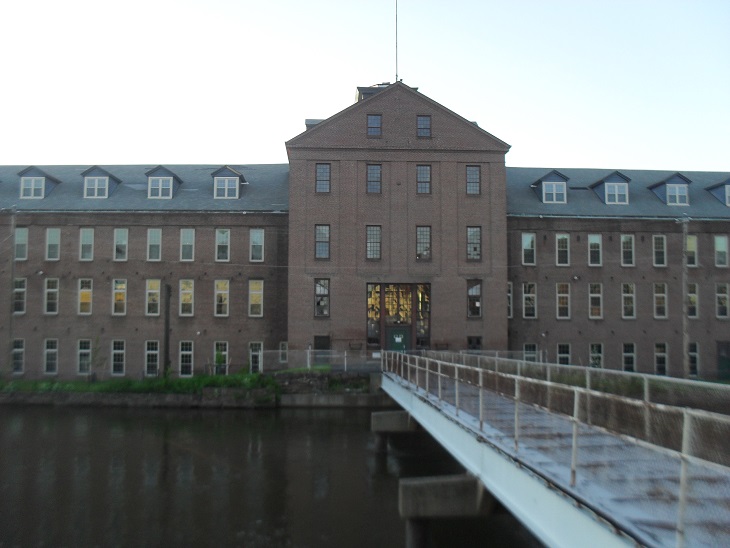
Also at this stop besides the mill and homes is the trolley barns. At the western bend of Canal Street is the second of the Holyoke trolley barns and still there at the junction of Canal and North Bridge Streets is the third trolley barn.
You can read more at the link above for this stop but also there is an expanded tour of the Flats section of Holyoke and you can read more at this LINK.
stop 8A – Holyoke Water Power Park
In the canal at this point is a large wooden crib made to house the yellow lampshade mussel. They only need the crib when the canals are drained twice a year. They enter the crib when they sense the ebbing of the water and stay there for a couple of days.
stop 9 – Holyoke Canal System
This second look at the Second Level Canal is toward the east. There once was 6 paper mills in a row here but now only the Valley Paper Mill is left.
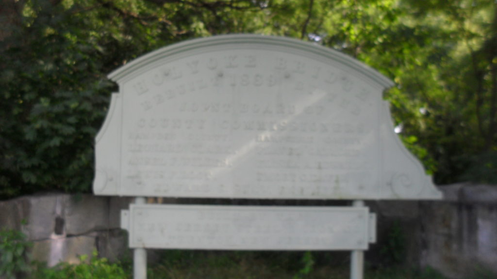
Stop 10 – County Bridge

The previous bridge was the County Bridge. It existed in two forms from 1873 to 1990. First was a wooden bridge from 1873 to 1888 and then a metal bridge. This was replaced in 1990 by the modern bridge.
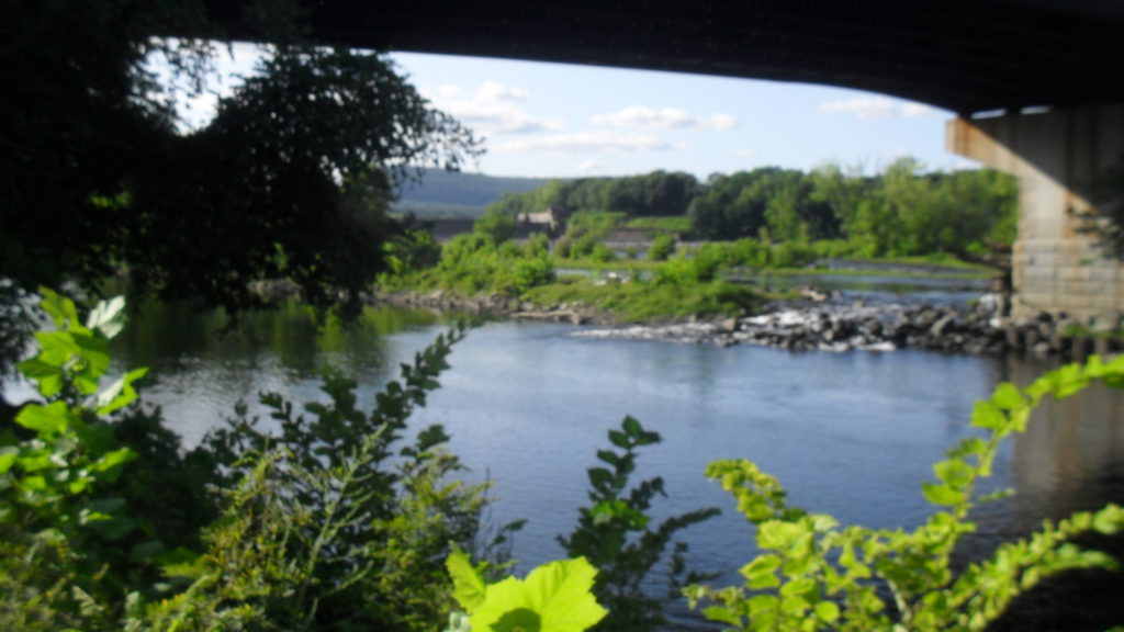
Stop 11 – Bridge and View of Connecticut River
As the water flows south, it enters Chicopee and then continues its journey to the Atlantic Ocean at Long Island Sound. The next bridge that you met is the Willimantic Bridge in Chicopee. Below you on the South Hadley side is a brook called the Buttery Brook.
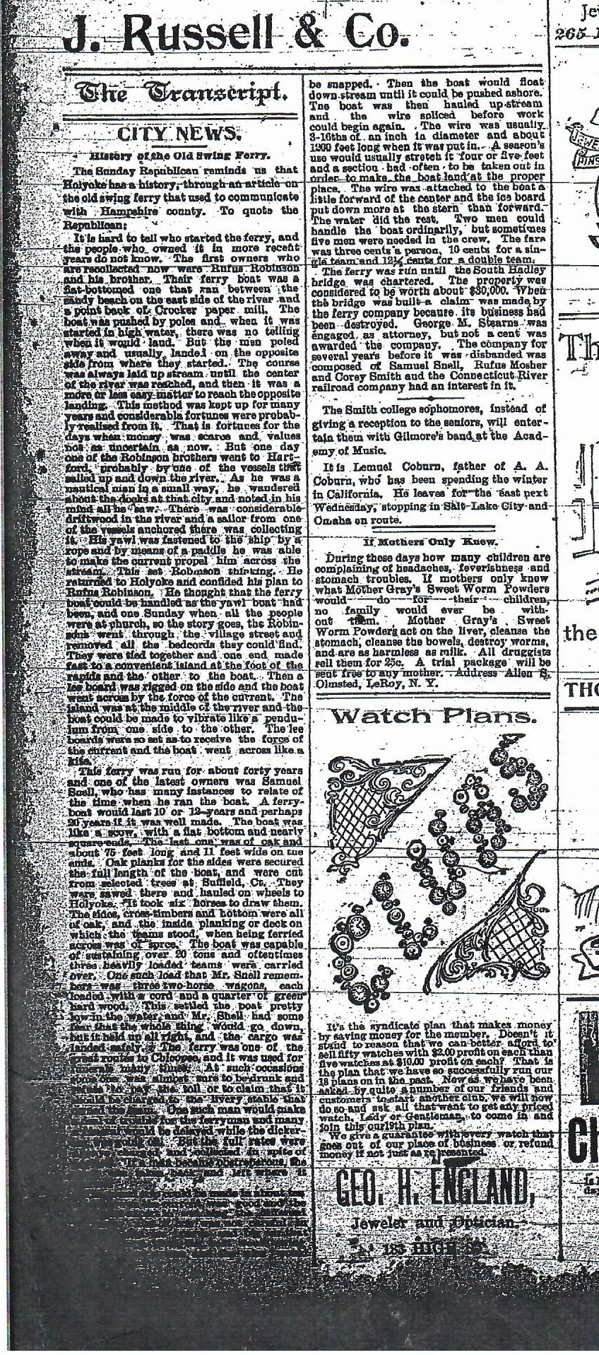
The Robinson swing ferry would run from the bend in the river at this point.
Stop 12 – South Hadley Falls (part B)
Saint Patrick’s Church in South Hadley is now in its third rendition. The last two are at this location but the first in at the corner of Crescent and North Main Street. It was a mission church of Saint Jerome Church of Holyoke.
Just pass the Beachgrounds is the cemetery. Read about it here.
Stop 13 – Texon Park
Enter from the parking lot of the South Hadley Public Library. First descend to the riverbank to look at the dam from afar. Then walk back up and walk west toward the dam. There is a lookout here that allows for close views of the dam.
Stop 14 – Gatehouse Park
The Gatehouse Park area is only open for special visits. To catch a similar view go to the South Hadley Public Library upper park to its northwest. At the back of this park the two gatehouses will be seen.