
Saint Mary of the Assumption Church is located in the Willimansett neighborhood of Chicopee. It was dedicated May 18 1941. It lies on Davitt land.
Category: Uncategorized
Holyoke Richardsonian Train Station
Holyoke Richardsonian Train Station is bounded by Lyman, Bower, Mosher, and Canal Streets. This is an outside sidewalk tour.
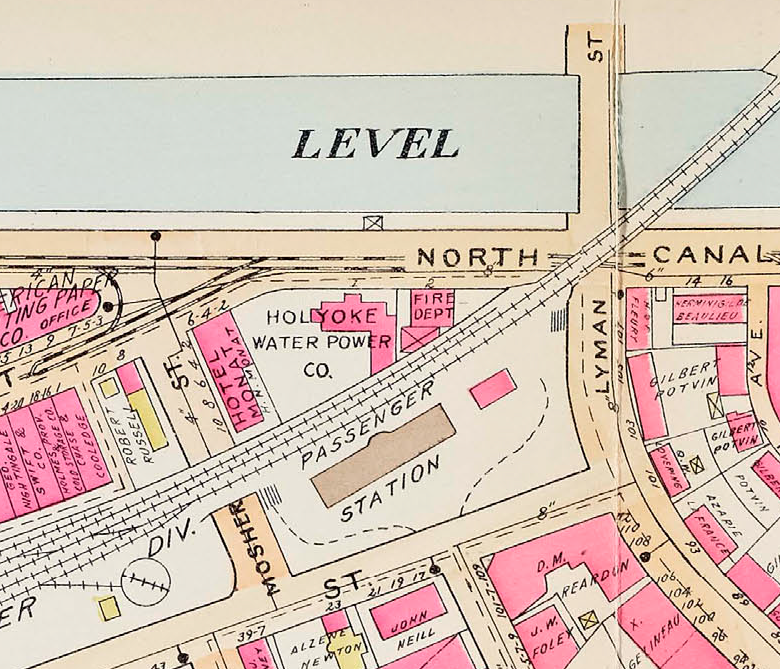
Connecticut River Railroad Passenger Station was built in 1884 and finished in 1885. (The first day of use was February 1 1885.) Henry Hobson Richardson designed this station. The station is 154 feet long and 38 feet wide. The overhang of the porch is 15.5 feet. The outdoor pillars are of yellow pine. The dark brown trim in the architecture is of Longmeadow brownstone. The light masonry is of Milford granite. There is curbing around the perimeter of the grounds and this is up to 8 feet high at the maximum. It is cut from Dummerston Vermont granite.
Inside any wood finishing is of oak. The floors are pine. Any masonry trim plus the fountain is of Knoxville marble. The stairwells have oak balustrades.
As a passenger walked out of the train station toward Bowers Street they would have seen in the 1920s the Immaculate Conception Church in the distance down Ely Street. What a site that would have been! This walking tour brings you back to what life would have been like from 1885 to 1965 when this train station was active. It would have brought many immigrants into Holyoke. The station was surrounded by some very active streets.
Within the lot of the railroad station there is a Boston and Maine Railroad Express Office. It was built between 1896 to 1910 since it does not appear on the Sanborn map of 1895 but does appear on the 1911 Richards map.
stop 1 – Bowers Street
Of great interest is that the Three Star Theatre was across the street from the station. Read a little about it at the LINK. Also across Bowers Street was a line of stores and houses.
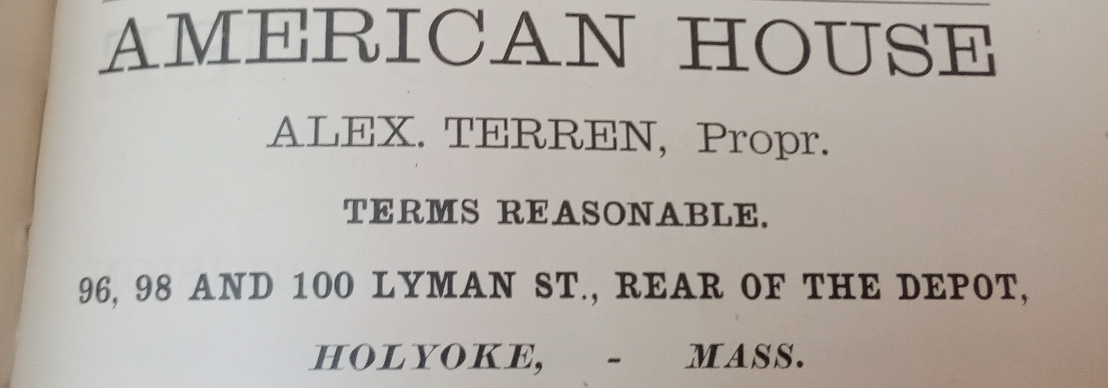
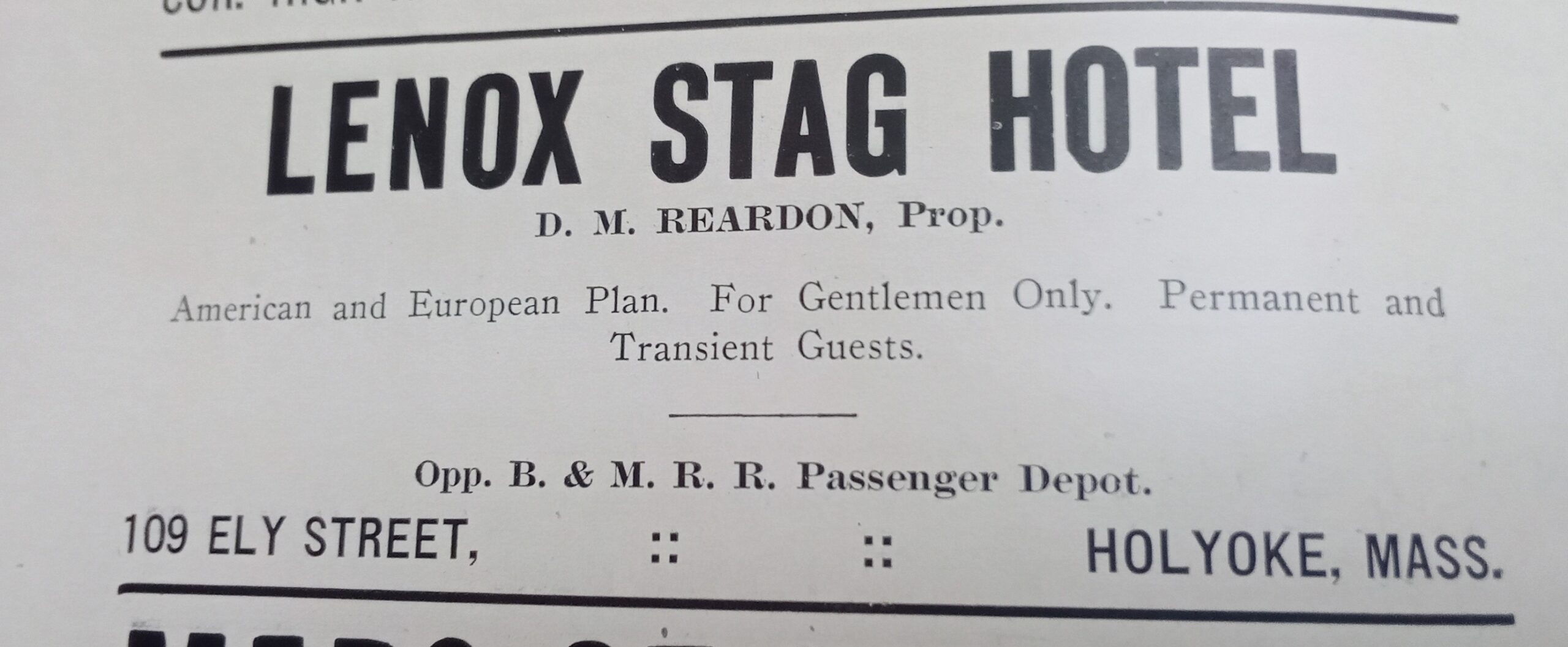
The American House was at the end of Bowers (officially at 96-98-100 Lyman Street) from at least 1887 to 1895 (in 1894 it was called the Daley Hotel). Alex Terren (Therrien) was the proprietor. The Lenox Stag Hotel was across the street for the entire block in at least the 1910s.
The most fascinating fact about the Bowers Street land is that when it was graded from 1868 to 1870 many Native American burials were found. Mosher and Bowers MAP.
stop 2 – Potvin Tenement Houses
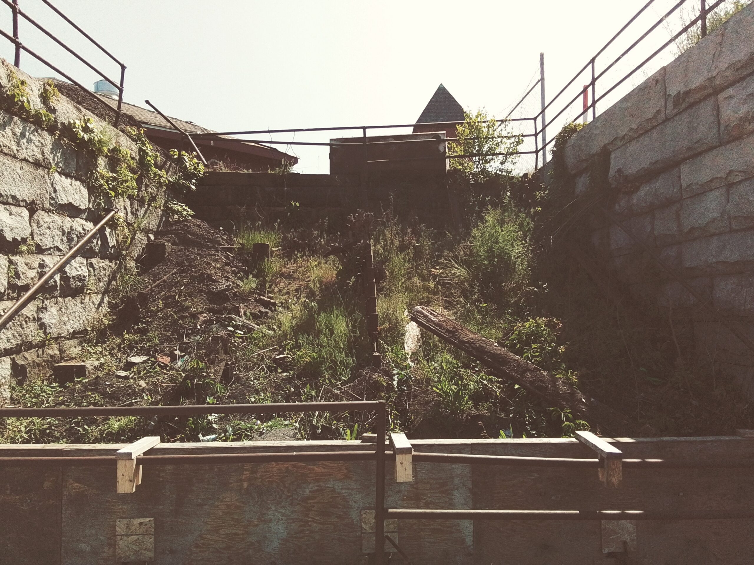
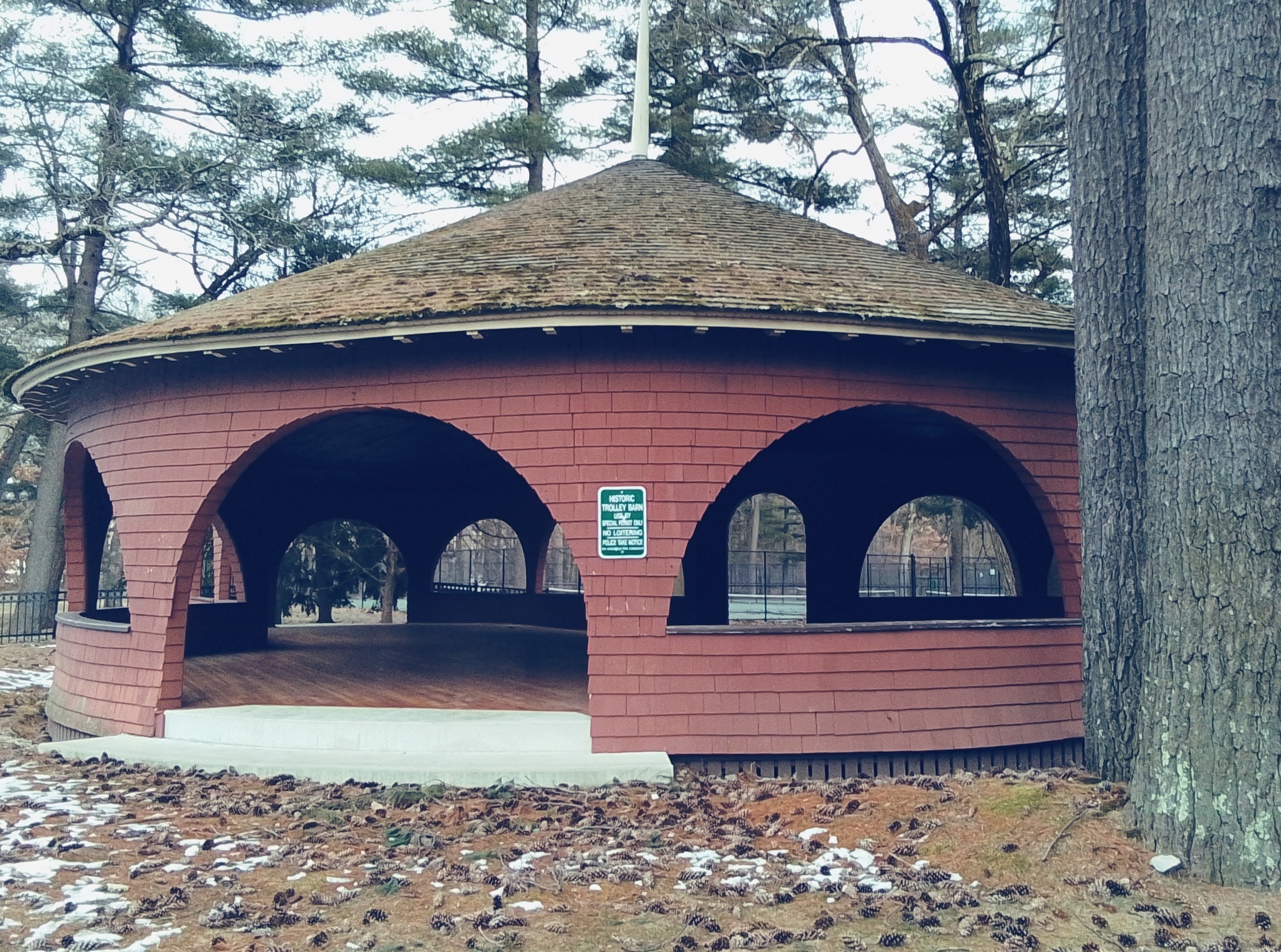
Across the station alongside Lyman Street many apartment buildings were constructed. Behind these structures there was a street that is not there any more called Potvin Street and then the 2nd of three trolley barns for the Holyoke Street Railway. TROLLEY
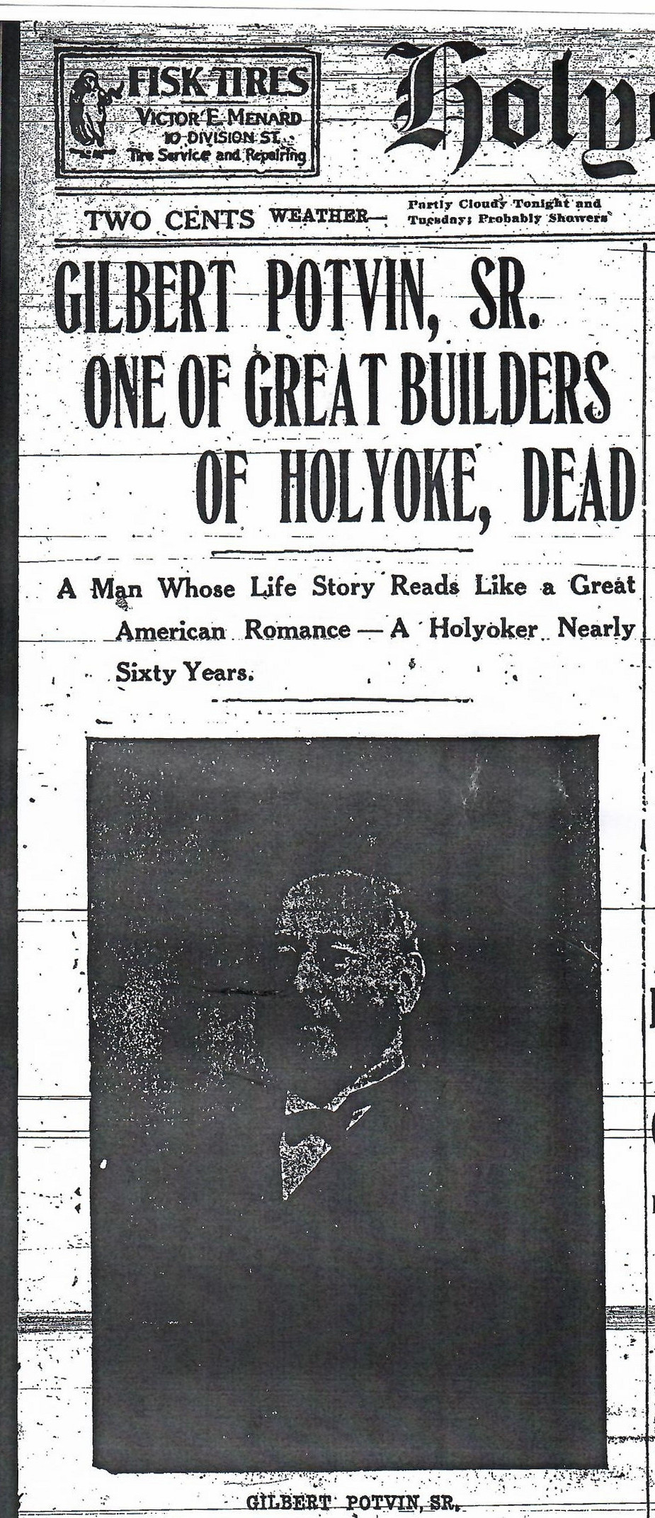
The tenement houses across Lyman were all built in the same style and by the same owner. Gilbert Potvin (FINDAGRAVE) had the Lynch Construction Company built 13 tenement houses along Lyman here and in a row onto the adjacent streets to form a long series. All were attached to the closest one by an elevated walkway on each floor. These wooden walkways lasted from the construction in 1880 until at least 1895. (They were on three Sanborn maps but not that in 1915 – at that point windows are in their place) Each building was 4 stories high and had the same dimensions.
stop 3 – Connecticut River Line Railroad Bridge

You can see the Connecticut River Line Railroad Bridge built in 1927 and completed in 1928. In the distance to the northwest is the Whiting Paper Mill and the Boatlock Station.
stop 4 – Juncture of North Canal and Main Streets
Now on to Canal Street and the Second Level Canal. The Lyman Mill dominates this section of Canal Street. You can read a great deal about the Second Level Canal at this LINK.
On the eastern side of Canal Street there was in order left to right a fire station, the Holyoke Water Power Company, and the Second Baptist Church.
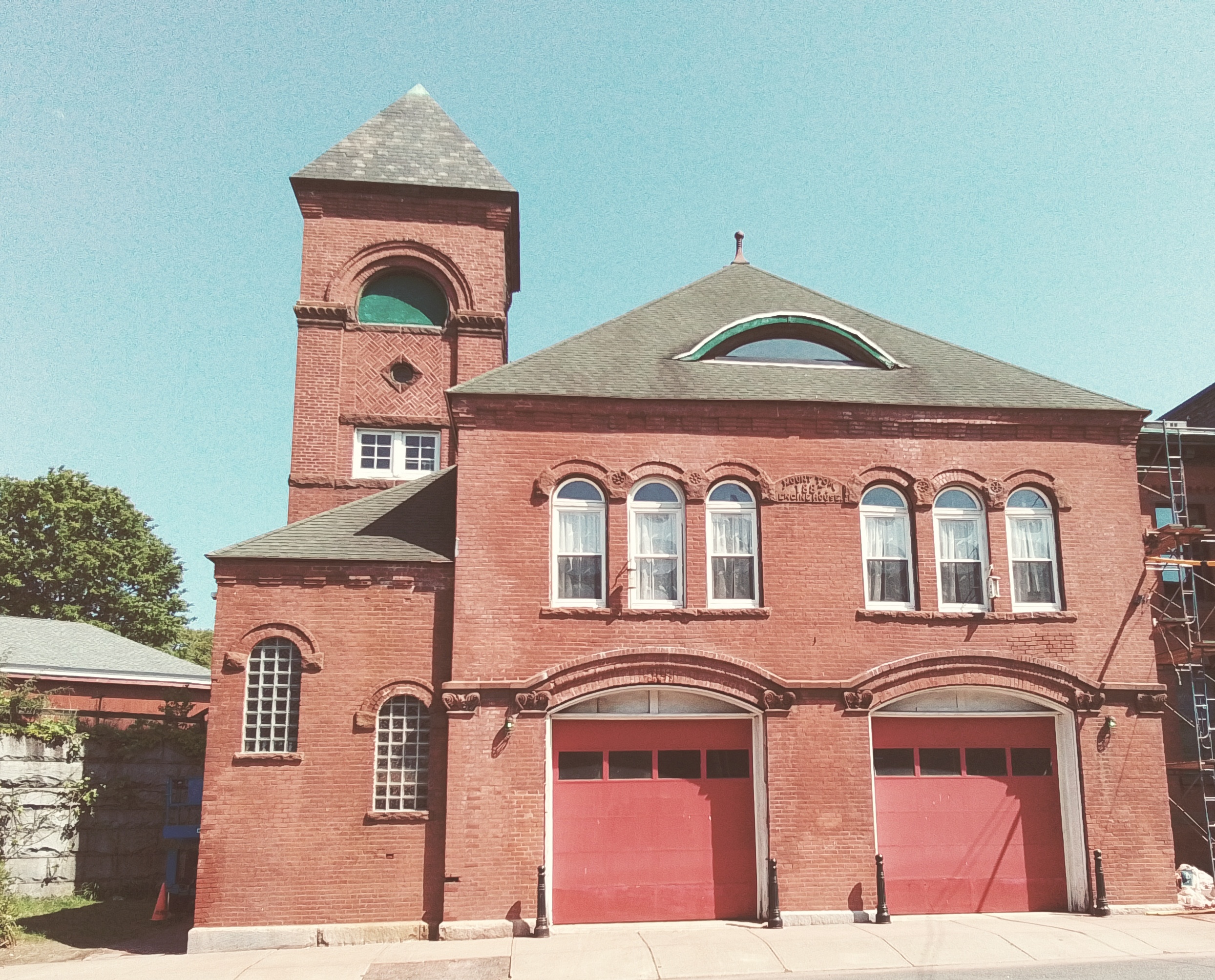
The Mount Tom Fire Station is first in this series.

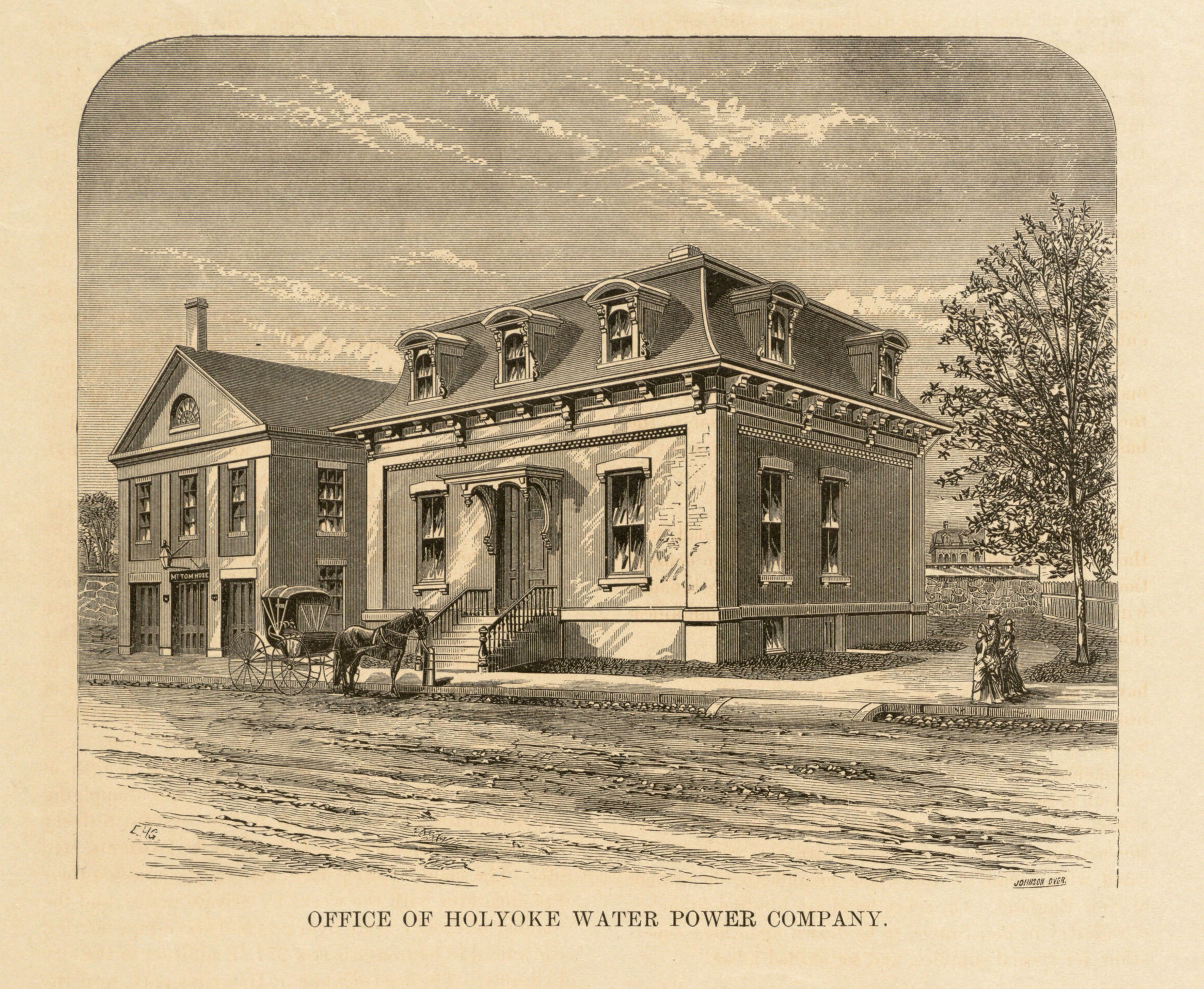
The administration building of the Holyoke Water Power Company is on this city block of Canal Street. It was built in 1871 as a Second Empire style building. In the early 1880s the French roof was raised off of the 1 story building and a second floor added. In the late 1880s a side and back addition were made.
The Second Baptist Church was built here in 1855 as a meeting house. In 1863 a fire destroyed the meeting house. In the new church, exterior was clad in brick and the steeple was 50 feet high. It was dedicated April 20 1865. Another Second Baptist Church was built on Appleton Street. The cornerstone was laid August 9 1884 and the church was dedicated October 20 1885. This Second Baptist Church at the juncture of Main and Canal was to remain part of the church system as a mission church.
The parish of the Holy Rosary Church met at the Second Baptist Church during 1886 and 1887. The Rosary Church was built on Mosher Street in 1888. The life of the Second Baptist Church at Main and Canal since by 1895 it had been removed. The church was removed in the 1880s or 1890s so that a building that faced onto Mosher Street could be expanded.
stop 5 – Hotel Monat
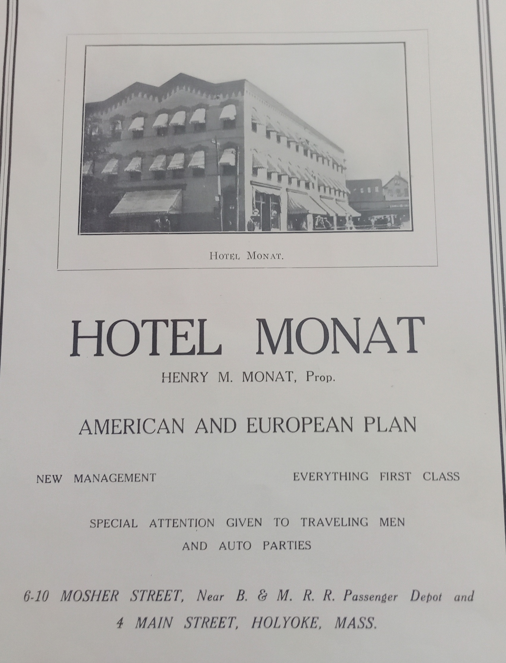
This building on Mosher Street was built in 1884. It was three floors high and had stores on the ground floor (fruit, barber, and a bar) and a chemical company on the second floor. By 1895 it now had a hotel on the upper stories and was called the Norris House. The Hotel Monat came into this building and expanded it backwards. By 1949 the Hotel Monat had two restaurants – 4 Main and 2 Mosher. The establishment was owned by Henry Monat.
Across the street from the Monat was the Robert Russell building. This area would become an auto repair shop in the 1910s with wood buildings and then masonry buildings. At the southwest corner of Mosher and Bower Streets, there was a railroad turntable.
Sanborn maps
1895 map A – map B – map C
1915 map A – map B – map C
1949 map A – map B – map C
1956 map A – map B – map C
Westfield
Holy Trinity Church
Canals
Crane Brothers Paper Mill Canal
Van Deusen Whip Mill Canal
Saint Mary’s Church Campus
Saint Marys Church Campus
Church – Bartlett Street
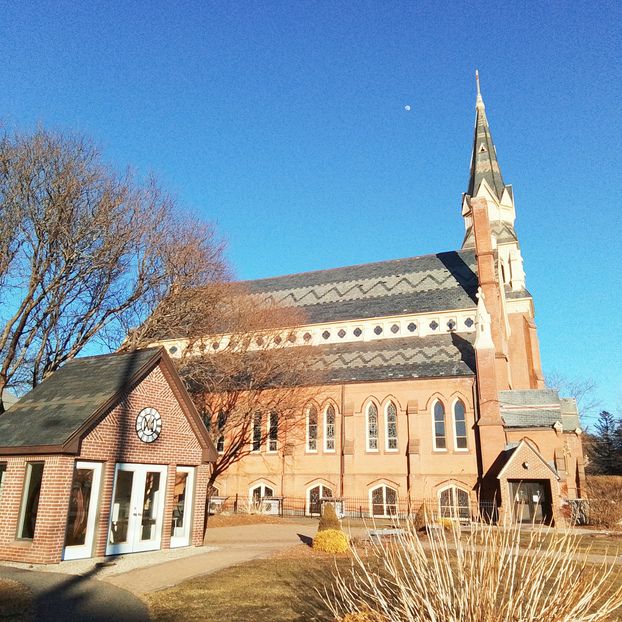
The second Saint Mary’s Church was made in 1885 as a neo-Gothic style. The first Saint Mary’s Church was opened in December 1854 and burned in 1881.
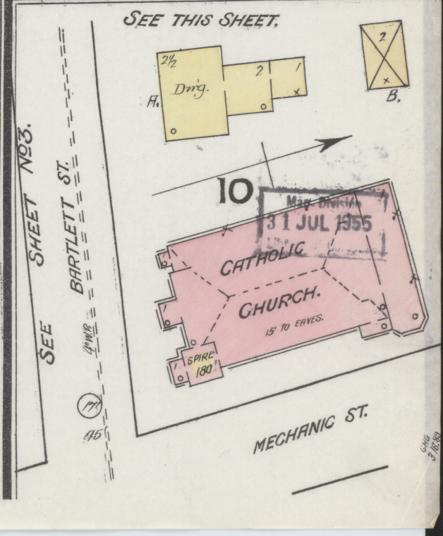
Sanborn 1889 map
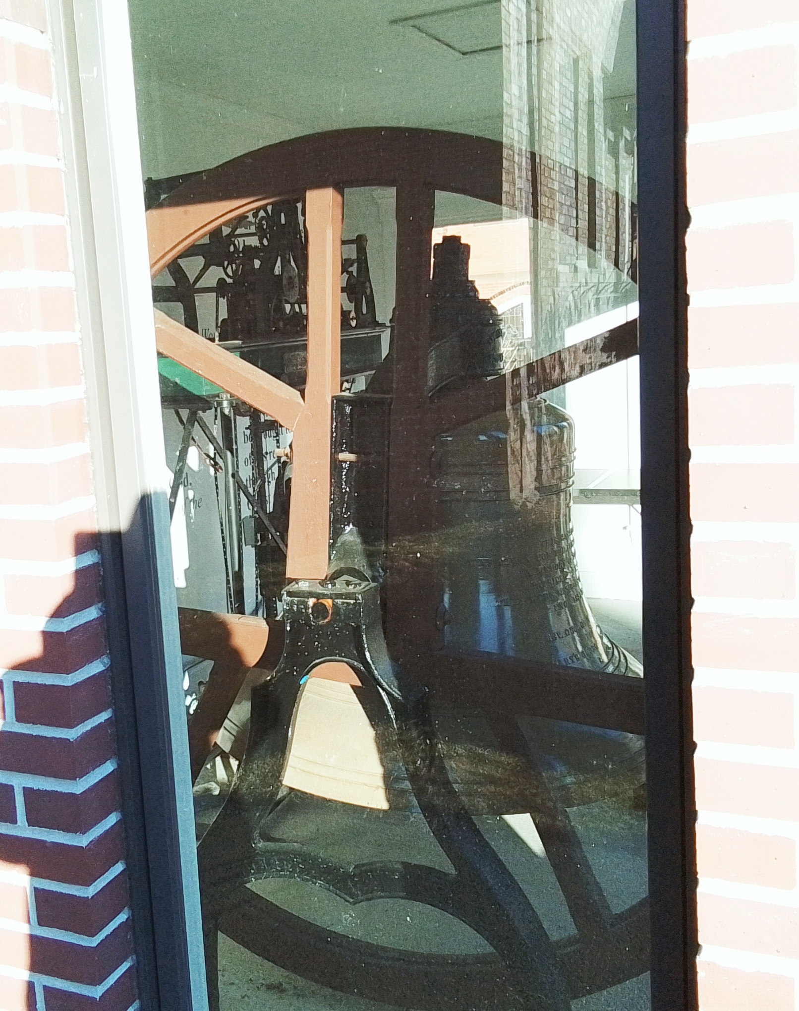
Saint Mary’s Churchbell
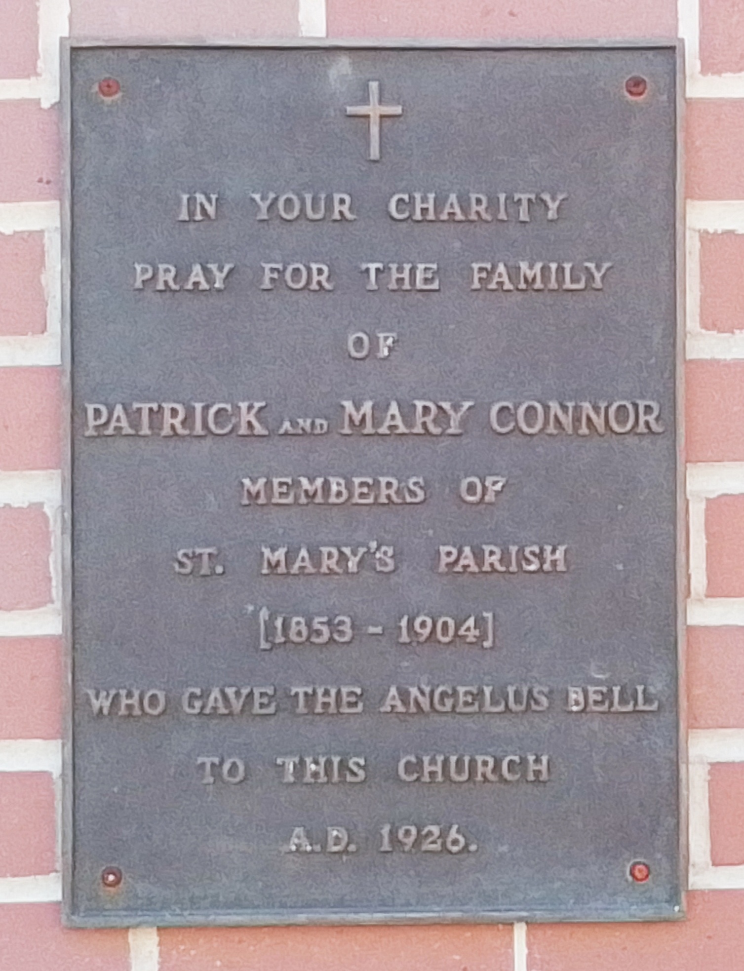
Patrick Connor – FINDAGRAVE
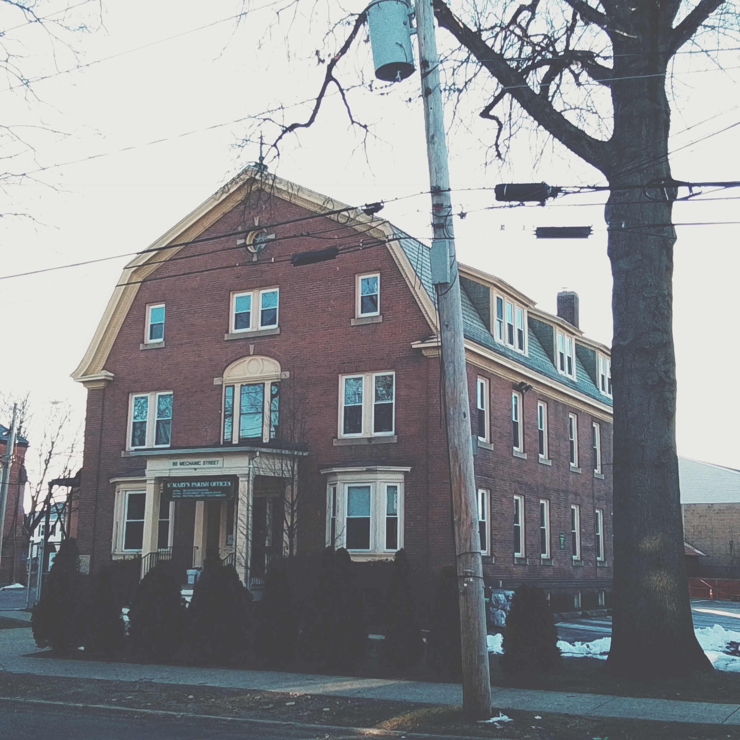
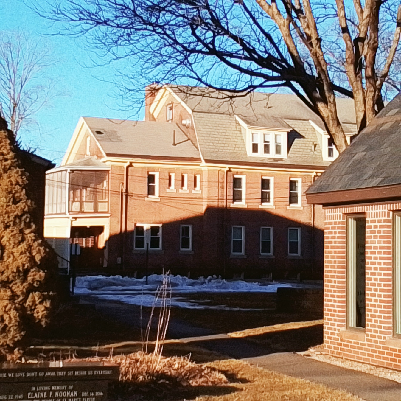
Convent – 86 Mechanics Street
Saint Mary’s Convent was made in 1909 in the Colonial Revival style.
Saint Mary’s Parish School – 35 Bartlett Street
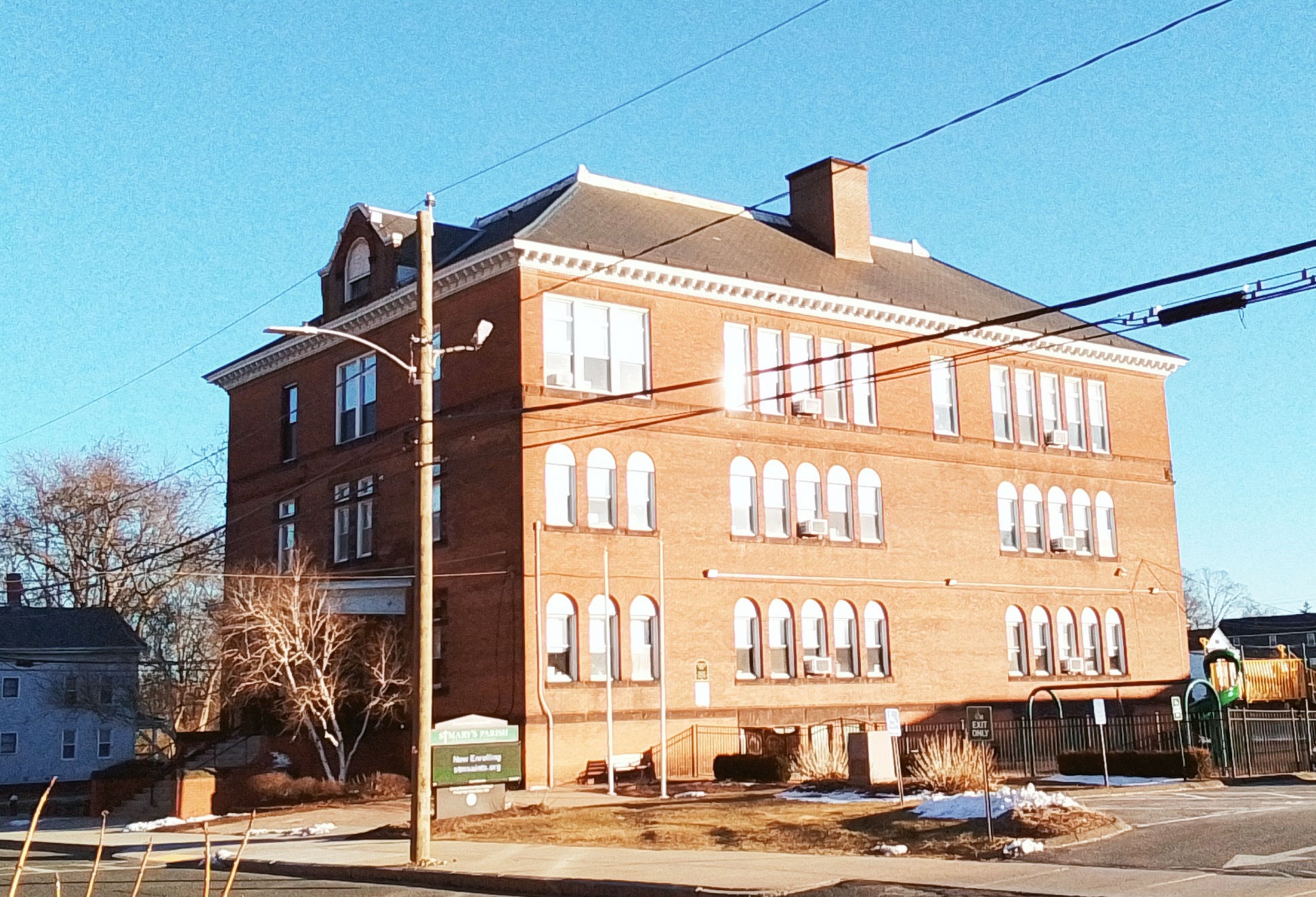
The school was constructed in 1898.
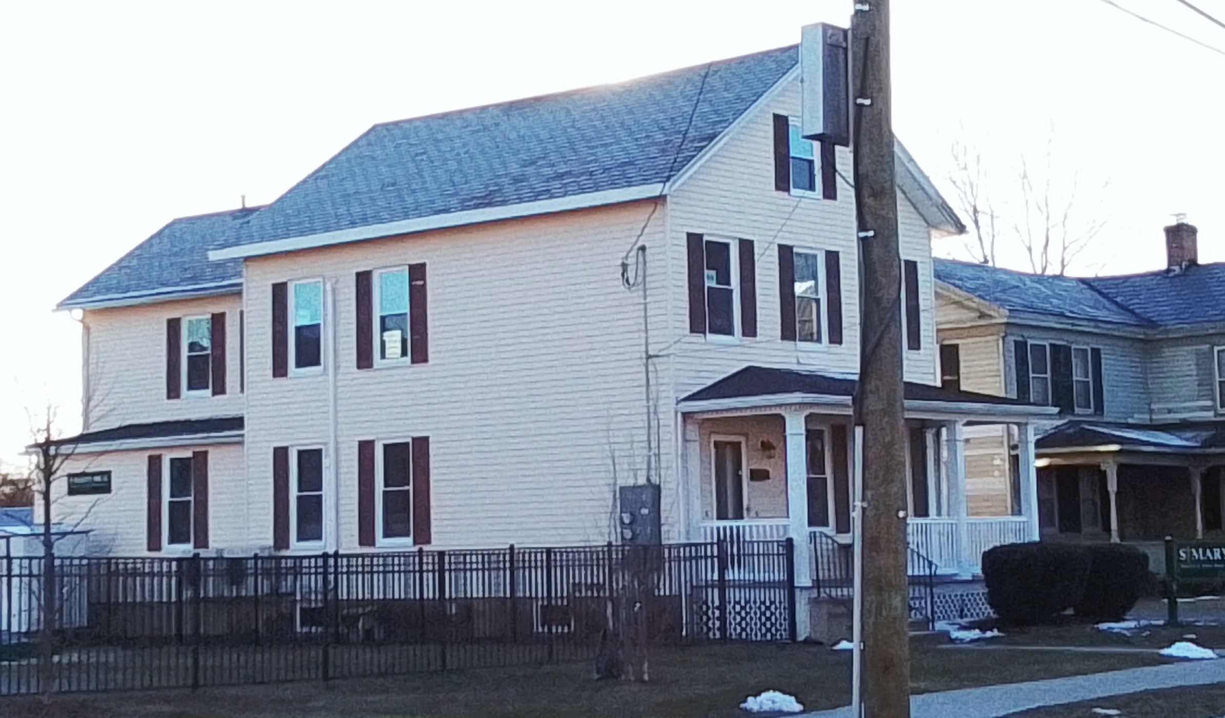
Parish House – 24 Bartlett Street
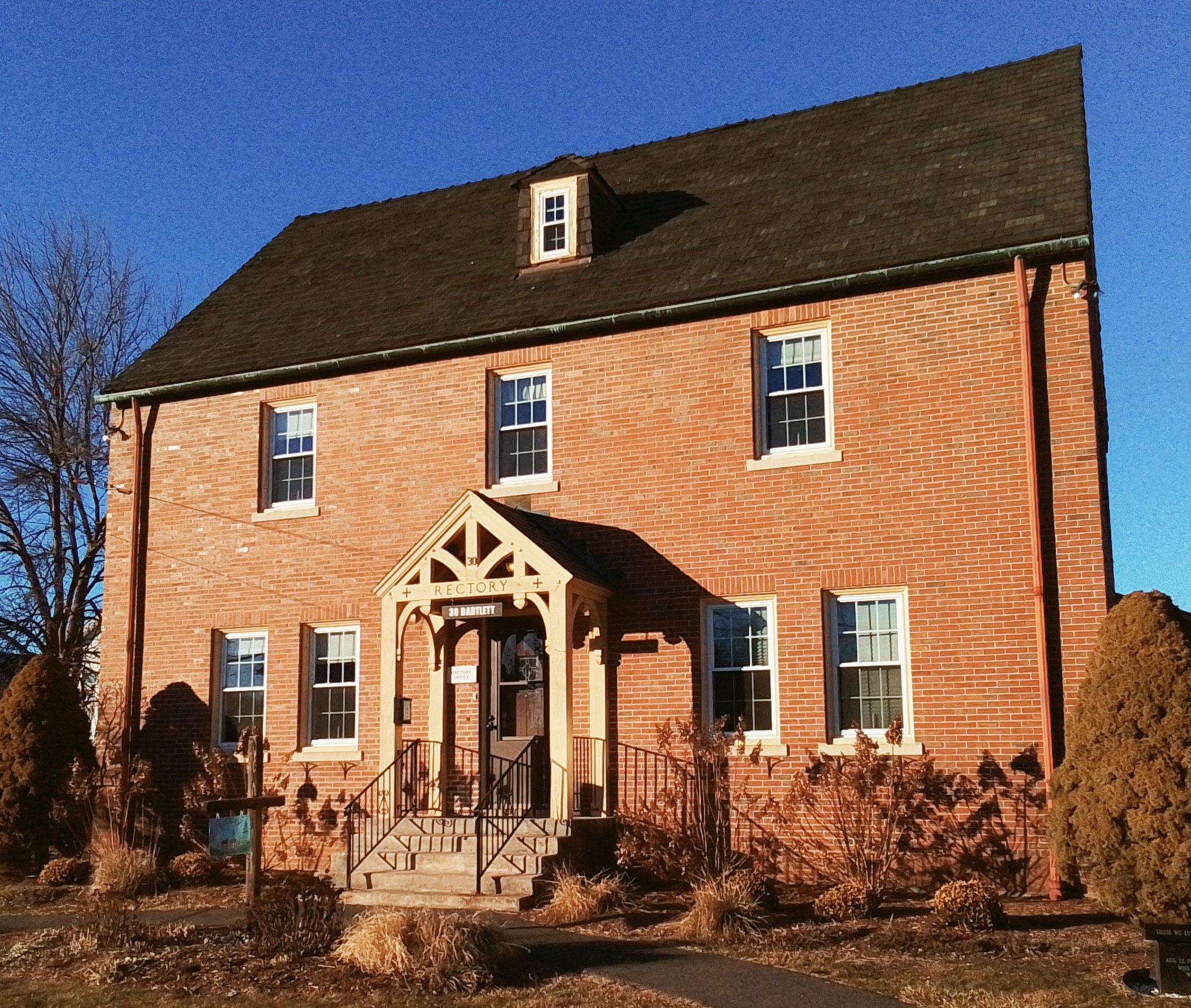
The Saint Mary’s Parish House was made about 1894.
Saint Mary’s High School – 27 Bartlett Street
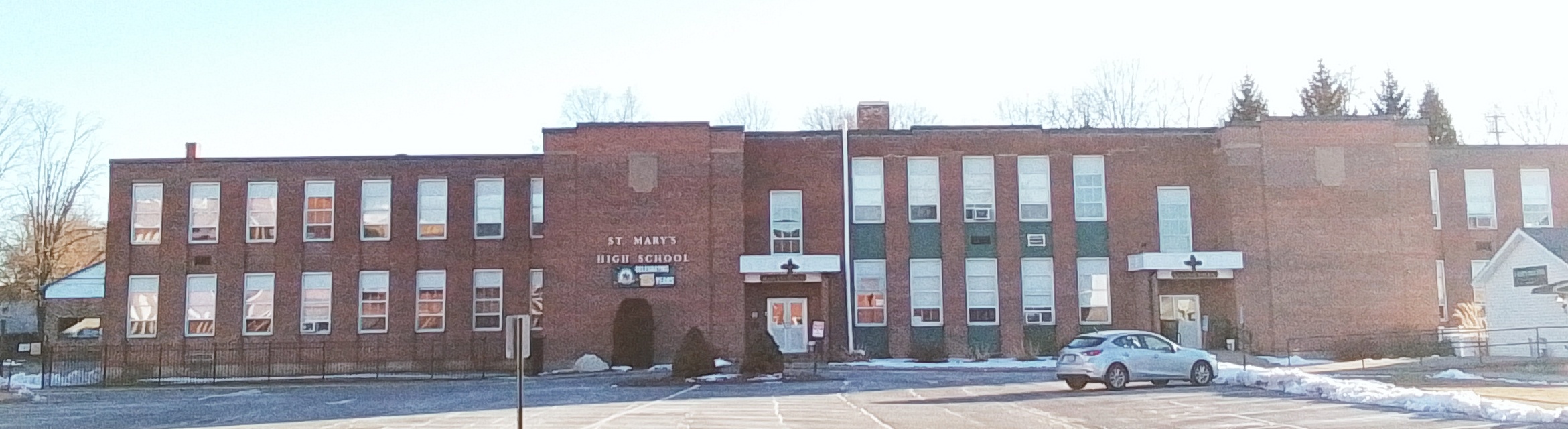
Saint Mary’s High School was made in 1922. This is the former Westfield Trade School. The parish purchased in 1963.
Saint Mary’s Preschool
Saint Mary’s Cemetery – LINK
The cemetery most likely opened in 1862.
PASTORS:
| pastor | start | end | FINDAGRAVE |
| M X Carroll | 1862 | FINDAGRAVE | |
| FINDAGRAVE | |||
| FINDAGRAVE | |||
| James Donohue | 1891 | 1908 | FINDAGRAVE |
| FINDAGRAVE | |||
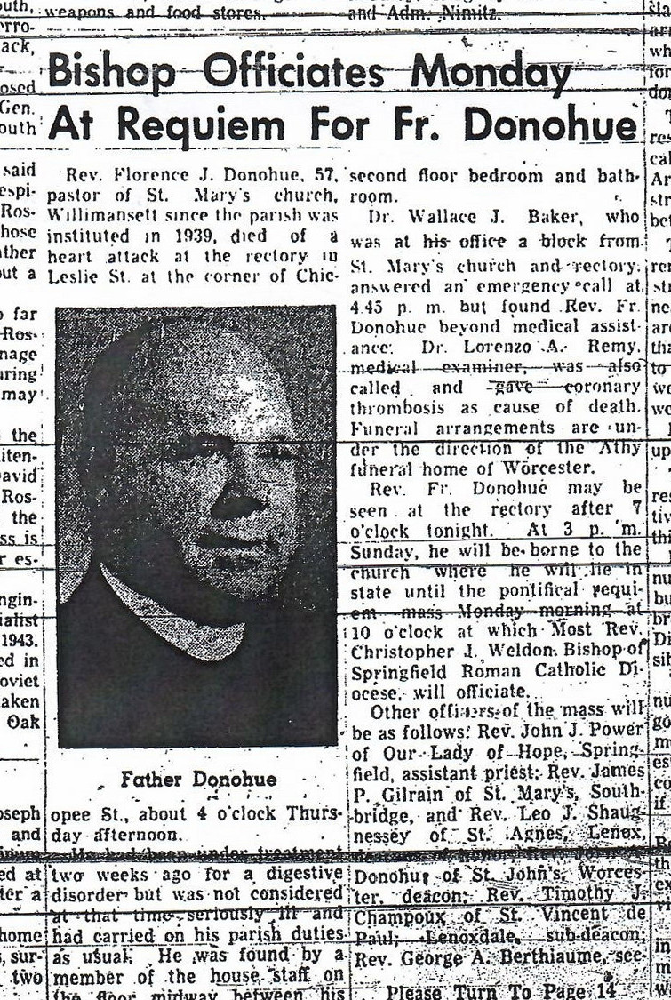
| Florence J Donohue | 1923 | 1939 | FINDAGRAVE |
| Patrick Dowd | 1946 | 1951 | FINDAGRAVE |
| FINDAGRAVE | |||
| George Shea | FINDAGRAVE | ||
| FINDAGRAVE | |||
| FINDAGRAVE | |||
Father Matthew Total Abstinence, Mutual, and Benevolent Society – 1892 – 14 Bartlett Street
Sanborn map
1884 hard to find
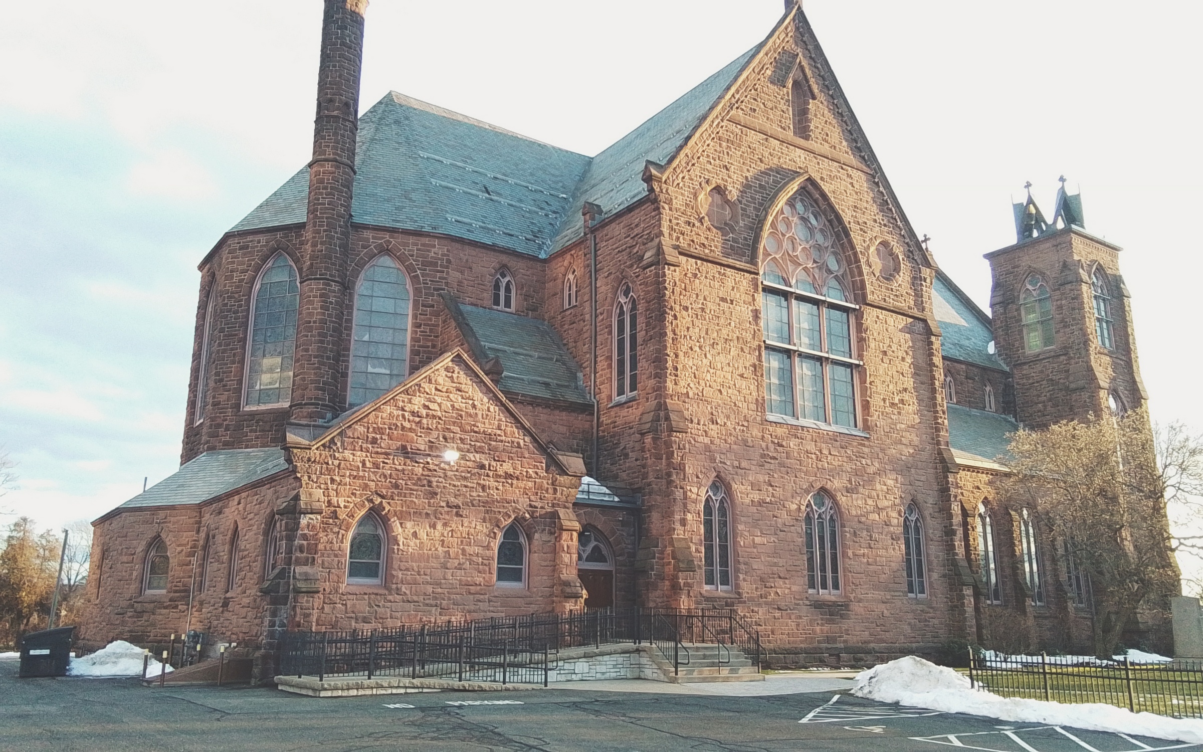
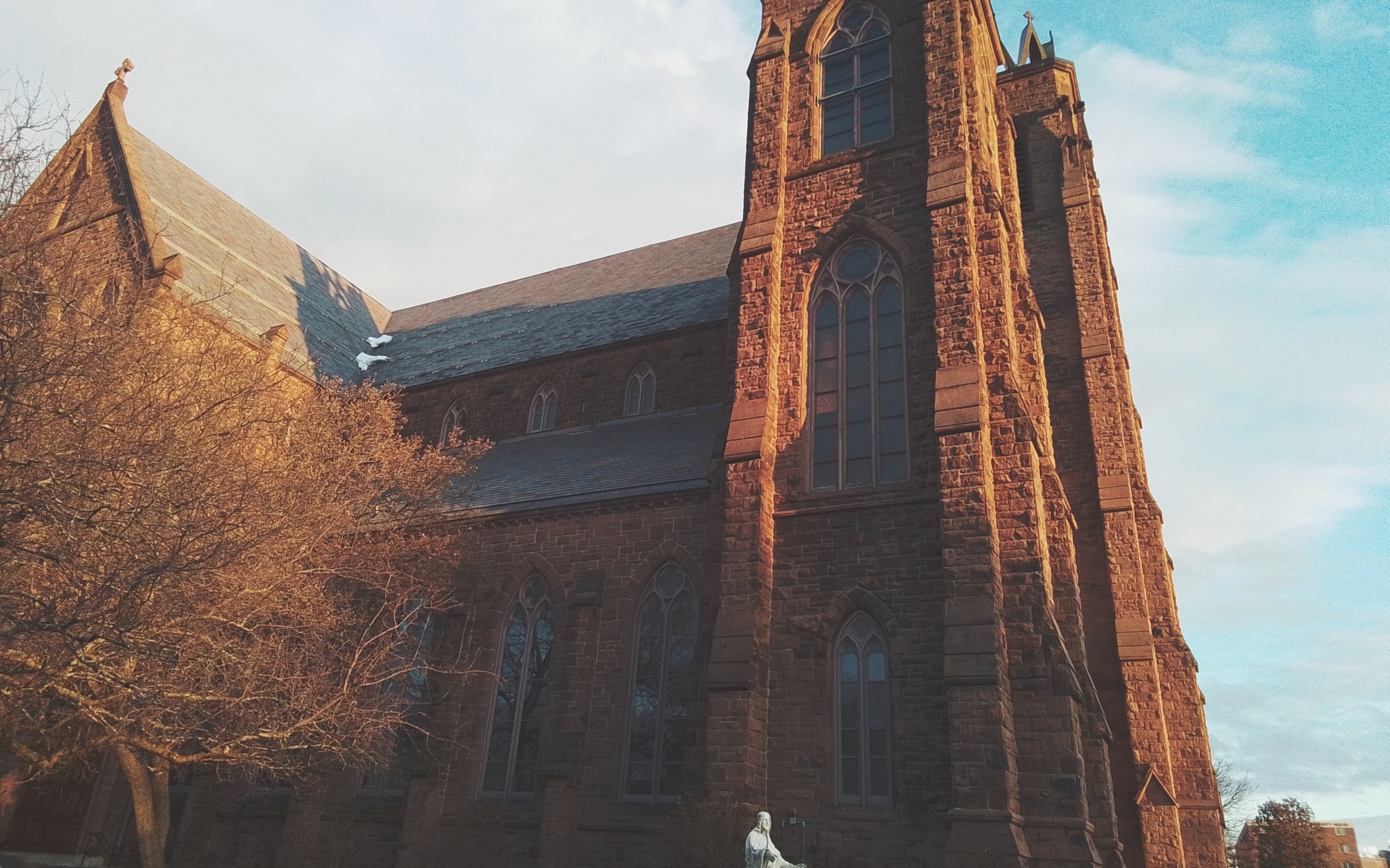
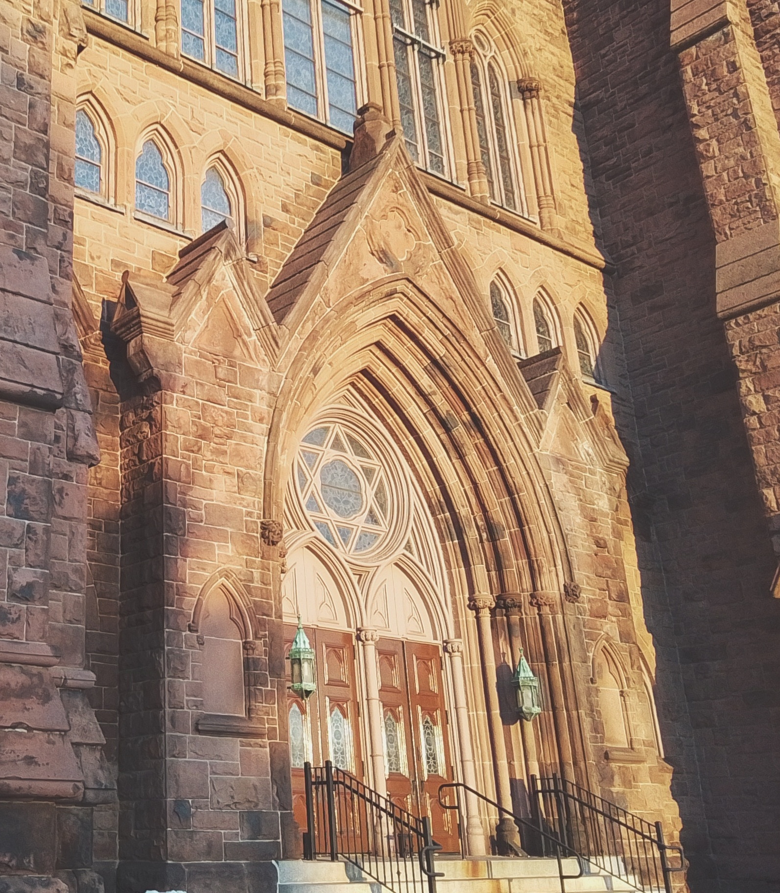
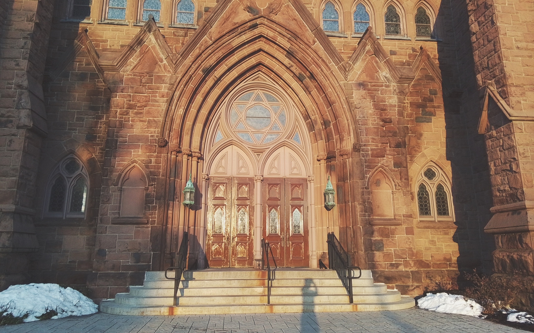
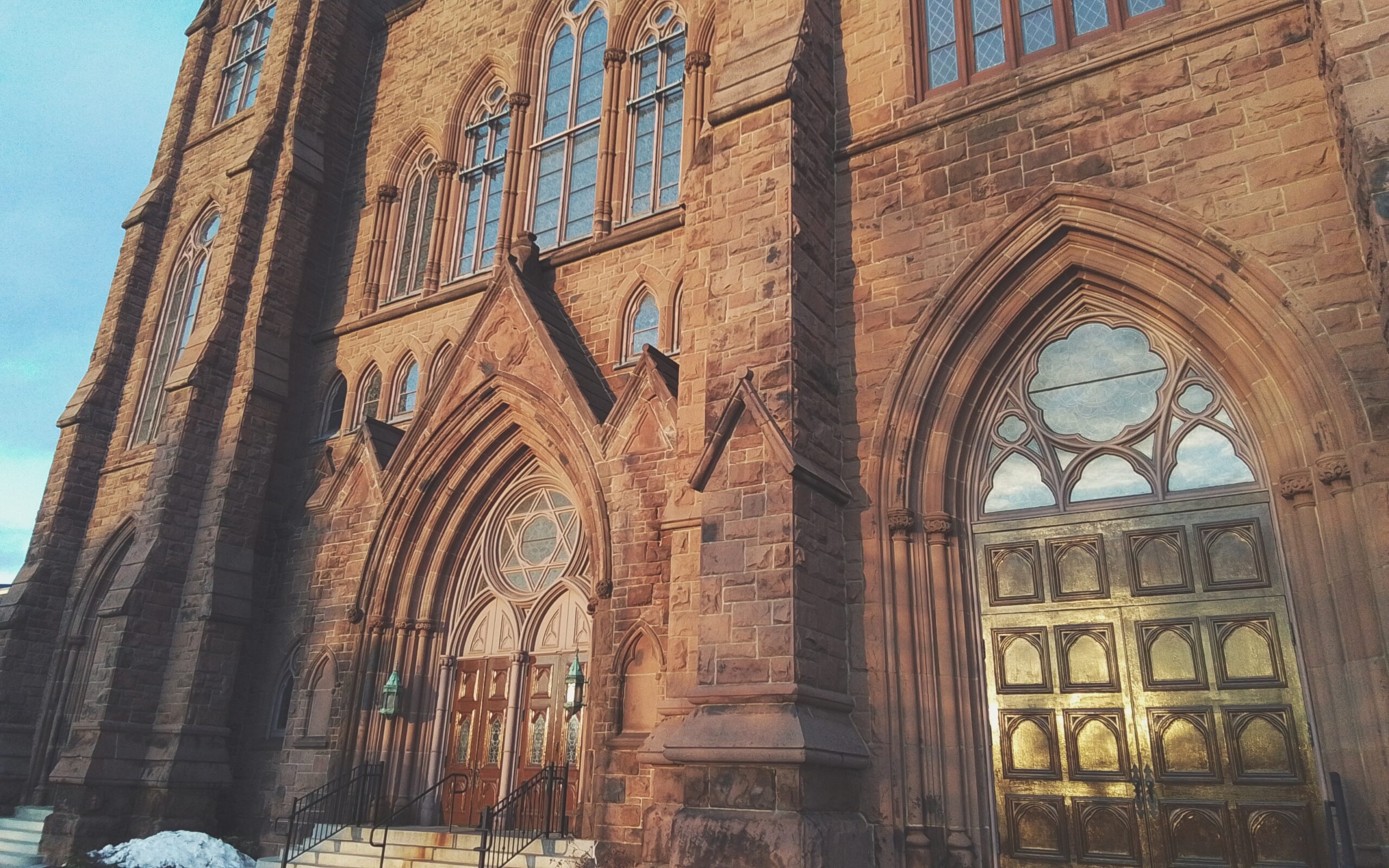
Sacred Heart Roman Catholic Church
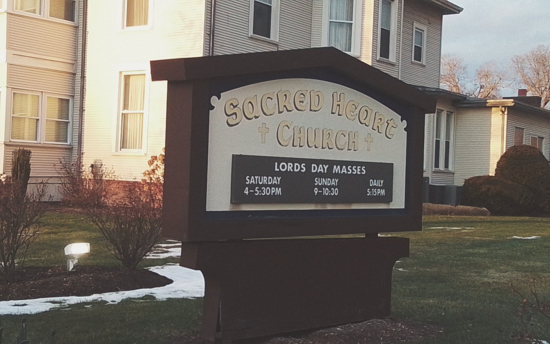
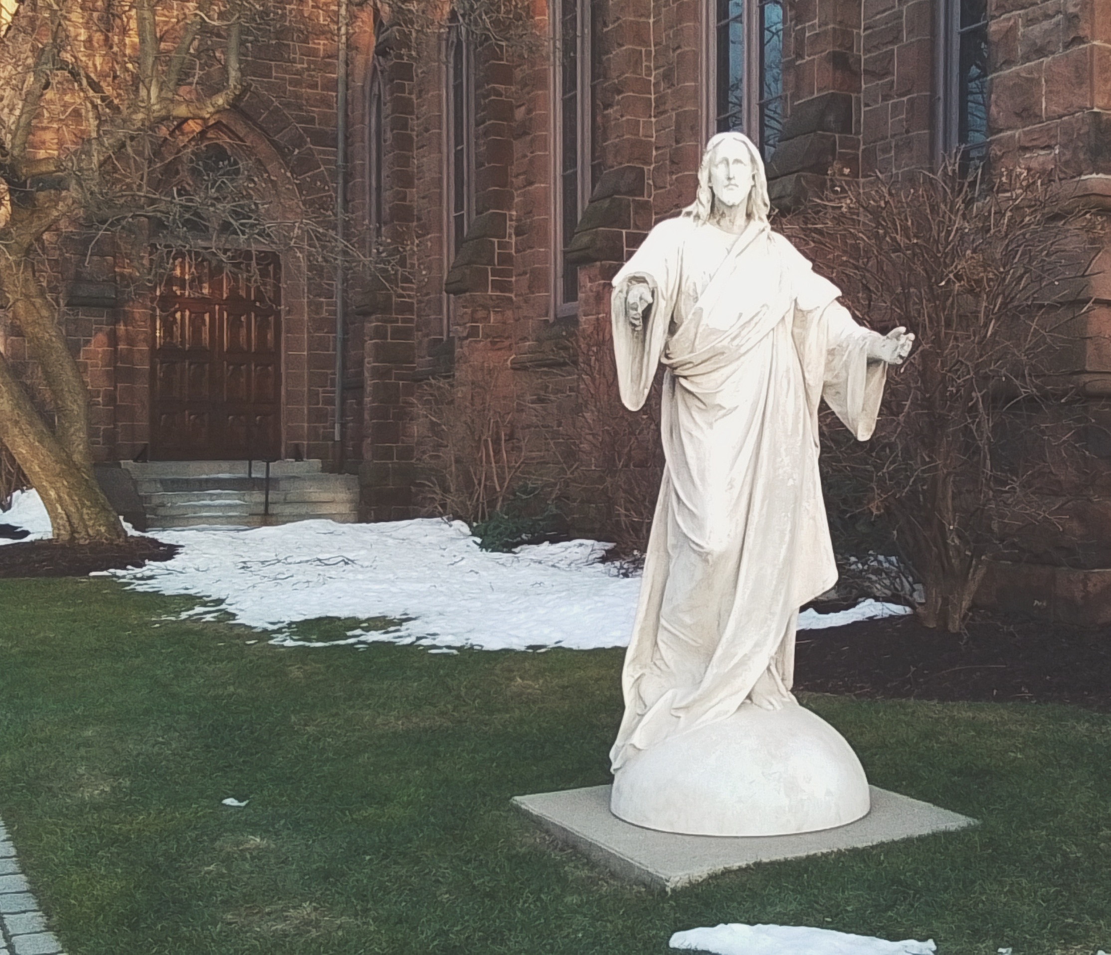
Sacred Heart Roman Catholic Church is a neo-Gothic church on Chestnut Street in Springfield. This is in the Liberty Heights neighborhood of the city. Its campus included a rectory, churchyard, convent, and school.
Church
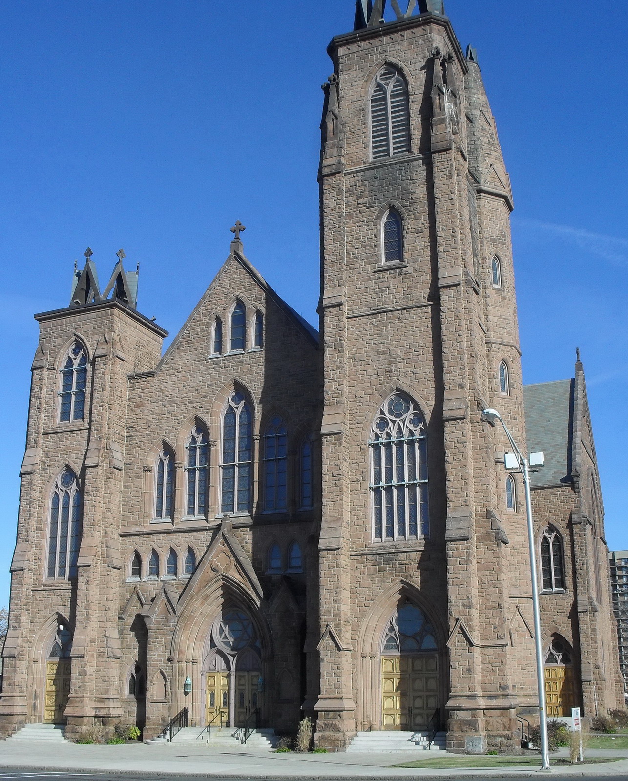
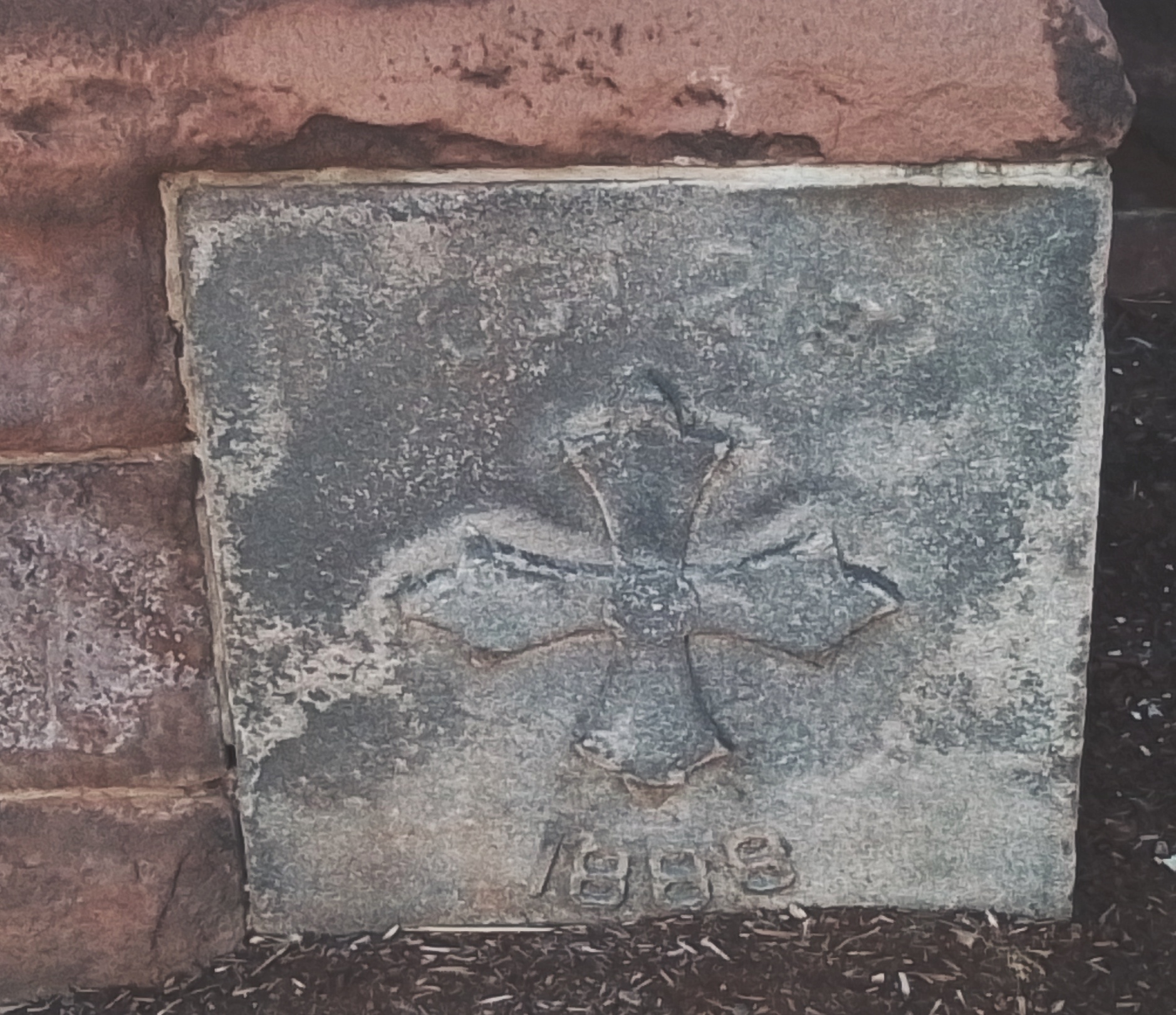
Sacred Heart Church was started in October 21 1888 and finished in 1896. The plans were made by James Murphy. It was consecrated on October 18 1896. The church is made of Longmeadow Sandstone. The church has 27 stained glass window that were made in Munich Germany.
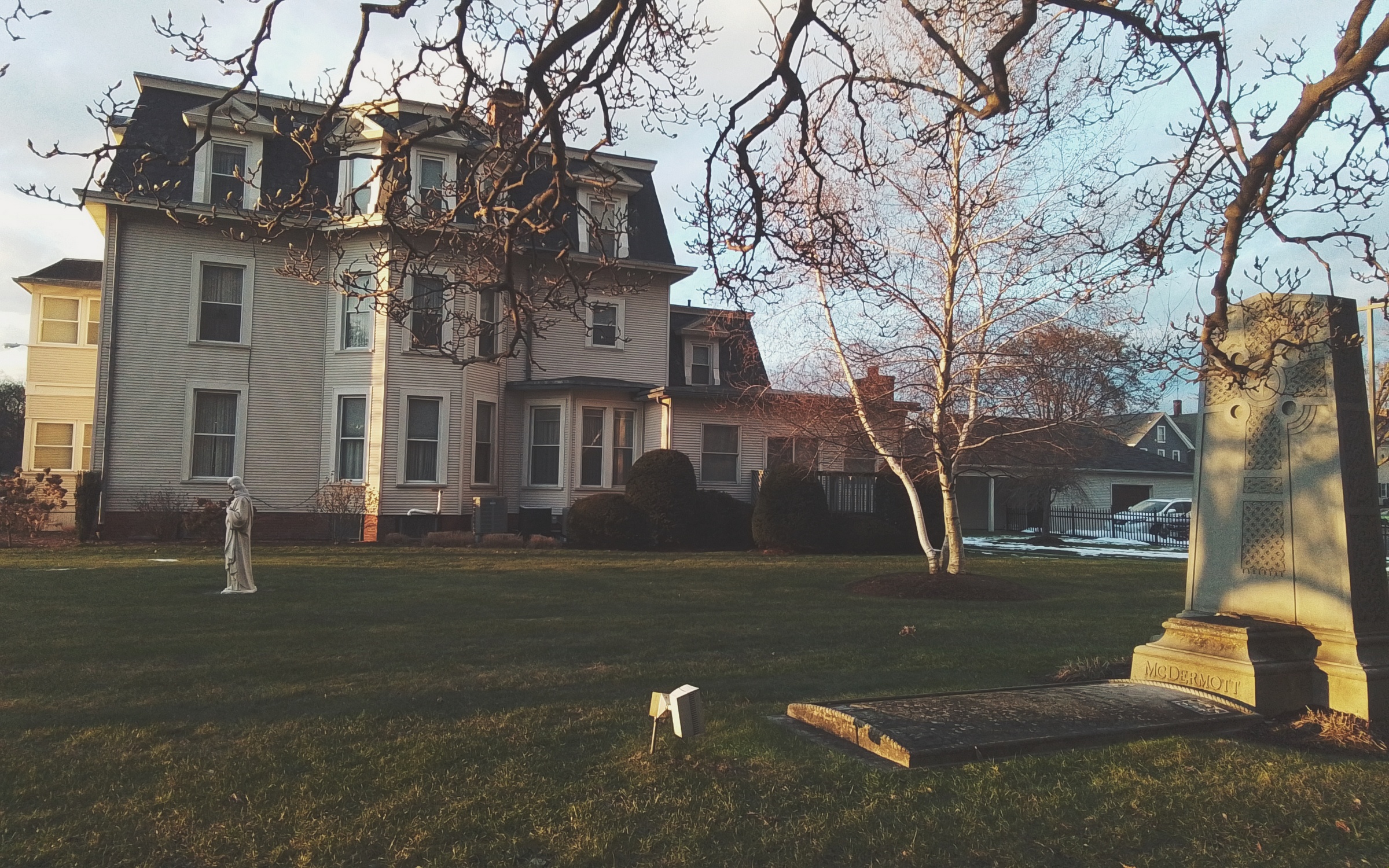
Churchyard

James J McDermott was the founder of this wonderful church. James had been ordained August 11 1866. The first mass was in 1874 at the Chapel of the Sacred Heart which was on Everett Street. The rectory was at 35 Everett Street. (Springfield city directory). Father McDermott was buried alongside the church in 1891 – FINDAGRAVE. He had gone to Paris France to deal with tuberculosis but died there.
Convent
In 1882 the convent was built.
School
The school was at 27 Everett Street and was ready in 1873. The church would be for a while on the ground floor and the school on the second floor. The school was served by the Sisters of Notre Dame who also served the girls’ schools in Chicopee and Holyoke. In 1925 a new school was erected on the site of the old school.
Rectory
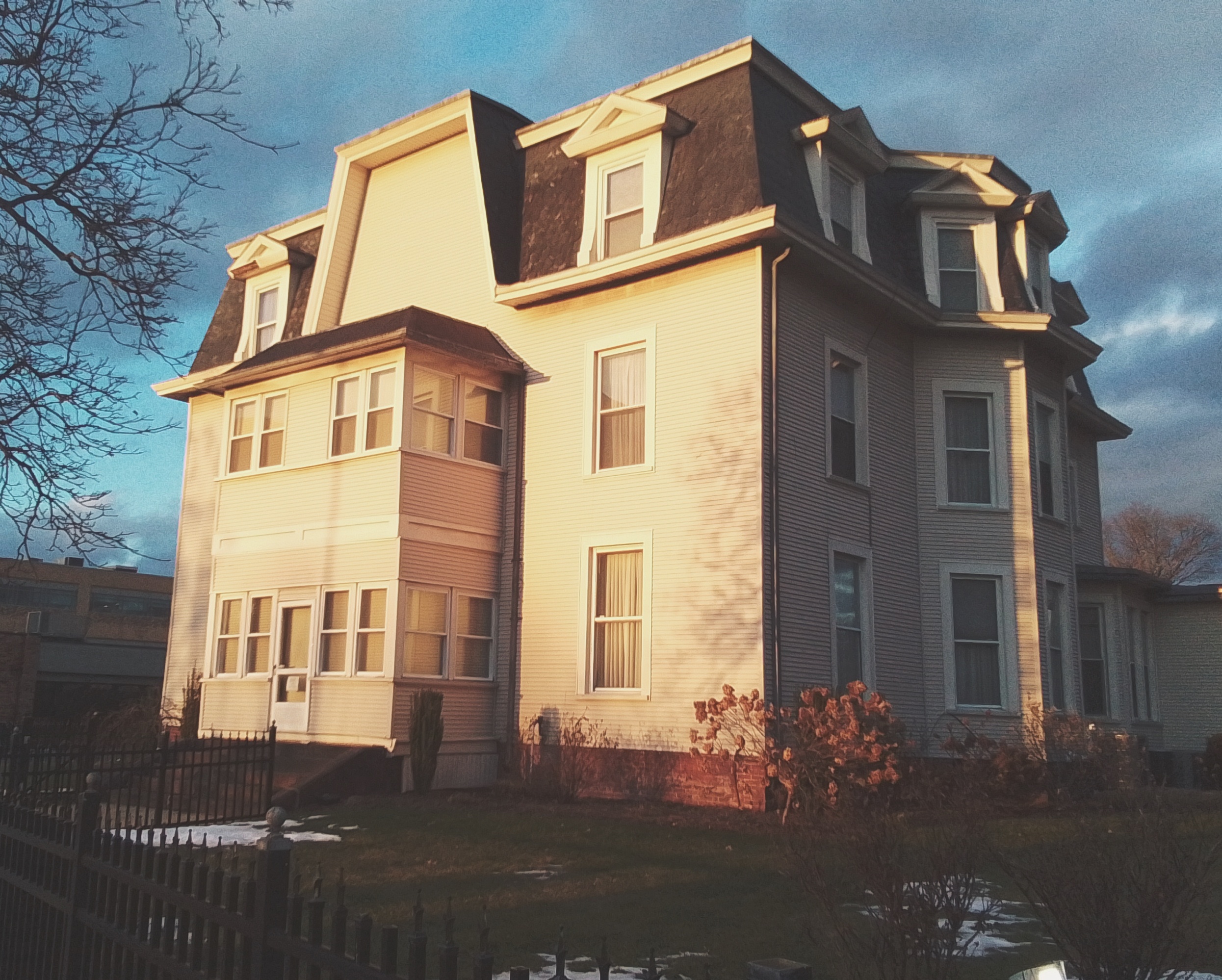
In 1872 the house that would become the rectory was built and occupied by a Luther Fisk. After the death of McDermott, Reverend Thomas Smythe took over.
Neighborhood
Two streets over on Carew Street in 1896 the Sisters of Providence started the Mercy Hospital.
Offshoot – Our Lady of Hope Parish was organized in 1906 as a mission church of Sacred Heart. All Souls Church was another mission church of Sacred Heart. It was on Plainfield Street and started in 1907.
Sanborn – 1886 map – 1896 map – 1911 map

Springfield
CHURCHES
Christ Church Cathedral – 1876
Saint Michael’s Church and Cathedral
Sacred Heart Roman Catholic Church
Cemeteries
Saint Aloysius Cemetery (Springfield)
OTHER
Springfield Central Library – 1912
Power Canals of the Chicopee River
Deacon Samuel Chapin – 1882
SCHOOLS and COLLEGES
Communities
Hampden County
| Agawam | Holland | Southwick |
| Blanford | Holyoke | Springfield |
| Brimfield | Longmeadow | Tolland |
| Chester | Ludlow | Wales |
| Chicopee | Monson | Westfield |
| East Longmeadow | Mongomery | West Springfield |
| Granville | Palmer | Wilbraham |
| Hampden | Russell |
Hampshire County
| Amherst | Hatfield | South Hadley |
| Belchertown | Hadley | Southampton |
| Chesterfield | Huntington | Ware |
| Cummington | Middlefield | Westhampton |
| Easthampton | Northampton | Williamsburg |
| Goshen | Pelham | Worthington |
| Granby | Plainfield | Enfield |
Franklin County
| Ashfield | Greenfield | Orange |
| Bernardston | Hawley | Rowe |
| Buckland | Heath | Shelburne |
| Charlemont | Levrett | Shutesbury |
| Colrain | Leyden | Sunderland |
| Conway | Monroe | Warwick |
| Deerfield | Montague | Wendell |
| Erving | New Salem | Whateley |
| Gill | Northfield |
Worcester County
Berkshire County
Hockanum Cemetery
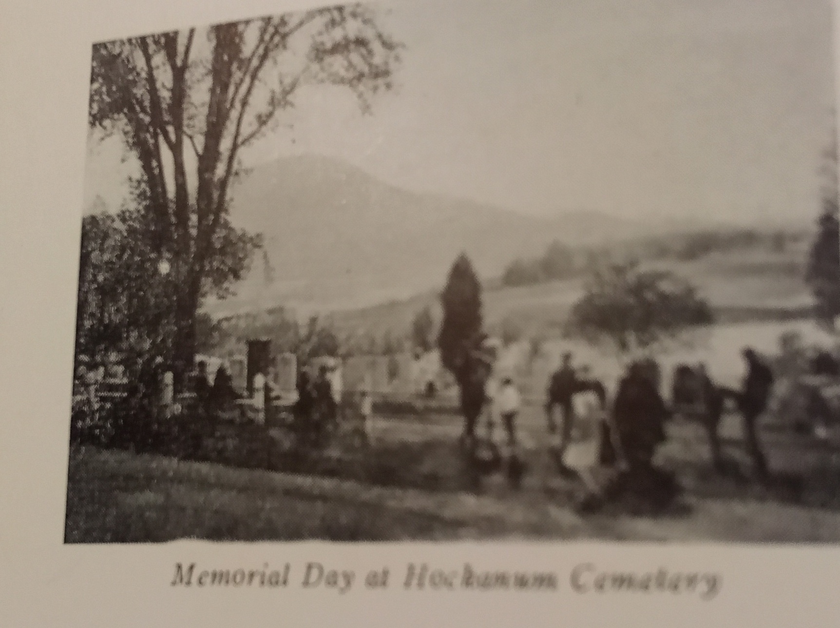
Hockanum Cemetery is a small cemetery along Route 47 in the Hockanum neighborhood of Hadley. It has very many burials from the late 1700s. It has many families here but the Lyman family predominates here.
Evergreen Cemetery
Evergreen Cemetery is also called West Hill Cemetery. It is found on Munsell Street.
Most likely it was founded in 1795.
A committee in Belchertown appointed in 1924 renamed this cemetery Evergreen.
The Ward and Pratt families have many members here.
Rural Cemetery
Rural Cemetery is also called Coleman Dark Corner Cemetery. It is also called the Dark Corner Cemetery. It is located near the Granby border. East State St in Granby to Ruel St to Rural St.
It was perhaps founded in 1769.